
Where Flight Simulation Enthusiasts Gather from Around the World!
AVSIM Library - Search Results

| Category: Orbiter - Spaceships | |
| Stanford Torus Space Station v1.5 |

|
File Description:
Updated with MUCH nicer and smaller textures!!
What will future space colonization realistically look like? What is it like to approach a rotating station almost 2km in diameter?
The Stanford Torus is based on a design created during a 10 week program in 1975 held at NASA’s Ames Research Center and Stanford University. The project participants considered how to create a practicable permanent colony in space using existing technology at minimum cost. The habitat is over 1800m in diameter and spins at 1 rpm to provide 1g of pseudo-gravity.
Package includes a scenario to fly from the ISS up to a GEO rendez-vous with Stanford, as well as documentation on the station itself.
INSTALLATION: You need Vinka's spacecraft.dll to use this add-on. A link is provided in the documentation. 1. Unzip files into your Orbiter directory, preserving the directory structure in the zipfile. 2. Load up the Stanford scenario in the Stanford directory in the Orbiter start window. 3. Enjoy the trip!
| Filename: | Stanford_Torus_Space_Station_v15.zip |
| License: | Freeware |
| Added: | 18th March 2005, 05:47:26 |
| Downloads: | 640 |
| Author: | Steven Ouellette |
| Size: | 976.08 KB |
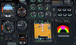
| Category: Flight Simulator X - Gauges | |
| DA Fokker 70 Panel Controller |
|
File Description:
After flying the DA Fokker 70 and 100 for a while, I realised that not all FS pilots would have access to a programmable joystick that would enable them to assign a button to operate the various pop-up panels in the Fokker, so I thought that a gauge mounted on the flight panel that centralised the controls for the pop-up windows may be a handy addition.
After adding the gauge you will be able to access the following pop-up panels using the mouse from one centralised position on both the Pilot Flying and First Officer the panels.
From left to right the pop-up panels are as follows..
Upper Row
Overhead Upper, Overhead Lower, Pedestal Forward. Pedestal Middle and Pedestal Rear...
Lower Row
Radio Stack, CDU, Doors and Ground Power, Secondary Annunciator Panel, Enlarged Left Hand MFDU
Also included are instructions on how to add the Groundhandling gauge by Rob Barendregt to the Doors and Ground Power panel of the Fokker.
| Filename: | DA_Fokker_70_Panel_Controller.zip |
| License: | Freeware |
| Added: | 28th July 2008, 11:01:36 |
| Downloads: | 839 |
| Author: | James Hodkinson |
| Size: | 365.34 KB |
| Category: Flight Simulator X - Missions | |
| The Most Dangerous Airports: Lukla V2 |
|
Images related to this file:
File Description:
Approach to Lukla V2 (Totally New Mission)
You are a very experienced pilot flying the Twin Otter for Yeti Airlines on an imaginary flight to and from Lukla. Take-off from Biratnagar airport VNVT climb to at least 13500 ft to WP1 Turn to Lukla. From WP1 carefully descent to 10000 ft (there should be cloud to make it more difficult, if you have some sort of weather add-on running) to WP2 Approach to VNLK, after passing through the gate turn sharp right and land at Lukla airport, remember that the runway has an incline of several degrees. Turn around and take-off again, stay on the runway and rotate just before the end of the runway. Follow the valley back to the south until you are able to track the VOR 112.30 at roughly 276�°, till you reach Kathmandu Intl Airport and land. Yes, it sounds easy, butâ�¦ find out for yourself.
| Filename: | The_Most_Dangerous_Airports_Lukla_V2.zip |
| License: | Freeware |
| Added: | 9th June 2010, 02:40:12 |
| Downloads: | 1,679 |
| Author: | Robbie Albers |
| Size: | 2.17 MB |
| Category: Flight Simulator 2004 - Scenery | |
| NTGK Kaukura, French Polynesia |
|
File Description:
Googly scenery for NTGK Kaukura, a small airport on Motu Panao island of Kaukura
atoll, part of the Tuamotu group in French Polynesia. The airport, opened in 1994,
is served just a couple of times per week by ATR turboprop aircraft of Air Tahiti.
Flight Simulator 2004 has only provided a runway at this airport and this scenery
seeks to redress the situation so that you and your "AI" traffic can use the
airport.
The scenery does not purport to be ultra-accurate. Based on high quality
satellite imagery from Google Earth, the layout is proportionally correct but the
added airport features, such as buildings, are built from default Microsoft objects
and add-on libraries so will not look exactly like the real thing.
You are not obliged to download and install any additional scenery libraries,
but to enjoy this scenery in its entirety, you may wish to. It will work fine,
with or without.
| Filename: | NTGK_Kaukura_French_Polynesia.zip |
| License: | Freeware |
| Added: | 19th April 2008, 20:34:24 |
| Downloads: | 1,572 |
| Author: | John Hinson |
| Size: | 70.52 KB |
| Category: Flight Simulator X - Utilities | |
| NumberPad Control for FSX and P3D |
|
Images related to this file:
File Description:
NpC4FSX&P3D (NumberPadControl for FSX and P3D) is a more efficient (and more convenient to set up)
version of a similar NpC program that I wrote a few years ago and which to
my surprise PC Pilot magazine included on their 100th Anniversary edition Freeware CD. With
NpC4FSX&P3D you assign keys to functions like Com, Nav, Heading, Course, Altitude, VS,
Autopilot functions, etc., and then can enter the associated values (like frequencies or headings) just by typing on the
keyboard’s numberpad instead of fiddling with elusive mouse click spots. NpC4FSX&P3D is
programmed primarily for aircraft with avionics that were developed within standard FSX
programming guidelines but also supports third party add-
on aircraft such as the Flysimware L35A and MU2, PMDG 737NGX / B777, Flight1 King Air
B200, A2A Cherokee 180, and also works with GPS units like the GTN750. Setup manual included.
A registered (payware) copy of FSUIPC is required.
| Filename: | NumberPad_Control_for_FSX_and_P3D.zip |
| License: | Freeware |
| Added: | 19th February 2018, 21:21:16 |
| Downloads: | 481 |
| Author: | Al Klayton |
| Size: | 683.59 KB |
| Category: Flight Simulator 2004 - Aircraft Repaints, Textures and Modifications | |
| HB-CIS AeroLocarno - Swiss Cessna C172 ( Flight 1 ) |
|
File Description:
"Swiss hangar" is a large repaint collection for payware and freeware aircraft that will give you the opportunity to fly over the FS 2004 swiss and european sky with aircrafts in original swiss livery. Every aircraft is perfectly reproduced like the original one. Drawing are based on the author photo documentation or from photos available on internet (Airliners.net, MyAviation.net etc.).
Hope you will enyoy my work! Happy landings!
This aircraft, Cessna C172 HB-CIS, belongs to AeroLocarno flying school ( www.aerolocarno.ch ) and is based on the "Aeroporto cantonale di Locarno" (LSZL) , in south Switzerland, near the italian border, ideal place for wonderful VFR flights over huge Alpi mountains and beatiful lakes.As the adversidsment clearly say (in italian and german) this Cessna is mainly used to make tourist flights.
It is strongly recommended the use of the payware add ons "Switzerland professional"by Flylogic, and "VFR-Airfields-Locarno" by CR-software for the most full immersion experience with this aircraft.
| Filename: | HBCIS_AeroLocarno__Swiss_Cessna_C172__Flight_1_.zip |
| License: | Freeware |
| Added: | 27th April 2006, 02:06:21 |
| Downloads: | 442 |
| Author: | Antonio Iozzi - Flight 1 |
| Size: | 7.38 MB |
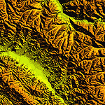
| Category: Flight Simulator 2004 - Scenery | |
| "Himalayan Peaks" LOD10 Mesh, Volume 4 - Annapurna |
|
Images related to this file:
File Description:

Highly detailed terrain mesh of the Annapurna area, N28-30 E83-85. The files in this package are based on Shuttle Radar (SRTM) Version 2 data but with many of the void areas, especially the most significant sections, filled with elevation data generated from topographic maps by Jonathan de Ferranti. While Jonathan's work is unrelated to flight simulation he kindly gave me permission to compile his data for use in FS. The result is a wonderful improvement in detail and accuracy over any existing mesh file, freeware or commercial, based on SRTM or DTED data alone.
Due to the large area of the Himalayas I've compiled the source data as two separate series: the "Himalayan Peaks" series covers prominent mountains and ranges in higher detail and locally overrides any existing LOD9 terrain mesh. In addition, a LOD9 "base mesh" series covering the entire Himalayas will be available for those who do not yet have an add-on terrain mesh of these beautiful mountains.
| Filename: | Himalayan_Peaks_LOD10_Mesh_Volume_4__Annapurna.zip |
| License: | Freeware, limited distribution |
| Added: | 29th May 2010, 08:59:29 |
| Downloads: | 10,459 |
| Author: | Holger Sandmann, Jonathan de Ferranti |
| Size: | 15.07 MB |
| Category: Flight Simulator 2004 - Scenery | |
| "Himalayan Peaks" LOD10 Mesh, Volume 7 - K2 and Karakoram |
|
Images related to this file:
File Description:

Highly detailed terrain mesh of the Karakoram area, N35-37 E73-77. The files in this package are based on Shuttle Radar (SRTM) Version 2 data but with many of the void areas, especially the most significant sections, filled with elevation data generated from topographic maps by Jonathan de Ferranti. While Jonathan's work is unrelated to flight simulation he kindly gave me permission to compile his data for use in FS. The result is a wonderful improvement in detail and accuracy over any existing mesh file, freeware or commercial, based on SRTM or DTED data alone.
Due to the large area of the Himalayas I've compiled the source data as two separate series: the "Himalayan Peaks" series covers prominent mountains and ranges in higher detail and locally overrides any existing LOD9 terrain mesh. In addition, a LOD9 "base mesh" series covering the entire Himalayas will be available for those who do not yet have an add-on terrain mesh of these beautiful mountains.
| Filename: | Himalayan_Peaks_LOD10_Mesh_Volume_7__K2_and_Karako.zip |
| License: | Freeware, limited distribution |
| Added: | 30th May 2010, 09:56:27 |
| Downloads: | 9,473 |
| Author: | Holger Sandmann, Jonathan de Ferranti |
| Size: | 38.58 MB |
| Category: Flight Simulator 2004 - Scenery | |
| "Himalayan Peaks" LOD10 Mesh, Volume 6 - Jammu and Kashmir |
|
Images related to this file:
File Description:
Highly detailed terrain mesh of the Jammu and Kashmir areas, N31-36 E76-78. The files in this package are based on Shuttle Radar (SRTM) Version 2 data but with many of the void areas, especially the most significant sections, filled with elevation data generated from topographic maps by Jonathan de Ferranti. While Jonathan's work is unrelated to flight simulation he kindly gave me permission to compile his data for use in FS. The result is a wonderful improvement in detail and accuracy over any existing mesh file, freeware or commercial, based on SRTM or DTED data alone.
Due to the large area of the Himalayas I've compiled the source data as two separate series: the "Himalayan Peaks" series covers prominent mountains and ranges in higher detail and locally overrides any existing LOD9 terrain mesh. In addition, a LOD9 "base mesh" series covering the entire Himalayas will be available for those who do not yet have an add-on terrain mesh of these beautiful mountains.
| Filename: | Himalayan_Peaks_LOD10_Mesh_Volume_6__Jammu_and_Kas.zip |
| License: | Freeware, limited distribution |
| Added: | 29th May 2010, 08:55:43 |
| Downloads: | 9,661 |
| Author: | Holger Sandmann, Jonathan de Ferranti |
| Size: | 52.19 MB |
| Category: Flight Simulator 2004 - Scenery | |
| "Himalayan Peaks" LOD10 Mesh, Volume 5 - Garhwal |
|
File Description:
Highly detailed terrain mesh of the Garhwal area, N30°-32° E78°-81°. The files in this package are based on Shuttle Radar (SRTM) Version 2 data but with many of the void areas, especially the most significant sections, filled with elevation data generated from topographic maps by Jonathan de Ferranti. While Jonathan's work is unrelated to flight simulation he kindly gave me permission to compile his data for use in FS. The result is a wonderful improvement in detail and accuracy over any existing mesh file, freeware or commercial, based on SRTM or DTED data alone. Due to the large area of the Himalayas I've compiled the source data as two separate series: the "Himalayan Peaks" series covers prominent mountains and ranges in higher detail and locally overrides any existing LOD9 terrain mesh. In addition, a LOD9 "base mesh" series covering the entire Himalayas will be available for those who do not yet have an add-on terrain mesh of these beautiful mountains.
| Filename: | Himalayan_Peaks_LOD10_Mesh_Volume_5__Garhwal.zip |
| License: | Freeware, limited distribution |
| Added: | 18th February 2006, 23:16:47 |
| Downloads: | 10,130 |
| Author: | Holger Sandmann and Jonathan de Ferranti |
| Size: | 27.72 MB |
© 2001-2026 AVSIM Online
All Rights Reserved
Privacy Policy |