
Where Flight Simulation Enthusiasts Gather from Around the World!
AVSIM Library - Search Results

| Category: Miscellaneous Files - Demos from Commercial Vendors | |
| QuickPlan for Windows |

|
Images related to this file:
File Description:

QuickPlan for Windows is a visual point and click flight planner that makes it easy to generate flight plans in native FSX, FS2004 or X-Plane formats.
The entire route is generated visually, by tapping the map to add the departure airport, intermediate waypoints and arrival airport in the same order that you intend flying the plan.
During plan creation and after adding the final arrival waypoint you also have the opportunity to remove any of the intermediate waypoints before saving the plan in your preferred format.
QuickPlan utilises a new mapping engine and includes 12 world-wide map styles and has support for FSWidgets Cloud Based Aero Charts (free Cuba/Puerto Rico WAC Cloud Based Chart included) and FSWidgets Cloud Based World Nav Data (Free KSFO - San Francisco Bay area Nav Data included).
QuickPlan can be used in Freeform Mode, Advanced Mode, or a combination of both.
FREEFORM MODE: Simply click anywhere on the map and QuickPlan will allow you to add it as a generic waypoint. VFR pilots often use towns, lakes and other unique geographic features and with QuickPlan you can add any geographical location shown on the base map. Plans created this way label the waypoints automatically with generic names (e.g. DEP, WP1, WP2, ARR).
If desired, the entire route from departure to arrival can be created without reference to any navigational aids or official airports. This is handy for bush pilots who often use unlicensed airfields and small landing strips (or seaplane landing areas). Helicopter pilots can also quickly create plans that depart from off-airport locations like building rooftops or land on a road.
ADVANCED MODE: If you own the FSWidgets Cloud Based World Nav Data product you can create more advanced flight plans by clicking on any of the icons displayed on the map to add them as waypoints - airports, VOR's, NDB's and intersections (data for the KSFO area is included free). Plans created this way label the waypoints automatically with airport and navigational aid identifiers taken from the Nav Data (e.g. KSFO, OSI, LV, FABLA). FEATURE LIST:
- Generates native FSX (.pln), FS2004 (.pln) and X-Plane (.fms) format flight plans
- Saves flight plans to any folder (preferred folder set in Preferences)
- Search for airport by ICAO identifier
- Map powered by CloudMade Leaflet API (using OpenStreetMap data)
- Includes 12 world-wide maps styles
- Supports FSWidgets Cloud Based AERO CHARTS
- Free Cuba/Puerto Rico WAC Cloud Based Chart included
- Supports FSWidgets Cloud Based WORLD NAV DATA
- Free KSFO (San Francisco Bay) area Nav Data included
- World-wide Metar and TAF Data icons
- US Nexrad (Next-Gen Radar) Data
| Filename: | QuickPlan_for_Windows.zip |
| License: | Commercial demo |
| Added: | 27th October 2012, 09:22:33 |
| Downloads: | 523 |
| Author: | Fermin Fernandez - FSWidgets |
| Size: | 1.95 MB |
| Category: Flight Simulator X - Miscellaneous Files | |
| Fireworks for Deepawali |
|
Images related to this file:
File Description:
Deepawali, also known as Diwali is one of the Major Festival celebrated in India from Jammu Kashmir to Kanyakumari. Deepawali or Diwali is certainly the biggest and the brightest of all festivals. It's the festival of lights (deep = light and avali = a row i.e., a row of lights) that's marked by four days of celebration, which literally illumines the country with its brilliance, and dazzles all with its joy. From darkness unto light the light that empowers us to commit ourselves to good deeds, that which brings us closer to divinity. During Diwali, lights illuminate every corner of India and the scent of incense sticks hangs in the air, mingled with the sounds of fire-crackers, Fireworks, joy, togetherness. On third day of the festival from evening to midnight the entire sky of India is full of colorful fireworks. Its the most awesome night of the year to witness. Every single family in India celebrates Diwali with lights, fire-crackers and fire works.
Lets celebrate Diwali in the virtual world of Flight Simulator. Fly in or out of any airport in India and enjoy your departure or approach phase with great show of fireworks all over the country. Fireworks for both FS2004 & FSX SP2 / Acceleration pack. Tested in FS2004 and FSX Acceleration pack only because its what I have. Enjoy!
| Filename: | Fireworks_for_Deepawali.zip |
| License: | Freeware |
| Added: | 15th October 2014, 00:10:49 |
| Downloads: | 222 |
| Author: | Ashish SIngh |
| Size: | 174.33 KB |
| Category: Flight Simulator X - Gauges | |
| AP_MultiFuel_Gauges for FIP |
|
Images related to this file:
File Description:
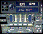
This set of 3 gauges is for use in the Saitek FIP and is an extension to my FIP gauge. That set of 3 gauges was designed to complement the Saitek AP/Multi panel and primarily showed the selected AP Altitude and Vert Spd whilst the Saitek AP/multi panel was displaying HDG. The second main part of those gauges were the Fuel Level displays, each gauge displaying a different combination of fuel tanks to suit the aircraft being flown and thus offered functionality for all types of aircraft.
This set of 3 gauges is designed for the same purpose but now encompasses a working AP that allows you to select HDG, ALT and VS values and activate the HDG and ALT mode (and AP master switch) to enable auto-pilot flight (for those who have a FIP but not an AP/multi panel).
For those who have an AP/multi panel, it gives a backup AP in your build/rig (although it all works off the same FS telemetry, I have found that when the AP/multi-panel freezes, especially the 'Alt' button, then this FIP gauge can de-activate it. The combinations displayed are those that suit my choice of aircraft, however it is easy to re-configure gauge Elements (fuel tank names) and artwork (fuel gauge titles) to suit the combination you prefer.
These gauges also retain the gear, flaps and light indicators, auto rudder on/off button plus rudder and aileron trim capability that were in the previous gauges. An additional feature is the battery switch will now turn off the AP display and fuel levels.
The artwork in these gauges has also been upgraded a bit and a template artwork is included to assist in customising.
| Filename: | AP_MultiFuel_Gauges_for_FIP.zip |
| License: | Freeware |
| Added: | 20th October 2014, 16:00:33 |
| Downloads: | 265 |
| Author: | Robert Budd |
| Size: | 764.26 KB |
| Category: Flight Simulator X - Missions | |
| Alps for VIP |
|
Images related to this file:
File Description:
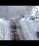
Take off with a VIP from Courchevel airport, in Alps to Neuchatel. Your Cessna is not really strong but not powerful too!
Be carefull: day is falling, snow is coming and something wrong with your plane could happen.
Be a full and wonder pilot. Your passengers need to be alive!
| Filename: | Alps_for_VIP.zip |
| License: | Freeware |
| Added: | 5th December 2015, 19:00:11 |
| Downloads: | 1,157 |
| Author: | Raph Grangier |
| Size: | 7.16 MB |
| Category: Flight Simulator X - Utilities | |
| Kml2Effect for FSX |
|
Images related to this file:
File Description:
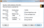
This simple application will help you to create street lights effects suitable for FSX custom and default sceneries. It will transform a kml path file made by Google Earth into a bgl add-on file consisting of rows of effects like street lights "floating" a few meters over the ground. Kml2Effect can also process other effects (fire, smoke, etc.), individually or in groups or rows. When flying low over cities this will create nice illusion of the real street lighting.
| Filename: | Kml2Effect_for_FSX.zip |
| License: | Freeware |
| Added: | 27th June 2018, 23:41:11 |
| Downloads: | 275 |
| Author: | Darko Tralic |
| Size: | 1.64 MB |
| Category: Prepar3D V1-4 - Scenery | |
| STEEPHOLM for ORBX |
|
File Description:
STEEPHOLM island in the Bristol Channel restored to STEEP status in ORBX Scenery(True Earth included).(All users)
Also included are surf breakers dependent on Windspeed.(For SODE users)
https://youtu.be/S_xl4-2of3k
| Filename: | STEEPHOLM_for_ORBX.zip |
| License: | Freeware, limited distribution |
| Added: | 10th March 2019, 17:20:51 |
| Downloads: | 143 |
| Author: | john watts |
| Size: | 422.1 KB |
| Category: Flight Simulator X - Miscellaneous Files | |
| ENBSeries for FSX |
|
File Description:
CORRECTED VERSION - Accidently included the wrong d3d9.dll in the previous upload, which messes up your textures. This one is the right one. My main goal in adjusting this ENBSeries file was to make sunny days look sunny and dark nights look dark, while maintaining a natural look to all things as much as possible (so no exaggerated bloom effects which you don't see at all in real life) I only changed the BLOOM and the COLOR CORRECTION options, nothing else. I have all the other options turned off anyway, since I don't have a very powerful computer. If you want to change options yourself you can read the 'readme_en.txt' for further information.
I included some screenshots to compare the default lightning to my custom made ENBSeries version (press the ZipDive! button to see them without downloading the whole package)
Install:
- Just copy the d3d9.dll and enbseries.ini to the FSX root folder.
- When in FSX you can press [SHIFT] + [F12] to turn the effect on or off. To remove, simply delete the 2 files from your FSX root folder.
| Filename: | ENBSeries_for_FSX.zip |
| License: | Freeware |
| Added: | 24th January 2016, 18:41:19 |
| Downloads: | 3,334 |
| Author: | Robin Heinis |
| Size: | 2.81 MB |
| Category: Flight Simulator 2004 - Miscellaneous Files | |
| All FS9 Airports for Botswana for ServInfo 2.02 |
|
File Description:
This adds all the airports for Botswana present in FS9 to ServInfo 2.02 Readme file has instructions on what to do.
| Filename: | All_FS9_Airports_for_Botswana_for_ServInfo_202.zip |
| License: | Freeware |
| Added: | 22nd February 2005, 23:17:44 |
| Downloads: | 302 |
| Author: | Desmond Klein |
| Size: | 1.78 KB |
| Category: Flight Simulator 2004 - AFCAD Files | |
| EDDH for Jan Martin's Jetways & Terminals For ACOF |
|
File Description:
AFCAD2 File for :
Hamburg, Fuhlsbuttel airport, Germany ( EDDH ) for Jan Martins's
jtacof_4.zip ( Jetways & Terminals For ACOF Package Four ) ( can also be used with default scenery )
Primarily Runway 15 and secundary 05 ( I am not sure if 33 and 23 work , haven't tested
it with wind .
Have released this one before on Avsim, but didn't do Runway Assignment properly .
| Filename: | EDDH_for_Jan_Martins_Jetways__Terminals_For_ACOF.zip |
| License: | Freeware |
| Added: | 21st October 2004, 00:22:38 |
| Downloads: | 1,564 |
| Author: | Silvester van Wijk |
| Size: | 8.48 KB |
| Category: Flight Simulator 2004 - Scenery | |
| Fix For Philadelphia Intl. Airport (KPHL) For FS2004 |
|
File Description:
Here are the additional files which I neglected to include with my scenery for the Philadelphia Intl. Airport (fs9jets2.zip), plus the correct link to the animated hangars. My sincerest apologies for the errors.
| Filename: | Fix_For_Philadelphia_Intl_Airport_KPHL_For_FS2004.zip |
| License: | Freeware, limited distribution |
| Added: | 10th November 2005, 22:05:36 |
| Downloads: | 9,664 |
| Author: | Patrick Finch |
| Size: | 144.5 KB |


© 2001-2026 AVSIM Online
All Rights Reserved
Privacy Policy |