
Where Flight Simulation Enthusiasts Gather from Around the World!
AVSIM Library - Search Results

| Category: Flight Simulator 2004 - Scenery | |
| Argyle International Airport, Saint Vincent |

|
Images related to this file:
File Description:
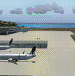
This is a scenery created by me of the soon to be completed Argyle International Airport on the island nation of Saint Vincent and the Grenadines. This scenery was created as a pet project of mine out of personal love for the project. The airport was created using only default scenery objects and the only thing that was changed was the type and direction of the turning point at the RWY04 end. I'm sharing this so FS2004 simmers can see what the airport will be like on completion. The scenery is 100% customizable to suit your preference. All I ask is that you don't change the actual airport design. I hope that this will bring you hours and hours of flying fun.
Important: This scenery requires the full RWY12 Scenery Library including the Gate Markings SS files. Also the Lesser Antilles Mesh is required.
| Filename: | Argyle_International_Airport_Saint_Vincent.zip |
| License: | Freeware |
| Added: | 22nd December 2013, 21:57:40 |
| Downloads: | 529 |
| Author: | Cilbert Campbell |
| Size: | 6.8 KB |
| Category: Flight Simulator X - Scenery | |
| PACK - Chefornak Airport - Alaska, USA |
|
Images related to this file:
File Description:
Chefornak Airport (IATA: CYF, ICAO: PACK, FAA LID: CFK) is a state-owned public-use airport in Chefornak,a city in the Bethel Census Area of the U.S. state of Alaska. The airport is on the Kinia River.
A new airstrip has been built further out from the village due to concerns with the current airstrip being near the school and pedestrian traffic, however, the runway must settle for several years before it is ready to be used. A new runway designated 5/23 was added.
| Filename: | PACK__Chefornak_Airport___Alaska_USA.zip |
| License: | Freeware |
| Added: | 17th October 2014, 01:26:08 |
| Downloads: | 662 |
| Author: | Wayne Roberts |
| Size: | 451.25 KB |
| Category: Flight Simulator X - Scenery | |
| PABE - Bethel Airport - Alaska, USA |
|
Images related to this file:
File Description:
Bethel Airport is a state owned, public use airport located three nautical miles (6 km) southwest of the central business district of Bethel.
Construction began September 21, 1941, and the airfield was activated July 4, 1942; it is also known as Bethel Air Base. It was used by Air Transport Command as auxiliary airfield for Lend-Lease aircraft being flown to Siberia. The facility was transferred to Eleventh Air Force, then to Alaskan Air Command in 1945; it became the joint-use Bethel Airport. It was used for construction of AC&W Bethel Air Force Station in mid 1950s. Full jurisdiction was turned over to Alaska Government in 1958.
Added and adjusted aprons and buildings. Also added additional parking. Added runway 1R/19L.Re-numbered runways to conform with AirNav data.
Created with Airport Design Editor 9x by ScruffyDuck Software using current FAA documentation and Google Earth measurements, this package offers a replacement for FSX's stock airport. All these enhancements are as close to the real airport as I can get with stock library objects and custom buildings.
| Filename: | PABE__Bethel_Airport__Alaska_USA.zip |
| License: | Freeware |
| Added: | 5th December 2014, 13:35:35 |
| Downloads: | 992 |
| Author: | Wayne Roberts |
| Size: | 94.58 KB |
| Category: Flight Simulator X - Scenery | |
| Merritt Island, FL Airport (KCOI) |
|
Images related to this file:
File Description:
Merritt Island is located on the east coast of Florida in the vicinity of Cape Canaveral and Cocoa Beach. Scenery in this package is based on Virtual Earth (Bing) and Google Earth imagery. This is a complete redo of the default FSX KCOI layout, surrounding landclass, FBO and hangers. Also includes placement of library objects and a library of new airport buildings.
| Filename: | Merritt_Island_FL_Airport_KCOI.zip |
| License: | Freeware |
| Added: | 17th April 2010, 19:47:04 |
| Downloads: | 1,687 |
| Author: | Art Poole |
| Size: | 1.14 MB |
| Category: Flight Simulator X - AFCAD Files | |
| Council Bluffs Municipal Airport, Iowa |
|
File Description:
An AFCAD fix for Council Bluffs Airport, IA. I've redone runway 18-36 (paved and extended), added taxiways accordingly, added buildings, and fixed parking. This is actually a second version, but the only one you'll need is this one.
| Filename: | Council_Bluffs_Municipal_Airport_Iowa.zip |
| License: | Freeware |
| Added: | 18th April 2010, 19:32:05 |
| Downloads: | 239 |
| Author: | Erik Ingram |
| Size: | 4.64 KB |
| Category: Flight Simulator X - AFCAD Files | |
| Washington Dulles International Airport -- KIAD |
|
Images related to this file:
File Description:
KIAD v3 represents Washington Dulles International Airport as it exists today. Terminal B and runway 1C-19C rehabilitation work now complete. Taxiways W2, W3, W4, S, EE, E1, E2 and E3 are open. Gates B14-B32 have been renamed to A14-A32. New RNAV(RNP) transition at TRING for 19L/19C. Updated custom airline parking assignments at all terminals per January 2010 parking specifications. Plus updated SID/STAR Navaids/Terminal Waypoints per January 2010 charts. See readme file enclosed for full details and installation instructions.
| Filename: | Washington_Dulles_International_Airport__KIAD.zip |
| License: | Freeware |
| Added: | 5th March 2010, 10:54:22 |
| Downloads: | 1,138 |
| Author: | Kambiz Agazi |
| Size: | 424.06 KB |
| Category: Flight Simulator X - AFCAD Files | |
| Cyril E. King Airport - TIST |
|
Images related to this file:
File Description:
TIST represents a modification to the default FSX scenery. The airport has been reworked per 2010 specifications including the new VOR A approach with transitions to runway 10. Other changes include, new control tower, reworked GA Ramp parking and aprons, new airport buildings and facilities, Main Terminal gates and cargo parking per specifications, reworked vehicle paths with extra fuel truck, and reworked landclass in and around the airport. Please see the text file enclosed for more detail and installation instructions.
| Filename: | Cyril_E_King_Airport__TIST.zip |
| License: | Freeware |
| Added: | 11th March 2010, 09:51:20 |
| Downloads: | 767 |
| Author: | Kambiz Agazi |
| Size: | 604.94 KB |
| Category: Flight Simulator 2004 - Scenery | |
| CYEN Estevan Saskatchewan Municipal Airport |
|
Images related to this file:
File Description:

CYEN Estevan Municipal airport is situated approximately three miles (6 Km) north of the City of Estevan. CYEN Estevan Muni was constructed using GMAX and represents the airport as it was in the Summer of 2006. It includes all the buildings at the airport, runway signs, addition of some fencing, anda new rotating beacon that is closer to the actual device. CYEN also includes a landclass file to better represent the terrain around the airport, at least as far as the limits of the default landscape will allow.
The airport is home to Sunrise Aviation (which operates the field for the city) and some 26 light aircraft. CYEN handles a wide variety of Canadian and U.S. corporate and charter aircraft given the large oil and coal mining industry in the area. With the U.S. border so close by, CYEN is also the first stop for many U.S. registered aircraft that land to clear customs and refuel.
(This is a re-upload of the scenery to replace the original that was lost in the AVSIM hack. No changes have been made)
| Filename: | CYEN_Estevan_Saskatchewan_Municipal_Airport.zip |
| License: | Freeware |
| Added: | 7th May 2010, 12:47:13 |
| Downloads: | 1,703 |
| Author: | Gregory Putz |
| Size: | 1.67 MB |
| Category: Flight Simulator X - AFCAD Files | |
| Spitfire Aerodrome Airport (7N7), NJ |
|
File Description:
Located 02 miles S of Pedricktown, New Jersey on 48 acres of land, Spitfire Aerodrome Airport is a public asphalt single-strip field that allows transient craft to tie down on the apron. There are also helicopters based here on this field (note there is no Jet-A fuel available) so the helicopter start location will place you on the ramp.
Although this airport has a beacon, FSX for some reason does not include one with the stock airport file and I can't yet create rotating beacons so it is there and lit at night but does not rotate and is not as visible as the rotating ones. This will be addressed in a later update. Also take note of the layout of this airport, it requires that AI traffic cross the runway in order to taxi to either end for take off. AI aircraft DO NOT hold short when taxiing across runways (this is an FSX limitation), so use extreme caution on approach and departure to avoid any unfortunate runway incursions. Aircraft can fuel up by parking near the fuel truck beside the hangar south of the runway. If you have trouble locating the windsock, look on top of the hangar roof north of the runway. The crashed aircraft in the pond is fictional, there is a distinctive airplane-shaped object there in the satellite textures but I could not determine what this might be from aerial photos so I just crashed a plane there for kicks :)
Scenery constructed with use of satellite images/streetview/aerial photos - the author has not been there in person.
This scenery is meant to be used in conjunction with MegaScenery Earth New Jersey/Delaware 004. It is not required, but apron use is minimized to allow satellite scenery to show through as much as possible, and objects are placed based on the MSE textures - lack of it may make scenery look out of place.
| Filename: | Spitfire_Aerodrome_Airport_7N7_NJ.zip |
| License: | Freeware |
| Added: | 11th February 2011, 15:29:36 |
| Downloads: | 241 |
| Author: | Drew Sikora |
| Size: | 833.54 KB |
| Category: Flight Simulator X - AFCAD Files | |
| Dave's Aerodrome Airport (7NJ9), NJ |
|
File Description:
Located 01 miles SW of Cedarville, New Jersey on 43 acres of land, Dave's Aerodrome Airport is a private turf field 2000' with a 600' displaced threshold on Runway 12. Each runway has a clear 20:1 approach slope, but in the case of Runway 12 be sure to aim for a landing past the hangar! There are power lines running along the road at the runway threshold that are not just there for decoration - come in too low and FSX will register a crash. In real life they have red balls on them - unfortunately I have no way of adding those in the sim at this time. So be on the lookout while on approach. Also take note that it is a right pattern for Runway 12 and a left pattern for Runway 30. The windsock is located next to the hangar and is not lit. There are no lights at this airport so daytime VFR operations only are suggested. No services are offered for transient aircraft. There is no hard-surfaced runway, you will be landing on bare terrain so set your mesh complexity slider as high as it will go for the best effect.
Scenery constructed with use of satellite images/streetview/aerial photos - the author has not been there in person.
This scenery is meant to be used in conjunction with MegaScenery Earth New Jersey/Delaware 005. It is not required, but apron use is minimized to allow satellite scenery to show through as much as possible, and objects are placed based on the MSE textures - lack of it may make scenery look out of place.
| Filename: | Daves_Aerodrome_Airport_7NJ9_NJ.zip |
| License: | Freeware |
| Added: | 16th February 2011, 15:36:42 |
| Downloads: | 211 |
| Author: | Drew Sikora |
| Size: | 1.02 MB |


© 2001-2026 AVSIM Online
All Rights Reserved
Privacy Policy |