
Where Flight Simulation Enthusiasts Gather from Around the World!
AVSIM Library - Search Results

| Category: Flight Simulator 2004 - Scenery | |
| WaterWorks 5.1 |

|
Images related to this file:
File Description:
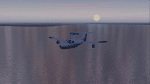
These textures re-colour and re-glint the FS2004 default waters. They work even better on payware, or other freeware water enviroment addons. They work best on WaterWrkx5. The textures are 32bit.
| Filename: | WaterWorks_51.zip |
| License: | Freeware |
| Added: | 24th December 2011, 09:30:25 |
| Downloads: | 1,213 |
| Author: | Lou McNeil |
| Size: | 28.84 MB |
| Category: Flight Simulator X - Missions | |
| UtahMysteryLakes.zip |
|
File Description:
Beginner/intermediate helicopter mission. A private helicopter company located at KP39 airport provides tour services. Take passengers on an evening tour of mysterious water phenomena at two lakes in the Utah mountains.
| Filename: | UtahMysteryLakeszip.zip |
| License: | Freeware |
| Added: | 1st April 2022, 23:24:32 |
| Downloads: | 42 |
| Author: | helomissionman |
| Size: | 4.59 MB |
| Category: Flight Simulator 2004 - AFCAD Files | |
| Official Water Aerodromes located in Province of Quebec territory. |
|
File Description:
These are AFCAD2 Scenery files for most popular and visited waterbases located in the province of Quebec, Canada. Your Ai floatplanes will come alive with these "invisible" waterbases airports installed (AI traffic flightplans required.) and your flyable floatplanes will be allowed to take-off directly into water, at official water aerodromes, using FS9 airports menu. Thanks to Holger Sandmann who has developped this technique. Must be used with Gilles Gauthier's "Terrain Mesh Province of Quebec" for FS2004 and his excellent "Quebec Sceneries Enchancements".
| Filename: | Official_Water_Aerodromes_located_in_Province_of_Q.zip |
| License: | Freeware |
| Added: | 21st July 2006, 20:05:28 |
| Downloads: | 2,241 |
| Author: | Guy F. Jutras |
| Size: | 379.29 KB |
| Category: Fly! II - TerraScene | |
| Sedona, AZ Area TerraScene Project Pack |
|
Images related to this file:
File Description:
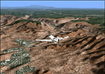
This TerraScene 2.1 Project pack covers all of global tile 176,154, with Sedona anchoring it just left of center. It extends from Sunset Crater in the NE southwest through Flagstaff, Sedona, Red Rock, and Prescott. This pack includes updated Tiger Census (2000) shapefile data, adding new water areas, new highways, and other details. All scenery data files are included: USGS data, shapefiles, an adapted texture set and a complete water mask. Requires TerraScene 2.1 and Fly!II patched to v230 or later.
| Filename: | Sedona_AZ_Area_TerraScene_Project_Pack.zip |
| License: | Freeware |
| Added: | 13th May 2010, 09:09:47 |
| Downloads: | 254 |
| Author: | Randall Rocke |
| Size: | 48.69 MB |
| Category: Fly! II - TerraScene | |
| Fayetteville (Carolinas Project) TerraScene Project Pack |
|
Images related to this file:
File Description:
This TerraScene 2.1 Project pack covers all of global tile 199,154, covering the area in and around the city of Fayetteville, NC. This tile includes Fort Bragg and Laurinburg as well as other towns in the sandhills region. This pack includes updated Tiger Census (2000) shapefile data, adding new water areas, new highways, and other details. All scenery data files are included: USGS data, shapefiles, and a complete custom water mask. Requires TerraScene 2.1 and Fly!II patched to v230 or later.
| Filename: | Fayetteville_Carolinas_Project_TerraScene_Project_.zip |
| License: | Freeware |
| Added: | 8th June 2010, 01:44:14 |
| Downloads: | 146 |
| Author: | Randall Rocke |
| Size: | 77.91 MB |
| Category: Flight Simulator X - Gauges | |
| Beaver Engine Panel for FIP v2 |
|
Images related to this file:
File Description:
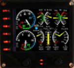
For Saitek Pro Flight Instrument Panel. This is folder contains a second version of the engine panel, digital type, for De Haviland Beaver DHC2. After some comments I added a water rudder warning light which light up in blue when the water rudder is unlocked and in down position. If you already use the Beaver FIP, I recommend to overwrite the previous needles by those coming with this version and which are updated. The package includes a serie of colored needles that can be changed easily, just replace the default needle by the one of your choice. Beaver_engine_v2.xml provides: Manifold pressure, Exhaust Gas Temperature, Fuel flow, Oil temperature, Oil pressure, Propeller RPM, Fuel quantity for center tanks 1, 2 and 3, Flaps position, Pitch, Rudder and Aileron trims, Water rudder warning light.
| Filename: | Beaver_Engine_Panel_for_FIP_v2.zip |
| License: | Freeware |
| Added: | 31st March 2012, 16:22:19 |
| Downloads: | 299 |
| Author: | Philippe Verhaege |
| Size: | 813.78 KB |
| Category: Flight Simulator 2004 - Scenery | |
| Frazier Lake Airpark (1C9) California Scenery |
|
File Description:
This is a scenery upgrade for Frazier Lake, California (1C9). This is part Eight of a series of small airstrip and minor airfield scenery enhancements which are based on real world data from Google Earth. The scenery mainly reflects the appearance of the airpark from directly above. If you are familiar with the place when on the ground, due to the limited number of buildings available it probably looks quite different. There is now however, a water strip for float planes which was missing from the default. It is proper FS9 water so you may land on it. Also, a few images from the net show that the ground varies from green grass to bare earth so I have made four .bgl files for the base texture. Note, I am using Flight1 Ground Environment; the default fields will look different. You must have rwy12 and EZ scenery libraries installed for the buildings to show. Both libraries of objects are free. EZ Library is available at http://www.abacuspub.com/pub/AbacusEZLibraries.exe. Rwy12 and additional EZ Custom libraries from Avsim. Search under Scenery design.
| Filename: | Frazier_Lake_Airpark_1C9_California_Scenery.zip |
| License: | Freeware |
| Added: | 31st March 2006, 01:00:25 |
| Downloads: | 501 |
| Author: | Kim Gowney |
| Size: | 400.27 KB |
| Category: Flight Simulator X - Scenery | |
| Hawaii - Niihau |
|
Images related to this file:
File Description:
Niihau, the westernmost of the inhabited Hawaiian Islands, is privately owned and used primarily to raise cattle. It's small population works the ranch. Because it is so isolated, it is the last of the Hawaiian Islands where Hawaiian is the primary language.
Niihau has no airport of its own. You get there by taking off from Kauai and flying west. I'd recommend using Port Allen (PAK). Unless visibility is limited, you can see Niihau across the water from the airport. Just take off and fly a heading of 270 degrees. However, a saved flight which places you just off Niihau's shore is included in the package should you need it.
| Filename: | Hawaii__Niihau.zip |
| License: | Freeware |
| Added: | 15th December 2009, 23:19:34 |
| Downloads: | 2,525 |
| Author: | Richard Sorochak |
| Size: | 36.49 MB |
| Category: Flight Simulator 2004 - Scenery | |
| Pitcairn Islands - Complete Scenery |
|
File Description:
This project is a complete & much more accurate scenery rendition of the Pitcairn Islands archipelago than the default scenery in FS2004.
The scenery includes all 4 islands redesigned, with detailed coastlines, Landclass with the only settlement, Adamstown represented, and accurate Waterclass representing the shallow reef banks bright colors.
A fictional AFCAD for each island was also made, with all 4 having a water landing area either along the coast or inside the lagoons. Ducie Island has a small sand strip as well.
Some scenery objects were added, mostly on Pitcairn Island, to recreate both the island's jetty & the Old Radio/Weather station.
Enjoy everyone!
| Filename: | Pitcairn_Islands__Complete_Scenery.zip |
| License: | Freeware, limited distribution |
| Added: | 5th August 2019, 06:36:31 |
| Downloads: | 284 |
| Author: | Leonardo Santos |
| Size: | 12.15 MB |
| Category: Flight Simulator 2004 - Miscellaneous Files | |
| DHC-2 Beaver Smoke With Control Gauge |
|
File Description:
This xml gauge and effect package automatically controls the light smoke effect in the DHC-2 Beaver by simply accelerating the throttle. The DHC-2 Beaver will automatically emit a very light smoke effect at a Manifold Pressure reading of 32(+) or greater, depicting a hard running engine. Reducing the throttle level for cruising (MP30-32) or less for descents deactivates the smoke effect.
Even though this xml gauge and effect file works perfectly well by itself, when used in conjunction with my dhc2_fx.zip, all the bases are covered. Smoke automatically engages for cold air temps and with this xml gauge, smoke engages as a result of high manifold pressure (eg. when taking off or climbing). The two work together very nicely without any conflict.
Designed for the FS2004 DHC-2 wheeled Beaver by Steven Grant, Fred Choate, and Aaron Swindle. In the AVSIM library-- dhc2_04w.zip --
Also works with the DHC-2 De Havilland Beaver Amphibian v2 that was made for FS2002, but works equally well in FS2004. In the AVSIM library-- dhc2ampv2.zip --
The README file includes complete instructions.
| Filename: | DHC2_Beaver_Smoke_With_Control_Gauge.zip |
| License: | Freeware |
| Added: | 7th October 2003, 16:34:19 |
| Downloads: | 1,767 |
| Author: | Brent Hricziscse |
| Size: | 5.31 KB |


© 2001-2026 AVSIM Online
All Rights Reserved
Privacy Policy |