
Where Flight Simulation Enthusiasts Gather from Around the World!
AVSIM Library - Search Results

| Category: Flight Simulator 2004 - Miscellaneous Files | |
| Doherty's Difficult and Dangerous Approaches - Vol 69 |

|
File Description:
FS 2004 Doherty's Difficult and Dangerous
Approaches - Volume 69. I am constantly
amazed by the high number of simers that
restrict their flying activities to small
localized areas, never venturing much
further than their own backyards. I can't
help thinking that they miss out
on some truly great flying experiences by
confining themselves to such limited
parameters. If nothing else, Doherty's
Difficult and Dangerous Approaches will
get you out more! Whether you are simply a
local pilot flying within your own well-worn
neighbourhood, or a demanding adventurous
international aviator, there's something for
everyone in these volumes. For the new simer
I have included some very easy approaches,
and for the army of case-hardened veterans who
think they have seen and done it all - let me
tell you now - you haven't! I'll introduce you
to approaches that will leave you absolutely
flabbergasted - and may I add, begging for
more! Each volume contains (10) difficult and
dangerous approaches which are set up for
you – all you have to do is fly them! I have
also included a special ~ (STAR) ~ approach
in each volume - which is a gem of an approach
that will thrill and amaze you. If you've
always wanted to know where all the difficult
and dangerous approaches could be found in
MSFS 2004, but never new where to look, I've
discovered them all - and now I'm sharing
them with you. Check out Doherty's Difficult
and Dangerous Approaches - by Michael
Doherty - you won't be disappointed.
| Filename: | Dohertys_Difficult_and_Dangerous_Approaches__Vol_6.zip |
| License: | Freeware |
| Added: | 1st February 2005, 04:45:19 |
| Downloads: | 2,208 |
| Author: | Michael Doherty |
| Size: | 1.07 MB |
| Category: Flight Simulator 2004 - Miscellaneous Files | |
| Doherty's Difficult & Dangerous Approaches - Vol 70 |
|
File Description:
FS 2004 Doherty's Difficult and Dangerous
Approaches - Volume 70. I am constantly
amazed by the high number of simers that
restrict their flying activities to small
localized areas, never venturing much
further than their own backyards. I can't
help thinking that they miss out
on some truly great flying experiences by
confining themselves to such limited
parameters. If nothing else, Doherty's
Difficult and Dangerous Approaches will
get you out more! Whether you are simply a
local pilot flying within your own well-worn
neighbourhood, or a demanding adventurous
international aviator, there's something for
everyone in these volumes. For the new simer
I have included some very easy approaches,
and for the army of case-hardened veterans who
think they have seen and done it all - let me
tell you now - you haven't! I'll introduce you
to approaches that will leave you absolutely
flabbergasted - and may I add, begging for
more! Each volume contains (10) difficult and
dangerous approaches which are set up for
you – all you have to do is fly them! I have
also included a special ~ (STAR) ~ approach
in each volume - which is a gem of an approach
that will thrill and amaze you. If you've
always wanted to know where all the difficult
and dangerous approaches could be found in
MSFS 2004, but never new where to look, I've
discovered them all - and now I'm sharing
them with you. Check out Doherty's Difficult
and Dangerous Approaches - by Michael
Doherty - you won't be disappointed.
| Filename: | Dohertys_Difficult__Dangerous_Approaches__Vol_70.zip |
| License: | Freeware |
| Added: | 6th February 2005, 04:35:17 |
| Downloads: | 2,645 |
| Author: | Michael Doherty |
| Size: | 1.01 MB |
| Category: Flight Simulator 2004 - Scenery | |
| VAOZ Nashik/Ozar, India |
|
File Description:
Googly scenery for Ozar, a small domestic airport located in Nashik (or
Nasik), 111 miles from Mumbai (Bombay). Nashik is a fast-expanding city in
the Maharashtra state in the Western Ghats located on the western edge of the Deccan
peninsula and is known as the Wine Capital of India or Grape City.
Owing to its close proximity to Mumbai, the airport has not proved popular as
the journey by taxi, bus or rail is not much greater after taking into account
check-in times etc. Air Deccan recently withdrew all flights from Ozar and as
far as I can establish the only airline now serving Ozar is Jagson Airlines,
using Dornier 228 turboprops. There is also a military presence at the east
end of the airport.
Flight Simulator 2004 has only provided a runway at this airport and this scenery
seeks to redress the situation so that you and your "AI" traffic can use the
airport.
The scenery does not purport to be ultra-accurate. Based on high quality
satellite imagery from Google Earth, the layout is proportionally correct but the
added airport features, such as buildings, are built from default Microsoft objects
and add-on libraries so will not look exactly like the real thing.
You are not obliged to download and install any additional scenery libraries,
but to enjoy this scenery in its entirety, you may wish to. It will work fine,
with or without.
| Filename: | VAOZ_NashikOzar_India.zip |
| License: | Freeware |
| Added: | 22nd April 2008, 07:55:32 |
| Downloads: | 737 |
| Author: | John Hinson |
| Size: | 118.11 KB |
| Category: Flight Simulator 2004 - Scenery | |
| Campbell River floats CAE3 in BC Canada |
|
Images related to this file:
File Description:
Campbell River is a medium sized town on Vancouver Island, some 50 miles north of Vancouver. The base is just north and west of the town on Spit Road. And Ultimate Terrain is required for the cost to be in the right place. The docks are on the south side of the spit, on the (relatively) sheltered river side, though take offs and landings are requested to take place outside the harbour if conditions permit. The base is noted as used and run by Corilair, though in fact there is also another company based there, Vancouver Island Air, who like Coril Air also have two docks, one for boarding passengers and one for maintenance and refuelling tie-ups. At the river mouth there is a small marina, run by the same folks who run the trailer park, and next to that a dock for visiting float planes. There is a seventh dock at the end furthest from the river mouth; I don't know what that is used for but it is next to Vancouver Island Air and might be theirs. At low tide there are numerous sandbanks (and more permanent islands with bushes and trees) in the mouth of the Campbell River and I decided to ignore installing these with all the problems they would cause me. The main buildings and most of the others are modeled specifically for this scenery; minor items like parked cars are RWY12.
| Filename: | Campbell_River_floats_CAE3_in_BC_Canada.zip |
| License: | Freeware, limited distribution |
| Added: | 12th February 2010, 18:45:00 |
| Downloads: | 881 |
| Author: | Roger Wensley |
| Size: | 5.3 MB |
| Category: Flight Simulator X - Scenery | |
| 130 AI Ships and AI Ship Traffic |
|
Images related to this file:
File Description:

This package contains 130 new AI ships and AI ship traffic routes for the North Sea, the Norwegian coast and the sea around the Arabian Peninsula and a few routes for the Mediterranean Sea.
The new ship models include 40 ferries, 4 cruise ships, different types of fishing vessels, Platform Supply Vessels (PSV), Offshore Subsea Construction Vessels (OSCV), and shuttle tankers from off shore oil industry, a pirate mother ship, pirate attack boats, a Greenpeace ship, a heavy lift ship, a couple of frigates, a coast guard ship, container ships, bulk carriers, a number of small coasters, and much more. Around 40 ships have landable helicopter platforms - all marked with an H. Most ships will have simple animations and custom wake, smoke and light effects.
Ships visits among other places Le Havre, Plymouth, Jersey, Hull, Aberdeen, Oslo, Kristiansand, Stavanger, Bergen, Trondheim, Bodo, Narvik, Tromso, Hammerfest, Murmansk, Mallorca, Rome, Neaples, Heraklion, Port Said, Suez, Jeddah, Djibouti, Salalah, Muscat, Dubai, Abu Dhabi, Doha, Ras Tanura, Kuwait, Basra, Bandar Imam, Mogadishu, Karachi, and Mumbai.
In order to get full benefit of this package you must first download and install 63 AI Ships and AI Ship Traffic for Europe and South America, 75 AI Ships and AI Ship Traffic, and the corresponding patch. With that installed you will have a total of 268 ships on shipping routes across the globe.
Full credits to the many people who have contributed in this project can be found in the PDF manual.
| Filename: | 130_AI_Ships_and_AI_Ship_Traffic.zip |
| License: | Freeware |
| Added: | 2nd March 2014, 12:37:04 |
| Downloads: | 11,536 |
| Author: | Henrik Nielsen |
| Size: | 56.11 MB |
| Category: Flight Simulator 2004 - Original Aircraft | |
| Piaggio P-166 Collection |
|
Images related to this file:
File Description:
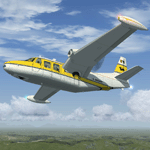
This package contains an updated re-release of all my original Piaggio P-166 models developed for FS-2002/2004. All versions are included in a single package: P-166A, P-166BL-2, P-166CL-2, P-166M, P-166S, P-166DL-3 and P-166DP-1. The 3D models are the same, so these are fairly simple models. Yet they come with a VC (no 2D panel this time!). With respect to the original releases, they come with very much improved panels, in two flavors: Piston and Turboprop. Gauges developed by Milton Shupe & Scott Thomas for the Aero Commander / Turbo Commander Aircraft series, and Edgar Guinart López of Aeroproyecto for the Embraer 110. Other Gauges from my own Piaggio P-180 & PD-808. Also Included is a brand-new flight model redeveloped from scratch. Please refer to the Reference and Checklist pages provided via the FS Kneeboard for flying and operating instructions.
The Piaggio P-166 is a light small twin. An Exotic twin-engine prop that sold all over the world including America, UK, and Australia. Its origin is traced Back to the Piaggio P-136, a light amphibian, which the P-166 keeps the wings, the engines and the tail planes. The first P-166A flew in November 1957. The aircraft was still in production in the early 21st century in an improved turboprop version, the P-166DP-1.
| Filename: | Piaggio_P166_Collection.zip |
| License: | Freeware |
| Added: | 2nd April 2020, 17:50:35 |
| Downloads: | 514 |
| Author: | Mario Noriega |
| Size: | 40.89 MB |
| Category: Flight Simulator X - Scenery Design | |
| (Version 2.0) KEFD -Ellington 2025 Refresh FSX (Circa 2006-2010)- Johnson Space Center Houston |
|
Images related to this file:
File Description:
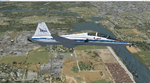
Version 2.0 covers landclass across the entire greater Houston area, with a large increase in LOD. This version significantly tightens up and improves the landclass from version 1.0, and adds a vast amount of scenery objects that brings the Bay Area-KEFD area into the modern era. This improves and adds a highly accurate runway 17 approach with accurate placement of buildings and scenery around the year 2011-modern day. In addition, includes several new files including a new airport/helipad via Houston Clear lake regional airport, T41 La Porte Municipal and surrounding shipping ports, Kemah Boardwalk, and a giant improvement to Johnson Space Center Houston. Rundway 35 and Runway 22 landclass is significantly increased, and more accurate as well. You can fly an accurate VFR approach or set up an ILS for any one of KEFD's runways with ease with this improvement.List of Version 2.0 additions and changes: - I added a ton of scenery objects and tightened up the landclass at Johnson Space Center Houston- NASA Control Center--- Added Talon Park with T38s (via static objects)--- Added Gemeni V rocket and 747 for the shuttle transporter--- And a whole bunch of vegetation, new buildings, and tour buses.- Added Kemah boardwalk and several boat docks- Removed a TON of highrise textures and replaced with medium and large city suburb landclass.- Added Clear Lake regional Hospital with helipad and surrounding scenery by Walter Reed Park- Added El Jardin or "Bayport Container port" with several scenery objects and significantly tightened up landclass.-- Looks great when setting up ILS approach for RWY 22- Tightened up Bay Area BLVD landclass, "adding" University of Houston Clear Lake"-- UHCL was semi already present, just made it more pronounced.- Made Red Bluff road landclass super recognizable!-- Red Bluff road is used to set up VFR approach and or field break for RWY 22 and RWY 17 R.----- Its common to see private jets and the USAF doing a break along Red Bluff road.- Added First Baptist Church, and water tower to Pasadena Convention center- Made Fairmont Parkway pronounced with landclass- Added Houston Port Authority at Morgan's Point--- Another Landmark for the RWY 22 ILS approach, NASA religiously uses this to line up the 10 mile ILS.- Tightened up landclass at Village Grove East and along Fairmont Parkway- Added a TON of scenery objects and landclass corrections for approach of RWY 17 L and 17 R.---- Added Home Depot, Lowes, Walmart Super center, Guitar center etc.---- added South Main Baptist Church--- Bondy Jr High, Turner Elementary, and Pasadena Memorial High School--- Added Saint Luke's Hospital--- Added Hampton Inn Suites and HCA rehab hospital--- Added a ton to the container facility behind best buy and storage facility--- Added smaller churches on RWY 17 approach--- Added a ton of scenery at the base of RWY 17 R, i.e., concrete plant, containers, trucks-- Added gas stations on the corner of beltway 8 and genoa red bluff-- Significantly changed and tightened up landclass at the base of RWY 22 and RWY 17 L and 17 R-- Made several roads and Beltway pronounced------ This decision looks AWESOME at night, really adds demarcation to the roads.**All of this makes the RWY 17 approach super recognizable** RWY 22 approach landclass is much more accurate.- Significantly changed and tightened up landclass near southbelt ellington and interstate 45.- Added Grace Church-- I wanted to do San Jacinto College south, but seemed over kill at that point.- SIGNIFICANTLY tightened up landclass for RWY 35 approach and near baybrook mall.-- Along I45- Added TDECU stadium at the University of Houston Main Campus---- So you can practice flybys for Cougar games!- Added the Battleship at San Jacinto Monument- I also "borrowed" T41 La Porte Municipal's tower camera to make a SWEET view of KEFD.- I included landclass for Sealy Texas this time, as well as my significant enhancements of Austin, Texas greater area as well (optional, but recommended!)---------------------------------------------------------------------------Version 1.0 originally added:- Added the Johnson Space Center Houston, which is now greatly enhanced and blended.- San Jacinto Community College-Central- Pasadena Convention Center- Pasadena Water Treatment Facility- NASA Bouncy Lab- Pasadena Shopping center, now greatly enhanced and blended.- Baybrook Mall and other shopping spots.- Significant Landclass improvements across the entire greater Houston Area File also includes landclass and scenery improvements for the greater Austin, Texas Area (optional), KIAH, KDWH, and Sealy, Texas. Each of these projects combined covers roughly 15,000 square miles of landclass improvement. Allowing you to fly entirely from Houston to Austin, or Houston to San Antonio in accurate landclass. -Enjoy!DJN
| Filename: | Version_20_KEFD_Ellington_2025_Refresh_FSX_Circa_2.zip |
| License: | Freeware |
| Added: | 12th October 2025, 16:15:47 |
| Downloads: | 70 |
| Author: | Dan Nelson |
| Size: | 277.28 MB |
| Category: Flight Simulator X - Original Aircraft | |
| Antonov AN225-210 "Colossus" |
|
Images related to this file:
File Description:
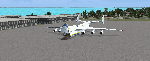
The AN225-210 is the result of a proposed 1 to 2-year projected modernization program which will
convert the current AN225 into a much more useful and capable aircraft than the already infamous
ÐœÑ€Ñ–Ñ (Mriya) . The latter First flew on December 21, 1988, and is currently 33 years old. There have
been a few maintenance periods and 1 major avionics modification, but otherwise is too old for reliable
future use. The 2 year process involves reconstructing the landing gear system to support much more weight. The
new engines are much more powerful, but lighter in weight, and much more fuel efficient. The wings
are replaced with similar wings with more wing-area built of modern light-weight material which gives
her higher lift capacity. The cargo hold area is reinforced for heavier weight limits. The crew areas
(upper deck, fore/aft main wing) are modernized for long duration flight, and two galleys are included.
The fuel tanks (9) now also involve 3 tanks in the upper center portion of the fuselage in order to put
less stress on the wings. The pressure system is modernized to achieve 6,000 feet cabin pressure up to
FL470. The internal and external lighting is fully modernized, the former for a pleasing effect and the
latter for distinct recognition during flight. Overall, the aircraft does not appear different to the
common observer.
Originally Created by:
Thomas Ruth & Alexander Kvitta (2009)
RB-211 Sounds by Sanjay Blair
Panel by: Philippe Wallaert
Auto Smoke Effects by: Richard Wisman
Camera Definitions by: Marc Renaud
Real World Aero/Engine Dynamics, EVP Mods, Effects and Data by:
Douglas E. Trapp
[email protected]
April 2021
All modifications herein are authorized by Thomas Ruth as contained within the AN225-210 Document pdf file.
This aircraft is designed for educational use protected by the Fair Use Doctrine:
http://www.expertlaw.com/library/intellectual_property/fair_use.html
| Filename: | Antonov_AN225210_Colossus.zip |
| License: | Freeware |
| Added: | 12th April 2021, 23:47:59 |
| Downloads: | 671 |
| Author: | Douglas Edward Trapp |
| Size: | 49.92 MB |
| Category: Prepar3D V1-4 - Utilities | |
| AIFlow SimConnect Utility for P3D v4 |
|
Images related to this file:
File Description:
AIFlow v1.1 is a simconnect utility designed to ease AI congestion and go-arounds at the airport the user is departing from and arriving at. AIFlow does this by enforcing spacing minimums between arriving AI aircraft resulting in more orderly arrival patterns. AIFlow also supports spacing spacing minimums between the AI aircraft and the USER’s aircraft when the user is flying (during all phases of the user's flight). For added realism, AIFlow adds landing effects (e.g., micro bank and pitch corrections that scale up during crosswind conditions) to the AI on short final approach. The user can also briefly squawk 1234 in their aircraft to temporarily suspend landings so that the user can find a slot to depart a busy runway. AIFlow is designed to compliment the default P3D AI program and thus is fully compatible with any AI-related program that is compatible with the default AI program (e.g., AIG, Ultimate Traffic Live, Radar Contact, etc.). AIFlow is targeted to Prepar3D version 4.5 or 5.0, specifically SimConnect Version 4.5.0.0 or later. AIFlow operates externally via simconnect and thus makes no changes to the P3D sim. NEW for v1.1: (1) detect and correct AI performing poor approaches (e.g., dive-bombing, descent into terrain) under control of the P3D AI engine, (2) user can specify minimum and maximum AI approach speeds in terminal area, (3) prevent AI from stopping on runway when user landing, (4) AI plane spotting mode only, (5) external database fallback in case simconnect fails to provide local airport data, (6) adjustable in-sim message level, (7) periodic read of .ini file to tweak parameters more easily, (8) AIFlow starts minimized. FIXES for v1.1 include: sequencing in heavy AI traffic would sometimes cause excessive go-arounds, going around AI would sometimes improperly hold, changing AI spacing from default value did not have any effect, sometimes user aircraft would get controlled, .ini file would sometimes get confused reading parameter values having whites spaces.
| Filename: | AIFlow_SimConnect_Utility_for_P3D_v4.zip |
| License: | Freeware |
| Added: | 3rd July 2020, 23:57:52 |
| Downloads: | 2,018 |
| Author: | Roland Foster |
| Size: | 1.18 MB |
| Category: Flight Simulator 2004 - Scenery | |
| Anahim Lake CAJ4 in British Columbia, Canada |
|
Images related to this file:
File Description:
Anahim Lake is around 55 miles east of Bella Coola by air, and clear of the deep and rugged valley that connects the two with a road that is over 75 miles long. The two are also linked by a daily Pacific Coastal flight. A further 150 miles east is Williams Lake (200 miles by road). The town of Anahim Lake is small, but renowned for numerous surrounding fishing lodges on the lakes and the enjoyment of "nature" in what is known as the Chilcotin Wilderness. The Anahim Lake airport is an odd one. It appears to have fallen into disuse over a period of years, but is now in the process of being upgraded, with some new hangars (though oddly situated, and with only dirt track taxiway access) and a recently completed terminal building. There is also a plan to upgrade the runway (lights etc, there are currently no runway or taxiway lights) and in general to greatly improve the facilities on offer. The only current airline to fly there is Pacific Coastal. The runway is just under 4,000 feet of asphalt aligned 13-31 and 75 feet wide. There used to be another runway which is still visible but is now unusable, gravel that has not been maintained for several years. The notes for Anahim Lake airfield in the Nav Canada manual warn of "Extensive float plane activity at Nimpo Lake to the south" and of "possible large animals within the airport perimeter". Nimpo Lake activity will follow in further posts.
| Filename: | Anahim_Lake_CAJ4_in_British_Columbia_Canada.zip |
| License: | Freeware, limited distribution |
| Added: | 29th November 2018, 19:21:59 |
| Downloads: | 153 |
| Author: | Roger Wensley |
| Size: | 5.72 MB |


© 2001-2026 AVSIM Online
All Rights Reserved
Privacy Policy |