
Where Flight Simulation Enthusiasts Gather from Around the World!
AVSIM Library - Search Results

| Category: Flight Simulator X - Scenery | |
| EDTQ Pattonville |

|
Images related to this file:
File Description:
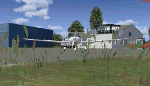
Airfield Pattonville (ICAO-Code: EDTQ)
See http://pattonville.pa.funpic.de/ for more information.
The Airfield Pattonville is a small airfield north of Stuttgart in southern germany. It is used by several aviator-clubs and hosts the base for a rescue helicopter. The runway suits for planes up till 3.5 tons.
This airfield was built bevor 2nd world war between Kornwestheim and Remseck-Aldingen. After WW2 it was used by the US-army and named "Ludwigsburg Army Airfield" and hosted missile-Launchpads during the Korea-war.
Since 16th of Juli 2003 The Airfield Pattonville is name as �������¢����������������Sonderlandeplatz Pattonville�������¢���������������� and has ICAO-Code EDTQ.
Due to the rising amount of airtraffic at Airport EDDS Stuttgart, the rescue-helicopter 'Christoph 51' moved to Pattonville at 1st of October 2009.
| Filename: | EDTQ_Pattonville.zip |
| License: | Freeware |
| Added: | 18th May 2012, 23:00:49 |
| Downloads: | 2,338 |
| Author: | Joe Herwig |
| Size: | 12.96 MB |
| Category: Flight Simulator 2004 - Scenery | |
| Nikolski (IKO), Nelson Lagoon (Z73), & Perryville (AK5) - Alaska, USA |
|
Images related to this file:
File Description:
These are villages in Alaska, spread out east and west of Dutch Harbor in the Aleutians and the peninsula, served by Grant Aviation regional flights from Dutch Harbor, Cold Bay, or King Salmon.
Nikolski is 115 miles west of Dutch Harbor at the western end of Umnak Island, which is just west of Unalaska, the large island adjacent to Dutch Harbor. Nikolski is small, with a population of perhaps only 20 now, and the main claim to fame is the wrecked Reeve Aleutian DC3 at the end of the runway. The runway is 3,500 feet of gravel aligned 08-26. Nelson Lagoon is on the north shore of the peninsula, 55 miles north of Sand Point and on a long spit of land that curves around to make the lagoon. There is no access except by boat or plane for the population of around 50. The airfield is a mile east of the village with a gravel runway 08-26, 4,000 feet long. Perryville is on the south shore of the peninsula, 65 miles east of Sand Point. The population is around 115, and the airfield is southwest of the town with the 3,500 feet of gravel runway aligned 02-20 beside the shore. There is a hangar on the apron, but no terminal building.
| Filename: | Nikolski_IKO_Nelson_Lagoon_Z73__Perryville_AK5__Al.zip |
| License: | Freeware, limited distribution |
| Added: | 14th March 2015, 13:27:53 |
| Downloads: | 257 |
| Author: | Roger Wensley |
| Size: | 11.45 MB |
| Category: Flight Simulator X - Scenery | |
| RAF Hooton Park - Cheshire, England |
|
File Description:
RAF Hooton Park, on the Wirral Peninsula, Cheshire, was a Royal Air Force station originally built for the Royal Flying Corps in 1917 as a training aerodrome for pilots in World War I. During the early/mid-1930s, it was one of the two airfields (with Liverpool Speke) handling scheduled services for the Merseyside region. Hooton Park was home to No. 610 (County of Chester) Squadron and, post World War II, to No. 611 (West Lancashire) and No. 663 (AOP) Squadron.
The airfield closed in 1957 after the disbandment of the Royal Auxiliary Air Force, but the three pairs of Belfast Truss hangars erected in 1917 survived the closure. The site was bought by Vauxhall Motors, who built their Vauxhall Ellesmere Port plant there, which today produces the Vauxhall Astra. A small remaining section of the airfield site is now owned and managed by The Hooton Park Trust. The hangars are also home to The Griffin Trust and an aircraft preservation society named The Aeroplane Collection. Another part of the old airfield, including a length of the old paved runway, perimeter track and the apron used to park Meteor jet fighters, remains in the ownership of The Naylor Trust. A Second World War B1 hangar is also on this site.
Third party add-on's will be required see the readme.txt for details.
| Filename: | RAF_Hooton_Park___Cheshire_England.zip |
| License: | Freeware |
| Added: | 13th December 2015, 12:12:02 |
| Downloads: | 195 |
| Author: | Terry Boissel |
| Size: | 1.47 MB |
| Category: Flight Simulator 2004 - Scenery | |
| Alaska South Slope 1: Noatak PAWN in AK, US |
|
Images related to this file:
File Description:
The town of Kotzebue is in the far northwest of Alaska, and these are villages to the north and then the east of Kotzebue on the South Slope of the Brooks Range of mountains. There will be further additions. Noatak is a small village (population now around 520 and rising) on the west bank of the Noatak River, around 50 miles north of Kotzebue. It is on the edge of the Noatak National Preserve and as the only village on the river is the centre for fishing, rafting, canoe, and other types of outdoor expeditions. The airfield has almost 5,000 feet of lit gravel just south of the town, aligned 18-36. There are scheduled flights by Era (now renamed Ravn) and by Bering Air, both of them originating in Kotzebue and routing north to Noatak, Kivalina, Point Hope, and then back again. The AI includes these flights plus a daily Everts Air cargo flight and GA. There are new bgl's for Kotzebue; the development of the northern and eastern AI meant that more dedicated parking spaces were needed at Kotzebue. The two new Bering Air planes are as listed in the AI folder, and there is also a new Era Cessna 208 to be installed. The next South Slope scenery will be Noorvik ORV, to the east of Kotzebue.
| Filename: | Alaska_South_Slope_1_Noatak_PAWN_in_AK_US.zip |
| License: | Freeware, limited distribution |
| Added: | 2nd September 2016, 20:54:32 |
| Downloads: | 254 |
| Author: | Roger Wensley |
| Size: | 4.22 MB |
| Category: Flight Simulator 2004 - Scenery | |
| Alaska South Slope 3; Kiana PAIK |
|
Images related to this file:
File Description:
The town of Kotzebue is in the far northwest of Alaska, and served by Alaska Airlines. These are villages to the (mostly) east of Kotzebue on the South Slope of the Brooks Range of mountains, served by local flights from Kotzebue. There will be further additions. Kiana is a small village (population now around 360) on the bank of the Kobuk River, around 60 miles east of Kotzebue. The airfield, called Baker Memorial, is just north of the village, with 4,000 feet of lit gravel aligned 06-24 (as are several other runways in the area) with PAPI on 24. There are scheduled flights by Era (now renamed Ravn) and by Bering Air, both of them originating in Kotzebue and routing east to Noorvik, Kiana, Ambler, Shungnak, Kobuk, and then back again. The AI includes these flights along with Everts Air and Northern Air Cargo flights and GA. In real life the runway is around 200 yards closer to the village; this complicated the removal of roads and revised ground textures so I left it as is to make my life easier. The post includes missing night textures that were omitted from the post of Noatak PAWN. Noatak also has incorrectly installed original FS9 taxiway lights that were, as a result, impossible to remove. I had hoped to somehow manage it, but there is no way.
| Filename: | Alaska_South_Slope_3_Kiana_PAIK.zip |
| License: | Freeware, limited distribution |
| Added: | 7th September 2016, 22:00:17 |
| Downloads: | 213 |
| Author: | Roger Wensley |
| Size: | 4.5 MB |
| Category: Flight Simulator X - Scenery | |
| EDST - Hahnweide Kirchheim - Germany *v1.2* |
|
Images related to this file:
File Description:
The airfield EDST-Hahnweide is located approximately 17 nautical miles southeast of EDDS- Stuttgart. Former it was just a gliderfield but now ist is available also for small motor-aircrafts.
Each two years there are happens the greatest meeting of oldtimer-aircrafts in Europe.
This scenery is designed very much in detail. All important objects have been created by me and Joachim Herwig using actual original photos of the airfield and its surrounding. A retouched photo background, covering all four seasons, completes the scenery.
EDST Hahnweide does not exist in the standard scenery of the FSX. So this scenery is an addon-scenery, which hopefully will fill one of the plenty “white spots†in the World of FSX.
Because this field is some like a “bumpi†medow, the airfield ground is exactly designed like this. Therefore you will not find a plane runway.
Libraries: Many smaller Objects, like people, cars or static airplanes in this scenery were taken from three popular freeware libraries for whose use I got the friendly permission of the authors. If these libraries are not installed , many objects are not visible !
The following libraries are used:
1. FS-Piloten_Objektlibrary -
http://www.fs-piloten.de/thread.php?threadid=1063
2. FSX_FlightPortLib -
http://www.flightport.de/libraries/flightport-library/
3. 3d People Library -
http://library.avsim.net/download.php?DLID=192454
| Filename: | EDST__Hahnweide_Kirchheim___Germany_v12.zip |
| License: | Freeware, limited distribution |
| Added: | 25th October 2016, 21:01:37 |
| Downloads: | 1,482 |
| Author: | Wolfgang Allers, Joachim Herwig |
| Size: | 369.26 MB |
| Category: Flight Simulator 2004 - Aircraft Repaints, Textures and Modifications | |
| Imperial Iranian Air Force One (IIAF1) Boeing 747-400 |
|
File Description:
This is a repaint of the FSPainter fabulous Boeing 747-400 V2 (model not included) in the Imperial Iranian Air Force 1 colour. Yes, Iran was due to receive her first American modeled Air Force 1 B747SP registered as EP-HIM (His Imperial Highness) during the reign of the late Shah of Iran Mohammad Reza Shah Pahlavi but the so called revolution of the 1979 put an end to all the good relations with the United States of America and resulted in cancellation of all the orders for American jet planes(including this fabulous aircraft) and fighters. Well, I had read about this certain aircraft sometime but had no idea how it would look like since I saw a small photo,a painting of it on the internet (what a wonderful plane it was due to become) and decided to make a repaint job of it on a 747-400(instead of 747SP) and FSPainter model.v2 was great for it. So I do hope that you enjoy this imperial repainting of the Queen of the Skies whose registeration is the same EP-HIM and the Persian writings on the sides of the fuslage (Keshvar-e Shahanshahi-e Iran) can be translated as the Imperial Land of Iran or the Imperial Country of Iran.744 Base textures by FSPainter, IIAF1 textures by Pantee Farhangi.
| Filename: | Imperial_Iranian_Air_Force_One_IIAF1_Boeing_747400.zip |
| License: | Freeware |
| Added: | 4th December 2003, 23:02:53 |
| Downloads: | 712 |
| Author: | Pantee Farhangi / FSPainter |
| Size: | 328.64 KB |
| Category: Flight Simulator 2004 - Aircraft Repaints, Textures and Modifications | |
| VT ANG Air Museum Collection Part 1 |
|
File Description:
The Vermont Air National Guard was organized on 1 July 1946 at Burlington Municipal Airport and was federally recognized as the 134th Fighter Squadron on 14 August 1946 making it the fifth US ANG unit so formed and recognized. Since that time the VT ANG has flown eight different aircraft types in its primary mission and several more in support of it. The primary mission aircraft flown include the P-47D-40, P-51D-25, F-94B, F-89J, F-102A, EB-57B, F-4D, F-16A and the current F-16C. The mission support aircraft flown include the L-5, AT-6C, AT-11, C-47B, T-33A, C-45H (?), C-54G, C-131D, C-12F and C-26A. The VT ANG has a small air museum near the main gate to their base at Burlington International Airport which currently includes a T-33A, F-94B, F-89J, F-102A, F-4D, C-47B, C-45H and C-131D. My virtual VT ANG Air Museum Collection for FS9 is an attempt by a 134th FS veteran to duplicate and expand upon the actual VT ANG Air Museum. This first texture only download package, vamc1.zip, includes my VT ANG repaints of the FS9 default DC-3/C-47, Arik Hohmeyer/Chris Grabow & FS-DESIGN BERLIN's DC-4/C-54 and Greg Pepper's Beech 18G-S/C-45H.
| Filename: | VT_ANG_Air_Museum_Collection_Part_1.zip |
| License: | Freeware, limited distribution |
| Added: | 6th March 2004, 00:22:14 |
| Downloads: | 793 |
| Author: | Mike MacIntyre |
| Size: | 4.25 MB |
| Category: Flight Simulator 2004 - Aircraft Repaints, Textures and Modifications | |
| VT ANG Air Museum Collection - Part 2 |
|
File Description:
The Vermont Air National Guard was organized on 1 July 1946 at Burlington Municipal Airport and was federally recognized as the 134th Fighter Squadron on 14 August 1946 making it the fifth US ANG unit so formed and recognized. Since that time the VT ANG has flown eight different aircraft types in its primary mission and several more in support of it. The primary mission aircraft flown include the P-47D-40, P-51D-25, F-94B, F-89J, F-102A, EB-57B, F-4D, F-16A and the current F-16C. The mission support aircraft flown include the L-5, AT-6C, AT-11, C-47B, T-33A, C-45H (?), C-54G, C-131D, C-12F and C-26A. The VT ANG has a small air museum near the main gate to their base at Burlington
International Airport which currently includes a T-33A, F-94B, F-89J, F-102A, F-4D, C-47B, C-45H and C-131D. My virtual VT ANG Air Museum Collection for FS9 is an attempt by an old 134th FS veteran to duplicate and expand upon the actual VT ANG Air Museum. This second download package, vamc2.zip, includes my VT ANG repaints of the AT-6G Texan by Cliff Presley, the P-51D Mustang by Andrew Wai and the P-47D Thunderbolt by Krzysztof Malinowski/Greg Pierson/Tom Kohler.
| Filename: | VT_ANG_Air_Museum_Collection__Part_2.zip |
| License: | Freeware, limited distribution |
| Added: | 9th March 2004, 00:28:31 |
| Downloads: | 865 |
| Author: | Mike MacIntyre |
| Size: | 7.17 MB |
| Category: Flight Simulator 2004 - AI Flight Plans | |
| Sorted default FS9 flight plans & GA flight plans sorted by ICAO/country |
|
File Description:
The Master_GA_sorted_country contains: some 20,436 flight plans that have been adopted from Reggie Fields' sorted aircraft registration collections. The following is from his readme file (included folder), "FS2004 General Aviation AI traffic with more correct registration numbers for the originating country. This file is a modification of the FS2004 default GA traffic designed to minimize the number of small single engine aircraft landing at the worlds major commercial airports. This will prevent a lot of go-around orders to commercial jets based on the length of time it takes a C172 to clear a 10,000 ft runway. This file makes commercial AI traffic flow much better than the MS default while retaining the GA aircraft in the airspace." Like Reggie Fields' files, all are free to use and redistribute but can not be sold. AC#defaultfp_sorted_ICAO folder contains all individual default aircraft in seperate files and their FS9 default flight plans are sorted by ICAO. A second folder contains a file for each country with the mentioned GA flight plans sorted by ICAO. This should be of an aide to those of us who wish to put more correct AI aircraft into a region or country. Copy/paste should be easier, this way, when building on each countries' aviation/flights. All files are text (.txt) files (ASCII.) They have no @ and TTOOLS by Lee Swordy is recommended.
| Filename: | Sorted_default_FS9_flight_plans__GA_flight_plans_s.zip |
| License: | Freeware |
| Added: | 10th May 2004, 14:48:30 |
| Downloads: | 2,983 |
| Author: | Rick Connolly |
| Size: | 5.57 MB |


© 2001-2026 AVSIM Online
All Rights Reserved
Privacy Policy |