
Where Flight Simulation Enthusiasts Gather from Around the World!
AVSIM Library - Search Results

| Category: Flight Simulator 2004 - Scenery | |
| Fort Graham CBW3 in British Columbia Canada |

|
Images related to this file:
File Description:
Fort Graham is what looks like a very small village on the eastern shore of Williston Lake in northern British Columbia, around 100 miles north of Mackenzie (a previous post). The lake, while not large by Canadian standards, is well over 100 miles long but squeezed in width to a maximum of 5 miles amid the surrounding Rockies. The airfield has a gravel runway of 5,000 feet aligned 13-31 and at 2,230 feet ASL. There is no lighting. The operator of the airfield (and presumably the "village" too) is Finlay River Outfitters, a company that is based in Mackenzie and "outfits" hunting trips in the local area. I have posted this as Fort Graham CBW3, but I suggest that you just add it to your previously created "BC airfields" and avoid the inevitable doubling up of common textures etc. Up to you. If you find a defect, email me.
| Filename: | Fort_Graham_CBW3_in_British_Columbia_Canada.zip |
| License: | Freeware, limited distribution |
| Added: | 23rd November 2020, 20:13:11 |
| Downloads: | 108 |
| Author: | Roger Wensley |
| Size: | 7.75 MB |
| Category: X-Plane - Scenery | |
| BR CE - SNIG Iguatu Airport v1.0.0 |
|
Images related to this file:
File Description:
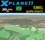
This is an X-Plane 11 and X-Plane 10 scenery package for Tomé da Frota Airport (IATA: IGT, ICAO: SNIG), which is the airport serving the city of Iguatu, state of Ceará, in Brazil.
It includes corrected aprons, ramps, gates, taxiways, lighting system, city buildings, ortho-photoscenery for the airfield area, and (XP11 only) airport ground services (like push back).
With an intense movement of small aircraft Iguatu Airport is of total importance for businessmen who have aircraft or use the air taxi. Sol Aviation flies from/to Fortaleza/SBFZ. Gol and Two airlines announced intention to fly to/from Fortaleza/SBFZ later in 2018.
This scenery was tested and is operational (as of January 26, 2018) in "X-Plane 11.11 64 bit", Windows 10 Home. It was also tested and is also operational (as of January 26, 2018) in "X-Plane 10.51 64 bit", Windows 10 Home.
| Filename: | BR_CE__SNIG_Iguatu_Airport_v100.zip |
| License: | Freeware |
| Added: | 2nd February 2018, 00:11:29 |
| Downloads: | 44 |
| Author: | Rui Mesquita |
| Size: | 8.3 MB |
| Category: Prepar3D V1-4 - Aircraft Repaints, Textures and Modifications | |
| Republic P-47D-25 324th FG (83) "Wee Three" |
|
Images related to this file:
File Description:
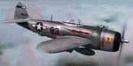
This folder contains a repaint for the P_47D-25 Bubbletop by Aeroplane Heaven, in the colors of P-47D-30 44-19726 #83 "Wee Three" of the 316th FS, 324th FG, 9th AF. The name came from its first pilot, who was married and had a small child, hence the "Wee Three". After he finished his tour, the aircraft was re-assigned to Lt John Jasper Yowell jr. On 19 march 1945, while on his 65th mission, to Pforzheim, the squadron was ambushed by a flight of Me-109's. His wingman, John Haun, shot down one Me-109, but Lt Yowell was hit by enemy fire and forced to bail out. Unfortunately, his parachute didn't open. He was found and buried in his parachute by French labourers. After the war, he was reinterred at Arlington National Cemetery. Repaint by Jan Kees Blom, based on the paintkit by Aeroplane Heaven.
| Filename: | Republic_P47D25_324th_FG_83_Wee_Three.zip |
| License: | Freeware |
| Added: | 2nd December 2018, 17:19:50 |
| Downloads: | 47 |
| Author: | Jan Kees Blom |
| Size: | 66.87 MB |
| Category: Flight Simulator X - AFCAD Files | |
| Redwing Airport (2N6), NJ |
|
File Description:
Located 01 miles S of Jobstown, New Jersey on 53 acres of land, Redwing Airport is a small dual turf strip that hosts both single engine craft and gliders. No services are provided to transient aircraft, you can park over near the hangars (no visible tie downs). The Runway 11/29 edge lights are adjustable low-high in real life but for the sim I've set them at medium. Trees are summer ONLY.
Scenery constructed with use of satellite images/streetview, the author has not been there in person.
This scenery is meant to be used in conjunction with MegaScenery Earth New Jersey/Delaware 002. It is not required, but apron use is minimized to allow satellite scenery to show through as much as possible, and objects are placed based on the MSE textures - lack of it may make scenery look out of place.
| Filename: | Redwing_Airport_2N6_NJ.zip |
| License: | Freeware |
| Added: | 15th October 2010, 15:34:10 |
| Downloads: | 329 |
| Author: | Drew Sikora |
| Size: | 527.92 KB |
| Category: Flight Simulator 2004 - Scenery | |
| Arviat CYEK in Nunavut, Canada |
|
Images related to this file:
File Description:
Arviat is a small town on the west coast of Hudson Bay in Nunavut, around 90 miles south of Whale Cove, 130 miles south of Rankin Inlet, and 160 miles north of Churchill. The airfield is just south of the town, and the 4,000 feet of gravel runway is aligned 149T/329T; these are true bearings and not magnetic as Arviat is just inside the Northern Domestic Airspace zone. There is 100LL fuel available in drums, with 2 hours prior notice. The visiting AI airline is Calm Air, plus a cargo delivery by Buffalo Air. As a town of 2,200 people is too large to model I have used a landclass with autogeneration. The result includes some trees, which is not realistic, but there was no way out. There is a special note in the instructions regarding Flight Ontario replacement textures and "glowing" gravel aprons.
| Filename: | Arviat_CYEK_in_Nunavut_Canada.zip |
| License: | Freeware, limited distribution |
| Added: | 6th January 2012, 16:13:45 |
| Downloads: | 508 |
| Author: | Roger Wensley |
| Size: | 2.19 MB |
| Category: Flight Simulator X - Scenery | |
| Provincetown Municipal Airport (KPVC) |
|
Images related to this file:
File Description:
This airport was made using Airport Facilitator X, and Instant Scenery 2. Provincetown Municipal Airport is a small airport located in Provincetown, Massachusetts. Cape Air is the only airline that flies there. I added a more accurate terminal, and an aircraft hangar. I put three fuel trucks on the ramp with a fuel station. I made the taxiways the correct length and width. I also put static aircraft on the ramp and added more gates. I made a parking lot with many cars in it. If you choose to start off from a DOCK gate, you will start off inside the aircraft hanger. Taxiing or starting off inside of the hanger will cause a crash unless you have crashes turned off. This is all based on Google Earth and Bing Maps. Please read the readme for instructions on how to install. This is for Flight Simulator X only.
| Filename: | Provincetown_Municipal_Airport_KPVC.zip |
| License: | Freeware |
| Added: | 21st January 2012, 20:08:09 |
| Downloads: | 607 |
| Author: | Tyler Lawrence |
| Size: | 6.86 MB |
| Category: X-Plane - Aircraft Repaints, Textures and Modifications | |
| Bergamo Aero Club Cessna 172N Skyhawk II (I-CCAP) |
|
Images related to this file:
File Description:

This archive only contains textures for the Carenado 172II V2 aircraft. In order for it to work, you need to own this specific aircraft. Since these are only textures, no further support is necessary, just follow the instructions below.
*** I have included a .obj file that Dan Klaue provided to fix a small problem causing wing registrations to display incorrectly. The filename is TransparentStickers.obj. You must copy this file to the aircraft's main objects folder of the Carenado C172II v2 main folder. You will be asked if you want to replace the existing file, say yes. Make a backup of the original first. This file will enable the under-wing registration of the aircraft.
Then open the zip file and move the whole folder I-CCAP to X-Plane 10 (where you installed X-Plane)--->Aircraft-->Carenado Cessna 172 v2 (where you installed the Carenado package)--->liveries. That's it!
| Filename: | Bergamo_Aero_Club_Cessna_172N_Skyhawk_II_ICCAP.zip |
| License: | Freeware, limited distribution |
| Added: | 16th June 2013, 02:23:15 |
| Downloads: | 98 |
| Author: | Michel Theriault |
| Size: | 14.82 MB |
| Category: Flight Simulator X - Scenery | |
| X5SB - Sutton Bank Yorkshire Soaring Club - North Yorkshire, England |
|
Images related to this file:
File Description: For ORBX England only.
This is a departure for me. away from Appalachia across the pond to Merry
England. This will be the first in a small series of English Glider fields, and
WW2 airfields.
All buildings are made using sketchup. These are exactly sized as all original
buildings and properly located. Improved the area around Hangars.
Sutton Bank, also known as Roulston Scar, is a hill in the Hambleton District of
North Yorkshire in England. The Yorkshire Gliding Club is based at the top of
the hill. A popular slope soaring site since the 1930's, it now is a major site
for aerotowing as well as winch launching sailplanes.
This scenery will appear nicely in the stock FSX, BUT, the field will not be
very flat, use at your own discretion.
| Filename: | X5SB__Sutton_Bank_Yorkshire_Soaring_Club__North_Yo.zip |
| License: | Freeware |
| Added: | 24th July 2014, 08:06:56 |
| Downloads: | 662 |
| Author: | Jon Davidson |
| Size: | 38.16 MB |
| Category: X-Plane - Scenery | |
| ENNM - Namsos Airport - Namsos, Norway |
|
Images related to this file:
File Description:
This Namsos scenery corresponds to the current Airport Layout of ENNM. The near surroundings are designed based on a satellite photo so that VFR flights and VFR orientation should be very easy. The second bridge a bit far west of the airport is included, also the City of Namsos, a cruise ship dock and the marina south of the Namsos Bridge.
I used some parts of freeware libraries, which are already included in this package.
The airport buildings are converted from the famous FS2004 scenery from Kjell Arild Bersaas & Arne Sundsboe.
I did some small changes which were absolutely necessary to fit the new airport layout. Finally I only deleted a fence which blocked the new apron.
This scenery is converted from my ENNM-FSX scenery and the reworked with WED and OverlayEditor. The library "OpenSceneryX" must be installed first:
http://www.opensceneryx.com/
| Filename: | ENNM__Namsos_Airport__Namsos_Norway.zip |
| License: | Freeware |
| Added: | 17th May 2015, 08:59:30 |
| Downloads: | 140 |
| Author: | Wolfgang Allers |
| Size: | 16.75 MB |
| Category: Flight Simulator X - Scenery | |
| RAF Folkingham |
|
File Description:
Royal Air Force Station Folkingham or RAF Folkingham is a former Royal Air Force station located south west of Folkingham, Lincolnshire and about 29 miles (47 km) due south of county town Lincoln and 112 miles (180 km) north of London, England.
Opened in 1940, it was used by both the Royal Air Force and United States Army Air Forces. During the war it was used primarily as a troop carrier airfield for airborne units and as a subsidiary training depot of the newly formed Royal Air Force Regiment. After the war it was placed on care and maintenance during 1947 when the RAF Regiment relocated to RAF Catterick.
You will need some additional scenery files by Ted Andrews and Ian Pearson which can be found at http://www.ianpsdarkcorner.co.uk, otherwise on the runway and peri track show. Ted Andrew - small buildings and Ians FSX Object Libraries.
| Filename: | RAF_Folkingham.zip |
| License: | Freeware |
| Added: | 8th October 2015, 17:55:15 |
| Downloads: | 296 |
| Author: | Terry Boissel |
| Size: | 9.59 KB |


© 2001-2026 AVSIM Online
All Rights Reserved
Privacy Policy |