
Where Flight Simulation Enthusiasts Gather from Around the World!
AVSIM Library - Search Results

| Category: Flight Simulator 2004 - Scenery | |
| Elevation Fix For Addon KBUR KDCA KSNA Airport Scenery |

|
File Description:
This file includes three small BGL files designed to be used with one or more of the following addon airport scenery files developed by Shehryar 'Shez' Ansari:
BUR2005.zip for KBUR Burbank / Bob Hope; dca2002.zip for KDCA Reagan National / Washington DC; and SNA2004.zip for KSNA John Wayne / Santa Ana.
These BGL files set the FS9 airport elevations allowing AFCAD files to work properly with this scenery. More info on how and why in the included readme.
| Filename: | Elevation_Fix_For_Addon_KBUR_KDCA_KSNA_Airport_Sce.zip |
| License: | Freeware |
| Added: | 22nd November 2005, 00:34:29 |
| Downloads: | 9,486 |
| Author: | Scott Smart |
| Size: | 5.21 KB |
| Category: Flight Simulator 2004 - AI Flight Plans | |
| Mint Airways, Summer 2010 (Fictional) |
|
Images related to this file:
File Description:

These are fictional representative flightplans for Mint Airways Summer 2010. I was unable to obtain the correct times and flight numbers from the website or other sources, so I had to make them up! However, I discovered from the Mint Airways website that they fly to certain routes on certain days, and these are incorporated into these schedules. The airline operates a small fleet of 1 Boeing 757-200, which was acquired following the demise of Flyglobespan.
| Filename: | Mint_Airways_Summer_2010_Fictional.zip |
| License: | Freeware |
| Added: | 24th April 2010, 09:08:38 |
| Downloads: | 598 |
| Author: | Chris Horsfield |
| Size: | 11.17 KB |
| Category: Flight Simulator X - Panels | |
| Three Engine Turbo Panel |
|
File Description:
Famous aircrafts as Boeing 727, MD11 and MD83 a.m. use Panel for three engines in the real world. Never or less I could not find any FSX-aircraft equiped with a real three engine turbo panel, so I decided to make one based on an old FS98/FS2000 model. I have fixed it to be used in FSX. Hopefully you will like the result. I have made some small changes in this edition of the panel.
| Filename: | Three_Engine_Turbo_Panel.zip |
| License: | Freeware |
| Added: | 5th January 2008, 16:18:07 |
| Downloads: | 2,940 |
| Author: | Mikael Seedorff |
| Size: | 12.22 MB |
| Category: Flight Simulator 2004 - Scenery | |
| Asmara Intl. Airport (HHAS) |
|
File Description:
Here is my light and simple scenery for Asmara Intl. Airport. The airport formerly was known as Yohannes IV International
Airport, it is located in Asmara the capital of Eritrea. Due to its small terminal, short runway and high altitude the airport
is not capable for heavy Aircrafts like 747, MD11, A380....., but many airlines serve from/to this airport. Eritrean Airlines
the national carrier of Eritrea uses this airport as a main hub for its fleet.
| Filename: | Asmara_Intl_Airport_HHAS.zip |
| License: | Freeware |
| Added: | 28th June 2008, 09:36:44 |
| Downloads: | 2,167 |
| Author: | Nuhaid Abdulkhaleq |
| Size: | 880.38 KB |
| Category: Prepar3D V1-4 - Scenery | |
| The island of Capraia N43.3.2 E9.50.13 and City |
|
File Description:
The island of Capraia N43.3.2 E9.50.13 is located in the Corsica Channel (arm of the sea on the border between the Ligurian Sea and the Tyrrhenian Sea), and is an island of volcanic origin, the third largest in the Tuscan Archipelago. It has high and rocky coasts with no beaches (sometimes in the Cala della Mortola there is a small sandy beach [5]) and a small lake basin (called Stagnone or Laghetto [6]) in the most mountainous area, with peaks along a central chain Anticamente called Aigylion Greeks and then Capraria from the Romans, the name derives from the presence of wild goats on the island, but according to another hypothesis the toponym derives from a Mediterranean theme * karpa with the meaning of «rock». It was certainly an Etruscan landing place like the other Tyrrhenian islands in the 7th century, becoming a pirate base when it was occupied by the Romans.Important VFR point for approaching fron Nord airport Isola d'Elba.
Within the downloaded package you will find readme files for scenery installation. Good fly VFR. Pasquale Marrulli.
| Filename: | The_island_of_Capraia_N4332_E95013_and_City.zip |
| License: | Freeware |
| Added: | 2nd January 2018, 17:31:32 |
| Downloads: | 154 |
| Author: | Pasquale Marrulli |
| Size: | 2.8 KB |
| Category: Flight Simulator X - Missions | |
| MSF2 |
|
Images related to this file:
File Description:
MSF2 is a mission which consists of several episodes. The present mission here is the 2nd episode. It is obvious that the 3rd episode will be the logical result of this adventure, and so on for the following episodes.
The story of this second episode is the continuation of the first one. It begins behind the hangar of a small runway on the shores of Lake Victoria at BUKOBA in TANZANIA, and ends on a beach near a small village of fishermen where there is a wounded young man.
The briefing of departure is voluntarily very short, you will find no indication for the realization of the episode, simply the description of the context there of departure. All the indications to realize the episode, will be given to you by sound files. In other words, it will be necessary to you to be very attentive to the diverse dialogues, in French, sorry, which you will hear. I will try to create an English version later.
ALL EPISODES OF MSF ARE A TRIBUTE TO THE WOMEN AND MEN OF THE MEDICAL WORLD.
| Filename: | MSF2.zip |
| License: | Freeware |
| Added: | 22nd May 2021, 19:09:58 |
| Downloads: | 94 |
| Author: | Alain.BOUTIE |
| Size: | 3.88 MB |
| Category: Flight Simulator 2004 - Scenery | |
| SPHZ Anta/Comandante German Arias Grazz, Peru |
|
Images related to this file:
File Description:
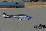
Googly scenery for SPHZ Anta/Comandante German Arias Grazz, Peru - a small
domestic airport for which nothing more than a runway is provided in Flight
Simulator 2004. These scenery files add the apron, taxiways, buildings and
other airport features so that you and your "AI" traffic can land, taxi, park
and take off in a realistic manner.
The airport is served daily by domestic operator L C Busre and perhaps also
others using small aircraft, but little information has been found on activity
in this area.
The scenery does not purport to be ultra-accurate. Based on high-detail satellite
imagery from Google Earth, the layout is proportionally correct but the added
airport features, such as buildings, are built from default Microsoft objects
and add-on libraries so will not look like the real thing.
You are not obliged to download and install any additional scenery libraries,
but to enjoy this scenery in its entirety, you may wish to. It will work fine,
with or without.
[File re-uploaded at request of AVSIM]
| Filename: | SPHZ_AntaComandante_German_Arias_Grazz_Peru.zip |
| License: | Freeware |
| Added: | 23rd May 2010, 01:24:24 |
| Downloads: | 1,224 |
| Author: | John Hinson |
| Size: | 65.15 KB |
| Category: Flight Simulator 2004 - Scenery | |
| Kimmirut CYLC on Baffin Island in Nunavut, Canada |
|
Images related to this file:
File Description:
Kimmirut is a village of some 400 folks at the southern end of the southwest-facing coast of Baffin Island, 75 miles southwest of Iqaluit. It is on the northern side of the Hudson Strait between Baffin Island and Quebec, opposite Kangiqsujuaq on the Quebec shore. The airfield is served by two flights per week, one on Monday and another on Friday, only half fueled to be able to use the 1,899' of gravel 75' wide runway. The terminal building is small and there is a garage building for airport maintenance vehicles (snow clearing). There are some nearby buildings that I have included. The village is "represented" (not "modeled") with approximately the right shape and road layout. Take enough fuel so that you can leave again, as fuel is no longer for sale here. The Cape Dyer bgls are to make a small correction, it is explained in the text. I will not be posting new sceneries in the future and this is the last one for Avsim; it completes Baffin Island.
| Filename: | Kimmirut_CYLC_on_Baffin_Island_in_Nunavut_Canada.zip |
| License: | Freeware, limited distribution |
| Added: | 25th July 2011, 17:36:57 |
| Downloads: | 535 |
| Author: | Roger Wensley |
| Size: | 2.53 MB |
| Category: Flight Simulator X - Scenery | |
| Boundary Bay Airport, British Columbia (CZBB) |
|
File Description:
The airport was based on a Google Earth photo, and the buildings are not 100% accurate, but are reasonably accurately placed and should give a good feel for the airport.
The airport was based on a Google Earth photo, and the buildings are not 100% accurate, but are reasonably acurately placed and should give a good feel for the airport. Historically this his represents a period at the airport in its GA heyday before Heli One and the new terminal building went up cica 2007-2009, from when McLeod Aviation was still in the big hanger and there were plenty of small flying Schools about, to when the new Alpha Aviation building went up.
There is a fuel truck, a single small gate area for commercial flights (even though there is none in reality) and various static items around the field, including the old white dome hangars down the East end of the field (where I used to keep my plane. Watch out for a surprise if you are taxiing out to 25 or 30!
Enjoy.
| Filename: | Boundary_Bay_Airport_British_Columbia_CZBB.zip |
| License: | Freeware |
| Added: | 6th December 2011, 00:42:16 |
| Downloads: | 582 |
| Author: | Bernie Garrett |
| Size: | 914.75 KB |
| Category: Flight Simulator X - Scenery | |
| NZOP- Opotiki Aerodrome (VectorLandClass, New Zealand) |
|
Images related to this file:
File Description:
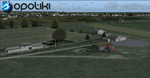
Opotiki aerodrome (ICAO: NZOP) is a small airstrip outside the township of of Opotiki, the gateway to the beautiful East coast of the North Island of New Zealand. Opotiki itself sits at the confluence of the Waioeka and Otara rivers and is surrounded by dairy farmland and Kiwifruit orchards with large areas of native bush to the south and east.
This scenery accompanies Tim Barnes'�� series of other small Bay of Plenty aerodromes (Whakatane,
Galatea, Waihi Beach) for use with VectorLandClass- It features custom modelled and textured buildings, large coverage of beautiful 0.5m aerial photography (fully auto-genned and including seasonal and night variations) and extensive use of high quality objects from the free VLC library. Installation of the library V1.1+ is required for this scenery to work properly and can be downloaded from the VectorLandClass website (www.vectorlandclass.co.nz)
This release, although not requiring it, works best with VectorLandClass topographic mesh and landclass addon covering all 268676 square kilometers of New Zealand. If you'��re not a VLC customer, you'��ll notice when the photoreal coverage runs out!
| Filename: | NZOP_Opotiki_Aerodrome_VectorLandClass_New_Zealand.zip |
| License: | Freeware, limited distribution |
| Added: | 21st February 2013, 13:52:47 |
| Downloads: | 969 |
| Author: | Tim Barnes |
| Size: | 146.68 MB |


© 2001-2026 AVSIM Online
All Rights Reserved
Privacy Policy |