
Where Flight Simulation Enthusiasts Gather from Around the World!
AVSIM Library - Search Results

| Category: Flight Simulator 2004 - Scenery | |
| Rae Lakes CYRA at Gameti in the Northwest Territories, Canada |

|
Images related to this file:
File Description:
Gameti is a village in the Northwest Territories, around 65 miles north of Whati which was recently posted. Until 2005 the village, which has a population of around 280, was known as Rae Lakes and the airfield is now renamed Gameti/Rae Lakes as shown in the 2010 version of the Nav Canada Flight Supplement, my standard reference year. Permanent settlement was established there in 1965. There is no all-weather road access and the village is reliant upon the airfield for supplies, along with an ice road in the winter months. The airfield is a mile or so east of the village, with a lit gravel runway of just over 3,000 feet aligned 14-32 and with PAPI at both ends. The airfield is served by Air Tindi from Yellowknife on an almost daily basis, included in the AI here along with some GA and a Friday delivery by a Buffalo DC3 that uses all of the runway. The runway has lake water at each end, ready for the unwary. A note here about my scenery making. There will not be many more to follow this as I am almost at the end of the photos I either took or found for scenery purposes, plus I expect to move on from FS9 at some point during next year.
| Filename: | Rae_Lakes_CYRA_at_Gameti_in_the_Northwest_Territor.zip |
| License: | Freeware, limited distribution |
| Added: | 26th December 2019, 19:32:09 |
| Downloads: | 122 |
| Author: | Roger Wensley |
| Size: | 4.81 MB |
| Category: Prepar3D V1-4 - Scenery | |
| POLISH AIRPORTS VOL. 3 X DEMO |
|
Images related to this file:
File Description:

POLISH AIRPORTS VOL. 3 X DEMO is a package of detailed sceneries of EPPO Poznan, EPWR Wroclaw, EPBY Bydgoszcz and EPSY Olsztyn-Mazury airports in Poland, fully compatible with FSX, FSX:SE and P3D (v1,v2,v3,v4).
This product is a fully functional DEMO version of the commercial payware product that features simplified airports with main buildings but with low resolution textures, non-animated jetways and generally much less details. Using this free demo ensures no problems with online (VATSIM, IVAO, multiplayer etc.) flying in case some users use the payware scenery and some don't.
Poznan-Lawica Henryk Wieniawski Airport (POZ/EPPO), built in 1913, is one of the oldest airports in Poland. Bydgoszcz Ignacy Jan Paderewski Airport (BZG/EPBY) is a Polish regional airport in the city of Bydgoszcz. Wroclaw Copernicus Airport (WRO/EPWR) is an international commercial airport in Wroclaw in southwestern Poland, the 4th largest airport in Poland. Olsztyn-Mazury Airport (SZY/EPSY) is an international passenger airport in the North-East of Poland, branded as the gateway to the Masurian Lake District.
The product is equipped with an automatic installer, which means that the scenery will be automatically added to the Flight Simulator Scenery Library. Please uninstall all previous versions of this airport you may have installed before. Please make also sure that no duplicated AFCAD files are installed.
Enjoy your virtual flying with Drzewiecki Design!
| Filename: | POLISH_AIRPORTS_VOL_3_X_DEMO.zip |
| License: | Freeware, limited distribution |
| Added: | 27th July 2018, 00:06:20 |
| Downloads: | 341 |
| Author: | Drzewiecki Design |
| Size: | 20.81 MB |
| Category: Flight Simulator 2004 - Scenery | |
| Sulphur Creek Ranch ID74 private airfield in Idaho USA |
|
Images related to this file:
File Description:
This airfield is in the mountains of Idaho, around 30 miles south of Johnson Creek 3U2 which was the third in the series to be posted. Sulphur Creek Ranch is a privately owned airfield, serving the "Ranch", which translates into "restaurant-bar-lodge-and-holiday-cabins". The field is at 5,744 feet ASL, and the runway is 2,920 feet long and aligned 10-28. It is a single-ended runway, with 28 used for landing and 10 for take offs; this is down to a large chunk of mountain occupying the sky at the western end of the runway. The AI planes comply with this single runway concept and the only snag is that you cannot announce a landing as there is no runway offered for you to select for landing in the AI procedure. When taking off runway 10 is offered and you can announce take off. The land used by the ranch is mostly flat, and with a slant approach on finals and a late turn it is fairly straightforward. The largest landark is the man-made lake. Morgan Ranch 02ID is nearby and the grass area has been modified down in size as per reality. The buildings have been omitted as they are not adjacent to the runway and not visible, and I have no information on them.
| Filename: | Sulphur_Creek_Ranch_ID74_private_airfield_in_Idaho.zip |
| License: | Freeware, limited distribution |
| Added: | 25th May 2017, 17:54:33 |
| Downloads: | 164 |
| Author: | Roger Wensley |
| Size: | 6.21 MB |
| Category: Flight Simulator X - Scenery | |
| POLISH AIRPORTS VOL. 3 X DEMO |
|
Images related to this file:
File Description:
POLISH AIRPORTS VOL. 3 X DEMO is a package of detailed sceneries of EPPO Poznan, EPWR Wroclaw, EPBY Bydgoszcz and EPSY Olsztyn-Mazury airports in Poland, fully compatible with FSX, FSX:SE and P3D (v1,v2,v3,v4).
This product is a fully functional DEMO version of the commercial payware product that features simplified airports with main buildings but with low resolution textures, non-animated jetways and generally much less details. Using this free demo ensures no problems with online (VATSIM, IVAO, multiplayer etc.) flying in case some users use the payware scenery and some don't.
Poznan-Lawica Henryk Wieniawski Airport (POZ/EPPO), built in 1913, is one of the oldest airports in Poland. Bydgoszcz Ignacy Jan Paderewski Airport (BZG/EPBY) is a Polish regional airport in the city of Bydgoszcz. Wroclaw Copernicus Airport (WRO/EPWR) is an international commercial airport in Wroclaw in southwestern Poland, the 4th largest airport in Poland. Olsztyn-Mazury Airport (SZY/EPSY) is an international passenger airport in the North-East of Poland, branded as the gateway to the Masurian Lake District.
The product is equipped with an automatic installer, which means that the scenery will be automatically added to the Flight Simulator Scenery Library. Please uninstall all previous versions of this airport you may have installed before. Please make also sure that no duplicated AFCAD files are installed.
Enjoy your virtual flying with Drzewiecki Design!
| Filename: | POLISH_AIRPORTS_VOL_3_X_DEMO.zip |
| License: | Freeware, limited distribution |
| Added: | 27th July 2018, 00:08:14 |
| Downloads: | 2,440 |
| Author: | Drzewiecki Design |
| Size: | 20.81 MB |
| Category: Flight Simulator X - Scenery | |
| Pichlingersee - LOW1 |
|
Images related to this file:
File Description:
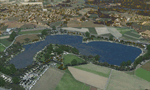
The Pichlingersee (LOW1) is a quarry pond near Linz (LOWL) in Austria (Upperaustria). The ILS approach to the runway 27 cross this lake. The helipad is in possession of Water Rescue Department and was not build on land. It was build "in water".
For the implementation of this area about 500 objects were set by hand from myself. Including not only trees and shrubs, but also signs, park benches, emergency call boxes (gernerated in gmax) etc at there right place. At night it was dark in real, so I does not create night texture. The scenery has 1.5 km ground imagery at 20cm per pixel and vary (hope) with the seasons.
Der Pichlingersee ist ein Baggersee in der Nhe von Linz (LOWL) in sterreich (Obersterreich). Der ILS Anflug auf die Landebahn 27 fhrt genau ber diesen See. Die Hubschrauberplattform gehrt der dortigen Wasserrettung und wurde nicht auf dem Land, sondern in den See hinein gebaut.
Fr die Umsetzung des Areals wurden von mir ber 500 Objekte von Hand gesetzt. Darunter nicht nur Bume und Strucher, sondern ebenso Schilder, Parkbnke, Notrufsulen (in gmax generiert) usw. an ihrem richtigen Platz. Da es dort in der Realitt nachts stockdunkel ist, habe ich auf Nachttexturen verzichtet. Die Szenerie hat eine 1.5 km Bodentextur mit 20cm/px und wechselt (hoffentlich) mit den Jahreszeiten.
| Filename: | Pichlingersee__LOW1.zip |
| License: | Freeware |
| Added: | 9th January 2013, 00:44:19 |
| Downloads: | 1,998 |
| Author: | Oliver Brandl |
| Size: | 54.71 MB |
| Category: Flight Simulator 2004 - AFCAD Files | |
| Southwestern British Columbia Airport Corrections |
|
File Description:
As shorelines, water bodies, roads, railways and other features become more accurate in addon scenery, inaccuracies in airport placement become apparent. Although Microsoft did an excellent job of using published data to place airports, the published information is not always accurate. Some airports in the area of interest were misplaced by as much as 850m, thus conflicting with water and/or roadways. This release corrects Canadian airports in South-western British Columbia, in LOD5 cell 15x14 (915140). This area covers a portion of Vancouver Island from Duncan to Victoria, and the BC Mainland as far east as Douglas Lake and north of Pemberton. In this region CAK3, CAL3, CBT6, CYHE, CYLY, and CYPS are corrected, and Bruce Ellison has kindly modified his CAM3 for inclusion; see separate readme document for details. All these airports have been activated for AI use. A few buildings that may conflict from roads have been removed from CYNJ. The unrealistically large flatten and airport polygon at CYYJ is reduced in size. Airport features that end up in the water have been removed from CYVR and the overly large flatten there reduced. Some Rwy12 goodies have been tossed in as well, but if these are not important to the user, it is not necessary to have Rwy12 installed. Ultimate Terrain or similar accurate hydrology and roads recommended. FSGenesis 38m mesh or other high quality terrain mesh recommended.
| Filename: | Southwestern_British_Columbia_Airport_Corrections.zip |
| License: | Check within download |
| Added: | 30th May 2005, 07:31:45 |
| Downloads: | 3,002 |
| Author: | Jon Patch, Bruce Ellison |
| Size: | 1.53 MB |
| Category: Flight Simulator 2004 - Scenery | |
| Ontario Small Fields in Canada: #05 Pelee Island (CYPT) |
|
Images related to this file:
File Description:
This is the fifth in a series of small airfields in southern Ontario Canada, Pelee Island CYPT, an airfield on the island in Lake Erie and the southernmost airfield in Canada. The airfield has an asphalt runway of 3,300 feet, aligned 09/27 in FS9 while today in real life it is 10/28 due to the wandering magnetic pole. There is also a second runway, 36/18 and around 1,500 feet of gravel. There is a small terminal building which now has blue cladding; here it is still in the dirty yellow of the original colour scheme.
This version is based upon what appears to be a "lost" 2005 scenery of Pelee Island. When I started to make Pelee Island I discovered that in fact I already had a version installed; my memory can be excused, as I installed it in 2005. I modified the scenery to include parking, taxiways that connected, revised runway markings, new windsocks, new signage, larger apron, parked cars and planes, revised landclass, AI, etc. My intention was to instruct you to download and install the original and then incorporate my changes. Problem: it does not appear to exist for download; perhaps it was washed away when the Avsim site crashed. I have included it in this post. If anyone knows who made it please let me know.
| Filename: | Ontario_Small_Fields_in_Canada_05_Pelee_Island_CYP.zip |
| License: | Freeware, limited distribution |
| Added: | 5th August 2015, 18:52:25 |
| Downloads: | 171 |
| Author: | Roger Wensley |
| Size: | 4.39 MB |
| Category: Flight Simulator 2004 - Scenery | |
| Homer PaHO in Alaska US |
|
Images related to this file:
File Description:
Homer is a mainly GA airfield with rows of open air parking, but it also has scheduled flights, a terminal building, a long (for GA) runway of just under 6,700 feet that is 150 feet wide and aligned 03-21 with VASI on both ends and ILS on 03. So I think we can refer to it as an airport. Plus, at the time of this scenery (around 2010) there were three newly completed hangars on the north apron that I was told were for three companies, Bald Mountain Air service, Maritime Helicopters, and Pathfinder Aviation. I do not know which was for whom, but all three companies are in the helicopter and/or plane charter business. The south apron has a number of hangars and other buildings along it's length, starting at the western end with Smokey Bay Air that has an old control tower on the roof, then the Fire Station, and then Homer Air. I am not aware of who owns what after those first three, except that at the far eastern end there are several garages etc for the airport maintenance equipment. Next to the airport at that end there are a number of boat maintenance companies with boats pulled out of the water; this could not be well replicated due to the airport elevation above the sea level and a misplaced road. The nearby Beluga Lake 5BL float base is also included here, with some AI. The lake height above sea level has been adjusted to cope with too many cliffs intruding into the water; this is an annoying FS9 habit. The Homer scenery is as close to the actual airport as I could make it, while coping with inaccurate coast lines and roads, and grassed areas that could not all be modified for reasons that I will not bore you with. The Spit is a major scenery feature next to the airport, and I have added to this to provide some boats, docks, and nearby buildings etc. Small planes use the adjacent gravel taxi path instead of the runway when back-tracking to take off on runway 21. They only go as far as the path takes them and then u-turn onto the runway and take off. By the way, this airport's AI will function at its best if the prevailing wind makes 03 the runway in use. And I will eventually stop writing 03 and just call it 3, as the US, alone in the world, does not put a zero in front of 01, 02, 03, 04 etc. Just one other thing to note is that all access to the runway is from taxiways A and B; there was (in 2010) no access to the extreme western end of the runway as the taxiway there is marked as out of service pending a needed resurfacing.
If you find an error email me please, and note that my email address has been changed to rogwens at Gmail dot com.
| Filename: | Homer_PaHO_in_Alaska_US.zip |
| License: | Freeware, limited distribution |
| Added: | 28th July 2021, 03:31:04 |
| Downloads: | 125 |
| Author: | Roger Wensley |
| Size: | 11.86 MB |
| Category: Flight Simulator 2004 - Scenery | |
| Sioux Lookout CYXL in northern Ontario, Canada, updated |
|
Images related to this file:
File Description:
This greatly modifies my previous post of Sioux Lookout; it is stand-alone and does not require you to have the 2009 version. The AI provided with the post complements what was included with Dryden (March 2013). Sioux Lookout is in northern Ontario, 40 miles east of Dryden, and 145 miles northwest of Thunder Bay. The town is on the northeastern shore of a lake that I don't know the name of (I've been there, but has anyone COUNTED how many lakes Canada has?). It has a population of around 5,000. The main businesses are lumber, tourism, and health care. The airport is immediately adjacent to the northeastern corner of the town, and has 5,300' of asphalt which is aligned 16-34. There are two taxiways which curve and climb up to the apron which is 20 or 30 feet higher. When you taxi on them the knowledge that in reality you would be climbing makes sense of the curved routing. The apron is large and a mixture of asphalt and gravel. I did not make the terminal building and I have no photo or even a recollection of what it looks like, so you should first install Northwest Ontario Airports by Eric O'Link as he has a terminal building for CYXL that might be how it looks; some of his airfields collide with other and newer versions and I have kept only his CYXL and CYPL bgl's.
| Filename: | Sioux_Lookout_CYXL_in_northern_Ontario_Canada_upda.zip |
| License: | Freeware, limited distribution |
| Added: | 19th March 2013, 19:23:24 |
| Downloads: | 405 |
| Author: | Roger Wensley |
| Size: | 5.08 MB |
| Category: Flight Simulator 2004 - Scenery | |
| Kugaaruk CYBB and DEW Pelly Bay CWPB in Nunavut, Canada |
|
Images related to this file:
File Description:
Kugaaruk is on the coast of northern mainland Canada on the Boothia Peninsula, 60 miles into a deep north-south fjord-like inlet called Pelly Bay. The name was changed from Pelly Bay in 1999, and the population is around 800. Gjoa Haven is 150 miles to the west, and Hall Beach just over 200 miles to the east. Six miles south of the village, and connected by a gravel road, there is a NWS station and what remains of a DEW Auxiliary Site; the DEW site was closed in 1992, a year after the NWS station became operational. There is also a 3,350 feet long gravel runway beside Barrow Lake 2 miles east of the site, Pelly Bay CWPB. Kugaaruk airfield is adjacent to the village and the 5,000 feet of 100 feet wide gravel runway is aligned 049T/229T where T stands for "true" as opposed to magnetic. There are flights by First Air and Canadian North and the AI includes a daily flight of each from Yellowknife via Gjoa Haven (as per real life) plus a cargo visit by Buffalo. Although the runway is long enough to accomodate a 737 it is not licensed for regular scheduled jet flights; the reason for this is that the approach lighting is "inadequate". Included here is a new .bgl for Gjoa Haven which will remove the small hold short line from the gravel; my mistake.
| Filename: | Kugaaruk_CYBB_and_DEW_Pelly_Bay_CWPB_in_Nunavut_Ca.zip |
| License: | Freeware, limited distribution |
| Added: | 25th November 2012, 00:43:07 |
| Downloads: | 427 |
| Author: | Roger Wensley |
| Size: | 6.1 MB |
© 2001-2026 AVSIM Online
All Rights Reserved
Privacy Policy |