
Where Flight Simulation Enthusiasts Gather from Around the World!
AVSIM Library - Search Results

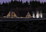
| Category: Flight Simulator 2004 - Scenery | |
| KPOY Powell, Wyoming Airport |

|
File Description:
Powell, Wyoming was a major stop-over for Frontier Airlines starting in 1950 with DC-3's for people going from Billings, Montana to Salt Lake City, Utah and points in-between. A nice little airport that needed alot of help.
I discovered this airport flying the Frontier route in my DC-3 and didn't like the looks of it at all! So I fixed it.
It has a 6175X100' asphalt runway and 2 dirt-grass useable runways.
Look at the default pics and then see what lots of help from Google Earth and FS Earth can do to a sad airport.
| Filename: | KPOY_Powell_Wyoming_Airport.zip |
| License: | Freeware |
| Added: | 23rd November 2008, 11:38:50 |
| Downloads: | 896 |
| Author: | Alan C. Heiner |
| Size: | 3.5 MB |
| Category: Flight Simulator 2004 - Scenery | |
| Turangi Airfield, New Zealand. NZTN. (to fit Turangi Photoreal area scenery, by Robin Corn) |
|
File Description:
Welcome to Turangi Airfield, 1nm North of the township of Turangi, at the southern end of the
beautiful Lake Taupo, in the central North Island of New Zealand.
The airfield is home to the Turangi Aero Club, and is served by Mountain Air, undertaking tourist flights
around the National Park and central North Island volcanoes, and flights to the Chateau and skifields
at Mount Ruapehu.
This scenery is built to fit into the freeware "Turangi" photoreal area scenery by Robin Corn, freely available
from avsim.com, filename...... godzoneturangi.zip . Requires some EZ Scenery Object sets (see INSTALL instructions for details).
| Filename: | Turangi_Airfield_New_Zealand_NZTN_to_fit_Turangi_P.zip |
| License: | Freeware, limited distribution |
| Added: | 7th November 2008, 22:48:37 |
| Downloads: | 665 |
| Author: | Lawrie Roache |
| Size: | 3.01 MB |
| Category: Flight Simulator 2004 - Aircraft Repaints, Textures and Modifications | |
| Delta Air Lines Boeing 777-200ER (Salt Lake 2002 Olympic Colors) N864DA "The Soaring Spirit" - FIX |
|
File Description:
Fix for the alternative livery options included in my original textures which are required.
| Filename: | Delta_Air_Lines_Boeing_777200ER_Salt_Lake_2002_Oly.zip |
| License: | Freeware, limited distribution |
| Added: | 9th October 2008, 02:55:07 |
| Downloads: | 465 |
| Author: | Ron Waite | Painting Bay Design |
| Size: | 1.79 MB |
| Category: Flight Simulator 2004 - Scenery | |
| Albian CAL4, Firebag CFG6, Horizon CYNR, Mildred Lake CER4, and Muskeg Tower CFW4 in Alberta Canada |
|
Images related to this file:
File Description:
All of these airfields are in or close to the Athabasca Tar Sands in Alberta, modelled here along with the airfields. The tar sands workings extend along the Athabasca River for over 60 miles north of Fort McMurray in northern Alberta, and the huge cleared areas, surface mining, tailings ponds, and refineries along the Athabasca are right up there as Alberta's biggest VFR landmark. One look at a tailings pond (sea? ocean?) makes it clear that someone was worried about public reaction to the size. As well as the surface mining there are also large areas where there is underground extraction with a grid of dirt tracks between equipment installations. There are four airfields associated with the tar sands. Horizon CYNR is a public service airport operated by Canadian Natural Reources Ltd. Mildred Lake CER4 is owned and operated by Syncrude. Albian CAL4 is owned and operated by Shell Canada, and Firebag CFG6 is owned and operated by Suncor Energy. The fifth airfield is the nearby Muskeg Tower CFW4, which is there solely to support folks during their fire watch in the 120 feet tall tower. There is also a sixth airfield east of Horizon across the river and still visible, Bitumount; this is no longer in use. There is Ai included involving Canadian North, North Cariboo, Wasaya, HTS, First Air, Suncor, etc.
| Filename: | Albian_CAL4_Firebag_CFG6_Horizon_CYNR_Mildred_Lake.zip |
| License: | Freeware, limited distribution |
| Added: | 4th October 2013, 22:12:42 |
| Downloads: | 935 |
| Author: | Roger Wensley |
| Size: | 16.75 MB |
| Category: Flight Simulator 2004 - Scenery | |
| CYSM - Fort Smith, Northwest Territories, Canada |
|
Images related to this file:
File Description:
Fort Smith is just north of the border between Alberta and Northwestern Territories, midway between Lake Athabasca to the southeast in (mostly) Saskatchewan (80 miles) and Great Slave Lake to the north west (90 miles). The runways all used to be larger, and while I don't know the history it looks as if it is ex-military and these are the remains of what were once 10,000 feet of asphalt. The main runway is now 11/29 and 6,000 feet long, and the secondary one is 1,800 feet of mostly gravel. There is an airline based at the field, Northwestern Air, and fuel (both 100LL and JA-1) is available at a self service point so long as you give it a credit card to read while you fill. The town of Fort Smith is two miles east of the airfield, on the bank of the Slave River and where there are some rapids that require a portage to get around them. Before aviation came along the river was a major route to the north and all those furry animals, which was why the Hudson's Bay Company established an outpost there in 1872. Today it has a population of 2,400 and the main activities are government administration of much of the Northwest Territories, education, and tourism.
| Filename: | CYSM__Fort_Smith_Northwest_Territories_Canada.zip |
| License: | Freeware, limited distribution |
| Added: | 28th January 2012, 17:11:47 |
| Downloads: | 592 |
| Author: | Roger Wensley |
| Size: | 4.29 MB |
| Category: Flight Simulator 2004 - Scenery | |
| Teslin CYZW in the Yukon, Canada |
|
Images related to this file:
File Description:
Teslin is a village on the Alaska Highway around 85 miles east of Whitehorse, on the banks of the very long Teslin Lake and where there is a sizeable bridge across an offshoot of the lake. The Hudson Bay trading company established a post there in 1903. The current population is a rather meagre 120 or so and the only reason I am making this scenery is that I know one of the 120. This scenery, in addition to the terrain, village, bridge, and airport items also modifies the Alaska Highway. The AI includes a school excursion trip on a chartered Air North Hawker Siddeley 748 on Saturday. There are no scheduled flights to the field. The runway is now around 5,600 feet of gravel aligned 08-26 and with VASI at both ends. It is lit with runway lighting on the tops of traffic cones, and you will need to download the lighting library from my earlier postings of either Allakaket Lights or Anaktuvuk Lights earlier this week. A note here about my scenery making. There will not be many more to follow this as I am almost at the end of the photos I either took or found for scenery purposes, plus I expect to move on from FS9 at some point during next year.
| Filename: | Teslin_CYZW_in_the_Yukon_Canada.zip |
| License: | Freeware, limited distribution |
| Added: | 5th December 2019, 18:37:13 |
| Downloads: | 127 |
| Author: | Roger Wensley |
| Size: | 6.87 MB |
| Category: Flight Simulator X - Scenery | |
| FSX Grand Canyon North Rim Simulation |
|
Images related to this file:
File Description:
Welcome to the North Rim of the Grand Canyon!
This scenery is a mostly fictitious representation of what the North Rim might look like of it had been developed like the South rim. A new airport (KKPA, Kaibab Plateau Airport) is the centerpiece. It sits at 8,730 ft MSL so density altitude is a real issue. Runway 17/35 is 6,500ft long so biz jets can get in and out safely. A new resort sits atop the ridge to the east [Eagle's Nest]. There is a helipad for access. An NDB makes finding it easier [AZ95 220.9 kHz]. Or you can just follow the traffic on the access road that branches off from highway 67 just south of the airport. To the north I have added a gravel strip to Jacob Lake where 67 joins 89A. Runway 14/32 is 3000 ft long and sits at 7900 ft MSL. An NDB [AZ93 393 kHz] is included. At the south end of Highway 67 sits the North Rim Visitor Center. There is a helipad on the roof for those who like rotary wing challenges. The NDB is AZ94 at 423.4 kHz. The entire length of Highway 67 is represented with traffic going both ways. You will see
air traffic from KGCN at the South Rim and traffic between KKPA and Jacob Lake.
| Filename: | FSX_Grand_Canyon_North_Rim_Simulation.zip |
| License: | Freeware, limited distribution |
| Added: | 19th May 2021, 19:28:12 |
| Downloads: | 100 |
| Author: | Brett Delana |
| Size: | 16.26 MB |
| Category: Flight Simulator 2004 - Scenery | |
| Mackenzie CYZY in British Columbia, Canada |
|
Images related to this file:
File Description:
Mackenzie is around 120 miles west of Peace River and the BC/Alberta border, at the southern end of Williston Lake. The lake is 135 miles long and the population of the town is about 3,500; those figures illustrate typical Canada, a huge area enjoyed by the few. The main occupations relate to timber and mining in some form, plus tourism (in particular winter sports tourism). The airport is 2 miles southwest of the town, with no regular scheduled flights but it is not unusual to find Central Mountain Air there delivering either charter passengers or freight. The single runway is aligned 16-34 and 100 feet wide lit asphalt that is just over 5,000 feet long, with (in 2010 or so) an additional 1,500 feet of gravel. There is PAPI at both ends of the asphalt. The largest operation based at the airfield is a helicopter company, at the northern end of the apron. There is a "mandatory frequency" of 123.5 which is a Canadian invention; you MUST have a radio. There is no control tower at the actual airfield, and if or when there is no response from further afield then you announce your intentions etc. In FS9 there is no way to "switch off or on" the monitoring of a MF radio frequency so you will find that this one is always silent.
| Filename: | Mackenzie_CYZY_in_British_Columbia_Canada.zip |
| License: | Freeware, limited distribution |
| Added: | 27th December 2018, 20:19:05 |
| Downloads: | 132 |
| Author: | Roger Wensley |
| Size: | 19.81 MB |
| Category: Prepar3D V1-4 - Scenery | |
| Sirmione (Brescia) Italy N45 ° 28'10 "E10 ° 36'22" |
|
File Description:
Sirmione (Brescia) Italy N45 ° 28'10 "E10 ° 36'22" The town is situated along the peninsula of the same name that stretches inside Lake Garda for about 4 kilometers and divides the southern lacquer into two parts. Part of the communal territory extends eastwards to the peninsula to include that of Punta Grò. It is a destination for international tourism, both for the presence of Roman and Medieval vestments and for thermal waters. Important VFR point for approaching airport Verona Villafranca, Verona Bosco Mantico e Brescia Montichiari.
Within the downloaded package you will find readme files for scenery installation. Good fly VFR. Pasquale Marrulli.
| Filename: | Sirmione_Brescia_Italy_N45__2810_E10__3622.zip |
| License: | Freeware |
| Added: | 13th November 2017, 17:25:21 |
| Downloads: | 434 |
| Author: | Pasquale Marrulli |
| Size: | 5.36 KB |
| Category: Flight Simulator 2004 - Scenery | |
| Parry Sound Harbour CPS1 in Ontario REPOST |
|
File Description:
This is a repost of yesterday's post of the Parry Sound Harbour as it seems one of the files didn't make it through the upload intact. Parry Sound Harbour float base is at the mouth of the Seguin River, where it flows into Parry Sound and Georgian Bay on Lake Huron, 110 miles north of Toronto. The base is run by Georgian Bay Airways Ltd who in 2006 were operating a Beaver and a Cessna 180, if I am remembering that right; the Beaver for sure. There is fuel and oil available, and food! This version has the modelled version of the float base building, after three years.
| Filename: | Parry_Sound_Harbour_CPS1_in_Ontario_REPOST.zip |
| License: | Freeware |
| Added: | 17th February 2009, 00:26:11 |
| Downloads: | 682 |
| Author: | Roger Wensley |
| Size: | 1.88 MB |
© 2001-2026 AVSIM Online
All Rights Reserved
Privacy Policy |