
Where Flight Simulation Enthusiasts Gather from Around the World!
AVSIM Library - Search Results

| Category: Flight Simulator X - Scenery | |
| FLOAT FUEL Boxes |

|
File Description:
All Float Plane Pilots can start refueling at your favorite Marina or Float Plane Dock with this instruction package. Now is the time to warm up to your SDKs and set your own Fuel Box's any where you need them. There is several BGLs for, Friday Harbor,Coal Harbour BC.
There are also two Scenery's of added Marinas, Ketchikan Alaska(not properly placed)with a fuel box set at the Marinas pumps. And then Bucks Lake Cal. with a Marina added with fuel. Both scenery's use Default Scenery Objects so the hit on frame rates should be minimal.
| Filename: | FLOAT_FUEL_Boxes.zip |
| License: | Freeware |
| Added: | 9th December 2006, 10:50:21 |
| Downloads: | 1,214 |
| Author: | Ken Countryman |
| Size: | 8.77 KB |
| Category: Flight Simulator 2004 - Scenery | |
| Manapouri-Te Anau Airport 2008, New Zealand. NZMO. |
|
File Description:
Welcome to the new Manapouri-Te Anau Airport, which underwent a 7 million dollar upgrade in late 2007. The airport is situated 3 nautical miles North-East of the town of Manapouri, and is nestled beside the Southland region's beautiful Lake Manapouri, in the lower South-Western part of the South Island of New Zealand.
The scenery reflects the upgrades done to the airport, and includes custom terminal buildings and signs (textures included). The scenery also contains an official GNZLAP AI Traffic file update by Charl Du Toit. Requires some EZ Scenery Object Sets (see INSTALL instructions for details).
| Filename: | ManapouriTe_Anau_Airport_2008_New_Zealand__NZMO.zip |
| License: | Freeware, limited distribution |
| Added: | 21st November 2008, 13:36:48 |
| Downloads: | 1,119 |
| Author: | Lawrie Roache / Godfrey Tier |
| Size: | 2 MB |
| Category: Flight Simulator 2004 - Scenery | |
| Reichenbach LSAZ |
|
File Description:
The virtual airfield includes several buildings such as a hangar, a restaurant, a club house, military shelters, a playground and stationary cars. The surrounding area of Reichenbach has been populated with autogens: From the lake of Thoune down to Gemmi pass South of Kandersteg, and up until Adelboden to the West. Moreover, there is a high-voltage power line from Gemmi pass to the Gürbe valley, which should help during visual flight.
The scenery has been designed in Gmax and optimized for the mesh of Switzerland Professional. In order to save system performance, a series of LODS have been created.
| Filename: | Reichenbach_LSAZ.zip |
| License: | Freeware |
| Added: | 20th January 2006, 04:36:22 |
| Downloads: | 4,238 |
| Author: | Michael Röthlisberger |
| Size: | 2.95 MB |
| Category: Flight Simulator X - Scenery | |
| Paulinia S.P. - Complement to Americana S.P. 4/5 |
|
File Description:
4/5 - This is the complement of Americana to cover all region taht include the lake Praia Azul. This scenery is composed by five parts. Folow instructions on Readme.txt and have a nice visual flight. Is a good idea install the FSX Mesh South America parts F7 and F8 cordinates in the map to have the essential mesh terrain. There is a link to download:
www.ceaero.com.br/meshxsa/dowsa.html
Other pack that you need install if want to see all hangars in SDAI Aeroclube de Americana,
is the STATIC BJECTS LIBRARY found on RWY12 OBJECTS PLACER found in http://www.rwy12.com/rwy12/
| Filename: | Paulinia_SP__Complement_to_Americana_SP_45.zip |
| License: | Freeware |
| Added: | 8th June 2008, 14:09:41 |
| Downloads: | 1,455 |
| Author: | Gilson A. Rocchetti |
| Size: | 71.84 MB |
| Category: Fly! II - TerraScene | |
| Rocky Mount (Carolinas Project) TerraScene Project Pack |
|
Images related to this file:
File Description:
Re-upload. This TerraScene 2.1 Project pack covers all of global tile 200,155, adjoining Raleigh to the west and the Edenton area to the east. Rocky Mount is near the center, with Pitt-Greenville near the eastern border. The beautiful John H. Kerr Reservoir runs from Virginia down near Henderson, NC, continuing to the east to Roanoke Rapids Lake. This pack includes updated Tiger Census (2000) shapefile data, adding new water areas, new highways, and other details. All scenery data files are included: USGS data, shapefiles, and a complete water mask. Requires TerraScene 2.1 and Fly!II patched to v230 or later.
| Filename: | Rocky_Mount_Carolinas_Project_TerraScene_Project_P.zip |
| License: | Freeware |
| Added: | 13th June 2010, 01:58:01 |
| Downloads: | 157 |
| Author: | Randall Rocke |
| Size: | 70.19 MB |
| Category: Flight Simulator X - Scenery | |
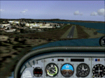
| Katies Lagoon |
|
Images related to this file:
File Description:

katies Lagoon is fictitous and located east of Kalispell on the north shore of Flathead Lake. it has a float plane dock, marinas, cabin rentals, a water runway and NDB with a frequency of 224.0 with a range of 55 nautical miles. Shows on GPS and has start points. Includes a landable helipad and many objects throughout the area. It's a lagoon, campground and ATV park. There will be a version 2 coming soon which will upgrade areas for RV's and ATV's. Read the text file and PLEASE enjoy! Designed with a clean install of FSX and to enhance your FSX world. Savageagle.
| Filename: | Katies_Lagoon.zip |
| License: | Freeware |
| Added: | 17th August 2010, 00:46:34 |
| Downloads: | 301 |
| Author: | Tim Durham |
| Size: | 705.42 KB |
| Category: Civil Flight Simulators - Looking Glass Flight Unlimited 3 | |
| Grant County International outer terrain airport |
|
Images related to this file:
File Description:
Tower-controlled outer terrain airport for FU3. Grant County International MWH lies in the outer terrain east of the Seattle region. It's in the Columbia River Basin, a few miles from Ephrata and at the north end of Moses Lake. Full comms, AI, ambient sounds, airport buildings, paved taxiways et c. as usual. Works best with a full installation of FU3's Seattle and outer terrain with FU2's Sanfran region. For best effect use also various 3d object libraries all available in the Avsim Library as otherwise this airport will lack a lot of 3d objects.
| Filename: | Grant_County_International_outer_terrain_airport.zip |
| License: | Freeware |
| Added: | 8th April 2011, 10:04:29 |
| Downloads: | 85 |
| Author: | Dave Morgan |
| Size: | 29.31 MB |
| Category: Flight Simulator 2004 - AI Flight Plans | |
| Corporate Air (United States) Summer 2012 |
|
Images related to this file:
File Description:

Corporate Air AI Flightplans for the Summer of 2012. Data taken from Flight Aware for the week of April 8th to April 14th 2012. Corporate Air (United States) is a Fed Ex feeder operation that also contracts with the US Postal Service. The have hubs in Casper WY., Salt Lake City UT., Grand Forks ND., Great Falls MT., and Honolulu HI with their headquarters in Billings, MT. They fly routes in Hawaii, Utah, Idaho, Montana, Wyoming, Nebraska, North Dakota, Minnesota and fly once a week to Winnipeg, Manitoba. In Hawaii, they operate three different aircraft, the Shorts 330, Beechcraft 1900C, and Cessna 208.
| Filename: | Corporate_Air_United_States_Summer_2012.zip |
| License: | Freeware |
| Added: | 6th May 2012, 20:09:21 |
| Downloads: | 786 |
| Author: | Brian Summers |
| Size: | 5.07 KB |
| Category: Flight Simulator 2004 - Scenery | |
| Argentina Villa Rumipal/Rio Tercero |
|
Images related to this file:
File Description:
This scenery was requested by Federico Malfu Sanchez, who also did all the legwork to find images and data, and as well did the complete Beta testing.
The area surrounding has been edited to help VFR pilots find their way. The whole LOD 8 tile the scenery is on has been resampled with SRTM3 data at LOD 13 level. The Rio Tercero lake has been configured to satellite images and rivers and roads follow their actual mapped courses.
Additionally the Rio Tercero dam and hydro electric plant, as well as other VFR relevant landmarks, have been included.
| Filename: | Argentina_Villa_RumipalRio_Tercero.zip |
| License: | Freeware, limited distribution |
| Added: | 12th May 2010, 00:19:55 |
| Downloads: | 315 |
| Author: | Alf B. Meier |
| Size: | 1.62 MB |
| Category: Flight Simulator X - Scenery | |
| KDYT - Sky Harbor Airport - Duluth, MN |
|
File Description:
Here is an improved version of the stock Sky Harbor Airport. I adjusted and added aprons, and taxiways to more closely match real life. I replaced default buildings and added additional buildings. I added more AI parking, static vehicles, aircraft, lightpoles, fences and other filler objects. I added a ramp for amphibious planes and docks for seaplanes. There are both land and water runways here.
This is a really interesting airport, located on a sliver of land in Lake Superior. If you're not using
Ultimate Terrain X the objects going into the water may not be placed correctly.
| Filename: | KDYT__Sky_Harbor_Airport__Duluth_MN.zip |
| License: | Freeware |
| Added: | 20th April 2009, 23:11:20 |
| Downloads: | 1,350 |
| Author: | Jim Cook |
| Size: | 4.72 KB |
© 2001-2026 AVSIM Online
All Rights Reserved
Privacy Policy |