
Where Flight Simulation Enthusiasts Gather from Around the World!
AVSIM Library - Search Results

| Category: Fly! II - TerraScene | |
| Fontana Lake (Carolinas Project) TerraScene Project Pack |

|
Images related to this file:
File Description:
This TerraScene 2.1 Project pack covers all of global tile 196,154. Adjoining the Knoxville tile, it continues through the Great Smoky Mountains into Cherokee, NC and Fontana Lake. Continuing south, this scenery area extends through portions of western South Carolina and NE Georgia, including Toccoa and Hartwell Lake to the SE. This pack includes updated Tiger Census (2000) shapefile data, adding new water areas, new highways, and other details. All scenery data files are included: USGS data, shapefiles, and a complete custom water mask. Requires TerraScene 2.1 and Fly!II patched to v230 or later.
| Filename: | Fontana_Lake_Carolinas_Project_TerraScene_Project_.zip |
| License: | Freeware |
| Added: | 10th May 2010, 05:20:25 |
| Downloads: | 318 |
| Author: | Randall Rocke |
| Size: | 88.73 MB |
| Category: Flight Simulator 2002 - Flight Plans | |
| Val-U-Prop VA Bloomington, IN to Pittsburgh |
|
File Description:
This a GPS-flown leisure excursion from the Great Hoosier Nation, over the Buckeye State and on to Pittsburgh PA. Enjoy the hills of Southern Indiana (you will fly right by Lake Monroe - largest lake in the state, just beyond Bloomington) before entering the flatlands of Ohio. Pittsburgh International is in the foothills of the Alleghenies and is surrounded by hills, so be careful. ACS-GPS and other fs98/2000 GPS users may also take part in the flight by selecting Pittsburgh International as their destination. For any airplane. Distance is 304 NM.
| Filename: | ValUProp_VA_Bloomington_IN_to_Pittsburgh.zip |
| License: | Freeware |
| Added: | 8th March 2003, 00:58:57 |
| Downloads: | 256 |
| Author: | James Underwood |
| Size: | 2.46 KB |
| Category: Flight Simulator X - Scenery | |
| The Raptors Roost Lodge, Reef Lake, Canada |
|
File Description:
This scenery is located East of Ketchikan up near Stewart in Canada at a lake named Reef Lake. It has a water runway but you can use the beach in a pinch. There is not much room to maneuver so it may be a good idea to start here so you will know what to expect. This is not your mothers scenery. If when Holger comes out with his scenery for this area and there are conflicts I will repair it to work with that. This scenery has sounds.
| Filename: | The_Raptors_Roost_Lodge_Reef_Lake_Canada.zip |
| License: | Freeware, limited distribution |
| Added: | 7th July 2008, 13:08:30 |
| Downloads: | 1,193 |
| Author: | Joe Watson / Raptor X Sceneries |
| Size: | 1.33 MB |
| Category: Flight Simulator 2004 - Scenery | |
| Lake Athabasca Airfields in Alberta & Saskatchewan Canada |
|
Images related to this file:
File Description:
These are four airfields around or near Lake Athabasca, in Alberta and Saskatchewan. Fort Chipewyan CYPY is at the southwestern end of the lake and the direct recipient of pollution that flows north from the Tar Sands to the south. The population of around 850 lives in one of the earliest European settlements in Alberta, founded as a trading post by Peter Pond of the Northwest Company in 1788 and named for the Chipewyan people who lived in the area. The airfield has one runway aligned 03-21 and 5,000 feet of asphalt, with PAPI at both ends. The landclass has been modified along with the grassed area of the airfield to create the village on the lakeshore. There are scheduled flights and GA flights in the AI for all four airfields. Charlot River CJP9 is on the northern shore at the western end of the lake, in Saskatchewan. It serves a nearby hydroelectric project and is used to transport technical staff in and out. There is no terminal building, only waiting pickup trucks and a generator building. There is one lit gravel runway aligned 04-22 and just over 3,200 feet long. Fond-du-Lac CZFD is on the northern shore in Saskatchewan, at the narrower eastern end. The population is around 900 and is a remotely situated "fly-in" village that has existed for over 150 years where "living off the land" is an accepted and normal way of life. The village has been created along with the airfield. The single runway is 3,800 feet of lit gravel aligned 10-28 with PAPI at the western end. Stony Rapids CYSF is east of the end of Lake Athabasca, on the Fond du Lac River. It has a population of around 250 and is only semi-connected to the rest of Canada by a rough gravel road. The runway is over 5,000 feet of gravel, aligned 06-24 with PAPI at both ends. The NorthSKlake is a flatten for an Ultimate Terrain lake that was at an incorrect elevation.
| Filename: | Lake_Athabasca_Airfields_in_Alberta__Saskatchewan_.zip |
| License: | Freeware, limited distribution |
| Added: | 7th August 2018, 12:39:52 |
| Downloads: | 178 |
| Author: | Roger Wensley |
| Size: | 20.36 MB |
| Category: Flight Simulator X - Aircraft Repaints, Textures and Modifications | |
| Douglas C-47 (N33326) Lake Central Airlines |
|
Images related to this file:
File Description:
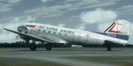
This folder contains a repaint for version 3.14 of the Douglas C-47 by Manfred Jahn and colleagues in the colors of DC-3A-197E c/n 4127 (41-7706) flew with Northwest, Mid Continent and Braniff before joining the Lake Central Fleet. Repaint by Jan Kees Blom for Manfred Jahn's C-47 version 3.14, based on the paintkit by Gman5250.
| Filename: | Douglas_C47_N33326_Lake_Central_Airlines.zip |
| License: | Freeware |
| Added: | 14th August 2018, 21:35:12 |
| Downloads: | 280 |
| Author: | Jan Kees Blom |
| Size: | 10.81 MB |
| Category: Flight Simulator X - Scenery | |
| NY9 - Helms Aero Service - Long Lake, NY |
|
Images related to this file:
File Description:

By request, here is an improved version of Helms Aero Service, Long Lake, NY. There was nothing at all there in FSX except a water runway. I moved the runway, added docks, static float planes, buildings, trees, park benches, telephone poles, and a marina. I also placed an Adirondack fire tower in the approximate location where a tower actually exists on Owl's Head. You'll have to search for it.
Due to the shore lines and roads involved in this scenery ULTIMATE TERRAIN X USA IS REQUIRED. Results will not be satisfactory without it.
| Filename: | NY9__Helms_Aero_Service__Long_Lake_NY.zip |
| License: | Freeware |
| Added: | 17th October 2010, 02:49:32 |
| Downloads: | 548 |
| Author: | Jim Cook |
| Size: | 3.54 KB |
| Category: Flight Simulator X - AFCAD Files | |
| CFQ5 - Silver City (Kluane Lake) - Yukon, Canada |
|
Images related to this file:
File Description:

This is a patch that should correct and brush-up the airport Silver City (CFQ5) in Yukon, Canada and furthermore some severe scenery discrepancies around the south-western shore of Kluane Lake close to it that are caused by elevation differences of the surface on both sides of Latitude N61.0 in the context with UTX Canada in combination with high resolution mesh like "FSGenesis" (tested by myself) or "FS Global Ultimate" (as reported by others). It may work in other configurations, too. However, the Microsoft standard scenery will likely be disturbed as the corrected shorelines are depending on Scenery Solutions Ultimate Terrain Canada X" (payware).
| Filename: | CFQ5__Silver_City_Kluane_Lake__Yukon_Canada.zip |
| License: | Freeware |
| Added: | 25th September 2013, 21:35:59 |
| Downloads: | 199 |
| Author: | Axel Birsul |
| Size: | 682.43 KB |
| Category: Flight Simulator 2004 - Scenery | |
| W63 - Lake County Regional Airport - Virginia, USA |
|
Images related to this file:
File Description:
Created with Airport Design Editor by ScruffyDuck Software using current FAA documentation and Google Earth measurements, this package offers a replacement for FSX's stock airport. All these enhancements are as close to the real airport as I can get with stock library objects and custom models. Trees were removed from the approach end of Rwy. 22.
| Filename: | W63__Lake_County_Regional_Airport__Virginia_USA.zip |
| License: | Freeware |
| Added: | 12th August 2014, 10:00:14 |
| Downloads: | 80 |
| Author: | Wayne Roberts |
| Size: | 79.52 KB |
| Category: Flight Simulator 2004 - Scenery | |
| Burns Lake CYPZ in British Columbia, Canada |
|
Images related to this file:
File Description:
Burns Lake is 90 miles east of Terrace and 130 miles west of Prince George, on the eastern side of the Coast Mountains. The airfield is at 2343' ASL and the 11/29 runway is just over 7,000' of 75' wide asphalt. There are buildings, some of them new, around the apron at the west end of the runway and both JetA and 1100LL are available. There is also a weather station in a fenced area west of the apron. All apron buildings were modeled specifically for this scenery; there may be some missing if new construction has continued in the last three years.
| Filename: | Burns_Lake_CYPZ_in_British_Columbia_Canada.zip |
| License: | Freeware, limited distribution |
| Added: | 11th May 2011, 16:57:44 |
| Downloads: | 467 |
| Author: | Roger Wensley |
| Size: | 4.57 MB |
| Category: Flight Simulator 2002 - AFCAD Files | |
| Lake County Airport, Colorado, USA KLXV AFCAD |
|
File Description:
AFCAD file fix for Lake County Airport, Colorado, USA (KLXV).
An airport in the Aspen area, west of Denver.
Fixes a couple of minor problems and adds more parking to the default airport.
Requires AFCAD by Lee Swordy. If you have AFCAD's newer versions you can just drop in the AFCAD installer screen and you are done.
| Filename: | Lake_County_Airport_Colorado_USA_KLXV_AFCAD.zip |
| License: | Freeware |
| Added: | 29th December 2002, 15:17:34 |
| Downloads: | 400 |
| Author: | Alex Feldstein |
| Size: | 2.25 KB |


© 2001-2026 AVSIM Online
All Rights Reserved
Privacy Policy |