
Where Flight Simulation Enthusiasts Gather from Around the World!
AVSIM Library - Search Results

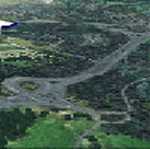
| Category: Flight Simulator 2004 - Scenery | |
| Kenmore Air Harbor Inc. SPB, Kenmore, Washington (S60) |

|
File Description:
Kenmore's home base is at the northern end of Lake Washington, northeast of Seattle. The base has been there since Kenmore was started in 1945. It is squashed up between a marina and a cement plant and if you want to know more about it then read the very entertaining book called "Success On The Step" by C. Martin Faure, with a foreword by Harrison Ford. You may already know that he is one of their more famous clients. This goes with the two scenery files for Lake Union, posted a while ago. For sure you need Ultimate Terrain, as otherwise the lake won't be in the right place. UT for Canada and Alaska may be sufficient, as it stretches south of the border, but I've never tried it without UT for both Canada and the US.
| Filename: | Kenmore_Air_Harbor_Inc_SPB_Kenmore_Washington_S60.zip |
| License: | Freeware |
| Added: | 16th March 2008, 20:16:24 |
| Downloads: | 1,526 |
| Author: | Roger Wensley and Jim Turner |
| Size: | 8.22 MB |
| Category: Flight Simulator X - Missions | |
| MountHoodRescue.zip |
|
File Description:
Helicopter mission. A remote helicopter company located at NZMC airport provides services. Fly out to an area near Abel Lake, New Zealand to rescue an injured climber. Fly back to the airport for medical services.
| Filename: | MountHoodRescuezip.zip |
| License: | Freeware |
| Added: | 10th March 2023, 02:31:52 |
| Downloads: | 39 |
| Author: | helomissionman |
| Size: | 3.11 MB |
| Category: Fly! II - Scenery | |
| Colorado Adventure No. 1 Flight Plan |
|
File Description:
This Colorado Adventure takes you through the mountains from Granby to Denver International. You can land at Glenwood Springs Municipal, Aspen Pitkin County/Sardy Field or Lake County Airport. Have a fun and safe flight.
| Filename: | Colorado_Adventure_No_1_Flight_Plan.zip |
| License: | Freeware |
| Added: | 11th August 2002, 22:15:50 |
| Downloads: | 250 |
| Author: | Wayne Roberts |
| Size: | 26.86 KB |
| Category: Flight Simulator 2004 - AI Flight Plans | |
| Tahoe Air - Fall 1998 |
|
File Description:
Tahoe Air Flightplans - Fall 1998. Include flight plans for Tahoe Air, a small airline operating scheduled flights into Lake Tahoe from San Jose and Los Angeles. The airline went out of business the next year.
| Filename: | Tahoe_Air__Fall_1998.zip |
| License: | Freeware |
| Added: | 14th April 2005, 02:21:47 |
| Downloads: | 305 |
| Author: | Brian Wheatley |
| Size: | 4.28 KB |
| Category: Flight Simulator 2002 - Scenery | |
| Bellechasse (LSTB) for Suisse 2002 - UPDATED |
|
File Description:
Updated Bellechasse (LSTB) for Suisse 2002. Fix a error on loading the scenery. Fix also a altitude problem in a harbour on Leman's Lake. Features all usual effects and textures of all Suisse 2002 sceneries.
| Filename: | Bellechasse_LSTB_for_Suisse_2002__UPDATED.zip |
| License: | Freeware |
| Added: | 1st April 2003, 10:03:36 |
| Downloads: | 1,359 |
| Author: | Daniel Gauthier |
| Size: | 2.03 MB |
| Category: Flight Simulator X - Scenery | |
| Hawaii - Niihau |
|
Images related to this file:
File Description:
Niihau, the westernmost of the inhabited Hawaiian Islands, is privately owned and used primarily to raise cattle. It's small population works the ranch. Because it is so isolated, it is the last of the Hawaiian Islands where Hawaiian is the primary language.
Niihau has no airport of its own. You get there by taking off from Kauai and flying west. I'd recommend using Port Allen (PAK). Unless visibility is limited, you can see Niihau across the water from the airport. Just take off and fly a heading of 270 degrees. However, a saved flight which places you just off Niihau's shore is included in the package should you need it.
| Filename: | Hawaii__Niihau.zip |
| License: | Freeware |
| Added: | 15th December 2009, 23:19:34 |
| Downloads: | 2,525 |
| Author: | Richard Sorochak |
| Size: | 36.49 MB |
| Category: Fly! II - Scenery | |
| China Lake Naval Air Weapons Station (Armitage Field) - KNID |
|
File Description:
TerraModels Scenery Development System by Allen Kriesman and Biber Salsa models were used to create the scenery for China Lake Naval Air Weapons Station (Armitage Field) - KNID, California. No custom models were created for this airport.
| Filename: | China_Lake_Naval_Air_Weapons_Station_Armitage_Fiel.zip |
| License: | Freeware |
| Added: | 4th April 2004, 05:50:20 |
| Downloads: | 137 |
| Author: | Wayne Roberts |
| Size: | 106.77 KB |
| Category: Flight Simulator 2004 - AI Flight Plans | |
| Morris Air - Effective Dec, 1993 |
|
File Description:
Morris Air flightplans effective Dec, 1993.
Morris Air operated flights out of Salt Lake City from 1992 - 1994 when purchased by Southwest Airlines. Flights were operated by an all 737-300 fleet. All flight are included.
| Filename: | Morris_Air__Effective_Dec_1993.zip |
| License: | Freeware |
| Added: | 29th March 2005, 04:04:09 |
| Downloads: | 424 |
| Author: | Brian Wheatley |
| Size: | 11.51 KB |
| Category: Flight Simulator 2004 - Scenery | |
| OSM World: Western Europe ** Update October 2014 ** |
|
Images related to this file:
File Description:
OSM world Updates are cumulative! Only download the latest one!
October 2014:
- !!! IMPORTANT !!! Move "Default Scenery" below "OSM World" areas!! Error in installation instructions!!
- Lake Constanz missing
- water area in Antwerp missing
- Better masking land class
| Filename: | OSM_World_Western_Europe__Update_October_2014_.zip |
| License: | Freeware |
| Added: | 2nd November 2014, 14:15:46 |
| Downloads: | 2,622 |
| Author: | Mario Noriega |
| Size: | 951.84 KB |
| Category: Flight Simulator 2002 - Flight Plans | |
| Val-U-Prop VA Bloomington, IN to Pittsburgh |
|
File Description:
This a GPS-flown leisure excursion from the Great Hoosier Nation, over the Buckeye State and on to Pittsburgh PA. Enjoy the hills of Southern Indiana (you will fly right by Lake Monroe - largest lake in the state, just beyond Bloomington) before entering the flatlands of Ohio. Pittsburgh International is in the foothills of the Alleghenies and is surrounded by hills, so be careful. ACS-GPS and other fs98/2000 GPS users may also take part in the flight by selecting Pittsburgh International as their destination. For any airplane. Distance is 304 NM.
| Filename: | ValUProp_VA_Bloomington_IN_to_Pittsburgh.zip |
| License: | Freeware |
| Added: | 8th March 2003, 00:58:57 |
| Downloads: | 256 |
| Author: | James Underwood |
| Size: | 2.46 KB |
© 2001-2026 AVSIM Online
All Rights Reserved
Privacy Policy |