
Where Flight Simulation Enthusiasts Gather from Around the World!
AVSIM Library - Search Results

| Category: Flight Simulator 2004 - AI Aircraft | |
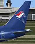
| United Express Air Wisconsin OC BAe 146-100 N463AP |

|
Images related to this file:
File Description:

United Express Air Wisconsin OC FMAI BAe 146-100 N463AP //
Air Wisconsin Airlines Corporation is an airline based at Outagamie County Regional Airport in the town of Greenville, Wisconsin, United States, near Appleton. Air Wisconsin is the largest privately held regional airline in the United States. It operates regional jet flights as US Airways Express under contract to US Airways, serving 69 cities in the US and Canada with hubs at Philadelphia International Airport and Ronald Reagan Washington National Airport. The airline is also a ground-handler for United Express at over 30 locations. Source Wiki. //
Flightplans may be available on AVSIM/Flightsim.com.
This works for both FS9 and FSX. Tested in FSX. FS9 model used.
For FSX users make sure you have UNCHECKED "Aircraft casts shadows on the ground" under the Aircraft - Exterior Settings in FSX to make any FS9-based model visible during the day!
Texture quality; FSX Native: DDS DXT5 with alpha. FS9 Native: BMP DXT3 with alpha.
FSX Light Fix included in the DDS night texture.
Custom Light Map. Custom Shadows, Highs, Weathering as usual...
Included repaint is for the following model; BAe 146-100 from FMAI
Model is available on AVSIM, FlightSim.com or on the author/developers site.
You need the basekit for this to work!!
Do make sure you copy the texture folder(s) in the respective folder.
| Filename: | United_Express_Air_Wisconsin_OC_BAe_146100_N463AP.zip |
| License: | Freeware, limited distribution |
| Added: | 5th August 2012, 13:45:16 |
| Downloads: | 401 |
| Author: | Stephan Faessler / ImpulseAI |
| Size: | 1.55 MB |
| Category: Flight Simulator 2004 - AFCAD Files | |
| Malolo Lai Lai Airport, Fiji Islands |
|
File Description:
This is Malolo Lai Lai airport/ airfeild which is found on a Fijian island around 15nm from Nadi Intl. Sun Air, the fijian regional airline flies here on a daily basis. This airport was excluded from FS2004 so i am putting it in, it is surrounded by two resorts( which unfortunately are not included in FS9 either) and has about two or three flights a day by a Britten Norman BN2 Islander. Enjoy!:)
| Filename: | Malolo_Lai_Lai_Airport_Fiji_Islands.zip |
| License: | Freeware |
| Added: | 3rd January 2007, 10:00:07 |
| Downloads: | 610 |
| Author: | Mitchell Delaney |
| Size: | 2.32 KB |
| Category: Flight Simulator 2004 - Aircraft Repaints, Textures and Modifications | |
| Bluebird Cargo Boeing 737-738SF(WL) - Fictional Airframe |
|
Images related to this file:
File Description:
2004/FSX TDS Boeing 737-738SF(WL) Bluebird Cargo on a fictional airframe. Bluebird Cargo is a cargo airline based in ReykjavÃk, Iceland, operating scheduled and chartered cargo services to and from Iceland and within Europe out of its base at KeflavÃk International Airport, with a special focus on Cologne Bonn Airport as a freight hub. Model design by Hiroshi Igami. Flight dynamics design by Nick Wilkinson and David Biggar. Master textures by Kyle Schurb.
| Filename: | Bluebird_Cargo_Boeing_737738SFWL__Fictional_Airfra.zip |
| License: | Freeware, limited distribution |
| Added: | 6th May 2018, 01:00:12 |
| Downloads: | 218 |
| Author: | Danny Cummings |
| Size: | 10.36 MB |
| Category: Flight Simulator X - AFCAD Files | |
| Eglin AFB - Valparaiso, FL (KVPS) |
|
File Description:
Here is an improved version of the stock Eglin AFB, including Okaloosa Regional Airport. I added many Military_combat parking spaces and Military_cargo spaces, a couple helipads, and even a few GA spots for those officers with their own planes. I added commercial spaces at Okaloosa airport, three jetways, and a parking lot with vehicles. At Eglin, I added the fire station with
a couple fire trucks, some military trucks, the water tower, and flag.
| Filename: | Eglin_AFB__Valparaiso_FL__KVPS.zip |
| License: | Freeware |
| Added: | 27th April 2008, 16:28:49 |
| Downloads: | 1,454 |
| Author: | Jim Cook |
| Size: | 25.05 KB |
| Category: Flight Simulator X - AFCAD Files | |
| Cyril E. King Airport - TIST |
|
Images related to this file:
File Description:
TIST represents a modification to the default FSX scenery. The airport has been reworked per 2010 specifications including the new VOR A approach with transitions to runway 10. Other changes include, new control tower, reworked GA Ramp parking and aprons, new airport buildings and facilities, Main Terminal gates and cargo parking per specifications, reworked vehicle paths with extra fuel truck, and reworked landclass in and around the airport. Please see the text file enclosed for more detail and installation instructions.
| Filename: | Cyril_E_King_Airport__TIST.zip |
| License: | Freeware |
| Added: | 11th March 2010, 09:51:20 |
| Downloads: | 768 |
| Author: | Kambiz Agazi |
| Size: | 604.94 KB |
| Category: Flight Simulator 2004 - Scenery | |
| Quonset State Airport KOQU |
|
Images related to this file:
File Description:
Re-upload. FS2004 Scenery-Quonset State Airport (KOQU) serves North Kingstown and Washington County and is owned by Rhode Island Airport Corp. The airport has more than one runway. The longest is a paved runway extending 7998 feet. The facility is at an elevation of 19 feet at a distance of about 3 miles from North Kingstown. Standard and custom textures included. Must have AFCAD2, Traffic Tools, Rwy12 and Lago's FSE for full effect. Main creation with FSDS2. By John B. Loney, Jr.
| Filename: | Quonset_State_Airport_KOQU.zip |
| License: | Freeware, limited distribution |
| Added: | 7th June 2010, 08:28:26 |
| Downloads: | 1,079 |
| Author: | John B. Loney, Jr. |
| Size: | 1.2 MB |
| Category: Prepar3D V1-4 - Utilities | |
| Powershell script to check P3D altitude BGLs using makerwys.exe protocol file |
|
File Description:
With Prepar3d 4.5 HF2, airport altitude processing has changed leading to conflicts with fsAerodata Navigraph BGLs. This script processes Peter Dowson's makerwys 4.9 protocol file runways.txt and prints a list of airport BGLs with their altitude. The entries appear in the order of makerwys finding them. This list could be used to create an airport altitude file for the fsAerodata elevation correction tool. But the list could also be used to have a short overview over airports with multiple altitude BGLs.
| Filename: | Powershell_script_to_check_P3D_altitude_BGLs_using.zip |
| License: | Freeware |
| Added: | 19th April 2020, 18:49:16 |
| Downloads: | 76 |
| Author: | Achim Haag |
| Size: | 9.32 KB |
| Category: Flight Simulator 2004 - AFCAD Files | |
| Canberra, Australian Capital Territory, Australia (YSCB/CBR) Crosswind Runways |
|
File Description:
This file is an update of my previous version for the default airport this activates both rwy's (my previous versions not required) a big thanks to Jim Vile and Reggie Fields for their hard work in activating crosswind rwy's airport views are from the roof of the control tower (only when you are in TOWER view) fully tested with Ultimate Traffic but not required. I will shortly upload a afcad with crosswind rwy's activated for Ian Thatchers scenery for this airport
| Filename: | Canberra_Australian_Capital_Territory_Australia_YSCBCBR_Crosswind_Runways.zip |
| License: | Freeware |
| Added: | 27th September 2004, 16:25:19 |
| Downloads: | 779 |
| Author: | Ray Smith |
| Size: | 7.23 KB |
| Category: Flight Simulator 2004 - Scenery | |
| Flying Cloud Airport KFCM |
|
File Description:
FS2004 Scenery-Flying Cloud Airport (KFCM) serves Minneapolis and Hennepin County and is owned by Metropolitan Airport Cmsn. The airport has more than one runway. The longest is a paved runway extending 3909 feet. The facility is at an elevation of 906 feet at a distance of about 11 miles from Minneapolis. This scenery was created using FSDS3, EZ Scenery, Rwy12, Lago's FSE and AFCAD2 and Traffic Tools.Objects placed with slightly different method. Please read readme file. Some textures included.
| Filename: | Flying_Cloud_Airport_KFCM.zip |
| License: | Freeware |
| Added: | 7th January 2006, 20:59:06 |
| Downloads: | 1,203 |
| Author: | John B. Loney, Jr. |
| Size: | 2.17 MB |
| Category: Flight Simulator X - AFCAD Files | |
| Kaliningrad Airport Russia UMKK |
|
File Description:
Kaliningrad, Khrabrovo Airport (UMKK), Russia is situated 24Km North of the city of Kaliningrad, near the village of Khrabovo. It is mainly a civilian airport but is still a base for the Russian Airforce. In 2014 it handled more than 1.4 million passengers.
I have used ADEX and Google Earth plus available charts to modify the stock airport in FSX. Added aircraft parking according to the charts and ILS on the hard runway. I have added some military parking and some static models.
| Filename: | Kaliningrad_Airport_Russia_UMKK.zip |
| License: | Freeware |
| Added: | 1st November 2016, 21:27:53 |
| Downloads: | 630 |
| Author: | Mike Major |
| Size: | 7.6 MB |


© 2001-2026 AVSIM Online
All Rights Reserved
Privacy Policy |