
Where Flight Simulation Enthusiasts Gather from Around the World!
AVSIM Library - Search Results

| Category: Flight Simulator X - AFCAD Files | |
| MSLP - El Salvador/Comalapa International Airport / San Salvador, El Salvador |

|
Images related to this file:
File Description:
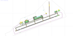
MSLP - El Salvador/Comalapa International Airport / San Salvador, El Salvador
This airport update was made with the latest version of ADE (Airport Design Editor) and made for FSX as a replacement for the stock (default) airport. I've made several changes to the airport which are listed below. All these enchancements are as close to the real airport as I can get with stock library objects. I've used satellite images, terminal photos and maps throughout the whole process so building locations are as accurate as possible. Happy landings in the sunny El Salvador!
Features:
*Fixed parking apron
*Main terminal building with its jetways
*Seperate parking apron for GA traffic
*Hangars and other airport buildings added
*Airport vehicles and objects throughout the airport
*Military cargo apron
*Parking lots with static vehicles
*Airport fire station with fire trucks
*Cargo area
*ILS heading error in stock file corrected
*Runway 18/36 closed as in the real world
| Filename: | MSLP__El_SalvadorComalapa_International_Airport__S.zip |
| License: | Freeware |
| Added: | 28th July 2012, 08:42:46 |
| Downloads: | 890 |
| Author: | Jaison Diaz / Endeavour ai |
| Size: | 128.88 KB |
| Category: Flight Simulator 2004 - Scenery | |
| Brewster Field KHDE |
|
File Description:
FS2004 Scenery-Brewster Field Airport (KHDE) serves Holdrege and Phelps County and is owned by Holdrege Airport Auth. The airport has more than one runway. The longest is a paved runway extending 4700 feet. The facility is at an elevation of 2313 feet at a distance of about 2 miles from Holdrege. Created using FSDS3, EZ Scenery, Rwy12 and Lago's FSE. Modified AFCAD2 file and AI traffic with Traffic Tools. For interesting story behind facility, read readme file.
| Filename: | Brewster_Field_KHDE.zip |
| License: | Freeware |
| Added: | 27th January 2006, 05:44:15 |
| Downloads: | 455 |
| Author: | John B. Loney, Jr. |
| Size: | 552.61 KB |
| Category: Flight Simulator 2004 - Scenery | |
| Sammamish Field - 14GK |
|
File Description:
This is a fictional airport for FS2004. This airport is located in Sammamish, WA (right near my house). There is no real airport there, but I made one anyways. You are in good distance from KSEA, so you can fly there. YOU MUST HAVE ABACUS EZ SCENERY INSTALLED! That is a must! It will not work without it. Well, it will but you will not have ANY scenery objects. I wouldn't recommend installing it without EZ Scenery.
| Filename: | Sammamish_Field__14GK.zip |
| License: | Freeware |
| Added: | 2nd January 2010, 15:31:54 |
| Downloads: | 116 |
| Author: | Grant Kozlak |
| Size: | 12.25 MB |
| Category: Flight Simulator X - AFCAD Files | |
| 4A2 - Atmautliak Airport, Alaska |
|
File Description:
Atmautluak Airport is a state-owned public-use airport located in Atmautluak, in the Bethel Census Area of the U.S. state of Alaska.
Atmautluak Airport has one runway designated 15/33 with a 3,000 by 75 ft (914 x 23 m) gravel surface. The runway was previously 2,000 by 30 ft. until it was expanded by the state.
All changes made were based on 2006 construction plans. Changed runway to 75 ft. wide.Added aprons, additional parking and buildings.
| Filename: | 4A2__Atmautliak_Airport_Alaska.zip |
| License: | Freeware |
| Added: | 28th December 2012, 00:44:08 |
| Downloads: | 332 |
| Author: | Wayne Roberts |
| Size: | 2.86 KB |
| Category: Flight Simulator X - Scenery | |
| YBLA Benalla Airport Victoria Australia |
|
Images related to this file:
File Description:
Airport YBLA Benalla in Victoria Australia which hosts a gliding club.
These files are for Flight Simulator X
Made using Airport Design Editor using only standard textures.
The scenery is a big improvement on the standard airport and accurately reproduces real world
including the narrow unlit taxiway.
NEEDED
The scenery is designed to interface with ORBX FTX_AU scenery for Australia (payware).
It should work without ORBX but has not been tested for how well it interfaces with standard scenery.
| Filename: | YBLA_Benalla_Airport_Victoria_Australia.zip |
| License: | Freeware |
| Added: | 25th January 2017, 16:40:16 |
| Downloads: | 331 |
| Author: | Colin Jeffery |
| Size: | 9.8 KB |
| Category: Flight Simulator 2004 - AFCAD Files | |
| Schwechat Vienna Austria (LOWW) |
|
File Description:
This file is a version for the default airport with 86 gates/parking/cargo parking concrete areas around the airport realigned with the buildings runways/taxiways/aprons now have improved lighting and the faulty taxiway A10 now corrected and for the heli pilots i have added a helipad which also has lighting airport views are from the roof of the control tower (only when you are in TOWER view)fully tested with Ultimate Traffic but not required.
| Filename: | Schwechat_Vienna_Austria_LOWW.zip |
| License: | Freeware |
| Added: | 10th January 2004, 19:32:26 |
| Downloads: | 3,108 |
| Author: | Ray Smith |
| Size: | 10.25 KB |
| Category: Prepar3D V1-4 - Scenery | |
| OZx YBMA Mount Isa Airport, City + Mines (FSX/P3D) |
|
Images related to this file:
File Description:
Mount Isa Regional Airport is an airport serving the western Queensland city of Mount Isa, Australia. It is served by a variety of scheduled regional airlines, with flights to Brisbane, Townsville and Cairns as well as several other regional centres. It is also a base for the Royal Flying doctor service. Scenery Includes Airport (with dynamic lighting for P3Dv4 users), Town, MT Isa mine and George Fisher Mine to the north of the city on the rwy16 approach path.
| Filename: | OZx_YBMA_Mount_Isa_Airport_City__Mines_FSXP3D.zip |
| License: | Freeware, limited distribution |
| Added: | 14th July 2019, 16:11:43 |
| Downloads: | 1,481 |
| Author: | Robert Fluke |
| Size: | 199.09 MB |
| Category: Flight Simulator X - Scenery | |
| OEMA - Madinah Intl Airport 2015 - Saudi Arabia |
|
Images related to this file:
File Description:
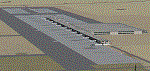
OEMA - GPS-accurate update to the default airport.
Madinah airport (Medinah), Saudi Arabia, serving the holy city of Medinah, has undergone a major construction of a new spacious eastern passenger terminal and apron with many parking gates, and runway 17/35 has been made longer and wider (4335m X 60m). At 2150 feet ASL, surrounded by high terrain makes an interesting approach, this is an airport you gotta love!
Works in both FSX and P3D.
| Filename: | OEMA__Madinah_Intl_Airport_2015__Saudi_Arabia.zip |
| License: | Freeware, limited distribution |
| Added: | 16th December 2015, 14:27:07 |
| Downloads: | 3,115 |
| Author: | Ahmed Abdessalam |
| Size: | 522.72 KB |
| Category: Flight Simulator 2004 - Scenery | |
| Athens Ben Epps Airport |
|
File Description:
FS2004 Scenery-Athens-Ben Epps Airport (KAHN) serves Athens and Clarke County and is owned by Clarke County. The airport has more than one runway. The longest is a paved runway extending 5522 feet. The facility is at an elevation of 808 feet at a distance of about 3 miles from Athens. The airport is named for Georgia's first aviator, Ben T. Epps Sr., who began building and flying airplanes in Athens in 1907 and opened Ben Epps Airport in 1917. Scenery created using FSDS2, Rwy12, Lago's FSE, with AFCAD2 and Traffic Tools. FSDS2 textures included with download. By John B. Loney, Jr.
| Filename: | Athens_Ben_Epps_Airport.zip |
| License: | Freeware |
| Added: | 4th December 2005, 03:37:31 |
| Downloads: | 1,658 |
| Author: | John B. Loney, Jr. |
| Size: | 796.36 KB |
| Category: Flight Simulator X - Gauges | |
| Airport Chart Gauge V2 |
|
File Description:
The first version was a disaster, due to a heavy error I made during packing the zip archive. This one will work.
The Airport Chart Gauge shows you the layout of an arbitrary airport, no matter, whether the airport is shipped with Flight Simulator or included in an Add-On. It doesn’t use any scanned charts, instead it takes its data directly from the Flight Simulator. The chart contains all taxiways, runways, heliports and parking places, including their identifiers, of course. With the Airport Chart Gauge you can easily find your way from your current parking place to the runway (or vice versa).
| Filename: | Airport_Chart_Gauge_V2.zip |
| License: | Freeware, limited distribution |
| Added: | 31st March 2008, 19:10:41 |
| Downloads: | 23,235 |
| Author: | Holger Maass |
| Size: | 5.59 MB |


© 2001-2026 AVSIM Online
All Rights Reserved
Privacy Policy |