
Where Flight Simulation Enthusiasts Gather from Around the World!
AVSIM Library - Search Results

| Category: Flight Simulator X - Scenery | |
| NZOP- Opotiki Aerodrome (VectorLandClass, New Zealand) |

|
Images related to this file:
File Description:
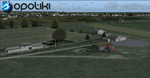
Opotiki aerodrome (ICAO: NZOP) is a small airstrip outside the township of of Opotiki, the gateway to the beautiful East coast of the North Island of New Zealand. Opotiki itself sits at the confluence of the Waioeka and Otara rivers and is surrounded by dairy farmland and Kiwifruit orchards with large areas of native bush to the south and east.
This scenery accompanies Tim Barnes'�� series of other small Bay of Plenty aerodromes (Whakatane,
Galatea, Waihi Beach) for use with VectorLandClass- It features custom modelled and textured buildings, large coverage of beautiful 0.5m aerial photography (fully auto-genned and including seasonal and night variations) and extensive use of high quality objects from the free VLC library. Installation of the library V1.1+ is required for this scenery to work properly and can be downloaded from the VectorLandClass website (www.vectorlandclass.co.nz)
This release, although not requiring it, works best with VectorLandClass topographic mesh and landclass addon covering all 268676 square kilometers of New Zealand. If you'��re not a VLC customer, you'��ll notice when the photoreal coverage runs out!
| Filename: | NZOP_Opotiki_Aerodrome_VectorLandClass_New_Zealand.zip |
| License: | Freeware, limited distribution |
| Added: | 21st February 2013, 13:52:47 |
| Downloads: | 969 |
| Author: | Tim Barnes |
| Size: | 146.68 MB |
| Category: Flight Simulator X - Scenery | |
| RAF Melbourne - Yorkshire, England. |
|
File Description:
RAF Melbourne was a Royal Air Force station typical of the expansion period of the Second World War. Located 5 miles to the South-west of Pocklington, Yorkshire, England. The nearest village is Seaton Ross.
East Common just outside the village of Seaton Ross was requisitioned for use as a grass airfield in November 1940. In late 1940 the airfield was used by Armstrong Whitworth Whitleys of 10 Squadron as a relief landing ground for RAF Leeming. The airfield soon closed for re-development as a standard Bomber Command airfield with three concrete runways and three hangars.
In May 1945 the airfield was transferred to RAF Transport Command and 575 Squadron moved in with the Douglas Dakota. The squadron only stayed for a few months operating transport flight to and from continental Europe. With the departure of the Dakota a number of specialised Flights used the airfield for six months but by the middle of 1946 the airfield was no longer used for flying.
| Filename: | RAF_Melbourne__Yorkshire_England.zip |
| License: | Freeware |
| Added: | 25th November 2015, 20:34:43 |
| Downloads: | 146 |
| Author: | Terry Boissel |
| Size: | 23.1 KB |
| Category: Flight Simulator X - Scenery | |
| Wynoochee Lake WA - (Bob's Fly-in Cabin) |
|
File Description:
Wynoochee Lake WA (Bob's Fishing Cabin) - Airport ID: BOB (FSX). - -
This is a fictitious fly-in lodge that I created for a quiet spot to fly into for weekend trips from the Seattle area. My cabin is located about 40 miles due south of Port Angeles, WA and about 50 miles due west of Seattle. - -
Wynoochee Lake is a real location, but my scenery around the lake is fictitious. - -
You will find my dirt airstrip to be quite challenging, although completely fly-able. My location is even more challenging at dawn or dusk with Weather. There are no approach lights, its just a rugged bush strip. - -
It is extra challenging with crash detection turned on - watch out for those birds, they're everywhere and that old tree just of the side of the dirt strip - don't get too close! - -
This is freeware. I hope you enjoy it. - -
Designed with the FS X Sdk Scenery function of the Mission builder,Abacus Scenery shortcut tool and Lee Swordy's AFCAD. - -
This scenery is frame rate friendly. - - Please read the "readme" - -
by Bob Caparoula
www.flydeervalley.com
| Filename: | Wynoochee_Lake_WA___Bobs_Flyin_Cabin.zip |
| License: | Freeware |
| Added: | 2nd February 2007, 21:10:37 |
| Downloads: | 1,456 |
| Author: | Bob Caparoula |
| Size: | 4.64 KB |
| Category: Flight Simulator X - Scenery | |
| Baiyun Intl Airport (ZGGG) Guangzhou, China |
|
Images related to this file:
File Description:
This is an accurate and up-to-date version of Baiyun Intl Airport and made only for FSX, do not use in P3D: The new Terminal 2 now added, when Terminal 2 opens it will be home to China Southern Airlines as well as other SkyTeam member airlines such as China Eastern Airlines, Xiamen Airlines, Air France and Korean Airlines, the new runway 2R/20L added with ILS and transitions included for it, all runways now have their correct numbers and the approaches corrected for them, assigned parking as per their website with extra parking including the overnight aprons plus gates added for the A380, the FedEx ramp and buildings updated, the STAG maintenance ramp and buildings also included, the GA ramp now moved to the south of the airport, taxiways and taxi signs updated to the latest charts, extra fuel trucks, support vehicle roads rebuilt, fuel tank farm and many other scenery objects and improvements included for a more realistic look, airport views are from inside the control tower (when in tower view) please view the readme before installation.
| Filename: | Baiyun_Intl_Airport_ZGGG_Guangzhou_China.zip |
| License: | Freeware, limited distribution |
| Added: | 19th February 2018, 23:13:51 |
| Downloads: | 28,640 |
| Author: | Ray Smith |
| Size: | 3.14 MB |
| Category: Flight Simulator X - Scenery | |
| Bornholm Island X DEMO |
|
Images related to this file:
File Description:
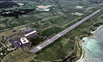
BORNHOLM ISLAND X DEMO features an extremely detailed scenery of Bornholm Island with EKRN Ronne airport in Denmark, fully compatible with both FSX and P3Dv1.
It's a fully functional DEMO version of the commercial payware product. It features same airport layout as in the full version but with limited 3D objects and low resolution textures. Using this free demo ensures no problems with online (VATSIM, IVAO, multiplayer etc.) flying in case some users use the payware scenery and some don't.
Bornholm is an island located in the Baltic Sea 37 km south of Sweden and the north of Poland. Bornholm Airport (RNN / EKRN) is a Danish airport located 2.7 nautical miles (5 km) southeast of Ronne.
This product is equipped with an automatic installer, which means that the scenery will be automatically added to the Flight Simulator Scenery Library.
Please uninstall all previous versions of this airport you may have installed before. Please make also sure that no duplicated AFCAD files are installed. Enjoy your virtual flying with Drzewiecki Design!
| Filename: | Bornholm_Island_X_DEMO.zip |
| License: | Commercial demo |
| Added: | 2nd September 2015, 21:47:52 |
| Downloads: | 1,789 |
| Author: | Drzewiecki Design |
| Size: | 15.39 MB |
| Category: Flight Simulator X - Scenery | |
| RAF Bottlesford - Lincolnshire, England |
|
File Description:
Royal Air Force Station Bottesford or more simply RAF Bottesford is a former Royal Air Force station located on the Leicestershire-Lincolnshire county border, 6.8 miles (10.9 km) north west of Grantham, Lincolnshire and 7.6 miles (12.2 km) south of Newark-on-Trent, Nottinghamshire and about 107 miles (172 km) north-northwest of London, England.
Opened in 1942, it was used by both the Royal Air Force (RAF) and United States Army Air Forces (USAAF). During the war it was used primarily as a troop carrier airfield for paratroopers and as a bomber airfield before closing in 1948.
Today the remains of the airfield are located on private property with the technical site being used as an industrial estate.
Third party add-on's will be required to see all the building included in the scenery, you will need Ted Andrews RAF Small Buildings and his hanger library, for the vehicles Ian Pearson FSX Object library will be required, the RAF Ensign hedges are the from Mike Hudson's scenery. All of which are available from Ian Pearsons' website; www.ianpsdarkcorner.co.uk.
| Filename: | RAF_Bottlesford___Lincolnshire_England.zip |
| License: | Freeware |
| Added: | 10th October 2015, 11:37:40 |
| Downloads: | 346 |
| Author: | Terry Boissel |
| Size: | 15.94 KB |
| Category: Flight Simulator X - Scenery | |
| X2AD - RAF Aston Down - Gloucestershire, England |
|
File Description:
Former RAF Aston Down (IACO X2AD) is located 2.5 miles (4.0 km) east of Minchinhampton, Gloucestershire, South West England and 6.9 miles (11.1 km) west of Cirencester, Gloucestershire.
The airfield was originally opened as RAF Minchinhampton and was first used in the First World War, serving as an aerodrome for the Australian Flying Corps with No. 2 Squadron AFC flying the Royal Aircraft Factory S.E.5a and the Sopwith Pup and No. 3 Squadron AFC flying the Avro 504. The airfield closed shortly afterwards.
In 1938 the airfield reopened under the new name of RAF Aston Down at the request of the residents of Minchinhampton village, which lies about 1 mile (1.6 km) to the west of the airfield, who feared not enemy attack, but a fall in the value of their houses.
During the Second World War the main unit present was No. 20 Maintenance Unit RAF (MU) which stored and prepared aircraft. The unit arrived during October 1938 and left in September 1960.
The airfield was used by the Royal Air Force from the First World War until 1967 when the Cotswold Gliding Club moved in from their previous base near Tetbury.
| Filename: | X2AD__RAF_Aston_Down__Gloucestershire_England.zip |
| License: | Freeware |
| Added: | 3rd May 2016, 13:55:23 |
| Downloads: | 175 |
| Author: | Terry Boissel |
| Size: | 1.97 MB |
| Category: Flight Simulator X - Scenery | |
| RAF Balderton |
|
File Description:
RAF Balderton is a former Royal Air Force station located 2.0 miles (3.2 km) south of Newark-on-Trent, sandwiched between the now extinct Great Northern Railway (GNR) Bottesford-Newark line and the A1 road in Nottinghamshire, England.
Opened in 1942, it was used by both the Royal Air Force and United States Army Air Forces. During the war it was used primarily as a troop carrier transport airfield and after for munitions storage before it was closed in 1957.
With the facility released from military control, Balderton was returned to agriculture, the runway concrete disappearing as hardcore under the AI road improvements of the 1960s. At that time, the developed Al was routed west of the original road, over the eastern perimeter track of the airfield, before coming back to the east to bypass Balderton village and Newark.
Gypsum open-pit mining has also taken its toll where quarrying has completely obliterated the airfield, with single track roads all that remain of the runway and perimeter track, and the occasional concrete runway end or pile of rubble.
Today the remains of the airfield are located on private property being used as agricultural fields.
| Filename: | RAF_Balderton.zip |
| License: | Freeware |
| Added: | 17th February 2016, 23:32:44 |
| Downloads: | 233 |
| Author: | Terry Boissel |
| Size: | 759.04 KB |
| Category: Flight Simulator X - Scenery | |
| 2016 Kigali Intl (HRYR) Rwanda |
|
Images related to this file:
File Description:
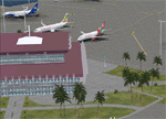
This sequel to the 2009 Kigali Intl (HRYR) Rwanda scenery (by Jacques Botha and Frits Beyer) brings it up to date with the current layout and enables full compliance with FTX Global/Vector and FSX. Buildings are added and adjusted to their real-world locations, and the new taxiway and south apron are added according to the May 2016 satellite imagery. In addition to real-world gate locations, custom apron markings are added along with apron lighting. The landclass around Kigali is also updated, and SRTMGL1 (30m) mesh is included. This scenery can be complemented by the Goma (FZNA) and Gisenyi (HRYG) scenery (FSX_FZNA-HRYG_CS.zip), and GA flightplans are included to supplement the commercial traffic at Kigali and provide more activity at FZNA and HRYG.
Updates were created or rebuilt in a manner which carefully aligns airport data with current satellite imagery. Scenery was created using Airport Design Editor X v1.70.6042, SBuilderX 3.13, and the FSX Object Placement Tool. Scenery objects were added and modified from stock FSX scenery to resemble as closely as possible the actual airports. The FSX apron lights included are from the set created by Jim Dhaenens.
| Filename: | 2016_Kigali_Intl_HRYR_Rwanda.zip |
| License: | Freeware |
| Added: | 4th August 2016, 21:10:09 |
| Downloads: | 3,387 |
| Author: | Carlyle Sharpe, Jacques Botha, and Frits Beyer |
| Size: | 17.12 MB |
| Category: Flight Simulator X - Scenery | |
| AR09 - Bella Vista Field - Arkansas, USA |
|
Images related to this file:
File Description:
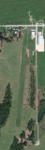
This is my first attempt at creating an airport for FSX. This airfield is located in Gravette, Arkansas, and is currently owned by Hendren Aviation. I added a few assets, so that it would appeal more to the casual simmer. Such changes, for example, is adding a helicopter pad, when in real life there isn't one. The changes are very mild, and are pointed out on the included BMP. This airport should definitely appeal to anyone who is a bush pilot. The approach from the south is a bit challenging.
You must have the Acceleration addon. This is version 2.0, which supersedes version 1.0.Version 1.0 was given to only 2 people for testing purposes, and it shouldn't have found it's way onto the internet. Please contact me if you ever come across version 1.0.
Future updates will include accurate models of the buildings, accurate night lighting (it's a grass airstrip, and as of right now, the only lighting comes from street lights and buildings), and a few changes to the airport background.
I hope everyone enjoys this scenery as much as I enjoyed learning and creating it.
| Filename: | AR09__Bella_Vista_Field__Arkansas_USA.zip |
| License: | Freeware, limited distribution |
| Added: | 14th May 2015, 17:25:41 |
| Downloads: | 295 |
| Author: | JackRiordan |
| Size: | 8.25 MB |


© 2001-2026 AVSIM Online
All Rights Reserved
Privacy Policy |