
Where Flight Simulation Enthusiasts Gather from Around the World!
AVSIM Library - Search Results

| Category: Flight Simulator X - Scenery | |
| Frankfurt Main Airport (EDDF) v7 - auto install |

|
Images related to this file:
File Description:
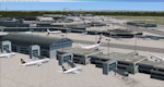
This major update represents EDDF in the December 2012 timeframe.
With the increasing development of the proposed Terminal 3 area now in use as extended apron parking, this update provides operational ramps for G and H gates including ramp parking for both airline and cargo aircraft, helicopter parking at gates H8 and H12, apron night lighting, vehicular traffic etc. In addition this update features a new Gmax custom fuel tank farm along with custom Frankfurt logos, the recently opened A-plus terminal (7 new gates including 4 A380 gates) in October 2012, a new Air Rail Center model and a new set of cargo offices/buildings that have been placed in the South Cargo area as well as the replacement of the standard FSX blast fences with a new Gmax fence model which adds even further realism to this scenery.
Also, a first time feature for this scenery, it now supports GSX (Ground Services for FSX). The G and H aprons have been customized to support GSX functionality with the correct positioning of the ground service vehicles and pushback operations based on scenery topology. The associated airport .ini file is supplied in this package.
Default FSX scenery is required. See readme/help file for more details.
| Filename: | Frankfurt_Main_Airport_EDDF_v7__auto_install.zip |
| License: | Freeware |
| Added: | 23rd December 2012, 22:28:57 |
| Downloads: | 12,700 |
| Author: | Mark Aldridge |
| Size: | 13.43 MB |
| Category: Flight Simulator X - Scenery | |
| Frankfurt Main Airport (EDDF) v7 - manual install package |
|
Images related to this file:
File Description:
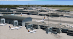
This major update represents EDDF in the December 2012 timeframe.
With the increasing development of the proposed Terminal 3 area now in use as extended apron parking, this update provides operational ramps for G and H gates including ramp parking for both airline and cargo aircraft, helicopter parking at gates H8 and H12, apron night lighting, vehicular traffic etc. In addition this update features a new Gmax custom fuel tank farm along with custom Frankfurt logos, the recently opened A-plus terminal (7 new gates including 4 A380 gates) in October 2012, a new Air Rail Center model and a new set of cargo offices/buildings that have been placed in the South Cargo area as well as the replacement of the standard FSX blast fences with a new Gmax fence model which adds even further realism to this scenery.
Also, a first time feature for this scenery, it now supports GSX (Ground Services for FSX). The G and H aprons have been customized to support GSX functionality with the correct positioning of the ground service vehicles and pushback operations based on scenery topology. The associated airport .ini file is supplied in this package.
Default FSX scenery is required. See readme/help file for more details.
| Filename: | Frankfurt_Main_Airport_EDDF_v7__manual_install_pac.zip |
| License: | Freeware |
| Added: | 23rd December 2012, 22:29:21 |
| Downloads: | 6,001 |
| Author: | Mark Aldridge |
| Size: | 13.82 MB |
| Category: Flight Simulator X - Scenery | |
| EDCB - Ballenstedt Airport - Sachsen-Anhalt, Germany *Version 1* |
|
Images related to this file:
File Description:
The airfield Ballenstedt is located in the eastern foothills of the €œHarz (North German low mountain range) and with twenty thousand aircraft movements per year a relatively highly frequented airport.
The scenery is designed very much in detail. All important objects have been created by me using photos of the original field. Also some clearly visible landmarks are integrated like the large photovoltaic arrangement north of the asphalt runway and the quite large pig farm “Asmusstedt†situated east of the field. An additional important point of reference for glider pilots is the so-called "Gegenstein", a narrow rock on top of the small hill south of the Gliderfield. A retouched photo background, covering all four seasons, completes the scenery.
However, many smaller Objects, like people, cars or static airplanes in this scenery were
taken from three popular freeware libraries for whose use I got the friendly permission of the
authors. If these libraries are not installed , many objects are not visible!
The following libraries are used:
--------------------------------
1. FS-Piloten_Objektlibrary: http://www.fs-piloten.de/thread.php?threadid=1063
2. FSX_FlightPortLib: http://www.flightport.de/libraries/flightport-library/
3. 3d People Library: http://library.avsim.net/download.php?DLID=192454
| Filename: | EDCB__Ballenstedt_Airport__SachsenAnhalt_Germany_V.zip |
| License: | Freeware |
| Added: | 1st May 2016, 21:00:27 |
| Downloads: | 1,368 |
| Author: | Wolfgang Allers |
| Size: | 272.19 MB |
| Category: Flight Simulator X - Scenery | |
| TNCB - Flamingo Airport (Bonaire) |
|
File Description:
Welcome to one of the 3 ABC's beautifull dutch island, Bonaire.
Flamingo Intl. is an international airport located at Kralendijk, Bonaire, Netherlands Antilles. Flamingo Airport serves as a connecting
point for flights of KLM to some destinations in South America. It once served as a hub for BonaireExel, BonaireExpress,CuraçaoExel,
CuraçaoExpress and now serves Dutch Antilles Express as it's secondary hub & also "EZAir" serves Bonaire as its main airline, although
the airline itself is based at Curaçao.
It is the 3rd largest airport in the Netherlands Antilles behind St.Maarten's Princess Juliana International Airport & Curaçao's Hato
International Airport and is the 4th largest between the islands of the Dutch Kingdom behind the already mention St. Maarten,
Curaçao & Aruba's Queen Beatrix International Airport. Arkefly, Continental, Delta & KLM are currently the largest airline operators
that operate flights to Bonaire.
The airport is large enough to accommodate most international widebody airliners such as the Boeing 747, the Boeing 777 and the
Airbus A340, although the largest widebody type to operate to Bonaire today is the MD11. It can also accommodate medium sized
aircraft such as the Boeing 737 and Airbus A310 as well as small aircraft such as the de Havilland Dash 8, ATR 42 and other such
turboprop aircraft.
| Filename: | TNCB__Flamingo_Airport__Bonaire.zip |
| License: | Freeware |
| Added: | 13th April 2009, 08:00:18 |
| Downloads: | 2,344 |
| Author: | Daniel Louvet |
| Size: | 1.01 MB |
| Category: Flight Simulator X - Scenery | |
| Iguassu Falls - Save The Planet |
|
Images related to this file:
File Description:
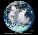
The Iguassu Falls, Itaipu Hydroelectric Power Plant, Foz do Iguassu City and Land Class Package for FSX
Save The Planet is my version of the Iguassu Falls, Itaipu Dam, bridges and landclass scenery for FSX.
Differently from my other version for MSFS 2004, I created a mesh of 5 meter resolution for Iguassu Falls area
to give me some idea how I could proceed. So, I decided to use on this addon
an image background avaliable at server (VirtualEarthSatellite). Thanks Microsoft.
Non-Airport Scenery - ICAO (SBFI). coming soon at www.Terra-Brasilis.org
Portuguese: Cataratas do Iguassu,
Spanish: Cataratas del Iguazu are waterfalls of the Iguassu River located on the border of the Brazilian state of Parana (in the Southern
Region) and the Argentinian Province of Misiones.
The Falls are shared between the Iguazu National Park (Argentina) and Iguacu
National Park (Brazil). The parks were designated UNESCO World Heritage Sites.
The Itaipu Hydroelectric Power Plant is located in the Parana River, in the stretch of the frontier between Brazil and Paraguay, 14 km north of the Friendship Bridge.
The area of the project extends from Foz do Iguassu, in Brazil, and Ciudad del Este, in Paraguay, in the south, up to Guaira (Brazil) and the Guaira Falls (Paraguay), in the north.
Enjoy FSX Iguassu Falls Scenery!
| Filename: | Iguassu_Falls__Save_The_Planet.zip |
| License: | Freeware |
| Added: | 9th December 2010, 01:57:00 |
| Downloads: | 2,850 |
| Author: | Cicero Costa |
| Size: | 31.71 MB |
| Category: Flight Simulator X - Scenery | |
| Ireland VFR Small Airports Part 2 |
|
Images related to this file:
File Description:
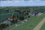
Ireland VFR Small Airports Part 2.
This scenery consists of EIME Casement Aerodrome, EIWT Weston Executive Airport and EIKH Kilrush Airfield. Casement and Weston are within 8nm of Dublin International whilst Kilrush lies approximately 30miles to the south west.
EIME's main runway 11/29 is 1,829m (6,001feet) in length and has handled the largest of heavies. Weston caters for small executive jets, GA and helicopters. Kilrush is a small private airstrip with grass and paved runways.
The scenery has been created almost entirely from real photographs and features many open hangers with internal textures. Each airport features a full panoramic view from inside the tower, sound, lighting, and smoke effects, together with animations, high definition people and military personnel. Full night lighting with wash lighting of the aprons is included. The scenery can be used as a standalone, however it also uses many objects from my Ireland VFR Small Airports Part 1. It has been tested with FSXA only and is designed to complement vfr photographic scenery. It will also work with the default terrain and I have included a set of photoreal textures with night masks. Full installation instructions are included in the Readme file. I hope you enjoy using the airports as much as I enjoyed making them.
| Filename: | Ireland_VFR_Small_Airports_Part_2.zip |
| License: | Freeware, limited distribution |
| Added: | 15th February 2012, 04:35:57 |
| Downloads: | 4,350 |
| Author: | George Keogh |
| Size: | 86.1 MB |
| Category: Flight Simulator X - Scenery | |
| Airport update for Pudong Intl with New Satellite Terminal (ZSPD) |
|
Images related to this file:
File Description:
This is a reasonably accurate and up-to-date version of Pudong Intl airport and made only for FSX users, not suitable for use in P3D: I have given this airport a complete makeover which now includes the new Satellite terminal S1 and S2, assigned parking as per their website with extra overflow parking, all gates/parking numbered correctly where possible with gates included for the A380 (Gates are 24 at T1, 71,75 at T2, 504 remote stand near S1 on taxiway L2, between taxiway P2 and south of P3 and 170 at S2), taxiways and taxi signs updated to the latest charts, extra fuel trucks, drainage channels, support vehicle roads rebuilt, and many other scenery improvements and objects added, airport views are from inside the control tower (when in tower view)
I have also added the new runway 15/33 and its taxiways, although not officially in operation yet, i have opened it so AI traffic will use it and be able to get to the terminals, because there are no charts available to me there are no approaches or taxiway designators for this runway,
I will try to update the approaches and taxiways for runway 15/33 when the updated charts become available to me, please view the readme before installation.
| Filename: | Airport_update_for_Pudong_Intl_with_New_Satellite_.zip |
| License: | Freeware, limited distribution |
| Added: | 15th December 2020, 03:51:37 |
| Downloads: | 44,913 |
| Author: | Ray Smith |
| Size: | 4.07 MB |
| Category: Flight Simulator X - Scenery | |
| AI Ship Traffic Mexican Gulf and Caribbean Sea |
|
Images related to this file:
File Description:
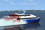
This package adds AI ship traffic to the Mexican Gulf including traffic related to the off shore oil industry but it also puts additional ship traffic in the Caribbean Sea including cruise ships and on the Hudson River in New York.
This package contains AI traffic files to be used with my packages "63 AI Ships and AI Ship Traffic for Europe and South America", "75 AI Ships and AI Ship Traffic" and "130 AI Ships and AI Ship Traffic" as well as couple of new models of typical American tugs and barges used on rivers and channels. With all this installed you will have 272 ship models available for AI traffic as well as an almost global AI Ship traffic following realistic shipping routes.
The ships visit among other places Coatzacoalcos, Veracruz, Tampico, Corpus Christi, Freeport, Galveston, Houston, Texas City, Port Arthur, New Orleans, Mobile, Panama City, Tampa, Miami, Havana, Santo Domingo, Punta Cana, San Juan, Charlotte Amalie, Road Town, Saint Martin, Pointe-a-Pitre, Roseau, Fort-de-France, Caracas, Puerto Cortes, Belize City, Playa del Carmen, Cancun, Cozumel, Isla Mujeres, and Kingston - in addition to this a few routes are placed on the Hudson River in New York.
| Filename: | AI_Ship_Traffic_Mexican_Gulf_and_Caribbean_Sea.zip |
| License: | Freeware |
| Added: | 24th March 2014, 08:14:18 |
| Downloads: | 7,608 |
| Author: | Henrik Nielsen |
| Size: | 2.67 MB |
| Category: Flight Simulator X - Scenery | |
| YEEB Eneabba, Western Australia strip and townsite |
|
File Description:
YEEB Eneabba strip and townsite
Sand mining town in heart of wildflower area Located 278 km north from Perth via the Brand Highway, Eneabba is basically a sand mining town surrounded by some of the most extensive and spectacular wild flower displays anywhere in Western Australia. The town itself is, to be fair, a real non-event with dreary modern housing (with more than a hint of construction town design), a small shopping centre and a service station all of which look as though they have sprung up in the last 20-30 years. The wealth of the area is based on the rutile sands which lie to the south of the town as well as farming, particularly cattle grazing. With an estimated 80 per cent of the world's known rutile supplies the town can boast that it has the biggest deposits of rutile in both Australia and the world. The major mining company in the area is Iluka Resources Ltd. Eneabba is basically a service town for the mines but some of the miners, realising that Eneabba is hardly a paradise, have opted for commuting and live on the coast at Leeman and drive to work preferring the beach to the dry inland.
REQUIRES blencowe_librarykit_309494.zip (Available HERE)
| Filename: | YEEB_Eneabba_Western_Australia_strip_and_townsite.zip |
| License: | Freeware |
| Added: | 25th February 2013, 23:48:24 |
| Downloads: | 255 |
| Author: | Alan Blencowe |
| Size: | 3.59 MB |
| Category: Flight Simulator X - Scenery | |
| NZGA- Galatea Aerodrome (VectorLandClass, New Zealand) |
|
Images related to this file:
File Description:
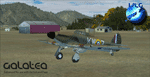
Welcome to Galatea (ICAO: NZGA), a gateway to exploring the Urewera ranges and the east coast of New Zealand. Galatea is a small and basic airstrip with only one old hanger, a public toilet and a small clubhouse on a wide plain surrounded by native bush and pine plantation near Murupara in the Bay of Plenty of New Zealand. It is a grass strip of 1025m length and 60m width and aligned 01/19 with a group rating of 8. No night lighting or fuel is available.
The FSX model includes custom textures and models placed on an aerial image. It makes extensive use of items from the free VLC object libraries which are required to be installed (download from www.vectorlandclass.co.nz downloads menu). This scenery and the VLC libraries have been funded
by sales of VectorLandClass and although you do not need VLC to use it, your purchase helps further development.
To the south west of Murupara township and sawmill is the LakeLand Helicopters base which just fits onto the photo-real coverage. Library objects have been placed here although they may not be accurate as the site was not visited when taking reference photos. This airfield makes a great stop over when flying between Rotorua, Mount Tarawera, Whakatane or Gisborne.
We hope you enjoy exploring the area!
| Filename: | NZGA_Galatea_Aerodrome_VectorLandClass_New_Zealand.zip |
| License: | Freeware, limited distribution |
| Added: | 15th November 2012, 23:35:42 |
| Downloads: | 1,127 |
| Author: | Tim Barnes / VectorLandClass |
| Size: | 45.7 MB |


© 2001-2026 AVSIM Online
All Rights Reserved
Privacy Policy |