
Where Flight Simulation Enthusiasts Gather from Around the World!
AVSIM Library - Search Results

| Category: Flight Simulator X - Scenery | |
| RAF Ludford Magna |

|
File Description:
RAF Ludford Magna was a Royal Air Force airfield operated by Bomber Command during the Second World War and the Cold War. The station lay on agricultural farmland immediately south of the village of Ludford, Lincolnshire and was sited 21.4miles (34.4 km) north east of the county town of Lincoln, Lincolnshire, England. The remains of the station can be seen from the B1225 Caistor High Street, and the long distance footpath the Viking Way passes right next to the eastern perimeter track.
It was the highest bomber airfield in England at 428 feet (130 m) above sea level, and cost £803,000 to build.
All credit must go to the following authors without whose work I could not have made this scenery; all credit for the models contained in it is theirs I merely placed it. If you don't have any of the third party addons you will only see the runway and peri track: Ted Andrews - Ian Pearson - Mike Hudson
| Filename: | RAF_Ludford_Magna.zip |
| License: | Freeware |
| Added: | 5th October 2015, 20:07:32 |
| Downloads: | 339 |
| Author: | Terry Boissel |
| Size: | 20.9 KB |
| Category: Flight Simulator X - Scenery | |
| X1BK - RAF Blakehill Farm - Wiltshire, England |
|
File Description:
RAF Blakehill Farm (ICAO X1BK) was an RAF airfield situated in Wiltshire, England. The station was originally allocated to the United States Army Air Forces Ninth Air Force but not used.
It opened in 1944 and was home for transport aircraft of No. 46 Group Transport Command. In 1948 the airfield was a satellite of RAF South Cerney and used by training aircraft before the airfield closed in 1952 and was returned to agricultural use.
After WWII, GCHQ set up an "experimental radio station", a top secret research facility, on the site of the RAF's wartime airfield at Blakehill Farm. It consisted of huge communications masts arranged in mysterious strategic patterns in the middle of the old airfield. The site was still active in some capacity until the mid 1990s and traces of the former antenna bases can still be seen on satellite photographs.
The site is now a Wiltshire Wildlife Trust nature reserve.
| Filename: | X1BK__RAF_Blakehill_Farm__Wiltshire_England.zip |
| License: | Freeware |
| Added: | 18th April 2016, 09:23:07 |
| Downloads: | 162 |
| Author: | Terry Boissel |
| Size: | 2.25 MB |
| Category: Flight Simulator X - Scenery | |
| RAF Bradwell Bay |
|
File Description:
RAF Bradwell Bay is a former Royal Air Force station located 9.5 miles (15.3 km) east of Maldon, Essex, England and 3.1 miles (5.0 km) south west of West Mersea, Essex.
The airfield was first used as grass landing strip for the nearby firing ranges before being turned into a RAF station with concrete runways and hangars.The station is unique as it was the only fighter station where the Fog Investigation and Dispersal Operation (FIDO) was used.
Part of the site is currently being used by the Bradwell nuclear power station. Several of the hangars are still used as storage by the local farmers and the control tower is now a private house. Agricultural buildings, built in the '70s and '80s on runways one and two, are now home to several local businesses.
If you would like a more detailed history follow the following link. http://www.worldwar2heritage.com/en/page/9069/189/Bradwell-Bay-Airfield
| Filename: | RAF_Bradwell_Bay.zip |
| License: | Freeware |
| Added: | 26th January 2017, 20:05:03 |
| Downloads: | 138 |
| Author: | Terry Boissel |
| Size: | 18.06 MB |
| Category: Flight Simulator X - Scenery | |
| Kaipara Flats (NZKF) |
|
File Description:
This download contains fully customised Gmax buildings and objects (with glass reflections, no night textures), phototrees, updated facility information and placed library objects.
Kaipara Flats (ICAO: NZKF) is a small airstrip west of Warkworth, a township north of Auckland in New Zealand. It is a grass strip with an offset thresholds giving a useable length of 839m, width of 30m and a group rating of 6. The runway is aligned 07/25. It isn’t lit and AvGas 100 fuel is available.
I decided to model it after doing a roadtrip north of Auckland and taking lots of reference photos of the smaller airfields suitable for the size of aircraft I fly in real life. I am also planning to model SpringHill and Parakai aerodromes in the near future
The airstrip makes a perfect stopping point for training flights around the Auckland region with Ardmore and Northshore aerodromes to the south, Springhill to the north, and Parakai to the west
| Filename: | Kaipara_Flats_NZKF.zip |
| License: | Freeware, limited distribution |
| Added: | 24th April 2009, 23:56:22 |
| Downloads: | 1,629 |
| Author: | Tim Barnes |
| Size: | 2.26 MB |
| Category: Flight Simulator X - Scenery | |
| Frankfurt Main Airport (EDDF), v3 |
|
Images related to this file:
File Description:
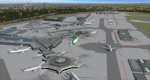
This is a major update to the previous airport package (Frankfurt ILS25R V2.2 package) using ADE 1.47 and represents the layout of the airport in June 2010.
Features now include updated ILS/DME capabilities to runways as per recent changes, a completely revised South City Cargo area, updated aprons including new flood lit lighting and a new Lufthansa A380 hangar built in Gmax.
Revised airline gate allocations for Terminal 1 and Terminal 2 included plus the addition of 5 new A380 gates at Terminal 2. A new control tower on the north parking apron has been added in preparation for the A-plus terminal expansion.
Runways and several taxiway textures changed to asphalt as per resurfacing work at real airport.
Improved quality CAT II/III signage available at intersections and new No Entry signage added for specific taxiways for extra realism.
Many other features from the previous packages are still included. See readme file for detailed information
| Filename: | Frankfurt_Main_Airport_EDDF_v3.zip |
| License: | Freeware |
| Added: | 25th October 2010, 10:30:49 |
| Downloads: | 3,692 |
| Author: | Mark Aldridge |
| Size: | 2.93 MB |
| Category: Flight Simulator X - Scenery | |
| SLET - El Trompillo Airport - Santa Cruz de la Sierra, Bolivia |
|
File Description:
El Trompillo Airport (IATA: SRZ, ICAO: SLET) is located in the south part of Santa Cruz de la Sierra, Bolivia, about 2 km (1.25 miles) away from the central plaza. Airport type:(Public / Military).
After a series of improvements, in June 3, 2014 Airport regained its status as an international airport by converting to Santa Cruz de la Sierra in Bolivia the only city with two international airports, international airport suitable as retention and/or support times of high demand in the Viru Viru Airport (ICAO: SLVR) can not supply completely.
The airport operates 24 hours and resides at an elevation of 1,371 ft (418 m) above mean sea level. Have one runway designated 15/33 with an asphalt surface measuring 8,967 by 114.82 ft (2,733 m by 35 m), El Trompillo Tunnel for vehicles, passes under the runway and connects the 4th ring (considered the most important highway in the city).
Compatible with both FSX and P3D.
| Filename: | SLET__El_Trompillo_Airport__Santa_Cruz_de_la_Sierr.zip |
| License: | Freeware |
| Added: | 19th November 2015, 09:49:14 |
| Downloads: | 1,848 |
| Author: | Marcos A. Rivas Torrez |
| Size: | 16.68 MB |
| Category: Flight Simulator X - Scenery | |
| Choctaw NOLF (KNFJ) |
|
File Description:
One of several Naval Outlying Landing Fields (NOLF's) in the Pensacola area, Choctaw NOLF is currently the only NOLF capable of supporting the newest US Navy primary training aircraft, the T-6B Texan II. Choctaw NOLF is located in Milton, FL just 13nm South of NAS Whiting Field. Designed for FSX, Choctaw NOLF features working IFLOLS trailers designed by Sylvain Parouty. The trailers have a functioning "meatball" to help with Field Carrier Landing Practice. Buildings and other objects were placed using default FSX objects as well as a couple of add-on libraries. You will need rwy_mark.zip by Lance Tucker and fsx_lts.zip by Jim Dhaenens. Both files are available at flightsim.com. View the readme file for more info and acknowledgments. The goal of this scenery is the same as in the real world...to provide a secondary landing field for Virtual Student Naval Aviators to practice pattern work, touch and go's, and Carrier Landing Practice. It's a great place for your FSX T-6A or T-34C!
| Filename: | Choctaw_NOLF_KNFJ.zip |
| License: | Freeware, limited distribution |
| Added: | 11th March 2010, 04:02:17 |
| Downloads: | 1,452 |
| Author: | Brandon Thetford |
| Size: | 13.53 MB |
| Category: Flight Simulator X - Scenery | |
| YPTN RAAF Tindal, Australia |
|
File Description:
Ants Aussie Airports Vol 5 : RAAF Tindal is a military base about 290kms south east of Darwin near the town of Katherine in Australia's Northern Territory. Tindal is a major front-line operational air base and home to No. 75 Squadron Air Combat Group (F/A-18). There is also a civilian apron in the north west corner of the airfield. This scenery contains photoreal ground textures and these are designed to blend in with the payware FTX textures (available from www.fullterrain.com). It is therefore recommended that you have the FTX textures installed if you wish to see this airfield at its best. I have tried to make this airfield as accurate as possible although as Tindal is a military base there aren't a lot of photos available so a lot of the hangars are "educated guesses". Almost all of the models have been custom made with the use of library objects kept to the minimum.
| Filename: | YPTN_RAAF_Tindal_Australia.zip |
| License: | Freeware, limited distribution |
| Added: | 6th January 2009, 13:49:54 |
| Downloads: | 3,635 |
| Author: | Anthony Lynch |
| Size: | 30.62 MB |
| Category: Flight Simulator X - Scenery | |
| LEMG Malaga (Costa del Sol) Airport - Spain - 2012 |
|
Images related to this file:
File Description:
Malaga LEMG (Costa del Sol) Airport, Spain, 2012. Spain's busiest airort. This scenery attempts to recreate as closely as possible the airport in Malaga, AGP / LEMG in FSX. Includes the new runway 12-30 to enter into service on May 3, 2012. It also contains two variants, one with south configuration, and another with north. This scenario is made with ADE, Airport desing editor, basing on the AENA charts and images of Google Earth.
------------------------------
Este escenario intenta recrear lo mas fielmente posible el aeropuerto de Malaga Costa Del Sol, AGP/LEMG en FSX.
Incluye la nueva pista de vuelos 12-30 que entrara en servicio el 3 de Mayo de 2012.
Ademas contiene dos variantes, una con configuración sur, y otro con norte.
Este escenario esta realizado con ADE, Airport desing editor, basandome en las cartas de navegación de AENA y imagenes de Google Earth.
| Filename: | LEMG_Malaga_Costa_del_Sol_Airport__Spain__2012.zip |
| License: | Freeware, limited distribution |
| Added: | 18th March 2012, 18:33:13 |
| Downloads: | 2,484 |
| Author: | Luis Lopez |
| Size: | 1.6 MB |
| Category: Flight Simulator X - Scenery | |
| George Bush Intercontinental/H Airport - KIAH - Texas, USA |
|
Images related to this file:
File Description:
This is an accurate and up-to-date version of George Bush Intercontinental Airport with two optional files and made only for FSX, do not use in P3D: There is one version with the Crosswind runways activated and in full operation where all 5 runways will be used for takeoff/landing and one version as the default airport runway operation: All terminals have been completely replaced with something better than the stock airport, this now includes terminal B south and the new terminal C expansion, the Fedex ramp and building replaced, and the northeast cargo ramp and buildings updated, assigned parking updated as per their website including a gate and parking spots for the A380, taxiways and taxi signs updated to the latest charts, drainage canals, support vehicle roads rebuilt and many other scenery improvements and objects added, airport views are from the roof of the control tower (when in tower view) please view the readme before installation.
| Filename: | George_Bush_IntercontinentalH_Airport__KIAH__Texas.zip |
| License: | Freeware, limited distribution |
| Added: | 28th May 2018, 01:35:54 |
| Downloads: | 44,424 |
| Author: | Ray Smith |
| Size: | 6.05 MB |


© 2001-2026 AVSIM Online
All Rights Reserved
Privacy Policy |