
Where Flight Simulation Enthusiasts Gather from Around the World!
AVSIM Library - Search Results

| Category: Flight Simulator X - Scenery | |
| Ghat HLGT Libya |

|
Images related to this file:
File Description:
Ghat is a medium-sized airport located in the south-west of Libya, near Algerian border, and 10 miles north of the city of Ghat. In early 2010s Ghat was undergoing major renovatios, but civil war in Libya has put these plans on hold. While all runways and taxiways were recently repaved, new passenger terminal is still unfinished, and air traffic is almost non-existent. Except from military and cargo planes, the only regular passenger flight to Ghat nowadays is Air Libyan from Tripoli: their A320 is visiting this place twice a week. This scenery has super-accurate layout, precise marking, and correct navaids according to the latest satellite images and charts. Photo background blends perfectly with ORBX Global. Unfinished new terminal with the construction site. Taxi signs were added for convenience. Enhanced city of Ghat and surrounding landclass. Made for P3Dv3, tested on P3Dv4 and FSX:SE. Made by Dmitriy Kozyrev.
| Filename: | Ghat_HLGT_Libya.zip |
| License: | Freeware |
| Added: | 27th September 2017, 06:18:00 |
| Downloads: | 1,225 |
| Author: | Dmitriy Kozyrev |
| Size: | 31.43 MB |
| Category: Flight Simulator X - Scenery | |
| ade scenery for LFLB v1.02 |
|
File Description:
ADE scenery for LFLB v1.02
New version corrects push back car sticking out through hangar door(sorry for that, didn’t see any pb car at all while checking)
Corrects ugly parking spots ( you should enter apron from north)
Small adjustment to birds flying at nw rwy (bigger area) extra car and stuff.
parking spot for light aircraft on the main apron (behind the md83)
scenery= 1 rearranged gates and parking spots (as seen on pictures)
2 birds SW and NW of the runway and high flying Eagles in the mountains left and right of the airport.
3 an NDB transmitter where the NDB is south of the runway.
4 rearranged buildings at the airport and some private planes on the parking's
5 An MD83 on the apron.
6 Overall: a more lively LFLB, Aix Les Bains in the French Alps
7 not much impact on frame rates.
| Filename: | ade_scenery_for_LFLB_v102.zip |
| License: | Freeware, limited distribution |
| Added: | 6th January 2009, 02:43:23 |
| Downloads: | 6,954 |
| Author: | Joost Visser / ADE |
| Size: | 611.76 KB |
| Category: Flight Simulator X - Scenery | |
| EDDF - Frankfurt/Main - Germany ** Version 2 ** |
|
Images related to this file:
File Description:
This airport is a very accurate rendition of EDDF to represent today situation and made only for FSX with two optional files: one file with the Crosswind runway 18/36 operating (18 takeoff only) where all 4 runways will be used simultaneously and one file as the default airport runway operation: The Northwest runway 7L/25R (landing only), ILS frequencies and approaches now corrected to the latest charts and some transitions, assigned parking as per their website with extra parking including gates for the A380, taxiways and taxi signs updated to the latest charts, new north side control tower, the South cargo apron updated, the A380 maintenance apron, extra fuel trucks, support vehicle roads rebuilt and many other scenery improvements and objects added, airport views are from the roof of the new North side control tower (when in tower view) please view the readme before installation.
| Filename: | EDDF__FrankfurtMain__Germany__Version_2_.zip |
| License: | Freeware, limited distribution |
| Added: | 6th July 2016, 09:06:54 |
| Downloads: | 44,945 |
| Author: | Ray Smith |
| Size: | 2.5 MB |
| Category: Flight Simulator X - Scenery | |
| Patch for 75 AI Ships and AI Ship Traffic |
|
Images related to this file:
File Description:
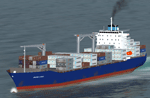
This package contains an update to be used with my packages "63 AI Ships and AI Ship Traffic for Europe and South America" and "75 AI Ships and AI Ship Traffic" when they are used together and to "75 AI Ships and AI Ship Traffic", when it is used alone. It replaces the ship "AI_Hyundai_Container" with an improved model, it corrects a problem with a model cfg file and it adds a missing wake texture.
If you install this patch you do not need the "Patch for 63 AI Ships and AI Ship Traffic" but you must install this update as the last in the installation process for my AI Shipping.
This package is part of a Global AI Shipping project for FSX, however, the container ship models included in this package can also be used individually for creating your own AI ship traffic.
| Filename: | Patch_for_75_AI_Ships_and_AI_Ship_Traffic.zip |
| License: | Freeware |
| Added: | 23rd August 2013, 23:50:07 |
| Downloads: | 11,009 |
| Author: | Henrik Nielsen |
| Size: | 1.8 MB |
| Category: Flight Simulator X - Scenery | |
| RNAS Henstridge (HMS Dipper) |
|
File Description:
Royal Naval Air Station Henstridge or RNAS Henstridge (HMS Dipper) is a former Fleet Air Arm base located 7 miles (11 km) west of Shaftesbury, Dorset (Now Somerset) and 12.4 miles (20.0 km) east of Yeovil, Somerset in South West England.
The main part of the land (355 acres) was purchased in August 1941, after which building of the airfield and the marsh lane accommodation site commenced, it was commissioned on April 1, 1943 as HMS Dipper, principally as number 2 naval fighter school, on the 11th September 1942, another 18 acres was acquired at the adjoining gibbs marsh area for an aircraft repair and maintenance site. The design and lay-out of the airfield was quite unique, having 5 runways, 2 of these being east west lay-out (07-25) both 1000 yards long, the northern runway incorporated a dummy deck landing strip, complete with under-ground arresting gear with four above ground arrestor wires, which was a duplicate of that installed on HMS Implacable for training of aircraft carrier landings, these mainly being carried out with the Seafire, a naval version of the spitfire with folding wings. The site also had its own cinema and stage hall
March 1952 the airfield became inactive and was placed under care and maintenance, during 1953 Air whaling (now Bristow group) used the facilities for repairs to the whaling fleet of helicopters until moving out in June 1958.June 1957 it was finally closed as a naval establishment, from 1958-1960 the entire site was sold off. 27 June 1980 the BBC purchased the whole site and applied for planning permission to erect at the airfield a shortwave radio station consisting of 21 self-supporting towers holding aerial arrays and ancillary buildings on a 300-acre site. The station would transmit overseas radio services to Eastern Europe, the Soviet Union and perhaps South America the application failed and the BBC sold the land during January 1987 The airfield is also the home of the wessex strut, a general aviation club formed in January 1977, which holds an annual fly in and other events their first fly-in was on 17 April 1977 and attracted 107 aircraft. As of today the only usable runway is the north 07-25 runway, extant with the concrete dummy deck, and the underground machinery chamber, it is also the home to a large number of light aviation enthusiasts aircraft as well as the Yakolevs aerobatic display team and the Dorset and Somerset air ambulance
The current airfield is operated by EGHS and is an unlicensed airfield. The only usable runway is 07/25 tarmac/concrete 750 mts long x 6 mtr wide. Henstridge radio can be contacted on 130.250 MHz, it can be found at the south eastern stub of the Yeovilton MATZ
Source:Wikipedia
| Filename: | RNAS_Henstridge_HMS_Dipper.zip |
| License: | Freeware |
| Added: | 9th February 2017, 22:14:54 |
| Downloads: | 165 |
| Author: | Terry Boissel |
| Size: | 4.53 MB |
| Category: Flight Simulator X - Scenery | |
| Mesolonghi Airport - Rio-Antirio Bridge - Greece ** UPDATED VERSION ** |
|
Images related to this file:
File Description:
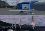
These are actually two sceneries offered in one pack. I started building the small airport of Mesolonghi in Western Greece. When nearing completion, I thought that FS was really missing the big suspension Bridge that connects mainland Greece with Peloponese that was finished in 2004, being the biggest in the world of the fully suspended type. The bridge project turned out bigger than the airport as I ended up doing the typical, Greek-style double ended ferries that served the straights for decades before the bridge and still offer a cheaper and, to some, more relaxing alternative.
Mesolonghi airport is situated 5 kilometers east of the historic city of Mesolonghi and is close to the technical school of fisheries. There is no ICAO code (ZZZZ) so I had to give it the fictional LGME in the sim. A purely day field, it houses the local Aeroclub and ultralight school. due to its small size and hospitable atmoshpere, it is a popular GA pilots destination, receiving also often international arrivals. The runway is asphalt and 800m (2635') in length. No PAPI or VASI are provided. There is no tower service and unicom frequency of 119.7MHz is used by the traffic. Closest controlled airport is Araxos (LGRX), a civil and military field, quite common in Greece, 12.5 nautical miles S-SE. The nearby city of Mesolonghi is famous for its heroic resistance and fall in 1826 during the Greek war of indepence. It is also famous for its fishery production, due to the natural lagoon, formed by the shallow waters.
Features of the Mesolonghi airport scenery include:
- Photoreal area with seasonal variations and watermask.
- Custom hangars and containerised buidings.
- AI default trike performing TnGs (in P3D it will work only if you copy over the FSX trike).
- The technical shool of fisheries on the north side.
- Customized shorelines, to fit with ORBX Global Vector.
- Optional shoreline fix for default scenery.
The Rio-Antirio bridge is located 14.5 nautical miles to the east of the airport. It connects the towns of Rio on the south side and Antirio on the north side. More data on the bridge can be found on Wikipedia.
Features of the Rio-Antirio bridge scenery include:
- Custom bridge model, bump mapped textures with hard platform surface and vehicle traffic.
- Night lighting textures and custom roadlights.
- Photoreal scenery for north and south shores, including hand placed autogen and night textures.
- Custom castle models on north and south sides, with bump mapped textures and night lighting.
- Custom model of the toll post on the north side.
- Custom AI ferry boats with constant shuttle service between Rio and Antirion piers.
- Customized shorelines, to fit with ORBX Global Vector.
- Optional shoreline fix for default scenery.
- Optional HDR optimized photoreal textures.
| Filename: | Mesolonghi_Airport__RioAntirio_Bridge__Greece___UP.zip |
| License: | Freeware |
| Added: | 16th March 2016, 09:15:21 |
| Downloads: | 2,628 |
| Author: | Vassilios Dimoulas |
| Size: | 300.05 MB |
| Category: Flight Simulator X - Scenery | |
| KMKG - Muskegon Country Airport - Muskegon, Michigan (Photoreal) Version 1.1 |
|
Images related to this file:
File Description:

Version 1.1 (corrected ILS & terminal Jetways)
This is a total reworking of KMKG - Muskegon County Airport in Muskegon, Michigan - USA.
Photo scenery includes two seasonal photo real ground textures (winter included) covering the airport and on the south side of the airport. New buildings include a custom Terminal & Parking lot, FBO (Executive Air Trainsport), Control Tower, Terminal Shed, and Hanger for West Michigan Flying Club. All new buildings have night textures. Runway 32/14 has been lengthened to the current real world length & the old Runway 36/18 has been closed and turned into a taxiway.Various other changes include taxiway/sign modifications and autogen changes.
This has been tested on FSX as well as P3d 2.2. Both work. The only difference is in P3d the night lighting will not "cover" the tarmac like in FSX.
Special thanks goes out to Jim Dhaenens and allowing me to use his lighting objects. All other custom items where made by myself using google sketchup.
| Filename: | KMKG__Muskegon_Country_Airport__Muskegon_Michigan_.zip |
| License: | Freeware |
| Added: | 18th August 2014, 21:16:41 |
| Downloads: | 2,400 |
| Author: | Matt Wohlford |
| Size: | 205.06 MB |
| Category: Flight Simulator X - Scenery | |
| LEMG-X-JVX |
|
Images related to this file:
File Description:

LEMG, Malaga, Spain.
Hello Flightsim friends.
This is an reworked ADE [Scruffy Duck] scenery of LEMG, Malaga Airport, Spain, for FSX
It was annoying to find that almost everything was wrong at LEMG in FSX.
Runway numbers, Exits, Entrances to the Apron etc.
I've tried to get all the runways, turn offs and runway signs in their correct positions.
The Runways are now: 13 and 31 instead of 14 and 32
-crows next to entrance D13 at the NW end of the runway 13 and south of the airport almost halfways.-Seagulls next to the shore line.-Fishingships, a Cruiseliner and a freighter at sea.-Oil tanks near Apron entrance D2 [extremely dense setting]- Some military objects on the MIL part of the airport plus extra buildings.-Somewhere in the mountains there should be Eagles I know they are there but heck, I didn't yet see them my self :-) The MAR approach should lead you past them though]
AVSIM upload only
| Filename: | LEMGXJVX.zip |
| License: | Freeware, limited distribution |
| Added: | 1st April 2010, 02:21:00 |
| Downloads: | 1,728 |
| Author: | Joost Visser |
| Size: | 435.24 KB |
| Category: Flight Simulator X - Scenery | |
| Frankfurt Main Airport v6 (EDDF) scenery auto install |
|
Images related to this file:
File Description:
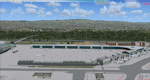
This major update for Frankfurt Main Airport supersedes v5.3 and includes an installer to simplify the process of installing the standard texture and scenery files This update now includes the new A-plus terminal with 7 gates (4xA380) complete with real-world textures and night lighting, a new lighted control tower model plus a whole new set of custom built Gmax models of airport buildings which help add realism to the airport. Also modelled is the extended G Apron on the south side now with x parking spots and night lighting, the Rwy 18 blast fence and A380 engine blast wall. Also included in this package are the latest airport runways/taxiway designations including latest updates to taxiway Sierra, ILS frequencies and navaids including the new VOR as per May 2012. Default FSX scenery is required.
Also includes updated airline codes for gate parking and other minor defect fixes.
See readme/help file for more details.
| Filename: | Frankfurt_Main_Airport_v6_EDDF_scenery_auto_instal.zip |
| License: | Freeware |
| Added: | 27th May 2012, 23:05:35 |
| Downloads: | 1,006 |
| Author: | Mark Aldridge |
| Size: | 7.27 MB |
| Category: Flight Simulator X - Scenery | |
| RNAS Inskip |
|
File Description:
RNAS Inskip is located a few miles north of a place called Kirkham near Blackpool which is in the county of Lancashire (U.K.). During WWII the Lancashire plain was used extensively for airfields. Most famously, USAAF's BAD2, which General Doolittle labelled
'the world's greatest air depot' was located at Warton, only a few miles south of Inskip. What with RNAS Burscough and RAF Woodvale close by the other side of the river, the skies above the Ribble must have been a dense mass of most of the u.k./u.s.a. aircraft types ever flown during WW2.
Otherwise known as HMS Nightjar (X4IP), it was only open as an active airfield for a few years 1943 - 1946. It was used by the Fleet Air Arm
mainly for Radar Training and bombing practice, but many operational units would disembark from their carriers for upgrades or maintenance during carrier refits. Flying out of Inskip were many FAA types - Fireflies, Swordfish, Ansons, Barracudas, Fulmars, Tarpons (Avengers)
and Martlets (Wildcats).
| Filename: | RNAS_Inskip.zip |
| License: | Freeware |
| Added: | 18th September 2015, 06:01:18 |
| Downloads: | 383 |
| Author: | Ian Robinson |
| Size: | 27.89 MB |


© 2001-2026 AVSIM Online
All Rights Reserved
Privacy Policy |