
Where Flight Simulation Enthusiasts Gather from Around the World!
AVSIM Library - Search Results

| Category: Flight Simulator X - Scenery | |
| RAF Blyton - Lincolnshire, England |

|
File Description:
RAF Blyton is a former Royal Air Force airfield,located 4.8 miles (7.7 km) north east of Gainsborough, and 9.6 miles (15.4 km) of south Scunthorpe, Lincolnshire, England.
It was built in 1942 and was heavily used during the Second World War and conformed to the usual 'A' Class airfield formation ie 3 runways laid out in the rough shape of an A.
The 3 runways were 09/27 & 14/32 at a length of 4200ft by 150ft wide and the main 03/21 for was the usual 6000ft by 150ft. Third party add-on's will be required - see readme.txt file for details.
| Filename: | RAF_Blyton__Lincolnshire_England.zip |
| License: | Freeware |
| Added: | 31st October 2015, 12:24:42 |
| Downloads: | 207 |
| Author: | Terry Boissel |
| Size: | 18.27 KB |
| Category: Flight Simulator X - Scenery | |
| RAF Metheringham - Lincoln, Lincolnshire, England |
|
File Description:
RAF Metheringham was a Royal Air Force station situated between the villages of Metheringham and Martin and 12.1 mi (19.5 km) south east of the county town Lincoln, Lincolnshire, England. Third party addons will be required - see Readme.txt file for details.
Operated as a bomber airfield during World War II the station opened in October 1943 and was decommissioned in the spring of 1946.
Although now mostly returned to agricultural and commercial uses the site retains one original runway, the eastern perimeter track and some contemporary buildings together with a No. 106 Squadron RAF memorial garden and a visitor centre.
Souce: Wikipedia
| Filename: | RAF_Metheringham__Lincoln_Lincolnshire_England.zip |
| License: | Freeware |
| Added: | 12th November 2015, 16:12:55 |
| Downloads: | 306 |
| Author: | Terry Boissel |
| Size: | 95.79 KB |
| Category: Flight Simulator X - Scenery | |
| RAF Harwell 1944 - Oxfordshire, England |
|
File Description:
RAF Harwell is a former Royal Air Force station in former Berkshire, near the village of Harwell, located 4.8 miles (7.7 km) south east of Wantage, Oxfordshire and 17 miles (27 km) north west of Reading.
The bulk of the Station lay within Chilton parish; about a third was in East Hendred; and the smallest portion was in Harwell. The first Commanding Officer, upon being asked what the name of the new airfield should be, responded that it should be named after the parish in which his house lay – and this happened to be Harwell.
| Filename: | RAF_Harwell_1944__Oxfordshire_England.zip |
| License: | Freeware |
| Added: | 26th April 2016, 14:33:34 |
| Downloads: | 128 |
| Author: | Terry Boissel |
| Size: | 642.7 KB |
| Category: Flight Simulator X - Scenery | |
| X3SF- Snitterfield - Warwickshire, England |
|
File Description:
RAF Snitterfield (ICAO x3SF) is a former Royal Air Force station located west of Snitterfield, Warwickshire, England, 3.3 miles (5.3 km) north of Stratford-upon-Avon and 4.6 miles (7.4 km) south-east of Henley-in-Arden, Warwickshire.
RAF Snitterfield was operational during the Second World War, the airfield was a class A airfield and had around 30 aircraft dispersals. The airfield was finished around June 1942 and cost around £1,147,000 and opened in 1943 and with the cessation of hostilities the Air Ministry having no further use for the Station it closed in 1946.
Source: Wikipedia.
| Filename: | X3SF_Snitterfield__Warwickshire_England.zip |
| License: | Freeware |
| Added: | 14th May 2016, 11:42:00 |
| Downloads: | 108 |
| Author: | Terry Boissel |
| Size: | 1.54 MB |
| Category: Flight Simulator X - Scenery | |
| Whale Island Scenery: "Islands of the Bay of Plenty" |
|
File Description:
This scenery was created from a digital Orthorectified aerial mosaic owned by Environment Bay of Plenty (The Bay of Plenty Regional Council). The imagery has been de-sampled for use in Flight Simulator X and utilizes the default terrain mesh. The textures are intended for summer daylight flying only, although due to the sparse nature of White Islands' Evegetation, the Islands appearance remains relatively consistent throughout the year.
It includes autogen trees, a landable helicopter pad on the top of the Island, Radio masts, and the Department of Conservation (DOC) hut in the south western bay of the island.
| Filename: | Whale_Island_Scenery__Islands_of_the_Bay_of_Plenty.zip |
| License: | Freeware, limited distribution |
| Added: | 9th May 2007, 08:42:59 |
| Downloads: | 1,496 |
| Author: | Tim Barnes |
| Size: | 7.05 MB |
| Category: Flight Simulator X - Scenery | |
| Tokol (LHTL) enhanced scenery and ADE file |
|
File Description:
Tokol (LHTL) is a former military airfield just south of Budapest Ferihegy.
This scenery replaces the default LHTL with an enhanced and "reactivated"
version of the military airbase. Parking for military aircraft is provided
on the ramps and in numerous hardened shelters. Parking is also provided
for general aviation aircraft. This design was accomplished using ADE,
SBuilderX, FSXPlanner and Whisplacer. Custom hardened shelters created
by Juri Masnik. Default FSX library objects, autogen and RWY12
objects were used for this creation, This scenery is for FSX only and
was tested in FSX-Acceleration\SP2 on WinXP Pro.
| Filename: | Tokol_LHTL_enhanced_scenery_and_ADE_file.zip |
| License: | Freeware |
| Added: | 3rd February 2008, 13:51:21 |
| Downloads: | 1,842 |
| Author: | Paul Strogen |
| Size: | 1.97 MB |
| Category: Flight Simulator X - Scenery | |
| Barrage Gouin - Gouin Dam |
|
File Description:
Barrage Gouin (CTP3) - Gouin Dam(CTP3) is a real bush destination in the central portion of the Canadian province of Quebec. It is a popular fishing destination. This accurate scenery contains many of the real buildings, chalets and docks near the dam. Bush pilots on wheels, there's a runway south of the dam near the river. There's also another outfitter (CB31) scenery north-west of the dam with a sand runway.
You can takeoff from Quebec city (CYQB) (see Gilles Boily's scenery) or Trois-Riviere (CYRQ) and fly north to the dam.
See the readme file for more informations.
| Filename: | Barrage_Gouin__Gouin_Dam.zip |
| License: | Freeware, limited distribution |
| Added: | 7th April 2008, 09:31:08 |
| Downloads: | 4,194 |
| Author: | Jean St-Cyr |
| Size: | 5.91 MB |
| Category: Flight Simulator X - Scenery | |
| Okanagan Landclass, Rivers and Lakes |
|
File Description:
Okanagan Landclass for FSX, enhanced version.
Inspired by the excellent bc_landclass collection by Martin Eldridge
Covers the Okanagan Valley from N50 37 50 south to the US Border.
(Roughly: Grindrod, BC to Oroville, WA)
reworked the vegetation in the valleys (crops/grass/woods/shrub) to better match real life.
Added/reworked minor towns and settlements:
Grindrod, Enderby, Armstrong, Coldstream, Lumby, Cherryville, Oyama, Winfield, Peachland, Naramata, Okanagan Falls, Oliver, Cawston, Keremos, Olalla, Scott, WA
and added/reworked major cities:
Vernon, Kelowna, Summerland, Penticton, Osoyoos, Oroville, WA.
This version also adds numerous lakes and streamlines to the Southern Okanagan area.
| Filename: | Okanagan_Landclass_Rivers_and_Lakes.zip |
| License: | Freeware, limited distribution |
| Added: | 23rd June 2007, 20:45:29 |
| Downloads: | 2,279 |
| Author: | A. Sievert |
| Size: | 19.7 KB |
| Category: Flight Simulator X - Scenery | |
| Paulinia S.P. - Complement to Americana S.P. 4/5 |
|
File Description:
4/5 - This is the complement of Americana to cover all region taht include the lake Praia Azul. This scenery is composed by five parts. Folow instructions on Readme.txt and have a nice visual flight. Is a good idea install the FSX Mesh South America parts F7 and F8 cordinates in the map to have the essential mesh terrain. There is a link to download:
www.ceaero.com.br/meshxsa/dowsa.html
Other pack that you need install if want to see all hangars in SDAI Aeroclube de Americana,
is the STATIC BJECTS LIBRARY found on RWY12 OBJECTS PLACER found in http://www.rwy12.com/rwy12/
| Filename: | Paulinia_SP__Complement_to_Americana_SP_45.zip |
| License: | Freeware |
| Added: | 8th June 2008, 14:09:41 |
| Downloads: | 1,456 |
| Author: | Gilson A. Rocchetti |
| Size: | 71.84 MB |
| Category: Flight Simulator X - Scenery | |
| Mach Loop Markers: Fast Jets |
|
Images related to this file:
File Description:
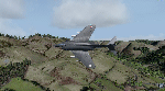
A series of markers around the famous "Mach Loop" in Wales to help sim flyers find and fly the
route.
The Mach Loop is a series of valleys in the United Kingdom in west-central Wales, notable for
their use as low-level training areas for fast aircraft. The system of valleys lies 13 km (8
mi) east of Barmouth between the towns of Dolgellau to the north and Machynlleth to the south,
from the latter of which it takes its name.
It is usually flown in an anti-clockwise direction.
Works in FSX and P3D.
| Filename: | Mach_Loop_Markers_Fast_Jets.zip |
| License: | Freeware |
| Added: | 10th October 2022, 14:02:20 |
| Downloads: | 86 |
| Author: | Peter J Forster |
| Size: | 2.31 MB |


© 2001-2026 AVSIM Online
All Rights Reserved
Privacy Policy |