
Where Flight Simulation Enthusiasts Gather from Around the World!
AVSIM Library - Search Results

| Category: Flight Simulator X - Scenery | |
| KOMA - Eppley Airfield - Omaha, Nebraska - USA |

|
File Description:
Eppley Airfield (KOMA) in Omaha, Nebraska updated for FSX to reflect the current state of the airport in 2016. AFCAD updated to include recent construction projects on the airport including runway extensions, terminal ramp extensions, as well as numerous taxiway layout changes. Gate parking information updated to reflect current gate usage. Photoreal coverage for Eppley Airfield extending south through downtown Omaha to Interstate-80 and west to Interstate-480, as well as numerous 3D models for downtown and parts of Creighton University.
Complements oma2008.zip found in this library but it is not necessarily a requirement.
| Filename: | KOMA__Eppley_Airfield__Omaha_Nebraska__USA.zip |
| License: | Freeware |
| Added: | 6th December 2016, 19:48:10 |
| Downloads: | 1,451 |
| Author: | Christopher Bruner |
| Size: | 60.02 MB |
| Category: Flight Simulator X - Scenery | |
| La Durance - French River - |
|
File Description:
The scene of the river Durance, Hautes Alpes and Alpes de Haute-Provence (France).
Durance is rooted at the foot of the Summit of Angels, 2390 m, south of Montgen�¨vre, to the confluence with the Rhone. Durance runs 305 km.
This scene represents the river durance and its floodway (EDF) of the dam of Serre-pon�§on to the Rhone, for Durance, to the pond of Berre EDF for the Grand Canal.
Some changes landclass more truthful were modeled.
This scene was designed for FSX default (SP1), it has not been tested with FS9.
| Filename: | La_Durance__French_River_.zip |
| License: | Freeware |
| Added: | 22nd December 2010, 00:55:31 |
| Downloads: | 1,846 |
| Author: | CLAUZE Norbert |
| Size: | 3.77 MB |
| Category: Flight Simulator X - Scenery | |
| LOWG- Graz Airport - Graz, Austira |
|
File Description:
Graz Airport, known as Flughafen Graz-Thalerhof in AUSTRIA, is a minor international airport in Graz, the second-largest city in Austria. It is located in the south of the alps the airport serves flights to European leisure and some metropolitan destinations. In this version you have new animated people, no flickering, new animated vehicle, new Taxiway-lights, seasonal textures, Hospital UKH-Graz and LKH-Graz, new buildings around the Airport.
This will be my last freeware-version of LOWG.
This version is tested in FSX and P3D, thank you and have fun.
Manfred Marbler.
| Filename: | LOWG_Graz_Airport__Graz_Austira.zip |
| License: | Freeware |
| Added: | 5th March 2016, 12:04:30 |
| Downloads: | 6,311 |
| Author: | manfred marbler |
| Size: | 454.79 MB |
| Category: Flight Simulator X - Scenery | |
| LTFM - Cukurova Regional Airport, Turkey |
|
Images related to this file:
File Description:
Cukurova Regional Airport is an under-construction airport which is located in the south of Turkey within the borders of Mersin province.The airport is planned to run operations by 2015 and when finished it will be the second largest airport in Turkey after Istanbul Ataturk (LTBA). However, instead of waiting by that time, just for joy, I wanted to create it by being to loyal
to geographical references. The construction of the runways are visible on Google Map and I located them accurately in accordance with the given data. Yet the parking spots, aprons, taxiways and COM frequencies are totally fictionally made.
| Filename: | LTFM__Cukurova_Regional_Airport_Turkey.zip |
| License: | Freeware |
| Added: | 27th May 2014, 06:26:56 |
| Downloads: | 1,144 |
| Author: | Ersay Kilinc |
| Size: | 2.06 MB |
| Category: Flight Simulator X - Scenery | |
| Cape_Verde_Mesh |
|
File Description:
To improve performance, FSX updated with SP1 loads DEM files in threads and only
the closer terrain (about 10 NM from the point of view) is rendered in high
detail, while at far distances FSX shows up its default low resolution mesh,
if it is not available a multi-resolution one. This terrain mesh file was multilod compiled from 90m SRTM2 source data, reprocessed with 3DEM to remove voids and spikes, providing a 76.4m (LOD9) horizontal resolution topography intended
for use only in FSX updated with SP1.
It covers the Cape Verde, a group of islands in the North Atlantic Ocean, that consist of two small archipelagos, about 400 miles off the western coast of Senegal (Africa), including: Boa Vista, Brava, Maio, Mosteiros, Paul, Praia, Porto Novo, Ribeira Grande, Sal, Santa Catarina, Santa Cruz, Sao Domingos, Sao Filipe, Sao Miguel, Sao Nicolau, Sao Vicente and Tarrafal (Geographic coordinates: 16ºN/24ºW).
Authors:
Hely Heck Junior - Magrao ( [email protected] ) and Jose Lobo (
[email protected] ) TerraBrasilis: www.terra-brasilis.org
| Filename: | Cape_Verde_Mesh.zip |
| License: | Freeware |
| Added: | 21st June 2007, 16:26:23 |
| Downloads: | 4,335 |
| Author: | Hely Heck Jr. and José Lôbo |
| Size: | 1.55 MB |
| Category: Flight Simulator X - Scenery | |
| 6I2 - Lebanon-Springfield Airport - Kentucky, USA [FreeMeshX - USA-optimized] |
|
Images related to this file:
File Description:
Lebanon-Springfield Airport (FAA LID: 6I2), a public use airport in Washington County, Kentucky (KY), USA. It is located three nautical miles (6 km) south of Springfield in Washington County) and north of Lebanon (in Marion County). The airport is owned by Marion and Washington Counties. The scenery contains seasonal ground textures for winter, spring, summer, autumn and night; autogen and default scenery objects of FSX plus a modified AFCAD file. Tested with FSX: SE on Windows 10. Version 1.1 contains fixes for the terrain aswell as corrected scenery objects.
** Do not use this version with the default mesh; use 6I2_NO_FMX.zip instead **
By Peregrine Simulations
| Filename: | 6I2__LebanonSpringfield_Airport__Kentucky_USA_Free.zip |
| License: | Freeware, limited distribution |
| Added: | 21st February 2018, 23:36:13 |
| Downloads: | 415 |
| Author: | Peregrine Simulations |
| Size: | 104.1 MB |
| Category: Flight Simulator X - Scenery | |
| 6I2 - Lebanon-Springfield Airport - Kentucky, USA |
|
Images related to this file:
File Description:
Lebanon-Springfield Airport (FAA LID: 6I2), a public use airport in Washington County, Kentucky (KY), USA. It is located three nautical miles (6 km) south of Springfield in Washington County) and north of Lebanon (in Marion County). The airport is owned by Marion and Washington Counties. The scenery contains seasonal ground textures for winter, spring, summer, autumn and night; autogen and default scenery objects of FSX plus a modified AFCAD file. Tested with FSX: SE on Windows 10. Version 1.1 contains fixes for the terrain aswell as corrected scenery objects.
** Do not use this version with FreeMesh X - USA; use 6I2_FMX.zip instead **
By Peregrine Simulations
| Filename: | 6I2__LebanonSpringfield_Airport__Kentucky_USA.zip |
| License: | Freeware, limited distribution |
| Added: | 21st February 2018, 23:36:38 |
| Downloads: | 250 |
| Author: | Peregrine Simulations |
| Size: | 104.1 MB |
| Category: Flight Simulator X - Scenery | |
| The Dry Tortugas Photo Scenery |
|
Images related to this file:
File Description:
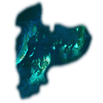
Where are the Dry Tortugas? Should you be wondering, at the western end of the Florida Keys. Located 68 miles west of Key West, they are accessible only by boat and of course via your favorite seaplane.
Source Data: National Agriculture Imagery Program (NAIP) Orthoimagery, 1 meter per pixel resolution. The scenery package also corrects the MS-FSX Island and Lighthouse position errors overlooked by UTX-USA and UTX-TAC.
For your finest virtual experience it is highly recommended you download, install and use with: South Florida and The Bahamas Water Class scenery. (S-FL_Bahamas_WC.zip)
Enjoy your flight and don't forget your Scuba Gear or the sunscreen! - Wally-Bob
| Filename: | The_Dry_Tortugas_Photo_Scenery.zip |
| License: | Freeware, limited distribution |
| Added: | 23rd August 2014, 11:08:17 |
| Downloads: | 918 |
| Author: | Walter Roberts |
| Size: | 50.9 MB |
| Category: Flight Simulator X - Scenery | |
| 3U2 Johnson Creek Airport |
|
File Description:
"Johnson Creek Airport (FAA LID: 3U2) is a grass airstrip located in Central Idaho three miles (5 km) south of Yellow Pine, a village in Valley County, Idaho, United States. It is managed by the Idaho Division of Aeronautics of the Idaho Transportation Department. A caretaker resides at the field, and as a result, the turf runway is well cared for. Johnson Creek is in the category of backcountry airstrips, and is popular with pilots who enjoy airplane camping." - Wikipedia
This FSX rendition includes volumetric grass, static aircraft, 1 meter/pixel photoscenery, 10 meter mesh, full autogen annotation, and is color corrected and blended into the surrounding scenery.
| Filename: | 3U2_Johnson_Creek_Airport.zip |
| License: | Freeware, limited distribution |
| Added: | 22nd July 2012, 20:11:57 |
| Downloads: | 899 |
| Author: | Orion Lyau |
| Size: | 12.69 MB |
| Category: Flight Simulator X - Scenery | |
| X2CB - RAF Chilbolton - Hampshire, England |
|
File Description:
RAF Chilbolton (ICAO X2CB) is a former Royal Air Force station in Hampshire, England. The airfield is located in Chilbolton approximately 4 miles (6.4 km) south-southeast of Andover; about 62 miles (100 km) southwest of London Opened in 1940, it was used by both the Royal Air Force and then later by the United States Army Air Forces. During the war it was used primarily as a troop carrier airfield for parachutists. After the war it was used for jet aircraft testing before being closed in 1946. Today the remains of the airfield are located on private property being used as agricultural fields.
| Filename: | X2CB__RAF_Chilbolton__Hampshire_England.zip |
| License: | Freeware |
| Added: | 1st April 2016, 08:06:40 |
| Downloads: | 115 |
| Author: | Terry Boissel |
| Size: | 2.77 MB |


© 2001-2026 AVSIM Online
All Rights Reserved
Privacy Policy |