
Where Flight Simulation Enthusiasts Gather from Around the World!
AVSIM Library - Search Results

| Category: Flight Simulator X - Scenery | |
| TNCA |

|
File Description:
Queen Beatrix International Airport (IATA: AUA, ICAO: TNCA) (Papiamento: Aeropuerto Internacional Reina Beatrix), in Oranjestad, Aruba, is an aviation facility. It has flight services to the United States, most countries in the Caribbean, the northern coastal countries of South America, Canada and some parts of Europe, notably the Netherlands. It was named after Queen Beatrix of the Netherlands, the head of state of Aruba.
This file has the right coordenates, with the apron and characteristics of the airport, working jetways. The runways and runways were resized the gates placed on correct location.
| Filename: | TNCA.zip |
| License: | Freeware |
| Added: | 14th April 2011, 02:14:09 |
| Downloads: | 1,904 |
| Author: | Anwar Gonzalez |
| Size: | 29.64 KB |
| Category: Flight Simulator X - Scenery | |
| Caribbean AI Ship Traffic for 63 AI Ships |
|
Images related to this file:
File Description:
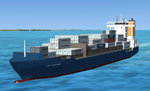
This package contains traffic files for the Caribbean Sea for the ships included in my package "63 AI Ships and AI Ship Traffic for South America and Europe V1". The new AI Ship routes are mainly concentrated in the Eastern part of the Carribbean along the Antilles from Puerto Rico to Tobago, but routes also include Panama, Colombia, Venezuela, Jamaica and Florida.
You will need to download and install "ai_ships_and_ai_ship_traffic_2013_v1.zip" before you can benefit from this package. This package does not contain any ships, but just the AI routes for the Caribbean Sea.
| Filename: | Caribbean_AI_Ship_Traffic_for_63_AI_Ships.zip |
| License: | Freeware |
| Added: | 9th March 2013, 22:56:28 |
| Downloads: | 11,025 |
| Author: | Henrik Nielsen |
| Size: | 716.81 KB |
| Category: Flight Simulator X - Scenery | |
| Okanagan Lake, British Columbia, Canada Upgrades |
|
Images related to this file:
File Description:
A scenery upgrade to Okanagan Lake, BC, Canada. This scenery continues the upgrades to the Kelowna area near CYLW. South of the airport the lake received marinas and docks and a marina entrance station located near the bridge. As per Google Earth both sides of the lake at the bridge have several marinas, docks and small piers, lot's of boats and some added fictitious objects including a landable water helipad. This scenery is stand-alone. Nothing else is required. Read the text file for instructions and please enjoy. By Savageale.
| Filename: | Okanagan_Lake_British_Columbia_Canada_Upgrades.zip |
| License: | Freeware |
| Added: | 4th December 2011, 08:08:34 |
| Downloads: | 994 |
| Author: | Tim Durham |
| Size: | 1.58 MB |
| Category: Flight Simulator X - Scenery | |
| Joinville, Brazil SBSV Photoreal Part1 |
|
File Description:
Joinville, is a Brazilian municipality located in the northeastern state of Santa Catarina, with 1130.878 km �² and has a population of 515,250 inhabitants in 2010 [3]. Largest municipality of Santa Catarina, and the third in the South, is also the headquarters of the micro-region of Joinville, Santa Catarina the Greater Region and Northern Metropolitan Region North / Northeast of Santa Catarina (along with Araquari). Its metropolitan area, comprising the counties adjacent to each other that form the Metropolitan North / Northeast of Santa Catarina, has about 1,094,570 inhabitants
| Filename: | Joinville_Brazil_SBSV_Photoreal_Part1.zip |
| License: | Freeware |
| Added: | 18th January 2012, 23:22:30 |
| Downloads: | 4,552 |
| Author: | Paulo Ricardo RubensGons |
| Size: | 244.87 MB |
| Category: Flight Simulator X - Scenery | |
| PLAN Fleet |
|
Images related to this file:
File Description:
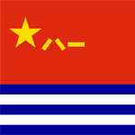
Here is a mighty PLAN fleet, capable of respectable force projection anywhere within the nine dash line and even beyond! I tried to find the Chinese Navy crest, similar to the one I used to represent my US Navy collection, but the only thing available anywhere is a depiction of the Peoples Liberation Army Navy flag.
These ships are currently assigned to the South Sea Fleet and so might be present at any of the events in the disputed South China Sea.
The LST YutingII/Type 072a Luhua Shan, pennant number 997, is the same type vessel that participated in the "near collision" with USS Cowpens recently. Now you can re-enact how a 18 knot transport was able to in any way interfere with the 32 knot Arleigh Burke class destroyer. Also in this fleet are two Houbei class missile boat catamarans, the Yuzhao class type 071 amphibious transport dock Changbai Shan, Luyang II/Lanzhou class type 052C destroyer DDG-171 Haikou and the Jiangkai II class type 054A frigate Hengshui.
All ships have landable decks, animated effects and night lights, Haikou has an animated Z-9 helicopter escort.
The ships are intended for placement with AICarriers, by Lamont Clark.
| Filename: | PLAN_Fleet.zip |
| License: | Freeware, limited distribution |
| Added: | 15th June 2014, 05:55:02 |
| Downloads: | 502 |
| Author: | Rick Keller |
| Size: | 31.7 MB |
| Category: Flight Simulator X - Scenery | |
| Frankfurt Main Airport v3.1 (EDDF) scenery |
|
Images related to this file:
File Description:
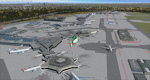
This is a minor update to the previous airport package (Frankfurt Airport v3) using ADE 1.47 and represents the layout of the airport in June 2010.
Updates include up-to-date ILS frequencies for all runways (ILS frequency for 07L updated to 110.55Mhz), corrected approaches for AI traffic, adds 2 new Gmax, custom-built radar towers, 3 updated C gate designations for A380 parking, updated de-icing pad layout and additional parking assignments for north and south cargo aprons as per real world airport.
Many other features from the previous packages are still included. See readme file for detailed information.
| Filename: | Frankfurt_Main_Airport_v31_EDDF_scenery.zip |
| License: | Freeware |
| Added: | 15th November 2010, 20:05:27 |
| Downloads: | 2,765 |
| Author: | Mark Aldridge |
| Size: | 2.94 MB |
| Category: Flight Simulator X - Scenery | |
| Frankfurt Main Airport v5.1 (EDDF) |
|
Images related to this file:
File Description:
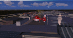
This minor update supersedes v5 and adds some additional nice features such as the remodeled North Cargo apron area due to the new Northwest runway and includes up-to-date parking assignments, improved/extended G Pier apron area, new Gmax models for hi-def CAT signs, additional jetways for the A380 C gates and the latest taxiways now in operation on the south side of the airport as of December 2011.Other miscellaneous updates and defect fixes also included in this revision.
See readme file for more details. Stay tuned for v6 which will add further updates to this freeware FSX Frankfurt scenery.
| Filename: | Frankfurt_Main_Airport_v51_EDDF.zip |
| License: | Freeware |
| Added: | 3rd December 2011, 01:18:50 |
| Downloads: | 1,517 |
| Author: | Mark Aldridge |
| Size: | 4.98 MB |
| Category: Flight Simulator X - Scenery | |
| YLGB Bidyadanga (La Grange Bay), Western Australia |
|
File Description:
YLGB Bidyadanga (La Grange Bay), the largest aboriginal community in WA has a population of 500 people and is situated 190km south of Broome. This is the traditional country of the Karajarri People who had their native title acknowledged by the Federal Court of Australia in 2003. Facilities in the community of Bidyadanga include a large community store, fuel outlet, multi-functional police unit, school, telecentre, and a community swimming pool completed in 2007. REQUIRES Blencowe_LibraryKit.zip
REQUIRES blencowe_librarykit_309494.zip (Available HERE)
| Filename: | YLGB_Bidyadanga_La_Grange_Bay_Western_Australia.zip |
| License: | Freeware |
| Added: | 28th February 2013, 13:55:11 |
| Downloads: | 221 |
| Author: | Alan Blencowe |
| Size: | 3.66 MB |
| Category: Flight Simulator X - Scenery | |
| Point Roberts Rail Depot |
|
Images related to this file:
File Description:
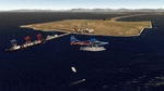
A small scenery adding many objects to the area near Point Roberts Airpark and Boundary Bay. Objects include small marinas, docks, vehicles, a cargo train, two elevated helipads and one ground level pad. There are many other objects that spruce up the area too. The main additions are at the two points west of the two airports mentioned and one on the shoreline close to Boundary Bay (south).
Has objects migrated from FS9 that work very well and was designed with Instant Scenery and FSX had no scenery enhancements of any kind. Created to enhance your flying experience. Enjoy! Savageagle.
| Filename: | Point_Roberts_Rail_Depot.zip |
| License: | Freeware |
| Added: | 28th August 2012, 19:25:45 |
| Downloads: | 375 |
| Author: | Tim Durham |
| Size: | 3.33 MB |
| Category: Flight Simulator X - Scenery | |
| KJYO - Leesburg Executive Airport - Virginia, USA |
|
Images related to this file:
File Description:

East Coast Simulations presents scenery for Leesburg Executive Airport (KJYO/JYO) for FSX/P3D! Leesburg Executive Airport at Godfrey Field (IATA: JYO, ICAO: KJYO, FAA LID: JYO) is a town-owned public-use airport located three nautical miles south of the central business district of Leesburg, a town in Loudoun County, Virginia, United States. It is a busy general aviation airport in the Washington, D.C. area, and a reliever for nearby Washington Dulles International Airport. This scenery includes all custom buildings and terminals with a season changing photoreal background. There are many custom ground polygons, and even 3-D PAPI lights are modeled.
| Filename: | KJYO__Leesburg_Executive_Airport__Virginia_USA.zip |
| License: | Freeware |
| Added: | 19th August 2015, 20:58:47 |
| Downloads: | 1,015 |
| Author: | Wesley Chin |
| Size: | 74.66 MB |


© 2001-2026 AVSIM Online
All Rights Reserved
Privacy Policy |