
Where Flight Simulation Enthusiasts Gather from Around the World!
AVSIM Library - Search Results

| Category: Flight Simulator X - Scenery | |
| KLUA - Luray Caverns Airport - Luray, Virgina, USA |

|
Images related to this file:
File Description:
Luray Caverns Airport (ICAO: KLUA, FAA LID: LUA, formerly W45) is a public use airport located two nautical miles (4 km) west of the central business district of Luray, a town in Page County, Virginia, United States. The airport is owned by the Town of Luray and Page County.It is included in the National Plan of Integrated Airport Systems for 2011-2015, which categorized it as a general aviation airport.
Added taxiways and aircraft parkng along with custom buildings. Created with Airport Design Editor by ScruffyDuck Software using current FAA documentation and Google Earth measurements, this package offers a replacement for FSX's stock airport. All these enhancements are as close to the real airport as I can get with stock library objects and custom buildings.
| Filename: | w45airport.zip |
| License: | Freeware |
| Added: | 29th November 2014, 14:11:35 |
| Downloads: | 308 |
| Author: | Wayne Roberts |
| Size: | 356 KB |
| Category: Flight Simulator X - Scenery | |
| LGLS - Lousoi Airfield **Fictional** |
|
Images related to this file:
File Description:
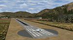
An imaginary airfield in north central Peloponnese Greece named after the elevated mountain plain where it would be situated. LGLS Lousoi airfield has a 1,000m runway at elevation of 3,186ft surrounded by mountains.
The aiport is equiped with NDB, ILS DME, PAPIs and night lighting for instrument approaches; approach chart included.
As bonus two imaginary helipads LGKK Kleitoria and LGPP Planitero are added in the nearby two villages.
All are infrastructure I wish they existed in the area since I drive there often for vacations in Planitero and always wondered how it would be if I could fly there. Planitero sits at the south footings of Chelmos mountain, the highest peak in the area. No AI traffic plans included.
| Filename: | lgls_lousoi.zip |
| License: | Freeware, limited distribution |
| Added: | 15th April 2015, 01:07:43 |
| Downloads: | 134 |
| Author: | Kyprianos Biris |
| Size: | 1.87 MB |
| Category: Flight Simulator X - Scenery | |
| S98 - Vista Field - Washington, USA |
|
Images related to this file:
File Description:
FSX Scenery - Vista Field (IATA: VSK, FAA LID: S98) was a public use airport located in Benton County, Washington, United States. The airport was located three nautical miles (6 km) northwest of the central business district of the City of Kennewick and was owned by the Port of Kennewick. It was also known as Vista Field Airport. Several shipping carriers operated out of the airport. There had been controversy in recent years over whether or not to continue to operate the airport or to shut it down, however it was officially closed on December 31, 2013. Vista Field is back, at least in FS9, with a hi-def runway by Donald Miller. For your flying pleasure by John B. Loney, Jr. and Donald Miller.
| Filename: | vista_field_s98_2015_fsx.zip |
| License: | Freeware, limited distribution |
| Added: | 19th September 2015, 21:34:03 |
| Downloads: | 337 |
| Author: | John B. Loney, Jr. |
| Size: | 18 MB |
| Category: Flight Simulator X - Scenery | |
| The Thames Barrier - England |
|
Images related to this file:
File Description:
This scenery adds the Thames Barrier to Orbx EU England Regional scenery package. Compatible with both FSX & P3D. The Thames Barrier is the world's second-largest movable flood barrier (after the Oosterscheldekering in the Netherlands) and is located downstream of central London, United Kingdom. Its purpose is to prevent London from being flooded by exceptionally high tides and storm surges moving up from the sea. It needs to be raised (closed) only during high tide; at ebb tide it can be lowered to release the water that backs up behind it. Not tested with default FSX or any other setup. You must have Orbx EU England regional scenery to use the compiled scenery files as intended. By Bryan Wallis aka fltsimguy.
| Filename: | thames_barrier.zip |
| License: | Freeware, limited distribution |
| Added: | 27th January 2013, 01:08:30 |
| Downloads: | 1,327 |
| Author: | Bryan Wallis |
| Size: | 584 KB |
| Category: Flight Simulator X - Scenery | |
| KHOU - Houston William P. Hobby Airport, Houston (TX), Photo Real Scenery |
|
Images related to this file:
File Description:
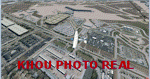
This is a Photo Real Scenery redesign for the FSX Default KHOU airport using the latest version of ADE (v01.50.11) & SBuilderX scenery design tool.
I added more airport buildings and Photo Real ground textures to the default KHOU scenery to give the airport a more realistic feeling. I constructed the new (Y Shaped) main Central Concourse building, the main parking garage, and added the original 1940 terminal building (located next to runway 17/35). I have also added several warehouse buildings, real gate assignments, and several other little scenery enhancements. The runways and airport aprons are aligned to match Google & Yahoo satellite imagery. An optional crossing runways AFCAD file is included for those who want to have all 4 runways active.
| Filename: | khou__pr.zip |
| License: | Freeware |
| Added: | 2nd October 2011, 19:51:47 |
| Downloads: | 3,915 |
| Author: | Glenn Johnson |
| Size: | 19.46 MB |
| Category: Flight Simulator X - Scenery | |
| KFRR - Front Royal-Warren County Airport - Front Royal - Virginia, USA |
|
Images related to this file:
File Description:
Front Royal-Warren County Airport (IATA: FRR[2], ICAO: KFRR, FAA LID: FRR) is a county owned, public use airport located three nautical miles (6 km) west of the central business district of Front Royal, a town in Warren County, Virginia, United States. It is included in the National Plan of Integrated Airport Systems for 2011-2015, which categorized it as a general aviation facility.
This is a complete re-work of the airport based on Google Maps. Created with Airport Design Editor by ScruffyDuck Software using current FAA documentation and Google Earth measurements, this package offers a replacement for FSX's stock airport. All these enhancements are as close to the real airport as I can get with stock library objects and custom buildings.
| Filename: | KFRR__Front_RoyalWarren_County_Airport__Front_Roya.zip |
| License: | Freeware |
| Added: | 1st October 2014, 14:01:40 |
| Downloads: | 364 |
| Author: | Wayne Roberts |
| Size: | 232.02 KB |
| Category: Flight Simulator X - Scenery | |
| Crete Island, Version 2 |
|
Images related to this file:
File Description:
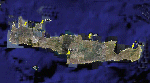
Crete is the bigger than the islands of the Greek archipelago and it is the south rampant of the Aegean sea. This scenery contains the following airports: LGIR, LGSA, LGOB, LGTL and 78 cities.
In this 2nd version I have used the mesh terrain of Yiannis Dermitzakis that offers a bigger realism to the costs. This has put under an obligation to reconstruct the entirety of the populations of the since costs they were located inside the sea. At the same time I have been able to redraw them populations with houses and real facilities that. I believe that I can offer a quite realistic scenery especially in the group of populations of the coast.
| Filename: | crete_264140.zip |
| License: | Freeware |
| Added: | 7th November 2009, 21:08:05 |
| Downloads: | 6,004 |
| Author: | Toni Agramont |
| Size: | 31.14 MB |
| Category: Flight Simulator X - Scenery | |
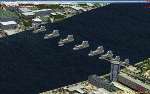
| VVCS - Con Dao Airport, Con Son Island, Vung Tau Province, Vietnam |
|
Images related to this file:
File Description:
Côn Äảo Airport or Cá» á»ng Airport (IATA: VCS, ICAO: VVCS) (Vietnamese: Sân bay Cá» á»ng) is located on Côn SÆ¡n Island, the largest island of Côn Äảo archipelago off the coast of Bà Rịa–VÅ©ng Tà u Province, Vietnam.
There is Vietnam Airlines operated by VASCO fly from and to here from Can Tho Airport and Tan Son Nhat International Airport.
There are also 3 battlecruisers, 3 destroyers, 1 aircraft carrier and an oil tanker. They depart from Con Dao Airport at 7 A.M with FSX system time.
You should install FTX ORBX global (And Vector if possible)
| Filename: | 4.vvcs_(con_son_con_dao).zip |
| License: | Freeware |
| Added: | 1st July 2017, 18:26:23 |
| Downloads: | 1,009 |
| Author: | Minh Bui |
| Size: | 30.55 MB |
| Category: Flight Simulator X - Scenery | |
| NSA - Pine Gap Australia |
|
Images related to this file:
File Description:
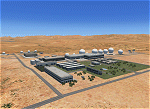
Joint Defense Facility Pine Gap is a satellite tracking station in the Australian outback operated by the United States intelligence community. The location is strategically significant because it controls United States spy satellites as they pass over the one third of the globe which includes China, the Asian parts of Russia and the Middle East. Central Australia was chosen because it was too remote for spy ships passing in international waters to intercept the signal. The facility has been described as the ground control and processing station for geosynchronous satellites engaged in signals intelligence collection. JDF Pine Gap is ran by the CIA, NSA, and NRO and is a key location in the global ECHELON surveillance network. Includes a helipad startup location with YPGP ident. Scenery by Jason L. Terry.
| Filename: | pinegap_jt.zip |
| License: | Freeware |
| Added: | 16th August 2014, 11:01:35 |
| Downloads: | 534 |
| Author: | Jason L. Terry |
| Size: | 1.25 MB |
| Category: Flight Simulator X - Scenery | |
| YKNP Kununoppin, Western Australia |
|
File Description:
YKNP Kununoppin was a bare military airstrip during WW2 and is now maintained in a shortened form by the shire of Trayning. Located between Trayning and Nungarin. Kununoppin, is nestled in a salmon gum woodland. The Shire of Trayning is located 235 kilometres north east of Perth in the Central Wheatbelt, with the main industry cropping of wheat and cereals, and sheep farming for meat and wool. The Shire is made up of three towns, Kununoppin, Trayning and Yelbeni with a combined population of approximately 420 residents. I've tinted the scenery to suit the seasons but unfortunately, in winter you will still get a harvest so let's pretend we are hay cutting! REQUIRES Blencowe_LibraryKit.zip
REQUIRES blencowe_librarykit_309494.zip (Available HERE)
| Filename: | blencowe_kununoppin.zip |
| License: | Freeware |
| Added: | 28th February 2013, 13:54:32 |
| Downloads: | 222 |
| Author: | Alan Blencowe |
| Size: | 8.41 MB |
© 2001-2025 AVSIM Online
All Rights Reserved