
Where Flight Simulation Enthusiasts Gather from Around the World!
AVSIM Library - Search Results

| Category: Flight Simulator X - Scenery | |
| LYBE Belgrade Nikola Tesla Airport |

|
File Description:
Belgrade Nikola Tesla Airport (IATA: BEG, ICAO: LYBE) is the primary international airport serving Belgrade, Serbia. Previously known as Belgrade International Airport, it was renamed in 2006 in honour of Serbian-American scientist and
inventor Nikola Tesla.
The airport is situated 12 km (7.5 mi) west, of central Belgrade, in the Surcin Municipality, surrounded by Syrmia's fertile lowlands. Passengers on the right hand side of planes descending from the east have a view of downtown
Belgrade, especially the districts of Cukarica and Novi Beograd. In 2008 the airport installed ILS CAT IIIb equipment to allow aircraft to land and depart in the heaviest of fog, which in past years led to numerous flight diversions
mostly in late December and early January.
The airport is owned and operated by the Public enterprise Aerodrom Nikola Tesla Beograd��. The company recorded profit of 21.5 million euros at the end of 2010.
The national flag carrier and largest airline of Serbia, Jat Airways, uses Belgrade Nikola Tesla as their main hub. It is also one of the hubs for low cost airline Wizz Air. Aviogenex charter airline, and air taxi airlines Air Pink,
Jat Airways AVIO taxi, Prince Aviation and Pelikan Airways also call the airport their home.
The airport charts are included.
This file has the right coordenates, with the apron and characteristics of the airport, airport vehicules and buildings, please take note the the gates numbers needed to changed: C1A= C11, C3A=C13, C5A=C15; general aviation parking
were added a extra number due to repetion on the numbers.
| Filename: | LYBE_Belgrade_Nikola_Tesla_Airport.zip |
| License: | Freeware |
| Added: | 8th November 2012, 03:32:04 |
| Downloads: | 8,801 |
| Author: | Anwar Gonzalez |
| Size: | 15.17 MB |
| Category: Flight Simulator X - Scenery | |
| Lelystad airport_EHLE_FSX_new_layout |
|
File Description:
Because the Netherlands 2000 Scenery Design Team no longer releases a new version for the FSX,
this version has been compiled based on nl2k_v4_EHLE_5 with the permission of the the Netherlands 2000 Scenery Design Team.
- Various buildings have been modelled and items from various sources have been added to the airport.
- The EHLElib.BGL file contains all the items that have been used and the textures are complete.
As a result, the airport can be installed without the use of the installation of the Netherlands 2000 Scenery Design Team.
- The airport is surrounded by more trees than the version nl2k_v4_EHLE_5.
- Lampposts have been added to the highway of the approach path of Runway 23 and parking places.
- By means of Airport Design Editor the airport can be changed.
- In the Effects folder, there are effects that should be added to the FSX (SE) folder.
- In the selection folder you will find two options. One is the choice where the new section is active and two where it is inactive.
By placing a copy of one of these in the scenery folder and deleting it already in the scenery.
It will become active after you restart the flight sim.
Enjoy and Happy flying
Jan Zijlstra from the Netherlands
| Filename: | Lelystad_airport_EHLE_FSX_new_layout.zip |
| License: | Freeware |
| Added: | 20th March 2024, 23:09:06 |
| Downloads: | 165 |
| Author: | Jan Zijlstra |
| Size: | 255.22 MB |
| Category: Flight Simulator X - Scenery | |
| YFRV Oombugurri Community, Western Australia (Town closed 2011) |
|
File Description:
YFRV Oombugurri Community, Western Australia, formerly Forrest River Mission. Features extensive flattening of Forrest River which runs uphill. Take a flight there before installing the scenery.
Oombulgurri, was an Aboriginal community in the eastern Kimberley, 45 kilometres southeast of Wyndham.
The Anglican Forrest River Mission for Aborigines was founded in 1896���¢������97 by Harold Hale (Later Bishop of Prth) but was abandoned after a few months. A permanent mission, known as the Forrest River Mission, was established on the site in 1913 by the bishop of the north west, the Rt. Rev. Gerard Trower. In December 1913, Anglican priest Ernest Gribble took charge, three years after he was forced to resign as superintendent at Yarrabah. Gribble remained as superintendent until the early 1930s.
In 1926 the mission was plagued by an influenza epidemic and impacted by the Forrest River massacre where police killed a number of Aboriginal people. This event remains controversial.
The mission was closed in 1969, after the 1967 Aboriginal referendum.
In 1973, fifty Aboriginal people decided to resettle their abandoned tribal land and rename it Oombulgurri. Within a year, the population had grown to 200. Infrastructure and welfare programs were set up in the 1970s and 1980s to provide the residents with basic amenities and to allow the town to become self-sufficient.
In 2007 a Coronial Inquiry began into Aboriginal deaths in the Kimberley, including five in Oombulgurri. It revealed high levels of alcohol abuse, suicide and child neglect in Oombulgurri. Some time after the inquest, alcohol was banned there and the population began to move away to areas where alcohol was available.
It had a population of 107 as of the 2006 census. In 2011, the government of Western Australia encouraged residents of Oombulgurri to move elsewhere as it considered the community "unviable". The last residents from Oombulgurri were relocated to Wyndham just before Christmas 2011. REQUIRES Blencowe_LibraryKit.zip
REQUIRES blencowe_librarykit_309494.zip (Available HERE)
| Filename: | YFRV_Oombugurri_Community_Western_Australia_Town_c.zip |
| License: | Freeware |
| Added: | 28th February 2013, 02:37:06 |
| Downloads: | 229 |
| Author: | Alan Blencowe |
| Size: | 2.97 MB |
| Category: Flight Simulator X - Scenery | |
| FSX Scenery/ AI Package Stapleton International Airport Denver circa 1980 |
|
Images related to this file:
File Description:
FSX Scenery and AI Package Stapleton International Airport Denver circa 1980
Custom built hangars, buildings and terminals, and landclassing for the 1980 version of Stapleton Field. Parking slots for all period traffic: Continental, Western, Frontier the locals, etc. EZ scenery, Dan French Core LibrariesVol4_FSX or higher, and some others required (see readme). AI flight plans are included for installation if you want a lot of jumbo traffic! 2 different "AFCADs" to choose from.
By Dan French and Stan Winke
| Filename: | FSX_Scenery_AI_Package_Stapleton_International_Air.zip |
| License: | Freeware |
| Added: | 25th July 2020, 21:42:33 |
| Downloads: | 404 |
| Author: | Dan French and Stan Winke |
| Size: | 29.18 MB |
| Category: Flight Simulator X - Scenery | |
| LFMQ - Le Castellet |
|
File Description:
Welcome to Le Castellet Airfield -
This airfield is situated few Nm east of Marseille Provence - LFML, in the south of France. On the 1,000 hectares of plateau he acquired between Marseille and Toulon, Paul Ricard, forever motivated by innovation and development, constructed in 1962 the largest
private airfield in the Provence-Alpes-Côte d’Azur region.
The landing strip at Le Castellet covered a distance of 1,000 metres and allowed for VFR (Visual Flight Rules) operation. Situated on a plateau at the time free of all economic development, it was above all a private airfield. In 1970, the construction
of the Paul Ricard Circuit nearby created an economic dynamic for the first time on Le Castellet plateau. In 1972, Paul Ricard invested in improvements to the runway, lengthening it from 1,000 to 1,750 metres, thus rendering it capable of
receiving business and private airplanes of up to 38 tonnes.
Over twenty years, Le Castellet Airport saw intense periods of activity due to business and private aviation, notably with the arrival of the first F1 French Grand Prix on the Paul Ricard Circuit in 1971, and more recently, with the creation of the Entreprise Zone at Signes, situated only a few kilometres from the airfield. Stop by for an amazing visit at the medieval village as well, situatued on top of a hill.
Nevertheless, from 1972 to 1999, no investment was made at the airfield. In May 1999, the company Excelis S.A. purchased the site (airfield and circuit) and refurbished and modernised the installations.
A truly amazing place to fly to - I have enhanced the entire apron as it is today, all marking correctly set, acces to runway and the Heli area for the "Eggbeater" fan :)
includes the hangar, building and other things around. Hope you'll enjoy your stay at "Le castellet"!
| Filename: | LFMQ__Le_Castellet.zip |
| License: | Freeware |
| Added: | 24th April 2009, 16:28:59 |
| Downloads: | 2,350 |
| Author: | Daniel Louvet |
| Size: | 986.65 KB |
| Category: Flight Simulator X - Scenery | |
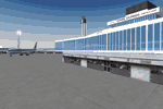
| North Central Ecuador v3, including SEQM (SEQU) and SEIB |
|
Images related to this file:
File Description:
FSX/P3D Version 3 of this scenery is a completely new build of SEQM from the ground up. The entire complex is rendered using FSX objects along with the new highway that connects to the highway infrastructure with AI road traffic. The airport is now at a mean altitude that better blends with the newly included NASA SRTM GL1 30m mesh for the region. The tower is at the correct altitude. Buildings use more accurate footprints, new models, floating jetways, and updated landclass, and work seamlessly with the roads added by FTX Global/Vector. Lakes are corrected within roughly 100 square miles. Although the Ibarra/Atahualpa (SEIB) airport no longer exists, there is an option to add it back. Startup files are included to fly from the lakes and the Ibarra/Atahualpa (SEIB) airport. As a “bonusâ€, SEQU was restored in this version, because much of the footprint of the airport still remains as part of its conversion to a park. As such, a custom and fully functional SEQU is included for users who would like to revisit the old airport. AI Traffic can be restored at SEQU by simply using the "Reversed SEQU-SEQM AI Traffic" option. Scenery was created using Airport Design Editor X v1.76.6715, SBuilderX 3.13, and the FSX Object Placement Tool. Scenery objects were added and modified from stock FSX scenery to resemble as closely as possible the actual airport. Bill Leaming's Ramp Lights for P3D/FSX illuminate the aprons.
| Filename: | North_Central_Ecuador_v3_including_SEQM_SEQU_and_S.zip |
| License: | Freeware |
| Added: | 22nd March 2020, 22:13:37 |
| Downloads: | 4,098 |
| Author: | Carlyle Sharpe |
| Size: | 29.44 MB |
| Category: Flight Simulator X - Scenery | |
| MYXY - Duncan Town, Ragged Island Chain, Bahamas - Version 2 |
|
File Description:
The Ragged Island Chain consists of a string of small islands in the Bahamas. Only one island, Ragged Island, has a settlement on it which is known as Duncan Town. This FSX scenery improves the airstrip at Duncan Town and creates a new private airstrip on Nurse Cay. The airstrip at MYXY (Duncan Town) has been lengthened by 500 feet and widened by 25 feet. Six parking ramps now exist as well as a fuel pump and helipad. Additional taxiways have been added and lights for the runway, taxiways and apron. A small building has been added to serve as a combined terminal, control tower, and customs office. There is also a hangar to protect your plane from tropical storms. These improvements were necessary to accomodate the increased air traffic due to the new high rise tropical hotel, the Ragged Island Resort. There is also a lighthouse on the island and a cruise ship with helipad just off to the east. A large private yacht just to the north also has a helipad. You can watch dolphins swim at both of those locations - the helipads make great viewing spots. About 20 miles north of Ragged Island is Nurse Cay (MYXN). This is where my private airstrip and villa are located. The airstrip has a 2500 ft concrete runway and a parallel taxiway as well as a helipad. The runway, taxiways, and apron are all lit for night operations. The airstrip was built right on a marsh so wandering off the runway or taxiways could result in getting wet. You will find a variety of birds flying around at various locations throughout this scenery. A flight plan is also included for a dusk flight from Ragged Island (MYXY) to Nurse Cay (MYXN). So come on out to Ragged Island, because it's better in the Bahamas! This is version 2 and supercedes my original file - this version corrects the runway numbers at MYXN.
| Filename: | MYXY__Duncan_Town_Ragged_Island_Chain_Bahamas__Ver.zip |
| License: | Freeware |
| Added: | 24th August 2007, 15:55:49 |
| Downloads: | 2,407 |
| Author: | Mike Lanza |
| Size: | 13.43 KB |
| Category: Flight Simulator X - Scenery | |
| Deshi Sceneries - Deshi Dhaka (VGHS/VGZR) Shahjalal/Zia International Airport, Dhaka, Bangladesh |
|
Images related to this file:
File Description:

This is the first and only full freeware scenery released for VGHS/VGZR Dhaka, Bangladesh. This has been a work in progress since 2012, and in 2016 we decided to make it public beta for the Bangladeshi Flight Sim Community. The team wasn't able to work further on this and the project was taken over by another developer who worked alongside our team. After years of hard work, we finally were able to collaborate with Final Approach Design Simulations, and released the full and final version of this scenery for P3D V4-5, in the simMarket as payware. While the FSX version was untouched and not upgraded further, we wanted to publish it online as a freeware scenery and NO MORE A BETA TEST. We hereby have uploaded the scenery, and according to our EULA, we are HEREBY changing the clause that states it is only to be used by Bangladeshi and that it is a limited release. We HEREBY declare it a full release for FSX, and we are allowing all nationalities to use our software. We hope you enjoy this free release and if you are a P3D V4-5 user, go check out our final product in the simMarket under the title "HAZRAT SHAHJALAL DHAKA VGHS DAC P3D4-5" by "Final Approach Design Simulations".
| Filename: | Deshi_Sceneries__Deshi_Dhaka_VGHSVGZR_ShahjalalZia.zip |
| License: | Freeware, limited distribution |
| Added: | 17th July 2022, 15:33:37 |
| Downloads: | 742 |
| Author: | Shafat Hasan, Karib Ahmed, Melus Haque, Imran Uddin |
| Size: | 41.24 MB |
| Category: Flight Simulator X - Scenery | |
| VYMM Mawlamyine Intl Airport V2.0 with Traffic-Pack 2 |
|
File Description:
Mawlamyine International Airport in Burma, Myanmar, include Traffic-Pack 2. Traffic-Pack 1 comes with vyyy4tp1.zip. Traffic-Pack 3 comes soon too. This scenery was produced based of suppositions, stories and voices. It is therefore pure speculation. Whether this airport is ever increased, the God know. If the planned Asean-Highway leads at it past, this airport should gain importance very quickly. Version 2.0 with new docks, jetways, already extended runway, taxiways and new taxisigns. First of all we corrected the airport location to the real one. With Myanmar Air Force area, Helipads and even more parkings for civilian airplanes. You need mai321x.zip, mai738x.zip and mai744x.zip to use with this. Many Thanks go to Harald Nehring and Frank Weiss,
Robert Versluys, Mike Stone and the teams of HOUSE-RP in Burma, FSX Planner, SceneGenX, SBuilder X, Open Ports Scanner, AFXBgDownloader, FSUIPC, Google Earth and AI Flight Planner. This scenery is pure fiction and for FSX only, for FS2004 please download newVYMMfs9.zip and newVYMMup.zip. By HOUSE-RP, Switzerland and Burma
| Filename: | VYMM_Mawlamyine_Intl_Airport_V20_with_TrafficPack_.zip |
| License: | Freeware, limited distribution |
| Added: | 6th June 2008, 15:34:08 |
| Downloads: | 672 |
| Author: | HOUSE-RP, Robby Pauletto |
| Size: | 3.42 MB |
| Category: Flight Simulator X - Scenery | |
| NY3C - Taylor Field - Hammondsport, New York (Fictional ICAO) |
|
Images related to this file:
File Description:
The airport named Taylor Field (on 1970's sectional charts) is a small 1800' strip not shown in the stock FSX list of airports. There is no ICAO code or other designator I could find with extensive research. I used my own code of NY3C.
This is a part reality part historic scenery as it represents the modern day airport, the Glenn Curtiss Museum, and adjacent to the Airport a facsimile of the original horse racetrack that was used by Glenn Curtiss to fly his June Bug on July 4th 1908. It is a close As I can determine to the original spot using archival photos and conversations with the Director of the Curtiss Museum, Traff Doherty. Extensive use of new land class is also employed to give a better representation of the geographic area.
This will work with FSX stock scenery, but is designed with UTX (Flight One Software) in mind. It will work with ORBX Global and Global Vector as well. With these latter two there may be some missing roads but it won't affect the scenery.
| Filename: | NY3C__Taylor_Field__Hammondsport_New_York_Fictiona.zip |
| License: | Freeware |
| Added: | 24th July 2014, 07:46:29 |
| Downloads: | 343 |
| Author: | Jon Davidson |
| Size: | 9.79 MB |
© 2001-2026 AVSIM Online
All Rights Reserved
Privacy Policy |