
Where Flight Simulation Enthusiasts Gather from Around the World!
AVSIM Library - Search Results

| Category: Flight Simulator X - Scenery | |
| Essweiler Gliderfield, Germany Ver. 1.0 |

|
Images related to this file:
File Description:
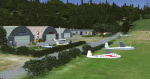
Essweiler is actually a classic glider field, but also engine aircrafts up to 2t are approved.
The field is situated in the region Rheinland-Pfalz/Germany at a hillside eastly of the village Essweiler, approximately 7,5 nautical miles north of the well known US-Airbase Ramstein.
The environment of the airfield is adapted by land classes. Surrounding villages and major roads are initially implemented.
As well the field is covered by a photo background, which includes four different images , each for one of the four seasons: spring, summer, autumn and winter. The buildings in this scenery should match quite good the originals. But also a lot of objects from three very popular freeware libraries are used.
If these libraries are not installed, many objects are not visible!
The following libraries are used:
1. FS-Piloten_Objektlibrary:
http://www.fs-piloten.de/thread.php?threadid=1063
2. FSX_FlightPortLib
http://www.flightport.de/libraries/flightport-library/
3: 3d People Library
http://library.avsim.net/download.php?DLID=192454
| Filename: | Essweiler_Gliderfield_Germany_Ver_10.zip |
| License: | Freeware |
| Added: | 29th November 2016, 19:15:50 |
| Downloads: | 606 |
| Author: | Wolfgang Allers |
| Size: | 168.18 MB |
| Category: Flight Simulator X - Scenery | |
| YBLT - Ballarat Aerodrome - Victoria, Australia |
|
Images related to this file:
File Description:
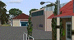
YBLT (Ballarat Aerodrome) is a regional 'airport' in the central west of the State of Victoria, Australia and utilises infrastructure from the days of RAAF operations which lasted till the early 1960's. Thus the buildings are now a bit outdated but this file does not reflect that as I have not done any custom texturing so everything in this package tends to look a bit new and crispy.
Note the name of this 'airport'. The locals are adamant it is an aerodrome, not an airport. I have not found any freeware or commercial offerings for an alternative to the default and so I have put one together.
This is a reasonable approximation of the airport /aerodrome but is not entirely accurate as the hangars/buildings I have modelled myself are generic ones I have done and do not look exactly like the ones at that facility. The connecting road is not in true alignment as I have created it so as it blends into the surrounding default scenery.
| Filename: | YBLT__Ballarat_Aerodrome__Victoria_Australia.zip |
| License: | Freeware |
| Added: | 21st October 2014, 01:51:16 |
| Downloads: | 841 |
| Author: | Robert Budd |
| Size: | 4.43 MB |
| Category: Flight Simulator X - Scenery | |
| RAF Balderton |
|
File Description:
RAF Balderton is a former Royal Air Force station located 2.0 miles (3.2 km) south of Newark-on-Trent, sandwiched between the now extinct Great Northern Railway (GNR) Bottesford-Newark line and the A1 road in Nottinghamshire, England.
Opened in 1942, it was used by both the Royal Air Force and United States Army Air Forces. During the war it was used primarily as a troop carrier transport airfield and after for munitions storage before it was closed in 1957.
With the facility released from military control, Balderton was returned to agriculture, the runway concrete disappearing as hardcore under the AI road improvements of the 1960s. At that time, the developed Al was routed west of the original road, over the eastern perimeter track of the airfield, before coming back to the east to bypass Balderton village and Newark.
Gypsum open-pit mining has also taken its toll where quarrying has completely obliterated the airfield, with single track roads all that remain of the runway and perimeter track, and the occasional concrete runway end or pile of rubble.
Today the remains of the airfield are located on private property being used as agricultural fields.
| Filename: | RAF_Balderton.zip |
| License: | Freeware |
| Added: | 17th February 2016, 23:32:44 |
| Downloads: | 233 |
| Author: | Terry Boissel |
| Size: | 759.04 KB |
| Category: Flight Simulator X - Scenery | |
| Whakatane Airport (NZWK), New Zealand |
|
File Description:
Whakatane Airport (ICAO: NZWK) is a small airport serving the town of Whakatane in the Bay of Plenty, New Zealand. It consists of a Asphalt runway flanked with a parallel grass strip and a helipad. While not a particularly busy aerodrome, there are daily movements by Air New Zealand/Eagle Airways Beech 1900Ds, general aviation movements including agricultural aircraft, training flights from the flight school and scenic flights to White Island off the coast of the Bay of Plenty.
Of particular interest is the main terminal, designed by Roger Walker in the modernist style. It has survived in its original form since its construction in the 1970’s and gives a cheerful welcome to visitors disembarking to discover the many natural and cultural attractions in the region.
This particular airport is of interest to me as I began my real world flying training there originally with Scott Air and later with Air Discovery (www.airdiscovery.co.nz) As well as flight training, they also fly scenic tours of White Island and Mount Tarawera.
This Scenery Features: High resolution 10cm imagery for the airport including night map, Custom made buildings including night lighting and window reflections, extensive trees and grass.
| Filename: | Whakatane_Airport_NZWK_New_Zealand.zip |
| License: | Freeware, limited distribution |
| Added: | 24th December 2008, 13:20:53 |
| Downloads: | 3,128 |
| Author: | Tim Barnes |
| Size: | 34.5 MB |
| Category: Flight Simulator X - Scenery | |
| SKBO 2011 |
|
File Description:
El Dorado International Airport (IATA: BOG, ICAO: SKBO) is an international airport located in Bogota, Colombia. It is the largest Latin America airport in terms of cargo movements with 593,946 tons (2010) and the third in terms of passenger traffic, only behind Sao Paulo-Guarulhos International Airport and Mexico City's Benito Juarez International Airport, transporting 18,934,203 passengers in 2010; as well as the largest airport in Colombia and the main international and domestic air gateway in the country, serving as an important hub for Avianca, Copa Airlines Colombia, Aires, Satena, EasyFly and other cargo companies.
This file has the right coordinates, with the apron and characteristics of the airport. The runways were reoriented to the correct direction, runway were resized the gates placed on correct location and number, CATAM was placed (Colombian Air force and Colombian National Army) and Colombia National Police and Colombian National Armada were assigned a correct apron. All the jet ways including the ones of the executive terminal are working. There is a copy of all the airport charts required to navigate in and out of this airport which are courtesy of: Areonatica Civil de Colombia
| Filename: | SKBO_2011.zip |
| License: | Freeware |
| Added: | 29th June 2011, 21:16:37 |
| Downloads: | 2,947 |
| Author: | Anwar Gonzalez |
| Size: | 14.34 MB |
| Category: Flight Simulator X - Scenery | |
| YTTI Troughton Island, Western Australia |
|
File Description:
YTTI Troughton Island - ShoreAir operates Troughton Island airstrip as an alternate to Mungalalu-Truscott. It has a 980m x 30m unsealed runway. Troughton Island sits 6 metres above sea level on a natural reef. Troughton is managed by two people who spend one month at a time on the island. During that time they are almost completely isolated from the outside world. Although they are isolated they are not alone; previous occupants of the island brought in quails and children's pythons that were once pets that escaped their cages during a cyclone. Now there is a healthy population of snakes living off the quails. Today Troughton Island is maintained as an emergency landing area for aircraft that are unable to reach Truscott. It also serves as a landing area if Truscott is inaccessible due to weather conditions. The Bureau of Meteorology has a weather station on Troughton island. Mungalalu-Truscott aerodrome supports all the FPSO (floating production storage and offloading facility) operations in the WA and NT waters of the Timor Sea, while the alternate aerodrome at Troughton Island is 20 nautical miles north of the main air route to Timor Sea facilities. REQUIRES Blencowe_LibraryKit.zip
REQUIRES blencowe_librarykit_309494.zip (Available HERE)
| Filename: | YTTI_Troughton_Island_Western_Australia.zip |
| License: | Freeware |
| Added: | 28th February 2013, 14:01:54 |
| Downloads: | 279 |
| Author: | Alan Blencowe |
| Size: | 2.37 MB |
| Category: Flight Simulator X - Scenery | |
| RAF Bodney - Norfolk, England |
|
File Description:
Originally built as an RAF Bomber Command station the airfield was grass-surfaced and located on slightly rolling land with a hard surface perimeter track.
Initially it was used by aircraft of No. 21 Squadron RAF and No. 82 Squadron RAF (No. 2 Group) Bomber Command. They carried operations over France and later the Netherlands and even Norway. Their Bristol Blenheim IVs were joined on occasions by, in May 1941, 90 Squadron evaluating its new Boeing Fortress Mk 1s some Handley Page Hampdens for mining operations. 90 Squadron suffered heavy casualties and the use of the Fortress I was discontinued. Towards October 1942, the Blenheims were changed to Lockheed Venturas but the squadron moved on to RAF Methwold before the Venturas were operational.
RAF Bodney was transferred to the United States Army Air Forces in the summer of 1943. Placed under the jurisdiction of VIII Fighter Command of Eighth Air Force, it was primarily the home of the 352d Fighter Group, the "Blue Nosed Bastards of Bodney". The unit briefly moved to Belgium in January 1945 due to the Battle of the Bulge, although it returned in April. It was closed after the 352d returned to the United States in November. Source: Wikipedia
| Filename: | RAF_Bodney__Norfolk_England.zip |
| License: | Freeware |
| Added: | 9th January 2016, 15:06:12 |
| Downloads: | 298 |
| Author: | Terry Boissel |
| Size: | 1.18 MB |
| Category: Flight Simulator X - Scenery | |
| PLAN Fleet |
|
Images related to this file:
File Description:

Here is a mighty PLAN fleet, capable of respectable force projection anywhere within the nine dash line and even beyond! I tried to find the Chinese Navy crest, similar to the one I used to represent my US Navy collection, but the only thing available anywhere is a depiction of the Peoples Liberation Army Navy flag.
These ships are currently assigned to the South Sea Fleet and so might be present at any of the events in the disputed South China Sea.
The LST YutingII/Type 072a Luhua Shan, pennant number 997, is the same type vessel that participated in the "near collision" with USS Cowpens recently. Now you can re-enact how a 18 knot transport was able to in any way interfere with the 32 knot Arleigh Burke class destroyer. Also in this fleet are two Houbei class missile boat catamarans, the Yuzhao class type 071 amphibious transport dock Changbai Shan, Luyang II/Lanzhou class type 052C destroyer DDG-171 Haikou and the Jiangkai II class type 054A frigate Hengshui.
All ships have landable decks, animated effects and night lights, Haikou has an animated Z-9 helicopter escort.
The ships are intended for placement with AICarriers, by Lamont Clark.
| Filename: | PLAN_Fleet.zip |
| License: | Freeware, limited distribution |
| Added: | 15th June 2014, 05:55:02 |
| Downloads: | 502 |
| Author: | Rick Keller |
| Size: | 31.7 MB |
| Category: Flight Simulator X - Scenery | |
| YLUW Leeuwin Estate Winery, Western Australia |
|
File Description:
YLUW Leeuwin Estate, one of the founding wineries of the now famous Margaret River district, consistently produces wines that rank with the world's finest. In 1972, following an extensive search for the area most suitable to produce the best varietal wines in Australia, legendary American winemaker, Robert Mondavi, identified the future site of the Leeuwin vineyard. Originally a cattle farm, Leeuwin Estate evolved, under the direction of Denis and Tricia Horgan, with Robert Mondavi acting as consultant and mentor. A nursery was planted in 1974 and the initial vineyards were deep-ploughed, deep-ripped, emptied of stone, planned, pegged, measured, marked and eventually planted by hand over a five year period from 1975. Featuring state-of-the art facilities, the winery building was opened in 1978, celebrating with a trial vintage. Leeuwin enjoyed its first commercial vintage in 1979, and was thrust into the international spotlight when Decanter Magazine gave its highest recommendation to the 1980 "Art Series" Chardonnay in an international blind tasting. Maintaining a team of highly skilled and dedicated winemakers, and now under the direction of two generations of the founding family, Leeuwin now exports to over 30 countries. www.leeuwinestate.com.au/?page=4 REQUIRES Blencowe_LibraryKit.zip
REQUIRES blencowe_librarykit_309494.zip (Available HERE)
| Filename: | YLUW_Leeuwin_Estate_Winery_Western_Australia.zip |
| License: | Freeware |
| Added: | 28th February 2013, 13:55:25 |
| Downloads: | 235 |
| Author: | Alan Blencowe |
| Size: | 3.66 MB |
| Category: Flight Simulator X - Scenery | |
| RAF Dunholme Lodge - Lincolnshire, England **UPDATE** |
|
File Description:
This is an-update to correct the location of the Tower, if you have installed my version uploaded on the 15 or 23 Oct 15
RAF Dunholme Lodge was a Royal Air Force station located between the parishes of Welton and Dunholme in Lincolnshire, England.
The grass airfield was first used by the Royal Air Force during 1941 and 1942 for use by Handley Page Hampden aircraft from nearby RAF Scampton, and was officially opened as a RAF Station in September 1942 as part of RAF Bomber Command with the building of three hard runways.
The main occupier of the station was 44 Squadron, with the Avro Lancaster four-engined heavy bomber, which moved in from RAF Waddington in May 1943 and stayed until it moved to RAF Spilsby in September 1944.
In November 1944 flying operations ceased due the proximity of other stations which did not allow night flying. At the end of the war 120 Lancaster's had been lost on operations from Dunholme Lodge.
From 1948 the site was host to motorcycle and car racing until 1959 when the base was reopened as an active RAF station when it became an active Bloodhound surface-to-air missile station with 141 Squadron. The Squadron in 1964 and the station finally closed in 1964. Source: Wikipedia.
| Filename: | RAF_Dunholme_Lodge__Lincolnshire_England_UPDATE.zip |
| License: | Freeware |
| Added: | 28th October 2015, 18:41:50 |
| Downloads: | 262 |
| Author: | Terry Boissel |
| Size: | 335.14 KB |


© 2001-2026 AVSIM Online
All Rights Reserved
Privacy Policy |