
Where Flight Simulation Enthusiasts Gather from Around the World!
AVSIM Library - Search Results

| Category: Flight Simulator X - Scenery | |
| RAF Manston 1944 |

|
File Description:
RAF Manston (ICAO EGMH)was an RAF station in the north-east of Kent, on the Isle of Thanet from 1916 until 1996. The site is now split between a commercial airport Kent International Airport (KIA) and a continuing military use by the Defence Fire Training and Development Centre (DFTDC), following on from a long-standing training facility for RAF firefighters at the Manston base.
Source: Wikipedia
I have represented it here in 1944 leading up to its part in Operation Market garden and D Day. It was one of the few airfields installed with the Fog Investigation Dispersal Organisation (FIDO) system designed to remove fog from airfields by burning it off with petrol and I have represented this with the 8 fuel tanks at the 29 end of the mail runway. I have laid the station out roughly according to an old map made in the mid 40s but I make no claims to the accuracy of building I have used.
| Filename: | RAF_Manston_1944.zip |
| License: | Freeware |
| Added: | 26th April 2016, 00:15:35 |
| Downloads: | 160 |
| Author: | Terry Boissel |
| Size: | 1.71 MB |
| Category: Flight Simulator X - Scenery | |
| X3ER - RAF East Wretham - Norfolk, England |
|
File Description:
RAF East Wretham (ICAO X3ER) is a former Royal Air Force station located 6 miles (9.7 km) northeast of Thetford, Norfolk, England.
East Wretham airfield was hurriedly brought into service during the early years of World War II as a satellite airfield with No. 311 (Czech) Squadron dispersed there from RAF Honington on 29 July 1940. A more permanent allocation followed in September. The squadron operated their bombers from the airfield until April 1942 when it transferred to Coastal Command.
Later, RAF Bomber Command No. 115 Squadron RAF, operating Vickers Wellington Mk IIIs and later Avro Lancasters, occupied the airfield from November 1942.
A plan to turn East Wretham into a "Class A" airfield was not carried through, the bomber unit moved to Little Snoring and the station turned over to the USAAF for fighter operations and in October 1943, was assigned USAAF designation Station 133 and was allocated to the United States Army Air Forces Eighth Air Force.
| Filename: | X3ER__RAF_East_Wretham__Norfolk_England.zip |
| License: | Freeware |
| Added: | 16th May 2016, 16:43:25 |
| Downloads: | 138 |
| Author: | Terry Boissel |
| Size: | 1019.49 KB |
| Category: Flight Simulator X - Scenery | |
| RAF Bradwell Bay |
|
File Description:
RAF Bradwell Bay is a former Royal Air Force station located 9.5 miles (15.3 km) east of Maldon, Essex, England and 3.1 miles (5.0 km) south west of West Mersea, Essex.
The airfield was first used as grass landing strip for the nearby firing ranges before being turned into a RAF station with concrete runways and hangars.The station is unique as it was the only fighter station where the Fog Investigation and Dispersal Operation (FIDO) was used.
Part of the site is currently being used by the Bradwell nuclear power station. Several of the hangars are still used as storage by the local farmers and the control tower is now a private house. Agricultural buildings, built in the '70s and '80s on runways one and two, are now home to several local businesses.
If you would like a more detailed history follow the following link. http://www.worldwar2heritage.com/en/page/9069/189/Bradwell-Bay-Airfield
| Filename: | RAF_Bradwell_Bay.zip |
| License: | Freeware |
| Added: | 26th January 2017, 20:05:03 |
| Downloads: | 138 |
| Author: | Terry Boissel |
| Size: | 18.06 MB |
| Category: Flight Simulator X - Scenery | |
| A85 - Kwigillingok Airport - Alaska, USA |
|
Images related to this file:
File Description:
Kwigillingok Airport (IATA: KWK, ICAO: PAGG, FAA LID: GGV, formerly A85) is owned by the Native Village of Kwigillingok and is a public-use airport located one mile (two kilometres) northwest of the central business district of Kwigillingok, in the Bethel Census Area of the U.S. state of Alaska. There is also a nearby seaplane landing area known as Kwigillingok Seaplane Base (FAA LID: KWK).Runway 15/33 was increased from 1,835 feet and 40 feet wide to 3,300 feet and 60 feet wide. Runway 4/22 was added along with custom models. All changes were made based on the 2014 construction plans.
Created with Airport Design Editor 9x by ScruffyDuck Software using current FAA documentation and Google Earth measurements, this package offers a replacement for FSX's stock airport. All these enhancements are as close to the real airport as I can get with stock library objects and custom buildings.
| Filename: | A85__Kwigillingok_Airport__Alaska_USA.zip |
| License: | Freeware |
| Added: | 5th January 2015, 00:26:44 |
| Downloads: | 710 |
| Author: | Wayne Roberts |
| Size: | 358.61 KB |
| Category: Flight Simulator X - Scenery | |
| KORD-Chicago O'Hare 2018 |
|
File Description:
Chicago O'Hare 2018
===================
This airport has been undergoing frequent change ever since I first landed there in 2005. Fortunately, the core buildings have remained essentially the same, but runways have come and some have gone.
I got very close to releasing a 2016 version, but held back for more data. Then I looked again this year and discovered another runway gone, new ones in construction etc.
So, what I have decided to release is basically as up to date as I can make it, using Google Earth to judge the state of things in March 2018, and Charts from August 18th 2018. A lot of Taxiway labelling has changed yet again, and I dare say I've missed some of the taxi signs. One taxiway isn't on the March image, but is on the chart, so I've added it as best I can.
I think this will always be a work in progress.
| Filename: | KORDChicago_OHare_2018.zip |
| License: | Freeware |
| Added: | 20th August 2018, 15:50:08 |
| Downloads: | 1,790 |
| Author: | Martin Connor |
| Size: | 20.5 MB |
| Category: Flight Simulator X - Scenery | |
| BATANES X v1.0 |
|
Images related to this file:
File Description:
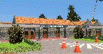
BATANES X v1.0
Archive includes the Photoreal Scenery of Batanes Island, Itbayat Island and its airports
(SLOPING RUNWAY NOT INCLUDED!)
Basco Airport (IATA: BSO, ICAO: RPUO) is an airport serving the province of Batanes in the Philippines. It is located in the provincial capital, Basco, and is one of two airports in the Batanes Islands, the other being Itbayat Airport. The airport is classified as a Class 2 principal (minor domestic) airport by
the Civil Aviation Authority of the Philippines (CAAP), a body of the Department of Transportation and Communications that is responsible for the operations of not only this airport but also of all other airports in the Philippines
except the major international airports.
Jorge Abad Airport (ICAO: RPLT), also known as Itbayat Airport, is an airport serving the island of Itbayat, the largest island in the province of Batanes, Philippines. The province's only other airport, Basco Airport, is located in the provincial capital, Basco, on Batan Island.
| Filename: | BATANES_X_v10.zip |
| License: | Freeware, limited distribution |
| Added: | 24th January 2019, 17:49:19 |
| Downloads: | 1,693 |
| Author: | Aeron M. Tumanut |
| Size: | 28.06 MB |
| Category: Flight Simulator X - Scenery | |
| Rybachiy Submarine Base "The Hornet's Nest" |
|
Images related to this file:
File Description:
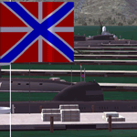
Rybachiy Nuclear Submarine Base, NATO reporting name "The Hornet's Nest." This scenery is specific to the Aerosoft addon "Kamchatka - the Lost Continent." You are welcome to use it, regardless, but in testing, only half the peninsula showed with the Aerosoft scenery inactive.
Rybachiy has a long and chequered past as the home of the Soviet Pacific submarine fleet. It launched the ill fated K-129 in 1968 and is the final stop for submarines before being "disposed" of, a process that includes either sinking the nuclear core, or interring it indefinitely on a floating platform.
I more or less copied the state depicted in Wikimapia, it shows the docks relatively clear of excess retired subs and 10 or 12 Grumble launchers at the SAM site, which is no longer the case. I wonder who's buying up the retired SA-10's..
The odd looking torpedo on the loading dock is the 240 mph, super-cavitating VA-111 Shkval, which is essentially a rocket engined defensive weapon. A consequence of the presumed and persistent superiority of Western underwater acoustics, it is understood that the enemy would "get the drop." In such a circumstance, the crew would load a Shkval and fire it in the direction of the approaching torpedo, which would force the attacking sub to sever the control wire to avoid being hit.
Elsewhere, at the SLBM dock, you can see the R-29 Vysota being loaded. It is being advertized as a launch platform for low orbit satellites, besides MIRV's, of course. The SLBM dock is removed from the main base. Steer north of west from the docks, or use Wikimapia to find it.
This is an edit and enhancement of a scenery addon already published by Blaunarwal. He did an excellent job adding detail to Yelizovo, Petropavlovsk-Kamchatsky and Avachinskiy Bay. I contacted him and asked if he would collaborate and edit his AI boat traffic to match the docks I moved and he graciously agreed. I tried to arrange the files so it would be equally easy to install to the previous version or as an original.
| Filename: | Rybachiy_Submarine_Base_The_Hornets_Nest.zip |
| License: | Freeware, limited distribution |
| Added: | 18th August 2013, 19:32:26 |
| Downloads: | 781 |
| Author: | Rick Keller |
| Size: | 198.88 MB |
| Category: Flight Simulator X - Scenery | |
| Harris Hill - 4NY8 |
|
Images related to this file:
File Description:
Harris Hill is known as the soaring Capital of the U.S. because of its' history, Martin Schempp (German soaring pioneer) "discovered" the area while traveling on business in the 1930's. (He worked in Pittsburgh PA at the time) Elmira NY is situated in a valley surrounded by hills facing several different prevailing wind possibilities. Presented with outstanding bungee launch points for any wind condition, several national soaring contests were held there before World War Two. Harris Hill is the only remaining of the original slope sites, and is now home to Harris Hill soaring Corporation and the National Soaring Museum.
The former Schweizer Aircraft Co.is located below Harris Hill at KELM, was before its closing, the only family owned sailplane manufacturer and aerospace contractor in the U.S. They ceased making sailplanes in the 1980's and continued in the Aircraft manufacturing business until selling to Sikorsky in 2004.
This package includes Harris Hill field, The Harris hill Youth camp site, and Harris hill Park and Driving range.All buildings are represented as close as possible to the actual structures.
| Filename: | Harris_Hill__4NY8.zip |
| License: | Freeware |
| Added: | 9th June 2014, 14:06:51 |
| Downloads: | 470 |
| Author: | Jon Davidson |
| Size: | 16.52 MB |
| Category: Flight Simulator X - Scenery | |
| EGVL - RAF Little Rissington - Gloucestershire, England |
|
File Description:
RAF Little Rissington (ICAO: EGVL) is an RAF aerodrome and former RAF station in Gloucestershire, England. It was once home to the Central Flying School, the Vintage Pair and the Red Arrows.
Built during the 1930s, the station was opened in 1938 and closed in 1994. The married-quarters and main technical site were sold in 1996 (the former becoming the village of Upper Rissington), but the aerodrome has been retained by the Ministry of Defence and remains active along with the southern technical sites, under the operational control of HQ No.2 Flying Training School at RAF Syerston.
It is now home to 637 Volunteer Gliding Squadron as the primary military unit, who provide elementary flying training for Combined Cadet Force and Air Training Corps cadets. The airfield is also used by the forces as a relief landing ground, training area and parachute dropping area. In previous years, the Royal Air Force estate has been used as a film set, including The Avengers, part of the ice chase in Die Another Day, and the Thunderbirds film. Souce: Wikipedia
| Filename: | EGVL__RAF_Little_Rissington__Gloucestershire_England.zip |
| License: | Freeware |
| Added: | 23rd November 2015, 14:41:23 |
| Downloads: | 468 |
| Author: | Terry Boissel |
| Size: | 19.74 KB |
| Category: Flight Simulator X - Scenery | |
| YGNW Gnowangerup Shire airstrip and town, Western Australia |
|
File Description:
YGNW Gnowangerup Shire Airstrip. The Shire of Gnowangerup is a Local Government Area in the Great Southern region of Western Australia, about 120 kilometres north of Albany and about 370 kilometres southeast of the capital, Perth. The Shire covers an area of 4,268 square kilometres, and its seat of government is the town of Gnowangerup. Gnowangerup was initially gazetted as a Road Board in 1912, taking in eastern sections of Broomehill and Tambellup. On 1 July 1961, it became a Shire Council following changes to the Local Government Act. The area of gnowangerup is mainly wheat sheep on sandplain country. In the 1960's it was reported to have good rainfall but when the clearing started, the rainfall changed. Farmers who managed large properties were able to survive because of the economies of scale. At regular intervals, farmers in this area now have to cart water for their stock. REQUIRES Blencowe_LibraryKit.zip
REQUIRES blencowe_librarykit_309494.zip (Available HERE)
| Filename: | YGNW_Gnowangerup_Shire_airstrip_and_town_Western_A.zip |
| License: | Freeware |
| Added: | 28th February 2013, 02:44:27 |
| Downloads: | 262 |
| Author: | Alan Blencowe |
| Size: | 5.39 MB |


© 2001-2026 AVSIM Online
All Rights Reserved
Privacy Policy |