
Where Flight Simulation Enthusiasts Gather from Around the World!
AVSIM Library - Search Results

| Category: Flight Simulator X - Scenery | |
| OPLH - Walton (Lahore) Airport - Punjab, Pakistan |

|
File Description:
The default Walton Aerodrome (OPLH) is not in its real position and only runway with tower and it seams really odd then if you see it in real.
This scenery contains Walton Aerodrome, Lahore (OPLH) with 8 parking and hangers for LFC, Hybrid aviation and Airborne Aviation and also two fuel position on each ramp.
| Filename: | OPLH__Walton_Lahore_Airport__Punjab_Pakistan.zip |
| License: | Freeware |
| Added: | 25th October 2016, 21:05:16 |
| Downloads: | 612 |
| Author: | Awais Ali |
| Size: | 365.45 KB |
| Category: Flight Simulator X - Scenery | |
| Bethel, Alaska, city and airport (PABE) Upgrades |
|
Images related to this file:
File Description:
This scenery upgrades the city of Bethel with a regional hospital w/landable helipad, a few fast food places, sport boat and fishing boat docks and piers and water treatment facitlities. This scenery also upgrades the airport (PABE) with taxiways and airport roads, airport buildings and hangers, aircraft and ground vehicles, a helipad w/start point, people and many eye candies throughout the airport. Please read the text file for installation instructions. Please enjoy, by Savageale.
| Filename: | Bethel_Alaska_city_and_airport_PABE_Upgrades.zip |
| License: | Freeware |
| Added: | 29th November 2011, 09:01:35 |
| Downloads: | 5,508 |
| Author: | Tim Durham |
| Size: | 837.87 KB |
| Category: Flight Simulator X - Scenery | |
| LWSK Skopje "Alexander the Great" Airport |
|
File Description:
Skopje "Alexander the Great" Airport (IATA: SKP, ICAO: LWSK)[2] (is the larger and busier of the two international airports in the Republic of Macedonia. It is located 17 km (11 mi) southeast of the national capital Skopje
in the Municipality of Petrovec.
This is a humble tribute to Macedonian people for all the culture that they inhered to us.
This file has the right coordenates, with the apron and characteristics of the airport and buildings and jetways.
| Filename: | LWSK_Skopje_Alexander_the_Great_Airport.zip |
| License: | Freeware |
| Added: | 27th October 2012, 00:40:17 |
| Downloads: | 1,348 |
| Author: | Anwar Gonzalez |
| Size: | 11.22 MB |
| Category: Flight Simulator X - Scenery | |
| Rotterdam The Hague Airport - Rotterdam - Netherlands (EHRD) |
|
Images related to this file:
File Description:
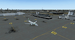
Frame rate friendly fix for the default airport EHRD. Gates and taxi ways at correct position. ILS current with ILS 24 at 110.900 and ILS 06 at 109.100. The package contains the old military airport EHVB nearby which is out of service because I had to disable its ILS at 110.900. I have set it to 110.950. Do not use it.
In case of problems mail "[email protected]" or have a look at https://sites.google.com/site/fsxvideosairports/.
| Filename: | Rotterdam_The_Hague_Airport__Rotterdam__Netherland.zip |
| License: | Freeware |
| Added: | 2nd February 2017, 19:19:41 |
| Downloads: | 2,240 |
| Author: | Rene Scharlach |
| Size: | 1.66 MB |
| Category: Flight Simulator X - Scenery | |
| LSZS - Samedan, Switzerland V3 |
|
Images related to this file:
File Description:

Version 3 of vf-air Samedan LSZS Engadin airport, the highest elevation airport of Europe at 5,600ft near St. Moritz Switzerland. Update to this scenery from previous version includes removal of auto refuel trigger, missing critical steep PAPI lights, parking locations to cooperate properly with GSX for aircraft up to B737-700 like the private Boeing BBJ aircraft that visit Samedan, fix to wrong taxiway night lighting and windsocks. Update is by permission of Guy Nemoz of vf-air.com
| Filename: | LSZS__Samedan_Switzerland_V3.zip |
| License: | Freeware, limited distribution |
| Added: | 5th February 2014, 09:39:17 |
| Downloads: | 7,270 |
| Author: | Kyprianos Biris - Guy Nemoz |
| Size: | 4.8 MB |
| Category: Flight Simulator X - Scenery | |
| NZOP- Opotiki Aerodrome (VectorLandClass, New Zealand) |
|
Images related to this file:
File Description:
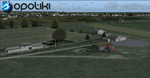
Opotiki aerodrome (ICAO: NZOP) is a small airstrip outside the township of of Opotiki, the gateway to the beautiful East coast of the North Island of New Zealand. Opotiki itself sits at the confluence of the Waioeka and Otara rivers and is surrounded by dairy farmland and Kiwifruit orchards with large areas of native bush to the south and east.
This scenery accompanies Tim Barnes'�� series of other small Bay of Plenty aerodromes (Whakatane,
Galatea, Waihi Beach) for use with VectorLandClass- It features custom modelled and textured buildings, large coverage of beautiful 0.5m aerial photography (fully auto-genned and including seasonal and night variations) and extensive use of high quality objects from the free VLC library. Installation of the library V1.1+ is required for this scenery to work properly and can be downloaded from the VectorLandClass website (www.vectorlandclass.co.nz)
This release, although not requiring it, works best with VectorLandClass topographic mesh and landclass addon covering all 268676 square kilometers of New Zealand. If you'��re not a VLC customer, you'��ll notice when the photoreal coverage runs out!
| Filename: | NZOP_Opotiki_Aerodrome_VectorLandClass_New_Zealand.zip |
| License: | Freeware, limited distribution |
| Added: | 21st February 2013, 13:52:47 |
| Downloads: | 969 |
| Author: | Tim Barnes |
| Size: | 146.68 MB |
| Category: Flight Simulator X - Scenery | |
| YRDY Reedy's Gold Mine, Western Australia |
|
File Description:
YRDY Reedy's Mine open cut was closed in 1997 but further exploration drilling is under way. Reedy is an abandoned town in the Murchison region of Western Australia. The town is located between Cue and Meekatharra in the Mid West region of Western Australia. Gold was discovered in the area by H Reed in 1899-1900 and a nearby well, Reedy's Well, was named after him. The well appeared on maps of the area in 1908 as a known water source. Further gold discoveries were made in the 1930s and sveral mines were developed. By 1933 the Cue-Day Dawn road board petitioned for a townsite to be surveyed and declared. Suggestions for the name of the town included Triton, Mathers and Reedy. The town was gazetted in 1934. If you fly over, you will note that the airstrip runs down the main streets of the old town. REQUIRES Blencowe_LibraryKit.zip
REQUIRES blencowe_librarykit_309494.zip (Available HERE)
| Filename: | YRDY_Reedys_Gold_Mine_Western_Australia.zip |
| License: | Freeware |
| Added: | 28th February 2013, 14:01:09 |
| Downloads: | 226 |
| Author: | Alan Blencowe |
| Size: | 8.99 MB |
| Category: Flight Simulator X - Scenery | |
| X2AM - RAF Aldermaston - Berkshire, England |
|
File Description:
RAF Aldermaston (ICAO X2AM) is a former Royal Air Force station located 8 miles (13 km) east of Newbury, Berkshire and 9.8 miles (15.8 km) southwest of Reading, Berkshire, England.
Originally built as an RAF Bomber Command airfield during 1941-1942, Aldermaston was transferred to the United States Army Air Forces in August 1942.
Placed under the jurisdiction of Eighth Air Force, it was home to several Douglas C-47 Skytrain Troop Carrier Groups. It was transferred to Ninth Air Force in 1943 primarily as a Troop Carrier Command base. Returned to RAF Control at the end of 1945, it was used by Technical Training Command before being placed on Care and Maintenance. In 1946, it was transferred to the Ministry of Civil Aviation and used by BOAC aircraft for training.
Also used by the Ministry of Aircraft Production for Supermarine Spitfire assembly and flight testing, the airfield closed in 1950 and the site became home of the Atomic Weapons Research Establishment (later the Atomic Weapons Establishment) from 1950.
| Filename: | X2AM__RAF_Aldermaston__Berkshire_England.zip |
| License: | Freeware |
| Added: | 25th March 2016, 15:29:24 |
| Downloads: | 286 |
| Author: | Terry Boissel |
| Size: | 1.37 MB |
| Category: Flight Simulator X - Scenery | |
| RAF Dalton |
|
File Description:
RAF Dalton was named after a local village although it was closer to RAF Topcliffe who it was intended to be the
satellite for.
RAF Dalton was home to No. 102 Squadron beginning in November 1941. No. 102 Squadron returned to Topcliffe in June
1942 and for a time Dalton hosted No. 1652 Heavy Conversion Unit (HCU) flying Halifaxes. The airfield was improved in
1942 and in early 1943 was allocated to No. 6 Group Royal Canadian Air Force (RCAF). Canadian squadrons stationed
here at one time or another included No. 428 Squadron, No. 424 Squadron, No. 420 Squadron, and No. 1666 Heavy
Conversion Unit (which moved to RAF Wombleton in October 1943). The station also housed no. 1691 Bomber Gunnery Flight
(BGF) RCAF and its successor, No. 1695 Bomber Defence Training Flight (BDTF) RCAF, the last RCAF unit to serve at this
station.
In November 1944, control passed from No. 6 Group to the new No. 7 (Training) Group. By August 1945 all units at
Dalton were disbanded or transferred and the Station closed in 1946.
Source:Wikipedia
| Filename: | RAF_Dalton.zip |
| License: | Freeware |
| Added: | 26th February 2017, 07:30:47 |
| Downloads: | 80 |
| Author: | Terry Boissel |
| Size: | 1.57 MB |
| Category: Flight Simulator X - Scenery | |
| RAF Hutton Cranswick |
|
File Description:
RAF Hutton Cranswick opened in January 1942 as a fighter airfield within No. 12 Group RAF. Unusually for the time its three runways were concrete "from new", many airfields (particularly fighter airfields) were initially built with grass runways which were later upgraded to concrete.
Many squadrons rotated through the airfield including 610, 19, 308 (City of Kraków), 316 (City of Warsaw), 195, 306 (City of Torun), 302 (City of Poznan), 315 (City of Deblin), 234, 168 and No. 170 Squadron RAF. From December 1943, the Anti-Aircraft Co-operation 291 Squadron was formed at the airfield for target towing and similar uses.
Whilst in use by 291 other fighter squadrons continued to rotate through including 401, 403, 412, 441, 442, 443 (all flying Supermarine Spitfires) and 439 using Hawker Typhoons. The final unit to operate from Hutton Cranswick was No. 124 Squadron RAF using Spitfire IXs.
The station closed in 1946 and has reverted back to farm land, an industrial site now stands were the tech site was situated and the tower became a house.
Source:Wikipedia
| Filename: | RAF_Hutton_Cranswick.zip |
| License: | Freeware |
| Added: | 27th February 2017, 15:12:55 |
| Downloads: | 125 |
| Author: | Terry Boissel |
| Size: | 4.95 MB |


© 2001-2026 AVSIM Online
All Rights Reserved
Privacy Policy |