
Where Flight Simulation Enthusiasts Gather from Around the World!
AVSIM Library - Search Results

| Category: Flight Simulator X - Scenery | |
| X2AM - RAF Aldermaston - Berkshire, England |

|
File Description:
RAF Aldermaston (ICAO X2AM) is a former Royal Air Force station located 8 miles (13 km) east of Newbury, Berkshire and 9.8 miles (15.8 km) southwest of Reading, Berkshire, England.
Originally built as an RAF Bomber Command airfield during 1941-1942, Aldermaston was transferred to the United States Army Air Forces in August 1942.
Placed under the jurisdiction of Eighth Air Force, it was home to several Douglas C-47 Skytrain Troop Carrier Groups. It was transferred to Ninth Air Force in 1943 primarily as a Troop Carrier Command base. Returned to RAF Control at the end of 1945, it was used by Technical Training Command before being placed on Care and Maintenance. In 1946, it was transferred to the Ministry of Civil Aviation and used by BOAC aircraft for training.
Also used by the Ministry of Aircraft Production for Supermarine Spitfire assembly and flight testing, the airfield closed in 1950 and the site became home of the Atomic Weapons Research Establishment (later the Atomic Weapons Establishment) from 1950.
| Filename: | X2AM__RAF_Aldermaston__Berkshire_England.zip |
| License: | Freeware |
| Added: | 25th March 2016, 15:29:24 |
| Downloads: | 286 |
| Author: | Terry Boissel |
| Size: | 1.37 MB |
| Category: Flight Simulator X - Scenery | |
| RAF Dalton |
|
File Description:
RAF Dalton was named after a local village although it was closer to RAF Topcliffe who it was intended to be the
satellite for.
RAF Dalton was home to No. 102 Squadron beginning in November 1941. No. 102 Squadron returned to Topcliffe in June
1942 and for a time Dalton hosted No. 1652 Heavy Conversion Unit (HCU) flying Halifaxes. The airfield was improved in
1942 and in early 1943 was allocated to No. 6 Group Royal Canadian Air Force (RCAF). Canadian squadrons stationed
here at one time or another included No. 428 Squadron, No. 424 Squadron, No. 420 Squadron, and No. 1666 Heavy
Conversion Unit (which moved to RAF Wombleton in October 1943). The station also housed no. 1691 Bomber Gunnery Flight
(BGF) RCAF and its successor, No. 1695 Bomber Defence Training Flight (BDTF) RCAF, the last RCAF unit to serve at this
station.
In November 1944, control passed from No. 6 Group to the new No. 7 (Training) Group. By August 1945 all units at
Dalton were disbanded or transferred and the Station closed in 1946.
Source:Wikipedia
| Filename: | RAF_Dalton.zip |
| License: | Freeware |
| Added: | 26th February 2017, 07:30:47 |
| Downloads: | 80 |
| Author: | Terry Boissel |
| Size: | 1.57 MB |
| Category: Flight Simulator X - Scenery | |
| RAF Hutton Cranswick |
|
File Description:
RAF Hutton Cranswick opened in January 1942 as a fighter airfield within No. 12 Group RAF. Unusually for the time its three runways were concrete "from new", many airfields (particularly fighter airfields) were initially built with grass runways which were later upgraded to concrete.
Many squadrons rotated through the airfield including 610, 19, 308 (City of Kraków), 316 (City of Warsaw), 195, 306 (City of Torun), 302 (City of Poznan), 315 (City of Deblin), 234, 168 and No. 170 Squadron RAF. From December 1943, the Anti-Aircraft Co-operation 291 Squadron was formed at the airfield for target towing and similar uses.
Whilst in use by 291 other fighter squadrons continued to rotate through including 401, 403, 412, 441, 442, 443 (all flying Supermarine Spitfires) and 439 using Hawker Typhoons. The final unit to operate from Hutton Cranswick was No. 124 Squadron RAF using Spitfire IXs.
The station closed in 1946 and has reverted back to farm land, an industrial site now stands were the tech site was situated and the tower became a house.
Source:Wikipedia
| Filename: | RAF_Hutton_Cranswick.zip |
| License: | Freeware |
| Added: | 27th February 2017, 15:12:55 |
| Downloads: | 125 |
| Author: | Terry Boissel |
| Size: | 4.95 MB |
| Category: Flight Simulator X - Scenery | |
| Mid West Victoria UPDATED. 14 airports. YARA YSWL YMBU YSTA YDOD YWYF YBIR YHPN YKER YSLK YSWH + *NEW* YNHL YHML YWKB |
|
Images related to this file:
File Description:
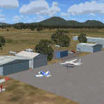
This is an updated version (original Jan 2018). Fixed some ground texture problems plus a lot of added and improved objects and 3 NEW airports. There are 14 airports starting at Ararat and extending up to the Murray at Swan Hill. YARA Ararat YSWL Stawell YMBU Maryborough YSTA Saint Arnaud YDOD Donald YWYF Wycheproof YBIR Birchip YHPN Hopetoun YKER Kerang YSLK Sealake YSWH Swanhill + *NEW* YNHL Nhill YHML Hamilton YWKB Warracknabeal. A lot of airports but not a quicky slap dash effort. It is several hundred hours over many months. Surrounding scenery modified to match real life. Towns, race courses, forests, sewage treatment ponds, obstacles (towers etc) have been added. Included is an AI traffic file that covers all airports that don't already have AI. These files are for Flight Simulator X. Made using Airport Design Editor using some objects borrowed from Robert Budd's excellent Baccus Marsh. RECOMMENDED The scenery is designed to interface with ORBX FTX_AU scenery for Australia (payware). It will work without ORBX but will not interface as well with standard scenery.
| Filename: | Mid_West_Victoria_UPDATED_14_airports_YARA__YSWL__.zip |
| License: | Freeware |
| Added: | 16th May 2019, 18:19:35 |
| Downloads: | 419 |
| Author: | Colin Jeffery |
| Size: | 5.23 MB |
| Category: Flight Simulator X - Scenery | |
| Area 51 V1.1 |
|
Images related to this file:
File Description:
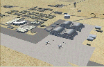
In V1 I added tower comms, taxiways/signs, and deleted start points for all those dirt & other closed runways and made the primary/secondary 14/32.
In V1.1 I have gone through the rest of the airport, aligning and cleaning up scattered oddly placed buildings and placed them in a logical manner - aligned with roads. with parking lots and/or pavement or concrete around their base. Gravel roads added thru the warehouses, sand maintenance roads to water tower and power station, Rec center pool and ballfield touched up. Fire station is in same place but turned towards flight line and added the trucks an ambulance. Fencing all around the flight line.
Also you get the F-117 and Janet 737 WITH traffic file. The Janet 737 is the shuttle aircraft for the Area 51 workers. Watch as the Janet flights arrive each morning from KLAS and depart each night Mon-Fri. KLAS (Las Vegas) Bgl also included with assigned parking at the Janet Terminal.
| Filename: | Area_51_V11.zip |
| License: | Freeware |
| Added: | 24th October 2014, 11:47:01 |
| Downloads: | 2,464 |
| Author: | Jeff Reed |
| Size: | 17.66 MB |
| Category: Flight Simulator X - Scenery | |
| YBIU Ballidu, Western Australia |
|
File Description:
YBIU Ballidu is a town located in the Wheatbelt region of Western Australia, about 217 kilometres (135 mi) north of Perth. The townsite was gazetted in 1914, with street names of the original settlers. A primary school opened in the town on 4 September 1922, moving into permanent premises in 1924. Ballidu has a population of less than 100 people and consists of Ballidu Primary School, the local Art Gallery, a hall, a few shops for groceries and essentials and several farming supply stores. As Ballidu is a farming region, over the years (as the size of the surrounding farms has increased), the town has become smaller and smaller.
This airfield is run by Dunn Aviation and mainly home for their Air Tractor and Dromadaire fleet. (I have created a low poly version beacuse its my first aircraft model). It has a windsock and hangar but little else.
REQUIRES blencowe_librarykit_309494.zip (Available HERE)
| Filename: | YBIU_Ballidu_Western_Australia.zip |
| License: | Freeware |
| Added: | 25th February 2013, 08:24:07 |
| Downloads: | 469 |
| Author: | Alan Blencowe |
| Size: | 2.76 MB |
| Category: Flight Simulator X - Scenery | |
| Akwa Ibom Airport-DNAI FSXP3D |
|
Images related to this file:
File Description:
Akwa Ibom Airport (IATA: QUO, ICAO: DNAI), is an airport serving Uyo, the capital of Akwa Ibom State in Nigeria. The airport is 24 kilometres (15 mi) southeast of Uyo, and 16 kilometres (9.9 mi) northwest of the river port of Oron.
The Akwa Ibom non-directional beacon (Ident: AI) and Uyo VOR-DME (Ident: AKW) are located on the field.
Photoreal Background, Corrected Parkings, Added more buildings, Ramp Lights(Dyanmic Lights only for P3D v4), Airport charts.
| Filename: | Akwa_Ibom_AirportDNAI_FSXP3D.zip |
| License: | Freeware |
| Added: | 13th December 2019, 19:01:39 |
| Downloads: | 397 |
| Author: | Raheem Adeleke |
| Size: | 62.37 MB |
| Category: Flight Simulator X - Scenery | |
| Sardinia Photoreal 9/14 - Baronia and Ogliastra (4/4) |
|
Images related to this file:
File Description:
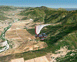
Baronia and Ogliastra are two provinces in eastern Sardinia. In Ogliastra is placed Arbatax - Tortoli airport (LIET). The package Baronia and Ogliastra 1/4, 2/4, 3/4 and 4/4 coverage photoreal scenery of Barbagia area, Posada, Gulf of Orosei, Calagonone, Nuoro, Arbatax, Perdasdefogu, until Villasimius. This file is part 4 of 4 for the scenery (baronia_ogliastra_1.4.zip, baronia_ogliastra_2.4.zip and baronia_ogliastra_3.4.zip are required).
Credits: Aerial photos summer 2012 courtesy of Microsoft Virtual Earth.
| Filename: | Sardinia_Photoreal_914__Baronia_and_Ogliastra_44.zip |
| License: | Freeware |
| Added: | 17th June 2013, 09:51:10 |
| Downloads: | 2,462 |
| Author: | Diego PAPARELLA |
| Size: | 73.48 MB |
| Category: Flight Simulator X - Scenery | |
| RJTC - Tachikawa Airfield - Tachikawa, Tokyo, Japan |
|
File Description:
This scenery represents Tachikawa AB, Japan (for use with the Vietnam War Project scenery by Xavier Carre, Jacques Godfrin and Jose Guenaizia)
during the early 1960's. It is made with ADEX ver. 1.55.
And now a little history on this installation. Tachikawa was home of the 1503d Air Transport Wing (Air Transport Wing)
and was the host unit until it's closure in 1970. Attached unils were the 21st (C-123), 35th (C-118),
41st (C-124) ATS.
| Filename: | RJTC__Tachikawa_Airfield__Tachikawa_Tokyo_Japan.zip |
| License: | Freeware |
| Added: | 10th August 2013, 21:51:26 |
| Downloads: | 593 |
| Author: | Larry Steinborn |
| Size: | 650.28 KB |
| Category: Flight Simulator X - Scenery | |
| Liverpool Xtreme |
|
Images related to this file:
File Description:

Liverpool John Lennon Airport (UK) is a busy Low fares airline hub for Easyjet and Ryanair, it also has a large GA area. This scenery captures the airport in all its glory.Includes detailed images of the real Liverpool airport, it has a high resolution 25cm base image, animation, effects, nearly all the buidlings, extremely detailed ground markings, interactive service fleet and stunning night effects.
DEMO VERSION ONLY, funtional but has 'demo signs' Full price is GBP14.99
| Filename: | Liverpool_Xtreme.zip |
| License: | Commercial demo |
| Added: | 7th May 2011, 04:03:25 |
| Downloads: | 1,137 |
| Author: | Gary Summons |
| Size: | 76.38 MB |


© 2001-2026 AVSIM Online
All Rights Reserved
Privacy Policy |