
Where Flight Simulation Enthusiasts Gather from Around the World!
AVSIM Library - Search Results

| Category: Flight Simulator X - Scenery | |
| KABE - Lehigh Valley International Airport - Allentown, PA |

|
File Description:
By request, here is an improved version of the stock Lehigh Valley International Airport. I added and
adjusted aprons and taxiways as needed. I replaced many of the existing buildings with more accurate ones
and added several additonal buildings. Gate assignments for commercial traffic are correct, and I added
Cargo and GA parking spaces, plus a helipad. I replaced the control tower and moved it, and added
static vehicles, aircraft, and other filler objects.
| Filename: | KABE__Lehigh_Valley_International_Airport__Allento.zip |
| License: | Freeware |
| Added: | 31st October 2008, 00:56:49 |
| Downloads: | 1,180 |
| Author: | Jim Cook |
| Size: | 12.65 KB |
| Category: Flight Simulator X - Scenery | |
| K09 - Piseco Airport - Piseco, NY |
|
File Description:
Here is an improved version of the stock Piseco Airport. T adjusted taxiways, added aprons, roads, buildings
and other objects. The airport is owned by the Town of Arietta and is located in the beautiful Adirondack
Mountain area of upstate NY. Please don't feed the bears!
I've added an extra file for UTX users called K09_docks_JC.bgl. It will add a seaplane dock with two seaplanes,
a couple of boats, and sailboats on Piseco Lake.
| Filename: | K09__Piseco_Airport__Piseco_NY.zip |
| License: | Freeware |
| Added: | 25th March 2009, 08:31:58 |
| Downloads: | 530 |
| Author: | Jim Cook |
| Size: | 5.24 KB |
| Category: Flight Simulator X - Scenery | |
| UK Airfields Volume 23 |
|
Images related to this file:
File Description:
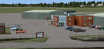
Volume 23 consists firstly of a small grass strip Audley End X3AE, 1nm Southwest of Saffron Walden. Second is Beccles EGSM, 4nm Eastsoutheast of Stowmarket and 5nm North of Ipswich. This was once a helicopter terminal for the North Sea Gas Fields and was made at the request of Gerry Francis who used to fly from there. Finally I offer Gamston EGNE, the bustling regional airport of Retford which is 2nm to the North.
| Filename: | UK_Airfields_Volume_23.zip |
| License: | Freeware |
| Added: | 25th June 2011, 22:59:05 |
| Downloads: | 1,276 |
| Author: | Alf Denham |
| Size: | 17.69 MB |
| Category: Flight Simulator X - Scenery | |
| VVCM - Ca Mau Airport, Ca Mau, Vietnam |
|
Images related to this file:
File Description:
Cà Mau Airport (IATA: CAH, ICAO: VVCM) (Vietnamese: Sân bay Cà Mau) is a small airport in Cà Mau Province, the most southern part of Vietnam. The airport is currently served by Vietnam Aviation Service Company (VASCO) with flight to Ho Chi Minh City (Tan Son Nhat International Airport, SGN). As of April 2011, Vietnam Air Service Company operates two flights daily for Ho Chi Minh City-Cà Mau route with ATR-72 aircraft.
| Filename: | VVCM__Ca_Mau_Airport_Ca_Mau_Vietnam.zip |
| License: | Freeware |
| Added: | 18th January 2018, 02:15:46 |
| Downloads: | 830 |
| Author: | NhatHoang |
| Size: | 65.54 MB |
| Category: Flight Simulator X - Scenery | |
| Governor's Harbour International Airport (MYEM) - The Bahamas |
|
Images related to this file:
File Description:
Central of three airports on Eleuthera Island in the Bahamas just east of Nassau. An abandoned watch tower existing at this airport, and familiar to those who have flown in, has been torn down recently and is not included. The scenery includes custom scenery objects; placement of library objects and landclass changes. Scenery is based on Bing Maps, Google Earth and photos taken locally, and it is optimized for use with UTX-TAC.
| Filename: | Governors_Harbour_International_Airport_MYEM__The_.zip |
| License: | Freeware |
| Added: | 28th June 2013, 00:15:08 |
| Downloads: | 1,266 |
| Author: | Art Poole |
| Size: | 1.61 MB |
| Category: Flight Simulator X - Scenery | |
| YKLN Kulin Town and YJLN Kulin, Jilakin Rock, Western Australia |
|
File Description:
YKLN Kulin Town and YJLN Kulin, Jilakin Rock. Kulin is located in the upper great southern Wheatbelt of Western Australia, the Shire of Kulin covers an area of 4,790 square kilometres. It encompasses the towns of Kulin, Pingaring, Dudinin, Jitarning, and Holt Rock. The Kulin economy is based on agriculture and was settled by pastoralists in 1905. The crosswind runway is actually 7 miles to the east at Jilakin Rock and slopes uphill to the east. For convenience, I have used fictitious YJLN. Jilakin Downs is a Dorper sheep stud farm and the home of the Kulin Bush Races. Dorpers are currently under a cloud in Western Australia as the local abatoirs claim their hair is contaminating the meat and won't accept them. "We welcome air traffic to our 2012 Kulin Bush Races Weekend. A crosswind airstrip is available, with a shuttle bus service to the Jilakin Track. GPS position is S32-39-95 E118-18-71 and the elevation is 950 feet. The strip is 7 nautical miles east of the town of Kulin. Camping and toilets are close to the strip so that you can camp near your plane.
Kulin airstrip is also available for landing and takeoff during the weekend, a shuttle bus is available to take you out to the race track. If this option is chosen please contact Barry West. Please contact Barry West for flying information on 9880 9021" www.kulin.wa.gov.au/tourism_and_local_events/kulin_bush_races/flying_visit.html REQUIRES Blencowe_LibraryKit.zip
REQUIRES blencowe_librarykit_309494.zip (Available HERE)
| Filename: | YKLN_Kulin_Town_and_YJLN_Kulin_Jilakin_Rock_Wester.zip |
| License: | Freeware |
| Added: | 28th February 2013, 13:52:31 |
| Downloads: | 225 |
| Author: | Alan Blencowe |
| Size: | 5.73 MB |
| Category: Flight Simulator X - Scenery | |
| RAF Honeybourne 1945 - Worcestershire, England |
|
File Description:
RAF Honeybourne was a Royal Air Force station located 0.6 miles (0.97 km) south of Honeybourne, Worcestershire, England and 4.6 miles (7.4 km) east of Evesham, Worcestershire, England.
The airfield was home to No. 24 Operational Training Unit RAF (OTU) which used Vickers Wellingtons and Armstrong Whitworth Whitleys from 15 March 1942 until July 1945 flying many operational bombing and leaflet dropping operations.
A number of units from Ferry Command were based here including a ferry training unit using Lockheed Hudsons and Bristol Beauforts.
The airfield was also temporarily home to No. 21 OTU flying Wellingtons from RAF Enstone from August 1945 for two months because the runways at their home base were being repaired. From October 1945 until 1946 107 Sub Storage Unit from No. 8 Maintenance Unit used the airfield for storing Wellingtons and General Aircraft Hamilcar gliders.
The role of the airfield after the war changed with the reduction of flying movements and with a slight change in what the units did on the airfield when No. 107 Sub Storage Unit from 1947 began to collect no longer needed Wellingtons which were then scrapped and taken to Weston Subedge goods yard (which was near to the south-western corner) where the railway would take them to the necessary destination.
In July 1948 the site was closed and much has reverted to farmland with runways being removed in 1968. Since then, the airside area has evolved into the Honeybourne Airfield Trading Estate with the five hangars being used for different purposes.
| Filename: | RAF_Honeybourne_1945__Worcestershire_England.zip |
| License: | Freeware |
| Added: | 3rd June 2016, 11:00:06 |
| Downloads: | 131 |
| Author: | Terry Boissel |
| Size: | 2.29 MB |
| Category: Flight Simulator X - Scenery | |
| Pagasa Island, Philippines |
|
Images related to this file:
File Description:
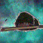
Pagasa Island is a jewel in the South China Sea. It is the one pictured - an emerald splash in an azure sea slashed by a coral runway - whenever new collisions or confrontations are reported in the news for the region. Occupied continuously by the Philippines since 1971, historical use dates back to the Han dynasty, which many believe forms the basis of the Chinese claim to the island. Each country has it's own interpretation of international law and the Filipinos are clearly banking on the precedence of continuous occupation, at no small expense, as Rancudo Field is the farthest airport from Manila within the Philippine sphere of control.
Surprisingly, the geography of the island serves to capture and retain rainwater, although the aquifer is stagnant and the water must be treated for consumption. Sea life remains abundant, poachers take coral heads and sea turtles. There is a solar farm and recently installed solar street lights, fuel for the generators is a precious commodity this far from the mainland.
Sadly, nature may solve the struggle for possession by withdrawing the island from the arena. It is believed that the construction of the runway may have compromised the islands basic integrity, allowing it to crumble into the sea. Whatever the cause, the evidence is clear. Bunkers built during the Japanese occupation in WWII are already slipping beneath the waves and the rate of salt water encroachment has been recorded at close to 6" per day.
There are some things to explore, the grounded BRP Laneo Del Norte to the west; over to the north near the resort grounds are a dugout fishing canoe and some authentic Philippine bangka boats; you may want to load up and head east to do some low warning passes over the Chinese fishing fleet. Standing at the east end of the field, you can just barely spot the China Coast Guard cutter's smoke on the horizon.
The tower is marked by a bright strobe that fires once every five seconds and at night it is bright enough to guide you back to the island from the distance of the fleet. There are no published procedures and the tower is not staffed. Airport ICAO is RPPN.
| Filename: | Pagasa_Island_Philippines.zip |
| License: | Freeware, limited distribution |
| Added: | 10th May 2014, 12:21:19 |
| Downloads: | 1,860 |
| Author: | Rick Keller |
| Size: | 16.17 MB |
| Category: Flight Simulator X - Scenery | |
| Akwa Ibom Airport-DNAI FSXP3D |
|
Images related to this file:
File Description:
Akwa Ibom Airport (IATA: QUO, ICAO: DNAI), is an airport serving Uyo, the capital of Akwa Ibom State in Nigeria. The airport is 24 kilometres (15 mi) southeast of Uyo, and 16 kilometres (9.9 mi) northwest of the river port of Oron.
The Akwa Ibom non-directional beacon (Ident: AI) and Uyo VOR-DME (Ident: AKW) are located on the field.
Photoreal Background, Corrected Parkings, Added more buildings, Ramp Lights(Dyanmic Lights only for P3D v4), Airport charts.
| Filename: | Akwa_Ibom_AirportDNAI_FSXP3D.zip |
| License: | Freeware |
| Added: | 13th December 2019, 19:01:39 |
| Downloads: | 397 |
| Author: | Raheem Adeleke |
| Size: | 62.37 MB |
| Category: Flight Simulator X - Scenery | |
| Sardinia Photoreal 9/14 - Baronia and Ogliastra (4/4) |
|
Images related to this file:
File Description:
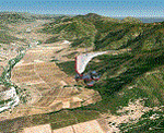
Baronia and Ogliastra are two provinces in eastern Sardinia. In Ogliastra is placed Arbatax - Tortoli airport (LIET). The package Baronia and Ogliastra 1/4, 2/4, 3/4 and 4/4 coverage photoreal scenery of Barbagia area, Posada, Gulf of Orosei, Calagonone, Nuoro, Arbatax, Perdasdefogu, until Villasimius. This file is part 4 of 4 for the scenery (baronia_ogliastra_1.4.zip, baronia_ogliastra_2.4.zip and baronia_ogliastra_3.4.zip are required).
Credits: Aerial photos summer 2012 courtesy of Microsoft Virtual Earth.
| Filename: | Sardinia_Photoreal_914__Baronia_and_Ogliastra_44.zip |
| License: | Freeware |
| Added: | 17th June 2013, 09:51:10 |
| Downloads: | 2,462 |
| Author: | Diego PAPARELLA |
| Size: | 73.48 MB |


© 2001-2026 AVSIM Online
All Rights Reserved
Privacy Policy |