
Where Flight Simulation Enthusiasts Gather from Around the World!
AVSIM Library - Search Results

| Category: Flight Simulator X - Scenery | |
| RAF Snetterton Heath - Norfolk, England |

|
File Description:
RAF Snetterton Heath is a former Royal Air Force station located south east of the A11, 6 miles (9.7 km) south west of Attleborough, Norfolk, England.
RAF Snetterton Heath airfield was constructed in 1942 to Class-A specifications. Originally thirty-six hardstandings of the "frying pan" type were constructed as when work started, the base was intended for Royal Air Force (RAF) use. When re-scheduled for the United States Army Air Forces (USAAF), the number was increased to fifty, all of them being on the south and eastern side of the airfield as a railway line and the A11 road restricted dispersed locations.
With the end of military control Snetterton Heath was closed and privately purchased in 1952 with a view to utilizing the runways and perimeter tracks as a motor racing circuit. The first motor cycle meeting was held in 1953 and the first motor races the following year. Source: Wikipedia.
| Filename: | RAF_Snetterton_Heath__Norfolk_England.zip |
| License: | Freeware |
| Added: | 22nd January 2016, 16:10:44 |
| Downloads: | 173 |
| Author: | Terry Boissel |
| Size: | 1.43 MB |
| Category: Flight Simulator X - Scenery | |
| RAF Moreton In The Marsh - Gloucestershire, England |
|
File Description:
RAF Moreton-in-Marsh was a Royal Air Force station near Moreton-in-Marsh, Gloucestershire. It was opened in November 1940 and closed for operational flying in early 1948. The base remained in use as a relief runway and for training. After a period of care and maintenance, the Station was handed over to the Home Office in 1955.
The town's environs are quite flat and low-lying although it is situated at the northern extremity of the Cotswold Hills range. During World War II, a large area of this flat land to the east of the town was developed as an airfield and became the base of 21 OTU (Operational Training Unit) RAF, flying mainly Vickers Wellington bombers. It is highly likely that the airfield inspired the title of the radio show Much Binding in the Marsh. After all, two of its stars, Kenneth Horne and Richard Murdoch, served there as flying instructors.
| Filename: | RAF_Moreton_In_The_Marsh__Gloucestershire_England.zip |
| License: | Freeware |
| Added: | 1st February 2016, 10:07:46 |
| Downloads: | 228 |
| Author: | Terry Boissel |
| Size: | 1.74 MB |
| Category: Flight Simulator X - Scenery | |
| YCRW Crawley Bay, Western Australia, US Catalina Base - QANTAS base (Historic 1942) |
|
File Description:
YCRW Crawley Bay USAF Catalina Base - QANTAS base (Historic 1942). This location was where the famous double sunrise flights left for Lake Koggala in Sri Lanka (Ceylon) between 1943 and 1946. Suited to Rick Stone's PBY5A Catalina. The USAF used the north side of the point and QANTAS used what is now the boat ramp at Nedlands. Remember, Perth was only about two or three stories high in those days so for a realistic enactment, totally overload the aircraft (towards the front) and just point between the buildings until you gain some height. To cover the distance, cruise at about 110kts and 500 feet. Don't forget the passengers stand at the front on takeoff and can be seated after you are in the air. (move the weights backwards after taking off) REQUIRES Blencowe_LibraryKit.zip
REQUIRES blencowe_librarykit_309494.zip (Available HERE)
| Filename: | YCRW_Crawley_Bay_Western_Australia__US_Catalina_Ba.zip |
| License: | Freeware |
| Added: | 25th February 2013, 09:02:15 |
| Downloads: | 303 |
| Author: | Alan Blencowe |
| Size: | 865.95 KB |
| Category: Flight Simulator X - Scenery | |
| YKAE Kalannie, Western Australia |
|
File Description:
YKAE Kalannie, about 300km north-east of Perth, lies in some of the best wildflower country in Australia and at the heart of WA���¢������s largest wheat producing area. The district also claims more species of wattle (acacias) than anywhere else in the world. Kalannie is also situated approximately 30 mins from Dalwallinu in what is called the northern wheatbelt region and is within the Dalwallinu Shire and hence council administration for the area is managed from Dalwallinu. Kalannie has a population of approximately 300 people in the town and immediate region around Kalannie. There is no accommodation at Kalannie except for the Caravan Park. The airstrip is gravel with a windsock and is marked with white plough disks. REQUIRES Blencowe_LibraryKit.zip
REQUIRES blencowe_librarykit_309494.zip (Available HERE)
| Filename: | YKAE_Kalannie_Western_Australia.zip |
| License: | Freeware |
| Added: | 28th February 2013, 13:51:08 |
| Downloads: | 212 |
| Author: | Alan Blencowe |
| Size: | 2.31 MB |
| Category: Flight Simulator X - Scenery | |
| KVC - King Cove Airport - Alaska, USA |
|
Images related to this file:
File Description:
King Cove Airport (IATA: KVC, ICAO: PAVC, FAA LID: KVC) is a state-owned public-use airport located four miles (6 km) northeast of the central business district of King Cove, a city in the Aleutians East Borough of the U.S. state of Alaska.
King Cove Airport has one runway (7/25) with a gravel surface measuring 3,500 x 75 ft. (1,067 x 23 m). For the 12-month period ending December 31, 2005, the airport had 1,030 aircraft operations: 71% air taxi and 29% general aviation.
Changes: Increased parking apron and turn arounds at both ends of the runway. Also added additional parking and custom models. Changes were based on 2014 construction plans.Created with Airport Design Editor 9x by ScruffyDuck Software using current FAA documentation and Google Earth measurements, this package offers a replacement for FSX's stock airport. All these enhancements are as close to the real airport as I can get with stock library objects and custom buildings.
| Filename: | KVC__King_Cove_Airport__Alaska_USA.zip |
| License: | Freeware |
| Added: | 20th December 2014, 00:02:03 |
| Downloads: | 850 |
| Author: | Wayne Roberts |
| Size: | 446.46 KB |
| Category: Flight Simulator X - Scenery | |
| Caribbean SeaPlane Tours, Bahamas |
|
File Description:
Part 3 of a 5 part series cover the Caribbean with custom airports and Seaplane Docks. "Caribbean SeaPlane Tours, Florida Operations" and Caribbean SeaPlane Tours, Caribbe West" are required for the scenery to display correctly. Please read the "Read-Me" files of all sceneries for installation information and hints. This scenery pack includes the following airports and seaplane docks: The airports - Nassau International, Walker's Cay, Deep Water Cay, Grand Bahamas International, Spanish Cay, Treasure Cay, Marsh Harbor Airport, Castaway Cay, Little Whale Cay, Exuma International, Hog Cay, Arthur's Town, Cutlass Bay, Rum Cay, Deadman's Cay, Duncan Town, Colonel Hill, Pittstown Point, Parrot Cay, Pine Cay, Conch Bay, Salt Cay, Mayaguna Island and a hidden Smuggler's scenery near Crooked Island. SeaPlane Docks - Nassau Lakeside, Nassau Oceanside, Paradise Island, Walker's Cay, Grand Bahamas, Treasure Cay, Castaway Cay, Hog Cay, Cutlass Bay, Rum Cay, Deadman's Cay, Parrot Cay, Pine Cay, Conch Bay, and Salt Cay. There are navigational aids included....Make sure you read the "Read-Me" File!
| Filename: | Caribbean_SeaPlane_Tours_Bahamas.zip |
| License: | Freeware, limited distribution |
| Added: | 24th November 2007, 17:16:16 |
| Downloads: | 5,462 |
| Author: | Chris Carel |
| Size: | 47.12 MB |
| Category: Flight Simulator X - Scenery | |
| KBRT - RI Bong AFB |
|
Images related to this file:
File Description:
Richard I. Bong AFB, Brighton, Wis. Originally designed out in the 1950's as a NORAD Base with the 56th FIG assigned to cover the Milwaukee/Chicago region the Great Lakes. Later it was transferred to SAC as a B-47/KC-97 installations and the 4040th Air Base Squadron taking command of the base. Initial drainage and the runway were laid out and the runway was within 3 days of being poured when the project was cancelled and the base closed. The base later became the Richard Bong State Recreation Area west of Kenosha, Wis. on US-142. The layout of the runway can be seen by satellite. This is the first of two versions of this base, this has the B-47/KC-97 layout, the second (KBRT RI Bong-B-52) will be B-52/KC-135. Both are set-up for the NORAD unit (56th FIG) using F-101 Voodoo aircraft. Check readme for requirements.
| Filename: | KBRT__RI_Bong_AFB.zip |
| License: | Freeware |
| Added: | 24th October 2013, 20:06:04 |
| Downloads: | 626 |
| Author: | Larry Steinborn |
| Size: | 916.95 KB |
| Category: Flight Simulator X - Scenery | |
| Pigs Down Under |
|
Images related to this file:
File Description:
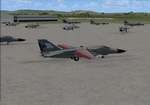
This is a simple upgrade to Australian Airbases Amberly and East Sales. It adds Military Combat and Cargo parking spots, Static F-111G aircraft, AI F-111C, F-111G and EF-111A aircraft and flight plans. Each AI aircraft has it's own tail number and is addressed by ATC with that tail number. Installer has option to add AI aircraft only if you already have an add-on scenery package for these airbases.
| Filename: | Pigs_Down_Under.zip |
| License: | Freeware |
| Added: | 26th August 2011, 16:45:19 |
| Downloads: | 247 |
| Author: | Steve Hess |
| Size: | 4.27 MB |
| Category: Flight Simulator X - Scenery | |
| Boca Raton, FL Airport (KBCT) |
|
Images related to this file:
File Description:
One runway and taxiway for private jets of the rich and famous. Generic floating buildings have
been replaced with custom and library objects. Landclass changes, roads, rework of runways,
taxiways and aprons, placement of library objects and a library of new airport buildings are
included. Scenery in this package is based on Virtual Earth (Bing) and Google Earth imagery. An
optional AI Traffic file is also included to populate the airport with executive aircraft.
| Filename: | Boca_Raton_FL_Airport_KBCT.zip |
| License: | Freeware |
| Added: | 5th February 2011, 03:10:42 |
| Downloads: | 2,308 |
| Author: | Art Poole |
| Size: | 2.95 MB |
| Category: Flight Simulator X - Scenery | |
| Death Valley Desert Strip. |
|
Images related to this file:
File Description:
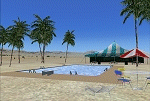
Death Valley Desert Strip (L51) was constructed as a location to test
the Aeroworks ARX-6 Reno racer at low altitudes.
This place even sports the world's lowest Formula 1
race course! But now that the ARX-6 has been released,
this facility has been converted to a desert retreat..
It's still used occasionally as a test facility for
other things and as a filming location.
Scenery by Joshua B. Nyhus and Jason L. Terry
| Filename: | Death_Valley_Desert_Strip.zip |
| License: | Freeware |
| Added: | 30th August 2012, 08:38:22 |
| Downloads: | 630 |
| Author: | Jason L Terry, Josh Nyhus |
| Size: | 5.04 MB |


© 2001-2026 AVSIM Online
All Rights Reserved
Privacy Policy |