
Where Flight Simulation Enthusiasts Gather from Around the World!
AVSIM Library - Search Results

| Category: Flight Simulator X - Scenery | |
| FSX Grand Canyon North Rim Simulation |

|
Images related to this file:
File Description:
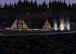
Welcome to the North Rim of the Grand Canyon!
This scenery is a mostly fictitious representation of what the North Rim might look like of it had been developed like the South rim. A new airport (KKPA, Kaibab Plateau Airport) is the centerpiece. It sits at 8,730 ft MSL so density altitude is a real issue. Runway 17/35 is 6,500ft long so biz jets can get in and out safely. A new resort sits atop the ridge to the east [Eagle's Nest]. There is a helipad for access. An NDB makes finding it easier [AZ95 220.9 kHz]. Or you can just follow the traffic on the access road that branches off from highway 67 just south of the airport. To the north I have added a gravel strip to Jacob Lake where 67 joins 89A. Runway 14/32 is 3000 ft long and sits at 7900 ft MSL. An NDB [AZ93 393 kHz] is included. At the south end of Highway 67 sits the North Rim Visitor Center. There is a helipad on the roof for those who like rotary wing challenges. The NDB is AZ94 at 423.4 kHz. The entire length of Highway 67 is represented with traffic going both ways. You will see
air traffic from KGCN at the South Rim and traffic between KKPA and Jacob Lake.
| Filename: | FSX_Grand_Canyon_North_Rim_Simulation.zip |
| License: | Freeware, limited distribution |
| Added: | 19th May 2021, 19:28:12 |
| Downloads: | 100 |
| Author: | Brett Delana |
| Size: | 16.26 MB |
| Category: Flight Simulator X - Aircraft Repaints, Textures and Modifications | |
| Korean Airlines Boeing 747-8i/8B5i (HL7630) |
|
Images related to this file:
File Description:

Korean Airlines Boeing 747-8B5/i (HL7630). REPAINT ONLY FOR FSX PMDG 747-400 expansion pack -8i/-8f
This livery is still fictional but I tried to collect as much data as I could from the -400 model as well as the concept/
previews of the -8i model. The real Korean 748i is still unpainted but is sitting in storage at Paine Field.
Features:
1. Korean Airlines Logo (New Livery with correct positions in referenced to the aircraft concepts).
2. Accurate placement of the SkyTeam Logo.
3. Korean text below the first class windows.
4. Studied and averaged precise sky blue color for fuselage.
5. Grey Stripe also averaged for closest match.
6. Grey Engine colors.
7. Korean Airlines Logo on the engines (accurate placement and removed engine warnings).
8. Studied design to create the "Closest" experience to the real thing.
9. White window door frames.
9. Boeing 747-8i decal above the last set of 8 windows (in Boeing font and accurate dark blue color).
10.Registration on the tail in accurate position, spacing, font, and color.
11.Korean Air logo flipped correctly (right side) and Flag included on top.
12.Added dirt textures to tail and aft belly.
13.Registration in accurate place on wing (color and font also studied and accurate).
14.Registration included on bottom of the wing as well.
| Filename: | Korean_Airlines_Boeing_7478i8B5i_HL7630.zip |
| License: | Freeware, limited distribution |
| Added: | 25th December 2014, 22:32:47 |
| Downloads: | 896 |
| Author: | Rohan Patel |
| Size: | 11.21 MB |
| Category: Flight Simulator X - Scenery | |
| YWWI - Woodie Woodie Manganese Mine, Western Australia |
|
File Description:
YWWI Woodie Woodie Manganese Mine - Pilbara Manganese, a wholly owned subsidiary of Consolidated Minerals (Consmin), operates the Woodie Woodie mine, which produces high-grade manganese ore of superior quality. The ore is sold to the international steel industry. Production in 2010 was 1,238,000t @ 46.2% Mn, with a capacity of 2.5mtpa of high grade lump and fines. The high-grade lump produced by the mine is an ideal blending material with high manganese and is very low in phosphorus. Furthermore, the lump is hard, has very low degradation and high thermal stability. The mine has a 100.5km2 mining corridor and approximately 5,500km2 of greenfield areas outside this corridor. Multiple open pits are in operation and owner mining of ore is used to promote selectivity and to minimise dilution. The mine also employs contract mining of waste to promote efficient bulk mining practices. The mineral processing techniques include crushing, screening and heavy media separation. Woodie Woodie has a new camp and an all-weather air-strip constructed in 2009, suitable for large aircrafts. Ore is trucked to Port Hedland for shipment. Consmin has committed in excess of A$34 million to exploration in 2011, with the intention to explore more than 60 corridor targets and more than 130 regional targets from nine prospect areas. www.consminerals.com.au/m/files/fs/woodie-woodie-fact-sheet.pdf REQUIRES Blencowe_LibraryKit.zip
REQUIRES blencowe_librarykit_309494.zip (Available HERE)
| Filename: | YWWI__Woodie_Woodie_Manganese_Mine_Western_Austral.zip |
| License: | Freeware |
| Added: | 28th February 2013, 17:07:43 |
| Downloads: | 271 |
| Author: | Alan Blencowe |
| Size: | 3.17 MB |
| Category: Flight Simulator X - Aircraft Repaints, Textures and Modifications | |
| Global Airways Douglas C-54 |
|
Images related to this file:
File Description:
The repaint features Global Airways' N79000, an early production Douglas C-54 (c/n 3058) built at the Douglas factory at Santa Monica, CA, and delivered to the USAAF on February 8, 1943 as 41-37272. In 1946 the Civil Aviation Administration took her over as NC79000. Having been converted to DC-4 standard, she was bought on April 11, 1951 by Eastern Air Lines as N79000 '721'. In May 1955 she was sold and served many users such as Northwest, Transocean and World. In 1960 California Airmotive became the owner of the C-54. During September and October 1960 the C-54 was leased by Global Airways, a company based in Philadelphia, PA, from 1946 to around 1960. (founded by Simon Bolnick and Joseph Raphael; passenger charter operations included fishing and hunting charters to Canada.) In May 1961 the C-54 was sold as D-ADAM to Continentale in Germany. Already in December 1962 Continentale went bankrupt and the aircraft was stored in the open at Hamburg. In July 1963 Aviation Traders (Engineering) Ltd purchased the C-54 for conversion to Carvair car-ferry aircraft. As it turned out, the condition of the C-54 was extremely poor (corrosion on many places on the wing spars) so makeshift repairs were done before the aircraft was ferried to Stansted for its rebuild to Carvair G-ASKN.
Textures only. You will need Jens B. Kristensen's FSX Douglas DC-4 & C-54 (DC4_V30X.ZIP). Repaint by Maarten Brouwer.
| Filename: | Global_Airways_Douglas_C54.zip |
| License: | Freeware, limited distribution |
| Added: | 19th November 2012, 12:46:35 |
| Downloads: | 127 |
| Author: | Maarten Brouwer |
| Size: | 1.23 MB |
| Category: Flight Simulator X - Scenery | |
| Middle East Carrier Operations (MECOPS) |
|
Images related to this file:
File Description: This scenery has been developed for FSX Flight Simulator SP1 or SP2. It

has also been tested with Microsoft Acceleration , but compatibility is not
guaranteed by the author.
The scenery includes: Two carrier groups CVN68 and CVN69, ( carrier models from
Javier Fernandez ), two AI KC-135 tanker aircraft, AI F-18A aircraft approaching
the carrier, Navy destroyer and a Navy Cruiser as escort ships for the carrier,
a number of oil platforms and the ARS4 radar gauge which displays air targets
and boat targets.
The ARS4 radar gauge provides also a auto landing function for the carrier and a
auto tracking function for aircraft in order to support a A2A re-fueling. The
scenery package includes as well the program Arrcab, developed by Richard Hogan,
and the RCBCO gauge developed by Rob Barendregt. Arrcab or RCBCO are required to
support a catapult start from a carrier and the cable arrestor function for a
carrier landing.
This is not a load and fly package. Please take your time to read the included
documentation for the ARS4 gauge and the MECOPS scenery carefully. Do not skip
chapters because you may think, they are not important for you.
Do not start the installation of the scenery before you have finished the
reading of the documents.
For copyrights and credits please look at the documentation for this scenery.
| Filename: | Middle_East_Carrier_Operations_MECOPS.zip |
| License: | Freeware, limited distribution |
| Added: | 4th March 2013, 18:03:32 |
| Downloads: | 1,892 |
| Author: | Dietmar Loleit |
| Size: | 62.04 MB |
| Category: Flight Simulator X - Scenery | |
| GABS Bamako Senou International Airport |
|
File Description:
Bamako Senou International Airport (IATA: BKO, ICAO: GABS) is Malis main airport approximately 15 km south of downtown Bamako, the capital of Mali in West Africa. It is managed by Aeroports du Mali (ADM). Its operations are overseen
by the Malian Ministry of Equipment and Transports. Senou Airport was opened to traffic in 1974. The airport was upgraded between 2007 and 2012 in a 181 million US dollar project funded by the Millennium Challenge Corporation, a United
States foreign aid agency. Passenger traffic steadily increased in the early 2000s. Government figures show 403,380 passengers in 1999, 423,506 in 2003, 486,526 in 2004, and 516,000 in 2005. It is predicted to reach over 900,000 by 2015
under a low (4%) yearly growth rate scenario.
To date this growth rate has been surpassed. Total air traffic at BKO increased by 12.4% in 2007 and 14% in 2008. Most of this increase came in passenger transport, with the number of passengers served increasing by 20% in 2007 and 17%
in 2008. Twenty-seven airline carriers operated weekly or better at BKO in the 2007-2008 period. This continued growth was offset by cargo flights decline of 16.75% in 2007, and 3.93% in 2008.
The highest frequency route is on the Bamako-Dakar sector with 29 weekly non-stop connections. Domestic flights also serve Mali's regional capitals Kayes, Mopti, Timbuktu, Sikasso, Gao, and Kidal.
This work is dedicated to West Wind Airlines.
| Filename: | GABS_Bamako_Senou_International_Airport.zip |
| License: | Freeware |
| Added: | 27th March 2013, 01:12:43 |
| Downloads: | 3,396 |
| Author: | Anwar Gonzalez |
| Size: | 915.65 KB |
| Category: Flight Simulator X - Gauges | |
| V-One Gauge for Boeing 727-100/200/F (Complete) |
|
Images related to this file:
File Description:
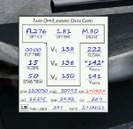
New features in this version are in indicated in '[ ]'.
Twenty call-outs sounds integrated into gauge [13 new call-outs].
Take-off V-Speeds calculated for Flaps 5, 15, or 25 with temperature and altitude adjustments.
[Take-off speed bugs and Command speed bug automatically set for: V1/Vr, V2, V2 + 15].
[Flaps-up maneuvering speed (clean speed) bug set after flaps-up].
Optimum altitude and optimum EPR (EPR calc for M.80) are continually calculated.
Gross Weight overage will display in 'red' text. Tooltip indicates overweight value (LB/KG).
Take-off trim calculated for current gross weight.
Maximum Climb Thrust (MCT) calculated based on current TAT temperature.
[Current EPR displayed adjacent to MCT for ease of use during climb phase].
Display units can be toggled between LB and KG (default LB).
Outside air Temperature can be toggle between Fahrenheit and Celsius.
Resettable fuel use.
Resettable flight timer.
[Selectable Vref landing configurations, Vref30 (default) or Vref40].
[Approach / landing speed bugs and Command speed bug automatically set for: Vref, Vref + 5, Vref + 15].
ZFW, Fuel, CG, Gross Weight and Barometric Pressure MSL (QNH) displayed.
['Barometer Set' call-out occurs when pressing keyboard letter 'B' (V-One gauge must be open)].
[Airspeed gauge enhanced: CMD speed bug colorized orange and notch added for visibly of tick marks below].
[Decision Height adjustment now on Data Card in hidden click-spot located on upper right corner].
[Now installation to a single location will work for all variants].
| Filename: | VOne_Gauge_for_Boeing_727100200F_Complete.zip |
| License: | Freeware, limited distribution |
| Added: | 28th January 2013, 11:30:53 |
| Downloads: | 1,512 |
| Author: | Paul Tally |
| Size: | 3.55 MB |
| Category: Flight Simulator X - Scenery | |
| KSNA, John Wayne-Orange County Airport |
|
Images related to this file:
File Description:

John Wayne Airport (IATA: SNA, ICAO: KSNA, FAA LID: SNA) is an airport in an unincorporated area in Orange County, California, with its mailing address in the city of Santa Ana, which is also the county seat, hence the International Air Transport Association (IATA) airport code. The main entrance to the airport is off of MacArthur Blvd in Irvine, the city that abuts the airport from the north and east. Newport Beach and Costa Mesa form the southern and western boundaries, respectively, together with a small unincorporated area along the Corona del Mar (73) Freeway. Santa Ana lies just north, not actually touching the airport directly. Originally named Orange County Airport, the county Board of Supervisors renamed it in 1979 to honor the actor John Wayne, who resided in neighboring Newport Beach and died that year. It also became the first airport to be named after an entertainer.
The main runway, at 5,701 feet (1,738 m), is one of the shortest of any major airport in the United States, resulting in most passenger aircraft operating from the airport to be no larger than the Boeing 757. However, some larger cargo aircraft, such as the FedEx A310/300, fly from SNA. Some gates are built to handle planes up to the size of a Boeing 767, which can operate with payload/fuel load restrictions. No wide-body passenger aircraft are currently in scheduled service at the airport.
| Filename: | KSNA_John_WayneOrange_County_Airport.zip |
| License: | Freeware, limited distribution |
| Added: | 11th October 2011, 08:25:20 |
| Downloads: | 11,005 |
| Author: | Mateusz Stabryla MK-Studios |
| Size: | 66.92 MB |
| Category: Flight Simulator X - Scenery | |
| YKLN Kulin Town and YJLN Kulin, Jilakin Rock, Western Australia |
|
File Description:
YKLN Kulin Town and YJLN Kulin, Jilakin Rock. Kulin is located in the upper great southern Wheatbelt of Western Australia, the Shire of Kulin covers an area of 4,790 square kilometres. It encompasses the towns of Kulin, Pingaring, Dudinin, Jitarning, and Holt Rock. The Kulin economy is based on agriculture and was settled by pastoralists in 1905. The crosswind runway is actually 7 miles to the east at Jilakin Rock and slopes uphill to the east. For convenience, I have used fictitious YJLN. Jilakin Downs is a Dorper sheep stud farm and the home of the Kulin Bush Races. Dorpers are currently under a cloud in Western Australia as the local abatoirs claim their hair is contaminating the meat and won't accept them. "We welcome air traffic to our 2012 Kulin Bush Races Weekend. A crosswind airstrip is available, with a shuttle bus service to the Jilakin Track. GPS position is S32-39-95 E118-18-71 and the elevation is 950 feet. The strip is 7 nautical miles east of the town of Kulin. Camping and toilets are close to the strip so that you can camp near your plane.
Kulin airstrip is also available for landing and takeoff during the weekend, a shuttle bus is available to take you out to the race track. If this option is chosen please contact Barry West. Please contact Barry West for flying information on 9880 9021" www.kulin.wa.gov.au/tourism_and_local_events/kulin_bush_races/flying_visit.html REQUIRES Blencowe_LibraryKit.zip
REQUIRES blencowe_librarykit_309494.zip (Available HERE)
| Filename: | YKLN_Kulin_Town_and_YJLN_Kulin_Jilakin_Rock_Wester.zip |
| License: | Freeware |
| Added: | 28th February 2013, 13:52:31 |
| Downloads: | 225 |
| Author: | Alan Blencowe |
| Size: | 5.73 MB |
| Category: Flight Simulator X - AFCAD Files | |
| Greenwood Lake Airport (4N1), NJ |
|
File Description:
Located 01 miles E of West Milford, New Jersey on 150 acres of land, Greenwood Lake Airport is a public asphalt strip that services small to medium GA air traffic. The second runway that used to be there has been re-paved and now serves as extra aircraft parking. You can park anywhere on the closed runway, along the edge of the main tarmac where the terminal building is, or between any two white cones (50 foot max wingspan) that mark tie-down locations in the middle of the main tarmac. A helicopter start is provided as well. For parking, Small GA spaces are for craft with wingspans of less than 50 feet; Medium GA spaces are for craft with wingspans from 50-60 feet. The glide slope for Runway 24 has been adjusted up from 3.5 degrees to 4 degrees as in real life the runway sits higher than the ground the trees grow from so this will give you proper clearance on approach. Fuel is available by stopping near the tank on the main tarmac. Scenery constructed with use of satellite images/streetview/aerial photos - the author has not been there in person. This scenery is meant to be used in conjunction with MegaScenery Earth New York 005. It is not required, but apron use is minimized to allow satellite scenery to show through as much as possible, and objects are placed based on the MSE textures - lack of it may make scenery look out of place.
| Filename: | Greenwood_Lake_Airport_4N1_NJ.zip |
| License: | Freeware |
| Added: | 22nd July 2011, 03:59:26 |
| Downloads: | 479 |
| Author: | Drew Sikora |
| Size: | 1.98 MB |


© 2001-2026 AVSIM Online
All Rights Reserved
Privacy Policy |