
Where Flight Simulation Enthusiasts Gather from Around the World!
AVSIM Library - Search Results

| Category: Flight Simulator X - AFCAD Files | |
| MZBZ - Philip S. W. Goldson International Airport / Belize City, Belize (v2.0) |

|
Images related to this file:
File Description:

This airport update was made with the latest version of ADE (Airport Design Editor) and made for FSX as a replacement for the stock (default) airport. I've made several changes to the airport which are listed below. All these enchancements are as close to the real airport as I can get with stock library objects. I've used satellite images, terminal photos and maps throughout the whole process so building locations are as accurate as possible. Happy landings in Belize, scuba diving heaven!
Features:
*Expanded parking apron
*Terminal building with parking for commercial aircraft
*Assigned parking for Maya Island Air flights
*Ramp extension construction
*Runway 7/25 expanded to 9,695ft
*Taxiway corrections
*Autogen exclusion for trees that occupy field in stock scenery (no other files needed)
*Palm trees and vegetation
*Airport hangars and static aircraft
*Airport vehicles and objects
*Parking lot with static vehicles
*Birds in proximity to airfield
(For more information on Endeavourai please visit our site at endeavourai.com or our forums at http://endeavourai.boards.net/)
| Filename: | MZBZ__Philip_S_W_Goldson_International_Airport__Be.zip |
| License: | Freeware |
| Added: | 21st August 2012, 23:13:12 |
| Downloads: | 1,176 |
| Author: | Jaison Diaz / Endeavour ai |
| Size: | 96.25 KB |
| Category: Flight Simulator X - Scenery | |
| Fiumicino Intl Airport - LIRF - Rome, Italy |
|
Images related to this file:
File Description:
This is a very accurate version of Fiumicino International Airport with two optional files designed only for FSX: one file with the Crosswind runway activated and in full operation, where all 3 runways will be used for takeoff/landing and one file as the default airport runway operation, runway 16C/34C is closed and now taxiway "D", although 16C/34C is still used under certain visibility conditions FSX will only allow one or the other, assigned parking as per their website with extra parking including gates for the A380, the new Terminal 3 expansion added, gates/parking now numbered in the correct order, all ILS approaches, taxiways and taxi signs updated and corrected to the latest charts, extra fuel trucks, support vehicle roads rebuilt and many other scenery improvements and objects added, airport views are from the roof of the control tower (when in tower view) please view the readme before installation.
| Filename: | Fiumicino_Intl_Airport__LIRF__Rome_Italy.zip |
| License: | Freeware, limited distribution |
| Added: | 24th March 2017, 05:59:39 |
| Downloads: | 45,843 |
| Author: | Ray Smith |
| Size: | 2.55 MB |
| Category: Flight Simulator X - Scenery | |
| Kloten/Zurich Airport - LSZH - Zurich,Switzerland |
|
Images related to this file:
File Description:
This is an accurate and up-to-date version of Zurich Airport with two optional files and made only for FSX, do not use in P3D: There is one version with the Crosswind runways activated and in full operation where all 3 runways will be used for takeoff/landing and one version as the default airport runway operation: A few changes have been made to improve the terminals appearance, assigned parking now updated as per their website including a gate (E67) and a parking spot at the maintenance apron for the A380, ILS added to runway 28 with all approaches and frequencies updated to the latest charts, new control tower, taxiways and taxi signs also updated to the latest charts, support vehicle roads rebuilt and many other scenery improvements and objects added, airport views are from the roof of the new control tower (when in tower view) please view the readme before installation.
| Filename: | KlotenZurich_Airport__LSZH__ZurichSwitzerland.zip |
| License: | Freeware, limited distribution |
| Added: | 15th May 2018, 15:53:03 |
| Downloads: | 44,622 |
| Author: | Ray Smith |
| Size: | 3.65 MB |
| Category: Flight Simulator X - Scenery | |
| George Bush Intercontinental/H Airport - KIAH - Texas, USA |
|
Images related to this file:
File Description:
This is an accurate and up-to-date version of George Bush Intercontinental Airport with two optional files and made only for FSX, do not use in P3D: There is one version with the Crosswind runways activated and in full operation where all 5 runways will be used for takeoff/landing and one version as the default airport runway operation: All terminals have been completely replaced with something better than the stock airport, this now includes terminal B south and the new terminal C expansion, the Fedex ramp and building replaced, and the northeast cargo ramp and buildings updated, assigned parking updated as per their website including a gate and parking spots for the A380, taxiways and taxi signs updated to the latest charts, drainage canals, support vehicle roads rebuilt and many other scenery improvements and objects added, airport views are from the roof of the control tower (when in tower view) please view the readme before installation.
| Filename: | George_Bush_IntercontinentalH_Airport__KIAH__Texas.zip |
| License: | Freeware, limited distribution |
| Added: | 28th May 2018, 01:35:54 |
| Downloads: | 44,428 |
| Author: | Ray Smith |
| Size: | 6.05 MB |
| Category: Flight Simulator X - Scenery | |
| KIND - Indianapolis Intl, Indiana, USA |
|
Images related to this file:
File Description:
This is an up-to-date version of Indianapolis Intl airport with two optional files and made only for FSX users, do not use in P3D: There is one version with the Crosswind runway 14/32 activated where all 3 runways will be used for takeoff/landing and one version as the default airport runway operation,
This update removes the "jfk jetways" mainly for those who have had issues installing the textures to get these jetways to display, these jetways have now been replaced by jetway extensions that use there own textures, the terminal and its piers completely rebuilt, assigned parking as per their website with extra parking, the Fedex ramp updated and buildings replaced, all taxiways and taxi signs updated to the latest charts, support vehicle roads rebuilt, extra fuel trucks, Helipad added to the GA apron and many other scenery improvements and objects added, airport views are from inside the control tower (when in tower view) please view the readme before installation.
| Filename: | KIND__Indianapolis_Intl_Indiana_USA.zip |
| License: | Freeware, limited distribution |
| Added: | 11th March 2020, 18:46:54 |
| Downloads: | 30,517 |
| Author: | Ray Smith |
| Size: | 4.2 MB |
| Category: Flight Simulator X - AI Aircraft | |
| Cubana Boeing 737-800 |
|
File Description:
Powerplants
� 737-800 - Two 107.6kN (24,200lb) CFM56-7B24s, or two 121.4kN (27,300lb) CFM56-7B27s on high gross weight versions.
737-900 - Two 117kN (26,300lb) CFM56-7B26s, or 121.4kN (27,300lb) or 121.4kN (27,300lb) CFM56-7B27s in high gross weight versions.
PerformanceÃ� Ã� Ã� Ã�ÂÂ
� Typical cruising speed Mach 0.785. Max certificated altitude 41,000ft.Ã�ÂÂ
737-800 - Standard range with 162 passengers 3585km (1990nm) or 5445km (2940nm) for high gross weight version.Ã�ÂÂ
737-900 - Standard range with 177 passengers 3815km (2060nm), high gross weight version 5083km (2458nm).
WeightsÃ� Ã� Ã� Ã�ÂÂ
� 737-800 - Operating empty 41,145kg (90,710lb), max takeoff 70,535kg (155,500lb), high gross weight max takeoff 79,015kg (174,200lb).
737-900 - Operating empty 42,493kg (93,680lb), max takeoff 74,840kg (164,000lb), high gross weight max takeoff 79,015kg (174,200lb).
DimensionsÃ� Ã� Ã� Ã�ÂÂ
� 737-800 - Wing span 34.31m (112ft 7in), length 39.47m (129ft 6in), height 12.55m (41ft 2in). Wing area 125.0m2 (1344sq ft).
737-900 - Same except length 42.11m (138ft 2in).
CapacityÃ� Ã� Ã� Ã�ÂÂ
Flightcrew of two.Ã�ÂÂ
737-800 - Typical two class seating for 162 with 12 first class passengers at four abreast and 91cm (36in) pitch and 150 economy class at six abreast and 81cm (32in) pitch. Max single class seating for 189 at 76cm (30in) pitch.
737-900 - Typical two class seating for 177, with 12 first class at four abreast and 91cm (36in) pitch, max seating for 189 in a single class at 81cm (32in) pitch.
ProductionÃ� Ã� Ã� Ã�ÂÂ
� 737-800 - 1028 ordered (including 8 BBJ-2s), with 664 (including 7 BBJ-2s) delivered by October 2002.
737-900 - 49 ordered, with 29 delivered by October 2002.
| Filename: | Cubana_Boeing_737800.zip |
| License: | Freeware |
| Added: | 25th November 2010, 14:16:53 |
| Downloads: | 418 |
| Author: | JCGregori |
| Size: | 4.57 MB |
| Category: Flight Simulator X - Scenery | |
| YPNW Pannawonica, Western Australia town and strip |
|
File Description:
YPNW Pannawonica with FSX default and ORBX tints condensed into one zipfile. The town of Pannawonica is an iron-ore mining town located in the Pilbara region of Western Australia, near the Robe River, about 200��� km south-west from Karratha. In 2006, it reportedly had the highest median weekly income of any town in Australia, due to the high income of its mine workers. Pannawonica was built in 1970 by Cleveland-Cliffs Robe River Iron (predecessor of the present Robe River Iron Associates) and was gazetted as a townsite in 1972. The township�¢����s name was derived from nearby Pannawonica Hill, named by a surveyor in 1885 after the corresponding Aboriginal placename which is said to mean "the hill that came from the sea". The traditional legend is that two local Aboriginal tribes were arguing over the ownership of the hill which was located by the sea. The sea spirit decided to resolve the dispute by moving the hill inland. As the hill was dragged over the land it left a deep indentation which became the Robe River. Pannawonica is one of a number of remote-area iron-ore-mining towns built throughout the Pilbara to house workers operating open-cut mines and the loading of ore trains. It is a 'closed town', having limited facilities for visitors, the company's accommodation being reserved for its staff and visiting contractors. Some visitor accommodation is available at the Pannawonica Tavern. Pannawonica is home to more than 800 people, comprising Robe and Pilbara Iron employee families, staff on fly-in fly-out (�¢����fifo�¢����) roster from Perth, and those involved in support services. It is accessible by road, rail and light aircraft. REQUIRES Blencowe_LibraryKit.zip
REQUIRES blencowe_librarykit_309494.zip (Available HERE)
| Filename: | YPNW_Pannawonica_Western_Australia_town_and_strip.zip |
| License: | Freeware |
| Added: | 28th February 2013, 14:00:44 |
| Downloads: | 287 |
| Author: | Alan Blencowe |
| Size: | 3.38 MB |
| Category: Flight Simulator X - Scenery | |
| LYPG Podgorica Airport, Montenegro |
|
File Description:
Podgorica Airport (IATA: TGD, ICAO: LYPG) is an international airport located 11 km (6.8 mi) south of Podgorica, Montenegro. It is the main hub for Montenegro Airlines.
It is one of two public airports in Montenegro, the other being Tivat Airport. Both are operated by the state-owned company Airports of Montenegro. The airport is sometimes called Golubovci Airport by the locals, as the town of
Golubovci is in close proximity. Airports Council International awarded Podgorica the best airport under 1 million passengers in 2007.
The IATA code of the airport is still TGD because Podgorica was named Titograd (after Josip Broz Tito) from 1946 to 1992, during which time the airport opened.
The airport handles domestic flights within Montenegro as well as international flights. As Montenegro's two main airports are merely 80 km apart, there are no regular passenger domestic flights. Domestic flights have been reduced to
charter flights and general aviation, and all scheduled traffic is international.
There are daily scheduled flights to various European destinations. During the summer season, there are many charter flights and air connections to various major cities in the world. The flight to Belgrade airport has traditionally
accounted for majority of the traffic at the airport, but the percentage is decreasing.
VIP and taxi airlines Vektra Aviation, Di Air and OKI Air are based at the airport. Serbian VIP airlines Air Pink and Prince Aviation also use the airport.
Podgorica Airport served 538,477 passengers in 2008. However, due to global economic downturn, passenger numbers declined to 450,504 in 2009. In 2010, strong growth was recorded, so numbers passed the 600,000 mark.
Thanks to Serbia And Montenegro Virtual Area Control Center for the airport charts.
This file has the right coordinates, with the apron and characteristics of the airport, airport vehicles and buildings, also it is set to the correct altitude of 126 feet or 38 meters.
| Filename: | LYPG_Podgorica_Airport_Montenegro.zip |
| License: | Freeware |
| Added: | 29th October 2012, 21:41:37 |
| Downloads: | 4,669 |
| Author: | Anwar Gonzalez |
| Size: | 10.52 MB |
| Category: Flight Simulator X - Scenery | |
| Albany International Airport (KALB) Albany, New York |
|
Images related to this file:
File Description:
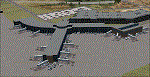
This airport was made using Airport Design Editor, Google Sketchup, and Instant Scenery 2. Albany International Airport, Is an airport located near Albany, New York. The airport has scheduled airline flights. Almost all of the buildings are custom made with photo textures to make it closer to real life. At the main terminal, I added more gates and put moving jetways. The gates have assigned parking codes. There is a parking lot next to the terminal full of cars. I put the airport access road in between the parking lot and the terminal. At the southwest ramp, I put hangars and some you can taxi inside of. If you choose to start off from the southwest DOCK gate, You will start off inside the Million Air Aviation FBO. I also put static aircraft on the ramp too. To the northwest, I put the New York Police hangar. You can start off inside this hangar by choosing the Northwest DOCK gate. Taxiing into or starting off inside a hangar will not cause a crash unless you touch the sides. To the Northeast, I put the cargo terminal with trucks. At the cargo section, I put three FedEx Cessna Caravans. I also put the control tower and the buildings. Tower views are from the roof of the control tower. To the southeast, I put small hangars and the Air National Guard Section with UH-60 helicopters. I extended runway 1/19 to the correct length of 8,500 feet. I also put red, blue, green, and purple Cessna 172s in different places around the airport. There will be more objects if your scenery complexity is set to normal (such as jetways, aircraft, and vehicles). This was all made based on Google Earth Imagery and Bing Maps. There are no night textures for the buildings. This will be added in a future version. An installer program is included to install the airport for you. There will be more versions of this that include night textures and static business jets. This is for Flight Simulator X only. By Tyler Lawrence.
| Filename: | Albany_International_Airport_KALB_Albany_New_York.zip |
| License: | Freeware |
| Added: | 2nd June 2012, 08:14:12 |
| Downloads: | 4,349 |
| Author: | Tyler Lawrence |
| Size: | 47.69 MB |
| Category: Flight Simulator X - AFCAD Files | |
| EHAM - Amsterdam Airport Schiphol - Amsterdam, The Netherlands |
|
Images related to this file:
File Description:
Amsterdam Airport Schiphol is the Netherlands' main international airport, located 20 minutes (9.1 km; 5.6 mi) southwest of Amsterdam, in the municipality of Haarlemmermeer.
The airport is the primary hub for KLM as well as for Arkefly, Corendon Dutch Airlines, Martinair and Transavia. The airport also serves as a European hub for Delta Air Lines and as a base for Vueling. Schiphol is considered to be an Airport City.
Using ADEx 1.50, aeronautical maps and Google Earth the default AFCAD has been completely reworked to reflect today's situation including gate assignments.
Schiphol has a complex runway lay-out and usage and FSX may assign a runway that in real life is not used as such. I have implemented Jim Vile's crosswind runway technique to open all runways. Now the pilot can decide which runway to use but AI aircraft may show unrealistic behaviour. Only tailored AFCADs taking into account different wind directions will solve this but that is beyond the scope of this project.
Jetways appear based on your 'scenery complexity' settings.
| Filename: | EHAM__Amsterdam_Airport_Schiphol__Amsterdam_The_Ne.zip |
| License: | Freeware |
| Added: | 2nd November 2012, 19:54:24 |
| Downloads: | 2,202 |
| Author: | Menno C. Robert |
| Size: | 3.86 MB |


© 2001-2026 AVSIM Online
All Rights Reserved
Privacy Policy |