
Where Flight Simulation Enthusiasts Gather from Around the World!
AVSIM Library - Search Results

| Category: Flight Simulator X - Scenery | |
| LEMG-X-JVX |

|
Images related to this file:
File Description:

LEMG, Malaga, Spain.
Hello Flightsim friends.
This is an reworked ADE [Scruffy Duck] scenery of LEMG, Malaga Airport, Spain, for FSX
It was annoying to find that almost everything was wrong at LEMG in FSX.
Runway numbers, Exits, Entrances to the Apron etc.
I've tried to get all the runways, turn offs and runway signs in their correct positions.
The Runways are now: 13 and 31 instead of 14 and 32
-crows next to entrance D13 at the NW end of the runway 13 and south of the airport almost halfways.-Seagulls next to the shore line.-Fishingships, a Cruiseliner and a freighter at sea.-Oil tanks near Apron entrance D2 [extremely dense setting]- Some military objects on the MIL part of the airport plus extra buildings.-Somewhere in the mountains there should be Eagles I know they are there but heck, I didn't yet see them my self :-) The MAR approach should lead you past them though]
AVSIM upload only
| Filename: | LEMGXJVX.zip |
| License: | Freeware, limited distribution |
| Added: | 1st April 2010, 02:21:00 |
| Downloads: | 1,728 |
| Author: | Joost Visser |
| Size: | 435.24 KB |
| Category: Flight Simulator X - Scenery | |
| RAF Ludford Magna |
|
File Description:
RAF Ludford Magna was a Royal Air Force airfield operated by Bomber Command during the Second World War and the Cold War. The station lay on agricultural farmland immediately south of the village of Ludford, Lincolnshire and was sited 21.4miles (34.4 km) north east of the county town of Lincoln, Lincolnshire, England. The remains of the station can be seen from the B1225 Caistor High Street, and the long distance footpath the Viking Way passes right next to the eastern perimeter track.
It was the highest bomber airfield in England at 428 feet (130 m) above sea level, and cost £803,000 to build.
All credit must go to the following authors without whose work I could not have made this scenery; all credit for the models contained in it is theirs I merely placed it. If you don't have any of the third party addons you will only see the runway and peri track: Ted Andrews - Ian Pearson - Mike Hudson
| Filename: | RAF_Ludford_Magna.zip |
| License: | Freeware |
| Added: | 5th October 2015, 20:07:32 |
| Downloads: | 339 |
| Author: | Terry Boissel |
| Size: | 20.9 KB |
| Category: Flight Simulator X - Scenery | |
| Denver International Airport |
|
File Description:
This is a redesign of the default FSX Denver International Airport. Here are the changes which have been made: Several jetways have been added throughout the airport; Concourse B, the United Airlines terminal, has been expanded, and the United Express commuter terminal has been added; numerous fuel trucks have been added to make a total of 30 in order to service aircraft faster; The vehicle roads have been rebuilt so as not to access taxiways, which can cause aircraft backups; the crosswind runways have been activated, ultimately allowing all six runways to be used simultaneously; accurate parking assignments have been created for AI aircraft; and settings have been changed so that as long as scenery complexity in FSX is set at Normal or higher, all of the jetways will display. In addition, as an option, a flyover of the completed airport has been created using the FSX Mission Editor. Please consult the Readme file for more information.
| Filename: | Denver_International_Airport.zip |
| License: | Freeware, limited distribution |
| Added: | 31st December 2007, 21:49:35 |
| Downloads: | 10,983 |
| Author: | Patrick Finch |
| Size: | 3.47 MB |
| Category: Flight Simulator X - Scenery | |
| LEMG Malaga (Costa del Sol) Airport - Spain - 2012 |
|
Images related to this file:
File Description:
Malaga LEMG (Costa del Sol) Airport, Spain, 2012. Spain's busiest airort. This scenery attempts to recreate as closely as possible the airport in Malaga, AGP / LEMG in FSX. Includes the new runway 12-30 to enter into service on May 3, 2012. It also contains two variants, one with south configuration, and another with north. This scenario is made with ADE, Airport desing editor, basing on the AENA charts and images of Google Earth.
------------------------------
Este escenario intenta recrear lo mas fielmente posible el aeropuerto de Malaga Costa Del Sol, AGP/LEMG en FSX.
Incluye la nueva pista de vuelos 12-30 que entrara en servicio el 3 de Mayo de 2012.
Ademas contiene dos variantes, una con configuración sur, y otro con norte.
Este escenario esta realizado con ADE, Airport desing editor, basandome en las cartas de navegación de AENA y imagenes de Google Earth.
| Filename: | LEMG_Malaga_Costa_del_Sol_Airport__Spain__2012.zip |
| License: | Freeware, limited distribution |
| Added: | 18th March 2012, 18:33:13 |
| Downloads: | 2,484 |
| Author: | Luis Lopez |
| Size: | 1.6 MB |
| Category: Flight Simulator X - Scenery | |
| LFAW - Villerupt-Errouville |
|
Images related to this file:
File Description:
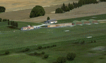
This scenery represents the field of Villerupt-Errouville LFAW where the flying club is based "Nord Lorraine" located in the north of the department 54 a few kilometers from Belgium and Luxembourg borders and the model aircraft club. The buildings have been modeled in GMAX, static devices are also present. Finally the autogen was placed on the same perimeter as the slab photo realistic.
********************************
Cette scene represente le terrain de Villerupt-Errouville LFAW qui est base l'aeroclub Nord Lorraine situe dans le nord du departement 54 a quelques kilometres de la Belgique et du Luxembourg ainsi qu'un club d'aeromodelisme et parachutisme.
L'ensemble des batiments ont ete modelises sous GMAX, des appareils statiques sont egalement presents.
Une dalle photo realiste a ete inseree mais je vous conseille de continuer le sol photo avec des logiciels comme fsEarthTile.
Enfin de l'autogen a ete place sur le meme perimetre que la dalle photo realiste.
| Filename: | LFAW__VilleruptErrouville.zip |
| License: | Freeware, limited distribution |
| Added: | 3rd January 2012, 11:24:06 |
| Downloads: | 1,864 |
| Author: | Alexandre Remy FAF010 |
| Size: | 17.72 MB |
| Category: Flight Simulator X - Scenery | |
| KMRY - Monterey Regional Airport - California, USA |
|
Images related to this file:
File Description:
FSX Scenery - Monterey Regional Airport (IATA: MRY, ICAO: KMRY, FAA LID: MRY) is three miles (5 km) southeast of Monterey, in Monterey County, California, USA. It was created in 1936 and was known as the Monterey Peninsula Airport until the board of directors renamed it on September 14, 2011. The airport is owned by the several municipalities that make up the Monterey Peninsula Airport District. It is a public entity and its five-member board of directors is publicly elected. The airport has its origins with flights from the polo field of the Hotel Del Monte in 1910. In 1941, local communities formed the Monterey Peninsula Airport District and acquired land to build an airport. World War II intervened, and the U.S. Navy leased the land, opening Naval Auxiliary Air Station Monterey on May 23, 1943. The Navy remained at the airport until 1972. For your flying pleasure by John B. Loney, Jr.
| Filename: | KMRY__Monterey_Regional_Airport__California_USA.zip |
| License: | Freeware, limited distribution |
| Added: | 5th June 2016, 12:11:50 |
| Downloads: | 594 |
| Author: | John B. Loney, Jr. |
| Size: | 39.38 MB |
| Category: Flight Simulator X - Scenery | |
| YPTN RAAF Tindal, Australia |
|
File Description:
Ants Aussie Airports Vol 5 : RAAF Tindal is a military base about 290kms south east of Darwin near the town of Katherine in Australia's Northern Territory. Tindal is a major front-line operational air base and home to No. 75 Squadron Air Combat Group (F/A-18). There is also a civilian apron in the north west corner of the airfield. This scenery contains photoreal ground textures and these are designed to blend in with the payware FTX textures (available from www.fullterrain.com). It is therefore recommended that you have the FTX textures installed if you wish to see this airfield at its best. I have tried to make this airfield as accurate as possible although as Tindal is a military base there aren't a lot of photos available so a lot of the hangars are "educated guesses". Almost all of the models have been custom made with the use of library objects kept to the minimum.
| Filename: | YPTN_RAAF_Tindal_Australia.zip |
| License: | Freeware, limited distribution |
| Added: | 6th January 2009, 13:49:54 |
| Downloads: | 3,636 |
| Author: | Anthony Lynch |
| Size: | 30.62 MB |
| Category: Flight Simulator X - Scenery | |
| BATANES X v1.0 |
|
Images related to this file:
File Description:
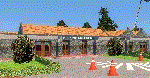
BATANES X v1.0
Archive includes the Photoreal Scenery of Batanes Island, Itbayat Island and its airports
(SLOPING RUNWAY NOT INCLUDED!)
Basco Airport (IATA: BSO, ICAO: RPUO) is an airport serving the province of Batanes in the Philippines. It is located in the provincial capital, Basco, and is one of two airports in the Batanes Islands, the other being Itbayat Airport. The airport is classified as a Class 2 principal (minor domestic) airport by
the Civil Aviation Authority of the Philippines (CAAP), a body of the Department of Transportation and Communications that is responsible for the operations of not only this airport but also of all other airports in the Philippines
except the major international airports.
Jorge Abad Airport (ICAO: RPLT), also known as Itbayat Airport, is an airport serving the island of Itbayat, the largest island in the province of Batanes, Philippines. The province's only other airport, Basco Airport, is located in the provincial capital, Basco, on Batan Island.
| Filename: | BATANES_X_v10.zip |
| License: | Freeware, limited distribution |
| Added: | 24th January 2019, 17:49:19 |
| Downloads: | 1,694 |
| Author: | Aeron M. Tumanut |
| Size: | 28.06 MB |
| Category: Flight Simulator X - Scenery | |
| Default Military Airbase Upgrade |
|
File Description:
FSX Default military and naval airfields rarely have anything other than a fuel box and I've decided to upgrade them with parking for military combat and cargo aircraft and fuel trucks. Fuel boxes are fine for GA airports but for larger airports they don't make sense. Plus the arrival of the fuel truck to service an AI aircraft prior to clearance adds some realism. There are quite a number of good sceneries already available but they often don't include fuel trucks and aren't always AI-friendly. A new initiative by airsource.us to include a militarycontract division has inspired me to share some of my upgrades with fellow airsource.us pilots. The airfields include: EGQL, EGQS, EGUN, EGVA, EGVN, EHLW, ETAD, ETAR, ETNH, LCRA, LEGT, LFOA, LFOE, LFRJ, LIPA, LLOV, LLRD, LLRM, OETB, OJ40, OJAM, LPLA, KFFO, KNTU, KOFF, KDYS, KHOP, KPOB, KBAD, KLRF, KLUF, KVBG, KWRI (added fuel truck and taxiway lights to Jim Cook's KWRI scenery). I highly recommend KDOV by JB Loney.
| Filename: | Default_Military_Airbase_Upgrade.zip |
| License: | Freeware |
| Added: | 3rd June 2018, 17:44:49 |
| Downloads: | 1,443 |
| Author: | Barry Woodward |
| Size: | 196.26 KB |
| Category: Flight Simulator X - Scenery | |
| Benina International Airport HLLB 2010 V.1 FS2004/FSX-sp2 |
|
File Description:
Benina International Scenery. located in the town of Benina, 19 km east of Benghazi, from which it takes its name. The airport is operated by the Civil Aviation and Meteorology Bureau of Libya and is the second largest in the country after Tripoli International Airport. Benina International is also the secondary hub of both Buraq Air and flag carrier, Libyan Airlines. During World War II, the airport was used by the United States Army Air Force Ninth Air Force during the Eastern Desert Campaign. Known as Soluch Airfield, it was used by the 376th Bombardment Group, which flew B-24 Liberator heavy bombers from the airfield between 22 February & 6 April 1943. Once the combat units moved west, it was used as a logistics hub by Air Transport Command. It functioned as a stopover en-route to Payne Field near Cairo or to Mellaha Field near Tripoli on the North African Cairo-Dakar transport route for cargo, transiting aircraft and personnel.
| Filename: | Benina_International_Airport_HLLB_2010_V1_FS2004FS.zip |
| License: | Freeware |
| Added: | 28th November 2010, 19:49:42 |
| Downloads: | 4,303 |
| Author: | Emad Qtiefan |
| Size: | 10.79 MB |


© 2001-2026 AVSIM Online
All Rights Reserved
Privacy Policy |