
Where Flight Simulation Enthusiasts Gather from Around the World!
AVSIM Library - Search Results

| Category: Flight Simulator X - AFCAD Files | |
| PAOT - Wien Meml - Kotzebue, Alaska |

|
Images related to this file:
File Description:
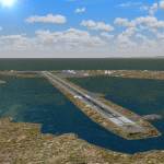
This AFCAD of the airport Wien Meml - Kotzebue (PAOT), Alaska, fixes some issues for Scenery Solution's UTX Alaska users who want to use mesh and texture resolutions better than 38 m and 1 m, respectively. Unfortunately this discloses some additional problems with lagoons surrounding runway 09/27. Some of the ponds had been elevated over apron level, the fence Microsoft had drawn around the airport ran through (elevated) water and so on. Runway 27 has no direct connection to the mainland like it is realized by UTX and furthermore a lot of water polygons (including the lagoons) had 'forgotten' shore line vectors. Included corrections are: fixed main waterpolygons around the airport (according to Google Maps), fixed airport layout, including aprons, GA parking, additional airport buildings (default FSX objects), fixed Runway designators (now 09/27 resp. 18/36 instead of 08/26 and 17/37, Nov. 2013), added shoreline vectors (compatible to UTX textures) and some more.
Again, THIS AFCAD IS INTENDED FOR USERS OF UTX ALASKA ONLY and will likely look horrible in other environments as it partially amends missing features only.
| Filename: | PAOT__Wien_Meml__Kotzebue_Alaska.zip |
| License: | Freeware, limited distribution |
| Added: | 3rd February 2014, 14:30:10 |
| Downloads: | 410 |
| Author: | Axel Birsul |
| Size: | 1.09 MB |
| Category: Flight Simulator X - Scenery | |
| Neujellingsdorf/Fehmarn, Germany ** Version 1.2 ** |
|
Images related to this file:
File Description:
This Version is only a small update wich makes the scenery a bit more realistic.
This small private Airstrip is situated on the island of Fehmarn in nothern Germany. It does not exist in the standard FSX. Because this strip does'nt have an ICAO-code I created one: ED01. Under this code you can find the airstrip in the FSX airport list.
I addited a photo-based background featuring all four seasons, although this airstrip is closed during the winter in real life.
During the summerseason it is mainly used for sightseeing trips over Fehmarn with a C172 offered by the one-aircraft-company "Fehmarn Air" (http://www.fehmarn-air.de/).
Libraries needed to install first if not already installed:
http://library.avsim.net/download.php?DLID=192454
B: FlightPort Dynamic Library_FSX for a lot of other objects
http://www.flightport.de/libraries/flightport-library/
C: FS_Piloten_Objektlibary
http://www.fs-piloten.de/thread.php?threadid=1063&sid=d07a13eb9fcb4469700df5c3de1fd6c1
| Filename: | NeujellingsdorfFehmarn_Germany__Version_12_.zip |
| License: | Freeware |
| Added: | 16th July 2016, 18:01:47 |
| Downloads: | 784 |
| Author: | Wolfgang Allers |
| Size: | 27.05 MB |
| Category: Flight Simulator X - Scenery | |
| Essweiler Gliderfield, Germany Ver. 1.0 |
|
Images related to this file:
File Description:
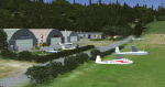
Essweiler is actually a classic glider field, but also engine aircrafts up to 2t are approved.
The field is situated in the region Rheinland-Pfalz/Germany at a hillside eastly of the village Essweiler, approximately 7,5 nautical miles north of the well known US-Airbase Ramstein.
The environment of the airfield is adapted by land classes. Surrounding villages and major roads are initially implemented.
As well the field is covered by a photo background, which includes four different images , each for one of the four seasons: spring, summer, autumn and winter. The buildings in this scenery should match quite good the originals. But also a lot of objects from three very popular freeware libraries are used.
If these libraries are not installed, many objects are not visible!
The following libraries are used:
1. FS-Piloten_Objektlibrary:
http://www.fs-piloten.de/thread.php?threadid=1063
2. FSX_FlightPortLib
http://www.flightport.de/libraries/flightport-library/
3: 3d People Library
http://library.avsim.net/download.php?DLID=192454
| Filename: | Essweiler_Gliderfield_Germany_Ver_10.zip |
| License: | Freeware |
| Added: | 29th November 2016, 19:15:50 |
| Downloads: | 606 |
| Author: | Wolfgang Allers |
| Size: | 168.18 MB |
| Category: Flight Simulator X - Scenery | |
| Steeple Morden |
|
File Description:
This FSX scenery package is for Former RAF Steeple Morden, USAAF Station No. 122. It includes the main airfield and 14 of the outlying sites
that housed all of the inhabitants. Built in 1940 , originally a grass satellite field of Bassingbourn, Steeple Morden first accommodated the RAF No. 11 and No. 17 OTU (Operational Training Unit), flying Vickers Wellingtons and Bristol Blenheims respectively. The RAF used the airfield from 1940 to July 9th of 1943.
In July of 1943, the RAF turned the base over to the 355th Fighter Group of the 8th USAAF and concrete runways and hard stands were added.
The 355th were famous for destroying more enemy aircraft on the ground than any other unit in the USAAF.
They were dubbed, "The Steeple Morden Strafers" and were comprised of the 354th (WR), 357th (OS) and 358th (YF) Fighter Squadrons.
Study of the site plans and other information revealed that RAF Steeple Morden was very much interwoven with the village of Litlington, Cambridgeshire .
The base may have well be called RAF Litlington instead of Steeple Morden.
| Filename: | Steeple_Morden.zip |
| License: | Freeware |
| Added: | 25th June 2016, 23:51:18 |
| Downloads: | 336 |
| Author: | Terry Flemming |
| Size: | 83.9 MB |
| Category: Flight Simulator X - Scenery | |
| LOSM Mauterndorf, Austria Version1 for FSX and P3D_v3/v4 |
|
Images related to this file:
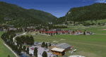
File Description: The Airfield Mauterndorf is the highest situated airfield in Austria: 3642 ft or 1110 meters above sealevel.
This Airfield is very common for glider flyers due to the usually good upwinds for flying in the alps. But also small engine aircrafts are approved. Link:
http://www.losm.at/index.php/losm.html The environment of the airfield is adapted by landclasses. Mauterndorf and the surrounding villages, valleys and major roads are included.
As well the field is covered by a photo background, wich includes four different images , each for one of the four seasons spring, summer, autum and winter. The buildings in this scenery are designed mainly new by myself, but also a lot of objects from two very popular freeware libraries.
If these libraries are not installed, many objects are not visible! The following libraries are used: 1. FS-Piloten_Objektlibrary:
http://www.fs-piloten.de/thread.php?threadid=10632 2.FSX_FlightPortLib:
http://www.flightport.de/libraries/flightport-library/ This senery works also with Austria Professional HD.
| Filename: | LOSM_Mauterndorf_Austria_Version1_for_FSX_and_P3D_.zip |
| License: | Freeware |
| Added: | 28th August 2017, 20:01:00 |
| Downloads: | 482 |
| Author: | Wolfgang Allers |
| Size: | 249.9 MB |
| Category: Flight Simulator X - Original Aircraft | |
| Cessna Citation Sovereign |
|
File Description:
This VJPL production of the Cessna Citation Sovereign comes fully loaded with all the features
one could expect of a 16 million dollar business jet Custom designed to be frame rate friendly using
a "Lite" switch that during use in high density scenery hides the passenger cabin in an instant
and reduces the load on the computer, further this model performs better in the VC than with the 2D panel in view, interior appointments include a high detail passenger cabin with running water in the lavatory and a flushing toilet, all tables extend for use and include wine for the animated passenger, a functional bar, an operational computer and all cabin doors including closet open and close and leather seating, animated copilot, fully click able Virtual Cockpit animated down to the visors, and custom cabin lighting, the exterior has all control surfaces and exits animated and thrust reverser's. PDF documents for this model include performance data, flight instructions and FMC operations manual, My thanks to Glenn Copeland for the computer display, the good Friar and all those who helped with specifications and layout.
| Filename: | Cessna_Citation_Sovereign.zip |
| License: | Freeware |
| Added: | 11th May 2007, 14:39:41 |
| Downloads: | 27,066 |
| Author: | Chuck Jodry VJPL WestcoastATC.com |
| Size: | 9.8 MB |
| Category: Flight Simulator X - Scenery | |
| KOAK - Metro Oakland Intl |
|
Images related to this file:
File Description:
This is a reasonably accurate and up-to-date version of Metro Oakland Intl airport with two optional files and made only for FSX users, do not use in P3D: There is one version with the Crosswind runways operating where all 4 runways will be used for takeoff/landing and one version as the default airport runway operation.
This update removes the "jfk jetways" mainly for those who have had issues installing the textures to get these Jetway to display, these have now been replaced by Jetway extensions that are more like the real world, Terminals 1 and 2 rebuilt with something better than the stock airport, assigned parking as per their website with extra parking, the Fedex and UPS ramps and buildings replaced, all taxiways and taxi signs updated to the latest charts, support vehicle roads rebuilt, extra fuel trucks, Helipad added to the GA apron and many other scenery improvements and objects added, airport views are from inside the control tower (when in tower view) please view the readme before installation.
| Filename: | KOAK__Metro_Oakland_Intl.zip |
| License: | Freeware, limited distribution |
| Added: | 29th January 2020, 01:05:10 |
| Downloads: | 44,394 |
| Author: | Ray Smith |
| Size: | 8.78 MB |
| Category: Flight Simulator X - Utilities | |
| TweakFS Utility Collection for FSX |
|
Images related to this file:
File Description:
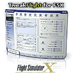
The TweakFS Utility Collection for FSX includes the following: TweakFlight for FSX (Flight File Editor), TweakFPS for FSX (Scenery Mode Editor), TweakLoad for FSX (Aircraft Loading Editor), TweakAircraft for FSX (Aircraft Config File Editor) and the TweakFS Explorer (File Manager for FSX). As a group these five unique applications each have a different scope and purpose, but come with a consistent look and feel. Between them they can handle well over 1000 settings and variables in FSX. They make fine-tuning your fsx.CFG, Aircraft.CFG and FLT (saved flight) files a breeze, providing functionality, speed and ease of use that goes well beyond what can be done by manually editing the files. All the tools are designed with one important principle in mind - a one-click "restore from backup" function. This means an adjustment can be applied with complete impunity and there is always the "bailout" option if there are any "funnies", the one justifiable concern that holds many back from making changes to their FS setup. All come as free 30-Day demos.
| Filename: | TweakFS_Utility_Collection_for_FSX.zip |
| License: | Shareware, time limited |
| Added: | 5th March 2010, 10:51:29 |
| Downloads: | 2,107 |
| Author: | TweakFS (Fermin Fernandez) |
| Size: | 44.1 MB |
| Category: Flight Simulator X - AFCAD Files | |
| EIDW - Dublin Intl - Dublin, Ireland v1.1 |
|
Images related to this file:
File Description:
With enhanced jetway appearance depending on your scenery complexity settings!
EIDW - Dublin Intl - Dublin, Ireland Dublin Airport is the headquarters of Ireland's flag carrier (Aer Lingus), Europe's largest low-cost carrier (Ryanair) and Ireland's regional airline (Aer Arann). Ireland's fourth airline, CityJet, operates flights from the airport. The current Terminal 1 building originally opened in 1972, and was initially designed to handle five million passengers per year. In October 2007, a new pier was opened to the north of terminal 1. This pier caters for the majority of Ryanair flights. In 2009, a new extension featuring new food and retail outlets was added to the side of Terminal 1. Terminal 2 is a 75,000 m2 (810,000 sq ft) terminal and pier (pier E) which provides 19 air bridges for aircraft and is capable of handling 15 million passengers annually, thereby allowing the airport to handle 35 million passengers a year. Using ADEx 1.50, aeronautical maps and Google Earth (2009) all these changes have been built into the default FSX airport.
| Filename: | EIDW__Dublin_Intl__Dublin_Ireland_v11.zip |
| License: | Freeware |
| Added: | 18th October 2012, 15:17:06 |
| Downloads: | 3,275 |
| Author: | Menno C. Robert |
| Size: | 5 MB |
| Category: Flight Simulator X - Scenery | |
| OMDB - Dubai Intl Airport - Dubai, UAE |
|
Images related to this file:
File Description:
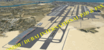
OMDB - GPS-accurate scenery based om Google maps and the FlyTampa base AFCAD (default FSX/P3D AFCAD). Every Runway, Gate and taxiway is right on the actual spot with a very small error margin.
Two types of Jetway structures used for Terminals 1 & 3, and are made by Victor Nauta. The new Concourse-D terminal for airlines other than Emirates is now added, with a basic terminal building design using Google Sketchup for better visuals.
WHAT'S NEW:
- The new Concourse-D terminal east of the existing Terminal 1. Terminal replaces the old Emirates Sky Cargo terminal, and servers all other visiting airlines.
- Apron Q used by FlyDubai is added.
- Extra runway rapid exits added.
- Extra parking gates in the C apron according to the latest charts.
- Extra Taxiways connecting to the runways according to the charts.
- Ground marking for Gates and taxiways! (A, B, C, D and F aprons)
- Aprons G and S are added according to the latest Airport layout and charts.
| Filename: | OMDB__Dubai_Intl_Airport__Dubai_UAE.zip |
| License: | Freeware, limited distribution |
| Added: | 25th July 2016, 20:17:21 |
| Downloads: | 11,002 |
| Author: | Ahmed Abdessalam |
| Size: | 4.16 MB |


© 2001-2026 AVSIM Online
All Rights Reserved
Privacy Policy |