
Where Flight Simulation Enthusiasts Gather from Around the World!
AVSIM Library - Search Results

| Category: Flight Simulator X - AI Flight Plans | |
| St.Barth Commuter Flight Plans for AI Traffic - July 2023 |

|
Images related to this file:
File Description:

St.Barth Commuter Flight Schedule for AI Traffic with July 2023 plans. By Alexandre Alves
| Filename: | StBarth_Commuter_Flight_Plans_for_AI_Traffic__July.zip |
| License: | Freeware |
| Added: | 24th July 2023, 20:01:10 |
| Downloads: | 149 |
| Author: | Alexandre Alves |
| Size: | 4.23 KB |
| Category: Flight Simulator X - Panels | |
| RDP AutoPilot Gauge and Mods for Just Flight HS748 |
|
Images related to this file:
File Description:

This project was born out of necessity to improve a very fun and an amazing aircraft, the Just Flight HS748. The objectives were to depict out of sight, hard to reach or sensitive information in an easier to read alternative. The lower panel is not based on any real panel or gauge, it was simply designed as so by me for easier reading of pertinent flight data. Whilst the top panel, is designed to replicate as close as possible, including how it functions, the 3D panel available on Just Flight HS748.
These include:
+ Autopilot and its various dependencies.
+ Elevator, Aileron and Rudder Trim, and their information.
+ NAV1 and NAV 2, with a DME (Only available for NAV1).
+ Flight Director Trim.
+ Outside and Total Air Temperature in Celsius and Fahrenheit.
+ Aircraft Heading and Vertical Speed ft/min.
+ Autopilot Vertical Speed numbers from the Autpilot VS wheel in Degrees and ft/min.
+ Pilot Input Heading and Course (Only for NAV1).
+ KOHLSMAN Setting, or Barometer in Millibars or inHg.
+ Left and Right Pitot switches.
+ GPS Icon for easier access.
+ Radios Icon.
+ Nav and GPS switch.
+ Indicated Aircraft Airspeed.
+ Indicated Altitude(Feets).
| Filename: | RDP_AutoPilot_Gauge_and_Mods_for_Just_Flight_HS748.zip |
| License: | Freeware |
| Added: | 26th February 2017, 08:07:59 |
| Downloads: | 405 |
| Author: | Ricardo de Paula |
| Size: | 1.31 MB |
| Category: Flight Simulator X - Aircraft Repaints, Textures and Modifications | |
| Alternative Flight Dynamics for Rob Richardsons 3 Hornet models |
|
File Description:
Alternative Flight Dynamics for Rob Richardson's 3 Dh Hornet models with power corrected, fuel burn set to give correct range and engines no longer explode. Rob Richardson's Hornet F3, Sea Hornet F20 and Sea Hornet NF21 Required.
| Filename: | Alternative_Flight_Dynamics_for_Rob_Richardsons_3_.zip |
| License: | Freeware |
| Added: | 1st September 2010, 21:34:33 |
| Downloads: | 186 |
| Author: | Rich Ruscoe |
| Size: | 27.15 KB |
| Category: Flight Simulator X - Miscellaneous Files | |
| RealAir Turbine Duke Checklists for EFB Aivlasoft Flight Planner |
|
File Description:
This xml file is a series of checklists for use with the Aivlasoft Electronic Flight Bag for the RealAir Turbine Duke V2.
It is reproduced from the original RealAir checklists.
| Filename: | RealAir_Turbine_Duke_Checklists_for_EFB_Aivlasoft_.zip |
| License: | Freeware |
| Added: | 13th March 2015, 13:29:19 |
| Downloads: | 231 |
| Author: | Mario Bergeron |
| Size: | 4.15 KB |
| Category: Flight Simulator X - AI Flight Plans | |
| Azul Conecta Flight Plans for AI Traffic July 2023 |
|
Images related to this file:
File Description:

July 2023 Schedule from Azul Conecta to AI Traffic by Alexandre Alves.
| Filename: | Azul_Conecta_Flight_Plans_for_AI_Traffic_July_2023.zip |
| License: | Freeware |
| Added: | 24th July 2023, 20:00:13 |
| Downloads: | 208 |
| Author: | Alexandre Alves |
| Size: | 4.99 KB |
| Category: Flight Simulator X - AI Flight Plans | |
| St.Barth Commuter Flight Plans for AI Traffic - January 2025 |
|
Images related to this file:
File Description:

St.Barth Commuter Flight Schedule for AI Traffic with January 2025 flightplans. See jcai.dk for repaints! By Alexandre Alves
| Filename: | StBarth_Commuter_Flight_Plans_for_AI_Traffic__Janu.zip |
| License: | Freeware |
| Added: | 18th January 2025, 01:21:11 |
| Downloads: | 77 |
| Author: | Alexandre Alves |
| Size: | 4.25 KB |
| Category: Flight Simulator X - Gauges | |
| TCAS and Radar for Flight Instrument Panels FS9 Compatible |
|
Images related to this file:
File Description:

TCAS (traffic collision avoidance system) shows aircraft in the vicinity of
your own aircraft and warns when other aircraft are in close proximity or when
they their projected paths cross your path within 40 seconds.
TCAS features:
- It shows AI (artificial intelligence) aircraft
- It shows IVAO and VATSIM traffic when connected to IVAO or VATSIM networks
- It shows traffic on all altitudes
- It shows relative altitude and climbing/descending indication
- It shows intruders and gives proximity alerts (traffic advisories, TA)
- It shows traffic on the ground
- It does not give resolution advisories (RA)
- It shows the callsigns of the 9 aircraft closest to your aircraft
- Range is adjustable from 2 to 40 nm
- Display can be dimmed
- Take a screenshot anytime
(due to the size limit, the thumbnail picture looks a bit blurred. In the zip file, a screenshot of actual resolution (320x240) is included.
| Filename: | TCAS_and_Radar_for_Flight_Instrument_Panels_FS9_Co.zip |
| License: | Freeware |
| Added: | 5th July 2011, 04:09:05 |
| Downloads: | 2,395 |
| Author: | Emile van Gerwen |
| Size: | 69.8 KB |
| Category: Flight Simulator X - Scenery | |
| Helgoland and Airports |
|
Images related to this file:
File Description:
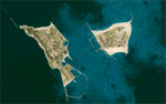
This project rebuilds Germany's Helgoland, upgrades the Duene (EDXH) and Wangerooge (EDWG) airports to be fully AI compliant, and includes AI flight plans between EDXH and EDWG to bring the airports to life. Accurate shorelines, as well as corrected landclass and waterclass, are provided. Updates were created or rebuilt in a manner which carefully aligned airport data with current satellite imagery. Scenery was created using Airport Design Editor X v1.61.5273, SBuilderX 3.13, and the FSX Object Placement Tool. Scenery objects were added and modified from stock FSX scenery to resemble as closely as possible the actual airports.
| Filename: | Helgoland_and_Airports.zip |
| License: | Freeware |
| Added: | 16th June 2014, 06:02:08 |
| Downloads: | 2,827 |
| Author: | Carlyle Sharpe |
| Size: | 1.65 MB |
| Category: Flight Simulator X - Scenery | |
| KECG - CGAS Elizabeth City - Elizabeth City, NC |
|
File Description:
Here is an improved version of the stock CGAS Elizabeth City. I adjusted and added aprons, roads and
taxiways to more closely match real life. Aprons were moved to align with Ultimate Terrain coastlines.
I replaced nearly every default building and added additional buildings. I added parking lots and static
vehicles, aircraft, lightpoles, water tower, and other filler objects.
The third file, KECG_docks_JC.bgl adds two wharfs with seaplane docks attached and also some buoys. These
are placed for Ultimate Terrain but should work ok with default terrain. If not, just remove the file.
| Filename: | KECG__CGAS_Elizabeth_City__Elizabeth_City_NC.zip |
| License: | Freeware |
| Added: | 23rd February 2009, 13:39:52 |
| Downloads: | 1,761 |
| Author: | Jim Cook |
| Size: | 13.93 KB |
| Category: Flight Simulator X - Scenery | |
| Mesh-South America MeSA_G04 |
|
File Description:
FSX Mesh South America Project:
This terrain mesh file is a part of a whole project covering all the Continent
of South America and some islands, divided in tiles identified in a map by its
column (letters) and rows (numbers).
Those files were multi-LOD compiled from 90m SRTM2 source data, reprocessed
with 3DEM to remove voids and spikes, providing a 76.4m (LOD9) horizontal
resolution topography intended for use only in FSX updated with SP1.
Although not well documented, to improve performance, the updated FSX loads DEM
files in threads and only the closer terrain (about 5-10 NM from the point of view)
is rendered in high detail, while at far distances FSX shows up its default low
resolution mesh, when there is not a third part terrain mesh compiled in all
others intermediate level of details (multi-LOD).
THIS FILE:
FSX_MeSA_G04 (Column G x Row 04)
covers the area inside the boundaries:
N = 0º 0' S; S = 5º 37.5' S;
W = 45º 0' W; E = 37º 30' W;
AUTHORS:
Hely Heck Junior - Magrao ( [email protected] )
and Jose Lobo ( [email protected] )
TerraBrasilis: www.terra-brasilis.org
| Filename: | MeshSouth_America_MeSA_G04.zip |
| License: | Freeware |
| Added: | 15th June 2007, 00:10:58 |
| Downloads: | 867 |
| Author: | Hely Heck Jr. and José Lôbo |
| Size: | 35.9 MB |
© 2001-2026 AVSIM Online
All Rights Reserved
Privacy Policy |