
Where Flight Simulation Enthusiasts Gather from Around the World!
AVSIM Library - Search Results

| Category: Flight Simulator X - Scenery | |
| South America Mesh Scenery MeshX_A9 |

|
File Description:
Mesh terrain scenery for the whole continental South America, based on SRTM 90m
dem geotiff files resampled to 76 meter of horizontal resolution (LOD 9). The new files have
improved the vertical resolution from 16m to 10m, resulting in more details
and accuracy over previous versions. There are 50 files, compatible with FS 9
and FS X, identified in a map by column letter and line number, covering the
contiguous countries and states. Boundaries: N = 33º 45' S; S = 39º 22.5' S;
E = 71º 15' W; W = 78º 45' W.
| Filename: | South_America_Mesh_Scenery_MeshX_A9.zip |
| License: | Freeware |
| Added: | 30th October 2006, 00:33:36 |
| Downloads: | 2,132 |
| Author: | Oséas Dourado and José Lôbo |
| Size: | 12.6 MB |
| Category: Flight Simulator X - Scenery | |
| South America Mesh Scenery MeshX_A10 |
|
File Description:
Mesh terrain scenery for the whole continental South America, based on SRTM 90m
dem geotiff files resampled to 76 meter of horizontal resolution (LOD 9). The new files have
improved the vertical resolution from 16m to 10m, resulting in more details
and accuracy over previous versions. There are 50 files, compatible with FS 9
and FS X, identified in a map by column letter and line number, covering the
contiguous countries and states. Boundaries: N = 39º 22.5' S; S = 45º 0' S;
E = 71º 15' W; W = 78º 45' W.
| Filename: | South_America_Mesh_Scenery_MeshX_A10.zip |
| License: | Freeware |
| Added: | 30th October 2006, 00:49:28 |
| Downloads: | 2,803 |
| Author: | Oséas Dourado and José Lôbo |
| Size: | 17.38 MB |
| Category: Flight Simulator X - Scenery | |
| South America Mesh, MeshX_B10 |
|
File Description:
Mesh terrain scenery for the whole continental South America, based on SRTM 90m
dem geotiff files,
resampled to 76 meter of horizontal resolution (LOD 9). The new files have
improved the vertical resolution from 16m to 10m, resulting in more details
and accuracy over previous versions. There are 50 files, compatible with FS 9
and FS X, identified in a map by column letter and line number, covering the
contiguous countries and states. Boundaries: N = 39º 22.5' S; S = 45º 0' S;
E = 63º 45' W; W = 71º 15' W.
| Filename: | South_America_Mesh_MeshX_B10.zip |
| License: | Freeware |
| Added: | 30th October 2006, 01:47:45 |
| Downloads: | 2,207 |
| Author: | Oséas Dourado, José Lôbo |
| Size: | 32.13 MB |
| Category: Flight Simulator X - Scenery | |
| NY9 - Helms Aero Service - Long Lake, NY |
|
Images related to this file:
File Description:

By request, here is an improved version of Helms Aero Service, Long Lake, NY. There was nothing at all there in FSX except a water runway. I moved the runway, added docks, static float planes, buildings, trees, park benches, telephone poles, and a marina. I also placed an Adirondack fire tower in the approximate location where a tower actually exists on Owl's Head. You'll have to search for it.
Due to the shore lines and roads involved in this scenery ULTIMATE TERRAIN X USA IS REQUIRED. Results will not be satisfactory without it.
| Filename: | NY9__Helms_Aero_Service__Long_Lake_NY.zip |
| License: | Freeware |
| Added: | 17th October 2010, 02:49:32 |
| Downloads: | 548 |
| Author: | Jim Cook |
| Size: | 3.54 KB |
| Category: Flight Simulator X - Scenery | |
| Toulouse Blagnac (LFBO) v1 |
|
File Description:
This is an addon scenery for FSX of the Toulouse Blagnac Airport LFBO. It has been made using the excellent freeware tool Airport Design Editor for the layout. I have used Sketchup from Google and Model Converter X to design the buildings of the airport.
You will find all the terminals of LFBO and the control tower, as well as the Airbus facilities of the A380 Lagardere plant North East of LFBO, the A380 delivery center Henry Ziegler North West of LFBO, and some buildings of the Airbus facilities in Blagnac, West of LFBO. All buildings have photo textures, most of them taking with my camera, as I am working in the area. All buildings include night textures. You have two landing pads for helicopters like in reality South East of LFBO.
I used google earth for some items position, but the current view not being up to date, I used my knowledge of the area to correctly position the taxiways, parkings, gates and building position.
I used the FSX generic buildings for the other missing buildings, however they have the size and position which corresponds as far as possible to the position of the real buildings. The surroundings of the airport not being too realistic with Ultimate Terrain X or with FSX, I have modified the landclass of the surroundings to make them look more in accordance with reality. I have changed the parking assignment to make sure that the usual traffic will park on the parkings E, F D AB, V and U.
| Filename: | Toulouse_Blagnac_LFBO_v1.zip |
| License: | Freeware |
| Added: | 21st December 2011, 13:09:29 |
| Downloads: | 23,244 |
| Author: | Jose Mauriz |
| Size: | 34.72 MB |
| Category: Flight Simulator X - Scenery | |
| WV29 - Valley Point Airport |
|
Images related to this file:
File Description:
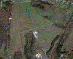
Valley Point (WV29) is a privately owned airport nestled in the hills of Albright, West Virginia. This has been updated from defualt FSX to include the north south grass runway.
Based on local a local flight instructor, the airport should always be approached for landing going north bound towards rising terrain (if the winds are less than 10 knots). This assists with braking. A go around should never be attempted going northbound after the wheels impact the ground.
Takeoffs should always be performed going south bound (if the winds are less than 10 knots) due to steeply rising terrain (300 feet above the airport) to the north.
| Filename: | WV29__Valley_Point_Airport.zip |
| License: | Freeware |
| Added: | 28th June 2021, 04:14:34 |
| Downloads: | 115 |
| Author: | David Abreu |
| Size: | 2.17 KB |
| Category: Flight Simulator X - Aircraft Repaints, Textures and Modifications | |
| TBAI Beech 99 Bemidji Repaints |
|
Images related to this file:
File Description:

Bemidji Airways repaints for my TBAI Beech 99. Includes TGA base files (2048 x 2048) and DDS DXT5 (1024 x 1024) See readme for details.
| Filename: | TBAI_Beech_99_Bemidji_Repaints.zip |
| License: | Freeware |
| Added: | 18th March 2022, 01:37:27 |
| Downloads: | 169 |
| Author: | Todd Bolgrin |
| Size: | 10.64 MB |
| Category: Flight Simulator X - Scenery | |
| Helgoland and Airports |
|
Images related to this file:
File Description:
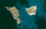
This project rebuilds Germany's Helgoland, upgrades the Duene (EDXH) and Wangerooge (EDWG) airports to be fully AI compliant, and includes AI flight plans between EDXH and EDWG to bring the airports to life. Accurate shorelines, as well as corrected landclass and waterclass, are provided. Updates were created or rebuilt in a manner which carefully aligned airport data with current satellite imagery. Scenery was created using Airport Design Editor X v1.61.5273, SBuilderX 3.13, and the FSX Object Placement Tool. Scenery objects were added and modified from stock FSX scenery to resemble as closely as possible the actual airports.
| Filename: | Helgoland_and_Airports.zip |
| License: | Freeware |
| Added: | 16th June 2014, 06:02:08 |
| Downloads: | 2,827 |
| Author: | Carlyle Sharpe |
| Size: | 1.65 MB |
| Category: Flight Simulator X - Scenery | |
| ITATIBA P1 - Photo Realistic Scenery |
|
File Description:
ITATIBA P1 - 1/2
This is the complement of Campinas to cover ITATIBA region. This scenery is composed by five parts. Folow instructions on Readme.txt and have a nice visual flight.
Is a good idea install the FSX Mesh South America parts F7 and F8 cordinates in the map to have the essential mesh terrain.
| Filename: | ITATIBA_P1__Photo_Realistic_Scenery.zip |
| License: | Freeware |
| Added: | 11th August 2008, 08:27:11 |
| Downloads: | 1,355 |
| Author: | Gilson A. Rocchetti |
| Size: | 47.69 MB |
| Category: Flight Simulator X - AFCAD Files | |
| KBVX - Batesville Regl Airport - Batesville, Arkansas |
|
File Description:
KBVX - Batesville Regl Airport - Batesville, Arkansas. The amount of parking has been doubled or tripled, traffic handling efficiency has been enhanced using the latest AFCAD techniques, and frame rate performance has been considerably improved at this airport. This is not designed for Flight Simulator 2004.
| Filename: | KBVX__Batesville_Regl_Airport__Batesville_Arkansas.zip |
| License: | Freeware |
| Added: | 7th December 2008, 10:57:29 |
| Downloads: | 302 |
| Author: | Dakota Smith / Smith Graphics |
| Size: | 87.82 KB |
© 2001-2026 AVSIM Online
All Rights Reserved
Privacy Policy |