
Where Flight Simulation Enthusiasts Gather from Around the World!
AVSIM Library - Search Results

| Category: Flight Simulator X - Missions | |
| Mountain Flying in Switzerland (Part 1 of 3) |

|
Images related to this file:
File Description:
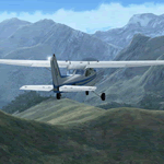
Mountain Flying in Switzerland (Part 1 of 3)
Welcome to beautiful Geneva, Switzerland. Today is a gorgeous day to be taking your first mountain flight in the Swiss Alps. Your round trip will take you over two mountain passes, an airport in the middle of a steep sided canyon and another airport in the heart of the Alps Part 1 of 3: Col de Coux - This first leg takes you from the grass runway in Geneva up and over a mountain pass named Col de Coux and down to an airport in a canyon. Along the way you will be able to enjoy all the beautiful scenery, including incredible views of the snow covered Alps and Lake Geneva, with its world famous jet d'eau. The chief flight instructor from the Aeroclub de Geneve will help you navigate and also handle all the radio communications, but it will be up to you to safely arrive at your destination. You are the Pilot in Command! Includes: - Detailed aeronautical charts of your departure, route, and arrival - FSX Nav Log, Flightplan and GPS with programmed waypoints - Real world voice actors with written text of entire dialog.
| Filename: | Mountain_Flying_in_Switzerland_Part_1_of_3.zip |
| License: | Freeware |
| Added: | 24th June 2010, 01:33:36 |
| Downloads: | 2,696 |
| Author: | Chris Klein |
| Size: | 33.32 MB |
| Category: Flight Simulator X - Scenery | |
| NRAO - Karl G. Jansky Very Large Array |
|
Images related to this file:
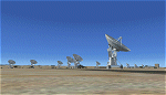
File Description: The VLA or "Jansky Array", managed by the National Radio Astronomy
Observatory (NRAO) consists of 27 independent radio telescope dishes, each with
a diameter of 82 feet and weight of over 200 tons. Each antenna is found along
the three arms of a track shaped in a Y configuration measuring 13 miles long.
Using the rail tracks that follow each of these arms the antennas can be
physically relocated to a number of prepared positions. At one point, the arms
intersect with U.S. Route 60 which passes right through the middle of the array.
It has been featured in numerous films, such as Armageddon, Independence Day,
Terminator Salvation, a Bon Jovi music video, and was featured most prominently
-and correctly- in the Carl Sagan novel Contact, as well as the film of the same
name. Also updated is the closest airport to the VLA - Magdalena, NM - N29. It's
a small dirt strip a few miles to the east, between Socorro and the VLA. It
serves as a nice staging area for flights to the VLA. Includes a helipad startup
location with NM99 ident. Scenery by Jason L. Terry. For FSX Acceleration.
| Filename: | NRAO__Karl_G_Jansky_Very_Large_Array.zip |
| License: | Freeware |
| Added: | 23rd August 2014, 11:18:02 |
| Downloads: | 409 |
| Author: | Jason L. Terry |
| Size: | 3.18 MB |
| Category: Flight Simulator X - Miscellaneous Files | |
| BMW 760li automobile FDE |
|
Images related to this file:
File Description:
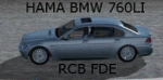
If you have ever driven an automobile addon in the FSX scenery, you may have felt
that a few things were missing. If so, try this addon ..... It adds a whole new driving experience.
This version is for Hama's BMW 760li visual model (not included), and adds:
- Accurate max speed, acceleration and braking, according to real-word specs.
- A transmission gearbox: 6-gear Forward, Neutral and Reverse.
- Manual and Automatic gear switching, with kickdown function.
- Revup/down sound, depending on engine RPM (so dependant on speed and transmission gear).
- Accurate steering, at low and high speeds. This includes a non-lineair control of the steering wheel and control axis assignments; both configurable via an .ini file.
- ABS, TractionControl and CruiseControl.
- Several coded "tricks", like: Spinning wheels and "doughnuts" at high throttle in 1st Gear, Drifting/spinning at high speed when steering angle too large, A visual/audible TireSmoke effect if the above applies, Brake lights.
- New engine-RPM and speed gauges.
- A horn (claxon) sound.
For a full description (required downloads, installation, configuration, etc), see
the included README.
By Rob Barendregt
| Filename: | BMW_760li_automobile_FDE.zip |
| License: | Freeware, limited distribution |
| Added: | 29th May 2011, 19:43:39 |
| Downloads: | 1,489 |
| Author: | Rob Barendregt |
| Size: | 399.57 KB |
| Category: Flight Simulator X - Missions | |
| Lindbergh's Flight to Paris |
|
File Description:
Mission: Lindbergh's flight across the Atlantic for FSX. I got inspired by watching the movie "The Spirit of St Louis" with James Stewart. Good movie. When FS9 was released, many historical aircraft were released along with it. Many of these aircraft were flown manually with no autopilot or way to speed up the flight process. No one was going to sit at the computer for 34 hours to fly to Paris in the Spirit of St Louis. The Spirit is still difficult to fly because of the weight of the fuel. I have provided the necessary panel.cfg and aircraft.cfg along with this mission to make it easier to cross the Atlantic. In order to have the full affect you will need some additional files which are not provided with this package. They are provided in other packages as well as some payware packages. You will need the Roosevelt field scenery from AVSIM ( http://library.avsim.net/download.php?DLID=54574). You will need the Spirit of St Louis from FS9 with the attached upgraded panel.cfg and aircraft.cfg. You should have the simicons1024 package in your gauges directory. You should have the concord gauges in your gauges directory. (concord.gau)
.
| Filename: | Lindberghs_Flight_to_Paris.zip |
| License: | Freeware |
| Added: | 28th April 2007, 21:47:59 |
| Downloads: | 1,796 |
| Author: | William K. Jibby |
| Size: | 1.44 MB |
| Category: Flight Simulator X - Scenery | |
| Whakatane Airport (NZWK), New Zealand |
|
File Description:
Whakatane Airport (ICAO: NZWK) is a small airport serving the town of Whakatane in the Bay of Plenty, New Zealand. It consists of a Asphalt runway flanked with a parallel grass strip and a helipad. While not a particularly busy aerodrome, there are daily movements by Air New Zealand/Eagle Airways Beech 1900Ds, general aviation movements including agricultural aircraft, training flights from the flight school and scenic flights to White Island off the coast of the Bay of Plenty.
Of particular interest is the main terminal, designed by Roger Walker in the modernist style. It has survived in its original form since its construction in the 1970’s and gives a cheerful welcome to visitors disembarking to discover the many natural and cultural attractions in the region.
This particular airport is of interest to me as I began my real world flying training there originally with Scott Air and later with Air Discovery (www.airdiscovery.co.nz) As well as flight training, they also fly scenic tours of White Island and Mount Tarawera.
This Scenery Features: High resolution 10cm imagery for the airport including night map, Custom made buildings including night lighting and window reflections, extensive trees and grass.
| Filename: | Whakatane_Airport_NZWK_New_Zealand.zip |
| License: | Freeware, limited distribution |
| Added: | 24th December 2008, 13:20:53 |
| Downloads: | 3,128 |
| Author: | Tim Barnes |
| Size: | 34.5 MB |
| Category: Flight Simulator X - Scenery | |
| 1F2 - Plateau Sky Ranch - Edinburg, NY |
|
File Description:
Here is an improved version of the stock Plateau Sky Ranch. This is a privately owned field, open to the public. It consists of two grass runways and is located just north of the Great Sacandaga Lake.
In FSX, there were no buildings at all, so I added the hangar, and the hangars and planes that are located across a public road. I moved both runways because, with UTX, the road crossed both runways. Now the runways clearthe road. In FSX there were taxiways with hold-short lines, taxiway signs, etc, which didn't belong so they
were removed. I added a dirt driveway, parking area, fuel station, light pole, flag, and a couple of local houses and barn.
There is a lot of nice scenery in any direction from Plateau Sky Ranch. If you take off from runway 6 and follow the waterway you will come to the earthen Conklingville dam and the upper Hudson River.
I've added an extra file for UTX users called Boats.bgl. It will add several marinas and boats in correct locations on the Great Sacandaga Lake.
| Filename: | 1F2__Plateau_Sky_Ranch__Edinburg_NY.zip |
| License: | Freeware |
| Added: | 22nd March 2009, 17:44:40 |
| Downloads: | 1,347 |
| Author: | Jim Cook |
| Size: | 4.56 KB |
| Category: Flight Simulator X - Scenery | |
| Trois-Rivieres CYRQ |
|
Images related to this file:
File Description:
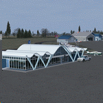
Trois-Rivieres Airport (CYRQ) is located near the city of Trois-Rivieres, Quebec, Canada, midway between Quebec and Montreal on the north shore of the St-Lawrence river. It has a large maintenance and painting shop to service aircrafts the class of B737, A320 or equivalent size. This GA airport had its runway (05-23) extended to 9000' so that is can now receive and accomodate the B767.
This scenery developed in GMax, is an exact and realistic representation of the airport. It features 28 detailed buildings including its unique terminal, custom vehicles and much more. From the airport, you can see the flashing strobe lights of the 1200 feet tower located 8 miles NE of the airport; cleary visible night and day which is a very good landmark coming in to land. Another nice landmark is the nearby beautiful Laviolette bridge (if installed from the same author). Take your favorite GA aircraft there for a sightseeing tour or a fishing trip a short distance north of Trois-Rivieres, your executive jet for a business meeting or service your airline jet in the maintenance bays. It is a nice airport to see.
| Filename: | TroisRivieres_CYRQ.zip |
| License: | Freeware |
| Added: | 26th November 2009, 02:43:30 |
| Downloads: | 7,254 |
| Author: | Gilles Boily |
| Size: | 6.9 MB |
| Category: Flight Simulator X - Scenery | |
| Odense Airport (EKOD), Funen, Denmark |
|
Images related to this file:
File Description:
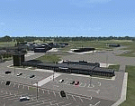
Odense Lufthavn (Odense Airport) is situated close the village of Beldringe, a few km north of Odense, the main city on the island of Funen, Denmark. Like several other Danish airports it was established as an airbase by the Germans during World War II. It was taken over by the Danish state after the war and owned by the state until 1998, at which time it was taken over by a consortium of local authorities, including the city of Odense.
Since the opening of the Great Belt Lin in 1997 there has been no regular passenger flights, apart from some charter traffic during the summer season. But there is a lot of traffic with one- and two-motor craft (including rotor craft) due to the many companies based in the airport.
The package is a complete scenery of the airport, including a few buildings around it. It includes approach lights, runway lights, taxiway lights and light on the apron, the car parking area and the surrounding roads. A traffic file with the (limited) charter traffic of the airport is also included.
| Filename: | Odense_Airport_EKOD_Funen_Denmark.zip |
| License: | Freeware, limited distribution |
| Added: | 31st October 2009, 10:29:34 |
| Downloads: | 3,731 |
| Author: | Peter H. Poulsen |
| Size: | 13.63 MB |
| Category: Flight Simulator X - AFCAD Files | |
| Active ILS - KATL (Hartsfield - Jackson Atlanta Intl Airport) |
|
File Description:
Many know that KATL was not updated in FSX do to the airport data cutoff date. KATL now has the new Runway 10/28 but there are many additions added which are to numerous for listing here. Several key changes are all 5 parallel runways are ATC controlled Arrival runways for both the User and AI Plane Traffic. All Gates and Parking Spots have been updated so AI Airline Planes including Cargo, Commuter, and Corporate GA park in the correct places. New Approach code including the 5 new STAR's, RNAV (gps overlay's), many new Transitions and correct Runway data as per current Jeppesen Charts (freeware charts included). Many features have also been fixed such as Jetways that moved the wrong way, recoding the ILS CAT II Runway 28 frequency, updating KLZU ILS Runway 25 frequency, many scenery GUID's to support KATL based on how it looks today and additional ground support tracks that go to many more places including all Cargo Stands. Read the included Whats New Readme txt file for all the enhancements and how I coded ATC to use all 5 parallel runways for arrival vectors to decrease the go around issues at large airports.
| Filename: | Active_ILS__KATL_Hartsfield__Jackson_Atlanta_Intl_.zip |
| License: | Freeware, limited distribution |
| Added: | 1st January 2007, 22:57:34 |
| Downloads: | 30,376 |
| Author: | Jim Vile |
| Size: | 10.84 MB |
| Category: Flight Simulator X - Gauges | |
| Advanced Radar System 4 (ARS4) |
|
Images related to this file:
File Description:
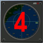
This gauge has been developed for FSX Flight Simulator SP1 or SP2. It
has also been tested with Microsoft Acceleration also, but compatibility is not guaranteed by the author.
This new Advanced Radar System (ARS 4) includes significant new features,
functions and displays for FSX AI traffic. The new key features are:
1)AI traffic display for air targets and boat/ship targets.
2)Auto landing on carrier if the carrier is part of the scenery MECOPS.
3)Allows switching between air target display and boat target display.
4) Provides for air and boat display to optionally insert airport and/or basic terrain display on the screen.
5)Different screen presentations for air and boat targets.
6)Simplified installation procedure.
7)The A2A re-fuel function remains the same as in the ARS2 version.
8)The auto tracking function remains the same as well as in the ARS2 version.
All displays for air, or boat/ship traffic, can be selected in a range of 5, 10, 20, and 40 miles.
For installation and additional information look at the ARS4 documentation inside the zip file. For copyrights and credits please look at the documentation for this gauge.
| Filename: | Advanced_Radar_System_4__ARS4.zip |
| License: | Freeware |
| Added: | 5th March 2013, 15:53:52 |
| Downloads: | 3,813 |
| Author: | Dietmar Loleit |
| Size: | 1.18 MB |


© 2001-2026 AVSIM Online
All Rights Reserved
Privacy Policy |