
Where Flight Simulation Enthusiasts Gather from Around the World!
AVSIM Library - Search Results

| Category: Flight Simulator X - Scenery | |
| KOAK - Metro Oakland Intl |

|
Images related to this file:
File Description:
This is a reasonably accurate and up-to-date version of Metro Oakland Intl airport with two optional files and made only for FSX users, do not use in P3D: There is one version with the Crosswind runways operating where all 4 runways will be used for takeoff/landing and one version as the default airport runway operation.
This update removes the "jfk jetways" mainly for those who have had issues installing the textures to get these Jetway to display, these have now been replaced by Jetway extensions that are more like the real world, Terminals 1 and 2 rebuilt with something better than the stock airport, assigned parking as per their website with extra parking, the Fedex and UPS ramps and buildings replaced, all taxiways and taxi signs updated to the latest charts, support vehicle roads rebuilt, extra fuel trucks, Helipad added to the GA apron and many other scenery improvements and objects added, airport views are from inside the control tower (when in tower view) please view the readme before installation.
| Filename: | KOAK__Metro_Oakland_Intl.zip |
| License: | Freeware, limited distribution |
| Added: | 29th January 2020, 01:05:10 |
| Downloads: | 44,390 |
| Author: | Ray Smith |
| Size: | 8.78 MB |
| Category: Flight Simulator X - Scenery | |
| YBLT - Ballarat Aerodrome - Victoria, Australia |
|
Images related to this file:
File Description:
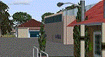
YBLT (Ballarat Aerodrome) is a regional 'airport' in the central west of the State of Victoria, Australia and utilises infrastructure from the days of RAAF operations which lasted till the early 1960's. Thus the buildings are now a bit outdated but this file does not reflect that as I have not done any custom texturing so everything in this package tends to look a bit new and crispy.
Note the name of this 'airport'. The locals are adamant it is an aerodrome, not an airport. I have not found any freeware or commercial offerings for an alternative to the default and so I have put one together.
This is a reasonable approximation of the airport /aerodrome but is not entirely accurate as the hangars/buildings I have modelled myself are generic ones I have done and do not look exactly like the ones at that facility. The connecting road is not in true alignment as I have created it so as it blends into the surrounding default scenery.
| Filename: | YBLT__Ballarat_Aerodrome__Victoria_Australia.zip |
| License: | Freeware |
| Added: | 21st October 2014, 01:51:16 |
| Downloads: | 840 |
| Author: | Robert Budd |
| Size: | 4.43 MB |
| Category: Flight Simulator X - Scenery | |
| LOSM Mauterndorf, Austria Version1 for FSX and P3D_v3/v4 |
|
Images related to this file:
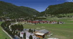
File Description: The Airfield Mauterndorf is the highest situated airfield in Austria: 3642 ft or 1110 meters above sealevel.
This Airfield is very common for glider flyers due to the usually good upwinds for flying in the alps. But also small engine aircrafts are approved. Link:
http://www.losm.at/index.php/losm.html The environment of the airfield is adapted by landclasses. Mauterndorf and the surrounding villages, valleys and major roads are included.
As well the field is covered by a photo background, wich includes four different images , each for one of the four seasons spring, summer, autum and winter. The buildings in this scenery are designed mainly new by myself, but also a lot of objects from two very popular freeware libraries.
If these libraries are not installed, many objects are not visible! The following libraries are used: 1. FS-Piloten_Objektlibrary:
http://www.fs-piloten.de/thread.php?threadid=10632 2.FSX_FlightPortLib:
http://www.flightport.de/libraries/flightport-library/ This senery works also with Austria Professional HD.
| Filename: | LOSM_Mauterndorf_Austria_Version1_for_FSX_and_P3D_.zip |
| License: | Freeware |
| Added: | 28th August 2017, 20:01:00 |
| Downloads: | 481 |
| Author: | Wolfgang Allers |
| Size: | 249.9 MB |
| Category: Flight Simulator X - Scenery | |
| OMDB - Dubai Intl Airport - Dubai, UAE |
|
Images related to this file:
File Description:
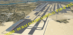
OMDB - GPS-accurate scenery based om Google maps and the FlyTampa base AFCAD (default FSX/P3D AFCAD). Every Runway, Gate and taxiway is right on the actual spot with a very small error margin.
Two types of Jetway structures used for Terminals 1 & 3, and are made by Victor Nauta. The new Concourse-D terminal for airlines other than Emirates is now added, with a basic terminal building design using Google Sketchup for better visuals.
WHAT'S NEW:
- The new Concourse-D terminal east of the existing Terminal 1. Terminal replaces the old Emirates Sky Cargo terminal, and servers all other visiting airlines.
- Apron Q used by FlyDubai is added.
- Extra runway rapid exits added.
- Extra parking gates in the C apron according to the latest charts.
- Extra Taxiways connecting to the runways according to the charts.
- Ground marking for Gates and taxiways! (A, B, C, D and F aprons)
- Aprons G and S are added according to the latest Airport layout and charts.
| Filename: | OMDB__Dubai_Intl_Airport__Dubai_UAE.zip |
| License: | Freeware, limited distribution |
| Added: | 25th July 2016, 20:17:21 |
| Downloads: | 10,988 |
| Author: | Ahmed Abdessalam |
| Size: | 4.16 MB |
| Category: Flight Simulator X - Scenery | |
| John F. Kennedy International Airport (KJFK) New York |
|
Images related to this file:
File Description:
This is an accurate and up-to-date version of JFK Intl Airport with two optional files and made only for FSX users, do not use in P3D: There is one version with the Crosswind runways activated and in full operation where all 4 runways will be used for takeoff/landing and one version as the default airport runway operation: assigned parking now updated as per their website including gates for the A380, runway 4L/22R now at its new length of 3682m, the new terminal extension updated for Terminal 4 concourse B, and allocated only for Delta connection, Terminal 5 and 8 have also been remodeled, taxiways and taxi signs updated to the latest charts, the freeway traffic that crosses taxiways A and B now ends before these taxiways, Autogen around the water edges of the airport removed, support vehicle roads rebuilt and many other scenery improvements and objects added, airport views are from the roof of the control tower (when in tower view) please view the readme before installation.
| Filename: | John_F_Kennedy_International_Airport_KJFK_New_York.zip |
| License: | Freeware, limited distribution |
| Added: | 4th May 2018, 04:47:55 |
| Downloads: | 53,469 |
| Author: | Ray Smith |
| Size: | 5.49 MB |
| Category: Flight Simulator X - Aircraft Repaints, Textures and Modifications | |
| FSX/P3D ANA - All Nippon Airways 747SR-81 1980 |
|
Images related to this file:
File Description:
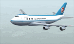
This is a repaint of the 747SR-81 (Short Range) in ANA - All Nippon Airways classic 1980 "Mohican" colors. The freeware 747-200 by Project Open Sky - POSKY is needed for this repaint. All Nippon Airways Company, Ltd.
(ANA) was formed on March 1, 1958 through the merger of two small companies. The Japanese government granted the carrier full certification to operate over domestic trunk routes on April 1, 1959, and by the mid 60s it was Japan's biggest domestic airline with a comprehensive network. During this time through to the 1970s, ANA expanded its fleet size greatly. ANA ordered its first jetliner, the 727-181, in 1964 and by 1978 they had a vast fleet of jetliners at their disposal, including the queen of the skies, the 747. ANA operated its first international flight, a charter flight, on July 15 and 31 1970, with YS-11s to Pusan, South Korea. However, a fully scheduled international flight was still in the distant future. In 1978 ANA held the position as the world’s sixth largest airline. Not bad for a domestic carrier. The carrier’s longest domestic route, the 2,051-km Sendai–Okinawa segment was opened in 1980. Interestingly, First-Class service was introduced on Japanese domestic flights as late as July 1985. In December 1985, the Japanese government opened international operations to all of the country’s airlines by revising its air transport policy and deregulating the industry. This included domestic carriers. ANA's desire for international routes became a reality and joined the fray It flew its first fully international scheduled route with a four times a week service to Guam, on March 3 1986. Today it has a vast network of international flights, and they are easily Japan's biggest carrier with 233 aircraft. They were also the launch customer of the 787. ANA has been going from strength to strength ever since its inception. For them, the sky's the limit. It might work on FS2004 as well. Textures are 32bit bmp.
| Filename: | FSXP3D_ANA__All_Nippon_Airways_747SR81_1980.zip |
| License: | Freeware |
| Added: | 12th May 2019, 18:39:42 |
| Downloads: | 162 |
| Author: | Ted Giana |
| Size: | 9.14 MB |
| Category: Flight Simulator X - Aircraft Repaints, Textures and Modifications | |
| Consolidated PBY-5A (C-FCRR) |
|
Images related to this file:
File Description:

This folder contains a repaint for the Aerosoft PBY Catalina for FSX. It is shown here as C-FCRR, with Air France colors. Built by Boeing of Canada at Vancouver, it became RCAF Canso 9767 on March 4, 1943, and was allocated to Squadron 162, coded S, at Reykjavik, Iceland. In 1944, piloted by Flying Officers Thomas Charles Cooke and Eric Walter Wiskin, 9767 sank the German U-boat U-342 off the coast of Iceland on April 17. The amphibian was removed from the military service on April 1, 1946. The same year it was sold to Canadian Pacific Airlines, registered CF-CRR and assigned fleet number 233 (later 933), it was operated until 1959, thereafter by Northland Airlines (1960-1968), Midwest Airlines (1969-1970), and Ilford Riverton until 1973. The registration was changed to C-FCRR when Avalon Aviation acquired it as a water bomber in 1977, listed as Tanker number 791.
In 1995 the aircraft was bought by Powell Eorp. Of Parry Sound, Ontario, subsequently it was owned by the Canadian Air Legend. The French pilot Franklin Devaux bought C-FCRR in 1995 and converted it to a flying television studio, it was based at Le Bourget, Paris, France. During 1996 C-FCRR was the star of monthly French television programme Operation Okavango, while in September 1998 it was the eye catcher of the three-week Champs-Elysees (Paris) static air show. The following October the aircraft started an 8,078 mls (13,000 km) trip to Chile via Dakar (Senegal) and Natal (Brazil) to commemorate early Air France South Atlantic mail service, returning to France in June 1999. On January 19, 2002 the aircraft was stored at Orly Airport, Paris, and has not flown since. Its Canadian registration was cancelled on October 7, 2005. At present it seems to be registered as N9767, and in airworthy condition again. Here's a youtube movie on this aircraft: http://www.youtube.com/watch?v=s6jyzV8Gawc. Repaint by Jan Kees Blom, based on the repaint kit by Aerosoft.
| Filename: | Consolidated_PBY5A_CFCRR.zip |
| License: | Freeware |
| Added: | 13th July 2018, 20:34:21 |
| Downloads: | 151 |
| Author: | Jan Kees Blom |
| Size: | 9.83 MB |
| Category: Flight Simulator X - Scenery | |
| YPNW Pannawonica, Western Australia town and strip |
|
File Description:
YPNW Pannawonica with FSX default and ORBX tints condensed into one zipfile. The town of Pannawonica is an iron-ore mining town located in the Pilbara region of Western Australia, near the Robe River, about 200��� km south-west from Karratha. In 2006, it reportedly had the highest median weekly income of any town in Australia, due to the high income of its mine workers. Pannawonica was built in 1970 by Cleveland-Cliffs Robe River Iron (predecessor of the present Robe River Iron Associates) and was gazetted as a townsite in 1972. The township�¢����s name was derived from nearby Pannawonica Hill, named by a surveyor in 1885 after the corresponding Aboriginal placename which is said to mean "the hill that came from the sea". The traditional legend is that two local Aboriginal tribes were arguing over the ownership of the hill which was located by the sea. The sea spirit decided to resolve the dispute by moving the hill inland. As the hill was dragged over the land it left a deep indentation which became the Robe River. Pannawonica is one of a number of remote-area iron-ore-mining towns built throughout the Pilbara to house workers operating open-cut mines and the loading of ore trains. It is a 'closed town', having limited facilities for visitors, the company's accommodation being reserved for its staff and visiting contractors. Some visitor accommodation is available at the Pannawonica Tavern. Pannawonica is home to more than 800 people, comprising Robe and Pilbara Iron employee families, staff on fly-in fly-out (�¢����fifo�¢����) roster from Perth, and those involved in support services. It is accessible by road, rail and light aircraft. REQUIRES Blencowe_LibraryKit.zip
REQUIRES blencowe_librarykit_309494.zip (Available HERE)
| Filename: | YPNW_Pannawonica_Western_Australia_town_and_strip.zip |
| License: | Freeware |
| Added: | 28th February 2013, 14:00:44 |
| Downloads: | 287 |
| Author: | Alan Blencowe |
| Size: | 3.38 MB |
| Category: Flight Simulator X - Aircraft Repaints, Textures and Modifications | |
| Consolidated PBY Catalina C-FCRR |
|
Images related to this file:
File Description:
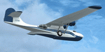
This folder contains a repaint for the Aerosoft PBY Catalina for FSX. It is shown here as C-FCRR, with Air France colors. Built by Boeing of Canada at Vancouver, it became RCAF Canso 9767 on March 4, 1943, and was allocated to Squadron 162, coded S, at Reykjavik, Iceland. In 1944, piloted by Flying Officers Thomas Charles Cooke and Eric Walter Wiskin, 9767 sank the German U-boat U-342 off the coast of Iceland on April 17. The amphibian was removed from the military service on April 1, 1946. The same year it was sold to Canadian Pacific Airlines, registered CF-CRR and assigned fleet number 233 (later 933), it was operated until 1959, thereafter by Northland Airlines (1960-1968), Midwest Airlines (1969-1970), and Ilford Riverton until 1973. The registration was changed to C-FCRR when Avalon Aviation acquired it as a water bomber in 1977, listed as Tanker number 791.
In 1995 the aircraft was bought by Powell Eorp. Of Parry Sound, Ontario, subsequently it was owned by the Canadian Air Legend. The French pilot Franklin Devaux bought C-FCRR in 1995 and converted it to a flying television studio, it was based at Le Bourget, Paris, France. During 1996 C-FCRR was the star of monthly French television programme Operation Okavango, while in September 1998 it was the eye catcher of the three-week Champs-Elysees (Paris) static air show. The following October the aircraft started an 8,078 mls (13,000 km) trip to Chile via Dakar (Senegal) and Natal (Brazil) to commemorate early Air France South Atlantic mail service, returning to France in June 1999. On January 19, 2002 the aircraft was stored at Orly Airport, Paris, and has not flown since. Its Canadian registration was cancelled on October 7, 2005. At present it seems to be registered as N9767, and in airworthy condition again. Here's a youtube movie on this aircraft: http://www.youtube.com/watch?v=s6jyzV8Gawc. Repaint by Jan Kees Blom, based on the repaint kit by Aerosoft.
| Filename: | Consolidated_PBY_Catalina_CFCRR.zip |
| License: | Freeware, limited distribution |
| Added: | 26th September 2010, 11:33:47 |
| Downloads: | 1,197 |
| Author: | Jan Kees Blom |
| Size: | 9.83 MB |
| Category: Flight Simulator X - Scenery | |
| LYPG Podgorica Airport, Montenegro |
|
File Description:
Podgorica Airport (IATA: TGD, ICAO: LYPG) is an international airport located 11 km (6.8 mi) south of Podgorica, Montenegro. It is the main hub for Montenegro Airlines.
It is one of two public airports in Montenegro, the other being Tivat Airport. Both are operated by the state-owned company Airports of Montenegro. The airport is sometimes called Golubovci Airport by the locals, as the town of
Golubovci is in close proximity. Airports Council International awarded Podgorica the best airport under 1 million passengers in 2007.
The IATA code of the airport is still TGD because Podgorica was named Titograd (after Josip Broz Tito) from 1946 to 1992, during which time the airport opened.
The airport handles domestic flights within Montenegro as well as international flights. As Montenegro's two main airports are merely 80 km apart, there are no regular passenger domestic flights. Domestic flights have been reduced to
charter flights and general aviation, and all scheduled traffic is international.
There are daily scheduled flights to various European destinations. During the summer season, there are many charter flights and air connections to various major cities in the world. The flight to Belgrade airport has traditionally
accounted for majority of the traffic at the airport, but the percentage is decreasing.
VIP and taxi airlines Vektra Aviation, Di Air and OKI Air are based at the airport. Serbian VIP airlines Air Pink and Prince Aviation also use the airport.
Podgorica Airport served 538,477 passengers in 2008. However, due to global economic downturn, passenger numbers declined to 450,504 in 2009. In 2010, strong growth was recorded, so numbers passed the 600,000 mark.
Thanks to Serbia And Montenegro Virtual Area Control Center for the airport charts.
This file has the right coordinates, with the apron and characteristics of the airport, airport vehicles and buildings, also it is set to the correct altitude of 126 feet or 38 meters.
| Filename: | LYPG_Podgorica_Airport_Montenegro.zip |
| License: | Freeware |
| Added: | 29th October 2012, 21:41:37 |
| Downloads: | 4,662 |
| Author: | Anwar Gonzalez |
| Size: | 10.52 MB |


© 2001-2026 AVSIM Online
All Rights Reserved
Privacy Policy |