
Where Flight Simulation Enthusiasts Gather from Around the World!
AVSIM Library - Search Results

| Category: Flight Simulator X - AI Aircraft | |
| AI Mexicana de Aviacion Airbus A319-112 New and Old Liveries Pack |

|
Images related to this file:
File Description:

This is the Third Oldest Airline in the world, the Second Oldest Airline in Latin America, and the First Oldest Airline in Mexico, Mexicana Airlines (Mexicana de Aviacion), this is the Airbus A319-112 for now the pack have the Last New Livery (2010), the Old Livery (2005), the 85th Anniversary, and the White Colors, more later will upload the Older Liveries, the Old Livery but with the Thin Logo and No Wingtips Logos, and the mos popular and old Mexicana´s livery, (1997-2005). For the 100th Anniversary I´ll upload all the fleet, since 1940´s with the DC-2 to the last fleet that had when it flies, the Mark and Airline still exists, BUT It doesn´t fly since 2011. The model is FSX AI Bureau (FAIB) Airbus A319-100 Basepack. I hope enjoy it!.
| Filename: | AI_Mexicana_de_Aviacion_Airbus_A319112_New_and_Old.zip |
| License: | Freeware |
| Added: | 26th August 2021, 00:19:02 |
| Downloads: | 113 |
| Author: | Jesús Gibran Soriano Solleiro |
| Size: | 224 MB |
| Category: Flight Simulator X - Gauges | |
| Multiple Moving Map Gauge |
|
Images related to this file:
File Description:
This Multiple Moving Map ( MMMap) provides a excellent and generic orientation and navigation gauge for any aircraft in FSX. The gauge will be implemented as a separate window in the panel.cfg ( for installation see pdf doc in this ZIP file).
The gauge allows the user to select different terrain presentations e.g. desert areas on the globe ( north of Africa for example ), or areas in the north of Europe/America .
In addition, the user can select a camera lookalike view. This is a dedicated view which allows the user to have a top view from the aircraft to the real FSX terrain.
Control buttons are available to insert into the map displays for airports, flight plans,VOR etc.. The gauge includes a commercial version ( MMMap_Com) and a military version (MMMap_mil). The difference is the gauge body only.
| Filename: | Multiple_Moving_Map_Gauge.zip |
| License: | Freeware |
| Added: | 18th December 2009, 23:34:50 |
| Downloads: | 2,508 |
| Author: | Dietmar Loleit |
| Size: | 2.36 MB |
| Category: Flight Simulator X - Scenery | |
| Descobrir Portugal X |
|
File Description:
This is the first version of DESCOBRIR PORTUGAL for FSX.
My intention is to create a new global scenery for the Portuguese territory, with new coast lines, roads, railroads, landclass, airports and local landmarks, lighthouses, bridges, castels and many other improvements.
In this first attempt for FSX:
Complete Scenery for: LPMU Mogadouro, LPCS Cascais Tires, LPEV Évora, LPPM Portimão.
Incomplete scenery for: LPBR Braga, LPBG Bragança, LPPR Oporto Intl, LPHR Horta; LPCE Cerval.
Realistic afcads for: LPVL Maia, LPVR Vila Real, LPMR Monte Real AB, LPSR Santarem, LPAT Almoster, LPMX Machede, LPLG Lagos, LPTV Tavira, LPAP Armação de Pera, LPPV Praia Verde, LPPI Pico.
150 Kms. Of replaced coastlines.
6200 Kms2 of realistic landcass, roads, Rivers, landmarks, etc.
Any comments and suggestions are wellcome.
ONLY for flight Simulator X.
| Filename: | Descobrir_Portugal_X.zip |
| License: | Freeware |
| Added: | 24th February 2007, 22:52:09 |
| Downloads: | 13,262 |
| Author: | José Maia |
| Size: | 24.29 MB |
| Category: Flight Simulator X - Scenery | |
| OPNH - Nawabshah Airport - Nawabshah, Sindh, Pakistan |
|
Images related to this file:
File Description:

First ever freeware Scenery of PSDG/MSK OPNH Nawabshah Airport FsX/P3D. Our projects will range from major to regional airports and we will strive to add realism and detail to flight locations spanning the entire country. With each new project we will aim to enhance the flight simulation experience by providing familiar terrain in the Pakistani air space for both training as well as recreation purposes. We have embarked upon our first project OPNH airport in Nawabshah, which is currently completed and have included screenshots in the pack Scenery Developed by Sarmad Khan (MSK) & Raihan Shahzad along with supported by Ali Kazimi, Irfan Khan, Omais Khan, Ahmed Arif & Mr. Shahid Iqbal. PSDG (Pakistan Scenery Development Group) was established by Pakistan vACC, a VATSIM division in West Asia region.
| Filename: | OPNH__Nawabshah_Airport__Nawabshah_Sindh_Pakistan.zip |
| License: | Freeware |
| Added: | 1st March 2015, 15:41:50 |
| Downloads: | 809 |
| Author: | M Sarmad Khan |
| Size: | 65.88 MB |
| Category: Flight Simulator X - Scenery | |
| Nomos Irakliou and Lasithiou |
|
Images related to this file:
File Description:
AS REAL AS IT GETS.
This is a detailed photo-realistic scenery of Nomos Irakliou and Lasithiou.
This upload is the last photo-scenery area containing airports in Greece.
Default FSX airports of Iraklio (LGIR), Sitia (LGST) and Kasteli (LGTL) were completely redone, positioned to their exact location, and many buildings and objects were added in the airport compounds.
New aprons, taxi signs and plenty of aircraft parking.
Also you have the choice of installing the textures of 22 original buildings (sketchup models) of the old Air Base near the town of Gouves. You could see the Base on your left at LGIR final runway 27.
The scenery contains plenty of autogen objects, buildings, vegetation and road traffic near the airports and the surrounding area.
I have also included 3 aircraft traffic files.
| Filename: | Nomos_Irakliou_and_Lasithiou.zip |
| License: | Freeware |
| Added: | 15th October 2011, 02:09:18 |
| Downloads: | 2,956 |
| Author: | Angelo Tassoglou |
| Size: | 245.12 MB |
| Category: Flight Simulator X - Scenery | |
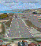
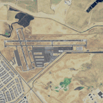
| St. Kitts Island - Federation of Saint Kitts and Nevis |
|
Images related to this file:
File Description:
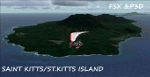
A representation of St. Kitts using photo-real scenery along with hand placed autogen. Robert L. Bradshaw International Airport is an international airport located just northeast of Basseterre, on the island of Saint Kitts, serving the nation of Saint Kitts and Nevis.
New construction started late 2004. Up to 6 wide bodied jets can now be accommodated on the tarmac. The airport can accommodate commercial jumbo jets and handles scheduled non-stop jet flights to Canada and the United States, as well as numerous regional commuter flights from within the Caribbean area. For the best results of this scenery, PWSceneries Volume 5 has to be installed. Features included are custom photo scenery covering the entire island, hand placed autogen, detailed 3D Objects and custom buildings. Works in FSX and P3D.
| Filename: | St_Kitts_Island___Federation_of_Saint_Kitts_and_Ne.zip |
| License: | Freeware |
| Added: | 24th September 2015, 10:57:42 |
| Downloads: | 827 |
| Author: | Kenje Thomas & Jamalje Bassue |
| Size: | 105.56 MB |
| Category: Flight Simulator X - Scenery | |
| Kavala - Greece |
|
Images related to this file:
File Description:
Kavala DN
AS REAL AS IT GETS.
This is a highly detailed photorealistic scenery of the beautiful Kavala area
and the Island of Thasos WITH NIGHT TEXTURES.
The scenery contains many objects like cars, boats and buldings in many cities
like Kavala, Keramoti, Thasos and around the airport.
Default FSX airport Megas Alexandros (LGKV) and Amigdhaleon (LGKM) were
corrected and repositioned to their exact location, runway 05L was added,
many buildings and trees, aircraft hangers, airforce static aircraft and army vehicles.
Also I added 2 small aircraft traffic files and a small file for helicopter traffic.
Check the Oil Rig in Kavala Bay and try to land on the helipad.
The scenery also includes the customary autogen buildings, vegetation and
road traffic near the cities to enhance and animate the landscape.
| Filename: | Kavala__Greece.zip |
| License: | Freeware |
| Added: | 24th November 2016, 17:35:13 |
| Downloads: | 1,466 |
| Author: | Angelo Tassoglou |
| Size: | 200.36 MB |
| Category: Flight Simulator X - Scenery | |
| ENFG_Fagernes/Leirin, Norway for FSX |
|
Images related to this file:
File Description: The airport ENFG is situated about 4 kilometers northeast of the city of Fagernes in the municipal of Nord-Aurdal, Oppland, about 120 miles northeast from Oslo.
The altitude of ENFG is 822 m / 2,697 ft. The airport is very close to the important rocks of Jutunheimen. The senery has a photo background that covers all four seasons: spring, summer, autumn and winter. The surroundings are made via new landclasses which fit mostly the reality. Also all lakes and rivers are updated. The buildings in this scenery are mostly taken from the fantastic XPlane scenery made by Hans Kristian Braaten Olsen, who kindly gave me permission to use his buildings in this scenery. I prepared them for FSX and partly reworked them a bit.
| Filename: | ENFG_FagernesLeirin_Norway_for_FSX.zip |
| License: | Freeware |
| Added: | 5th October 2019, 18:01:05 |
| Downloads: | 481 |
| Author: | Wolfgang Allers |
| Size: | 245.88 MB |
| Category: Flight Simulator X - Scenery | |
| Meigs Field KCGX |
|
File Description:
FSX Scenery- Meigs Field (KCGX) Chicago. Merrill C. Meigs Field Airport (IATA: CGX, ICAO: KCGX), was a single strip airport built on Northerly Island, the man-made island originally created to house the 1933-1934 Century of Progress in Chicago, Illinois. The airport opened on December 10, 1948, and became the country's busiest single-strip airport by 1955. The latest air traffic tower was built in 1952 and the terminal was dedicated in 1961. The airfield was named for Merrill C. Meigs, publisher of the Chicago Herald and Examiner and an aviation booster. Meigs no longer exists. Created with FSDS3 and EZ Scenery. The textures for the FSDS3 element is included. You must download the EZ Scenery Libraries for the EZS element. PLEASE READ README FILE!!! By John B. Loney, Jr.
| Filename: | Meigs_Field_KCGX.zip |
| License: | Freeware, limited distribution |
| Added: | 28th December 2009, 20:16:10 |
| Downloads: | 5,936 |
| Author: | John B. Loney, Jr. |
| Size: | 685.06 KB |
| Category: Flight Simulator X - Scenery | |
| Rio Vista Municipal Airport, California (O88) |
|
Images related to this file:
File Description:
Rio Vista Municipal Airport, is located on the western edge of the city of Rio Vista in the heart of California's San Joaquin River Delta, about 260 mile northeast of San Francisco. Rio Vista Municipal Airport has an 4,200-foot long, 75-foot wide primary runway. There is also a 2,200-foot long, 60-foot wide secondary runway and a helipad. This is a major overhaul of the default airport, dramatically improving accuracy of taxiways, runways, aprons, structures and other scenery details. Designed so that anyone familiar with the actual airport will experience immediate recognition, the project includes several custom buildings and many custom scenery objects modeled on the actual airport. The surrounding area has been extensively modeled. Including, 324 accurately place wind turbines, 3690 houses, and a total count of 4740 scenery objects.
| Filename: | Rio_Vista_Municipal_Airport_California_O88.zip |
| License: | Freeware |
| Added: | 5th December 2011, 21:26:45 |
| Downloads: | 943 |
| Author: | John Hottel |
| Size: | 19.21 MB |
© 2001-2026 AVSIM Online
All Rights Reserved
Privacy Policy |