
Where Flight Simulation Enthusiasts Gather from Around the World!
AVSIM Library - Search Results

| Category: Flight Simulator X - Flight Plans | |
| Out To Grass UK |

|
File Description:
Out To Grass (OTG) is a series of ten flight plans covering most of England and using only grass airfields. The flights, each having several legs, are intended to exploit the VFR Photographic Scenery X and the UK2000 Scenery airfields for the three areas covering England. Full briefings are included describing the areas and airfields visited, along with some help with the flying. The Readme has full instructions for installation and recommendations for freeware add-ons required. By Gordon Wilkinson.
| Filename: | Out_To_Grass_UK.zip |
| License: | Freeware |
| Added: | 29th April 2012, 21:22:13 |
| Downloads: | 278 |
| Author: | Gordon Wilkinson |
| Size: | 431.62 KB |
| Category: Flight Simulator X - AFCAD Files | |
| LNMC - Principality of Monaco Heliport |
|
File Description:
I dedicate this to all virtual pilots for FSX scenery who fly at night and during the day, thist is the scenario of the Principality of Monaco (Principato di Monaco) with its heliport (LNMC). For a better representation/experience I suggest using Ultimate Terrain Europe for FSX.
The installation of this scenario is very simple, the file goes placed in the folder Addon Scenery for FSX and you do not even add it as a scenario because it will be added automatically.
| Filename: | LNMC__Principality_of_Monaco_Heliport.zip |
| License: | Freeware |
| Added: | 25th May 2013, 19:45:02 |
| Downloads: | 1,600 |
| Author: | Pasquale Marrulli |
| Size: | 11.97 KB |
| Category: Flight Simulator X - AFCAD Files | |
| BGSF - Kangerlussaq Airport - Qeqqata, Greenland |
|
File Description:
BGSF is located at the head of Sondre Stromfjord, 90 NM Miles North East of the month of the Davis Strait. Greenland's permanent icecap is located approximately 15 NM to the east. The airport also known as Sondrestrom was originally an American airbase during WWII, but is now under civilian control. The airport has domestic air service as well as Airbus 330 service to Denmark with Air Greenland.
This scenery was designed to be used with the default FSX scenery.
| Filename: | BGSF__Kangerlussaq_Airport__Qeqqata_Greenland.zip |
| License: | Freeware |
| Added: | 20th June 2013, 02:01:43 |
| Downloads: | 1,685 |
| Author: | Bill Bridges |
| Size: | 9.46 KB |
| Category: Flight Simulator X - Scenery | |
| Sacrario Monte Grappa |
|
File Description:
The landscape refers to the Memorial of Monte Grappa in Italian at coordinates 45 ° 52 '20 "N, 11 ° 47 '50" E, in memory of the fallen of the First World War. The location and a destination for visitors. In the zip file you will find the Sacrario_Monte_Grappa.zip Sacrario_Monte_Grappa.bgl and Readme.txt files. The installation procedure is very simple just put the files in Sacrario_Monte_Grappa.bgl addon scenery FSX scenery folder and restart the file will be read automatically. Good flight.
| Filename: | Sacrario_Monte_Grappa.zip |
| License: | Freeware |
| Added: | 10th June 2016, 14:30:37 |
| Downloads: | 428 |
| Author: | Pasquale Marrulli |
| Size: | 2.2 KB |
| Category: Flight Simulator X - Scenery | |
| Tindari Geographic Coordinates N 38.08.27 E 15.02.48.Important VFR reference point for planes coming from Palermo and heading to Reggio Calabria |
|
File Description:
I wanted to realize the scenery of the sanctuary of Maria Santissima of Tindari village of Patti, in the province of Messina. It rises on the summit of the homonymous hill and overlooks Marinello's ponds in the homonymous nature reserve. Important VFR reference point for planes coming from Palermo and heading to Reggio Calabria. Geographic Coordinates N 38.08.27 E 15.02.48. For more information on the site search on google. In the Package you will also find instructions for installing the scenery.
| Filename: | Tindari_Geographic_Coordinates_N_380827_E_150248Im.zip |
| License: | Freeware |
| Added: | 24th August 2017, 05:08:31 |
| Downloads: | 256 |
| Author: | Pasquale Marrulli |
| Size: | 1.6 KB |
| Category: Flight Simulator X - Scenery | |
| San Giovanni Rotondo Puglia Italy Coordinate N 41°42 'E 15° 44' |
|
File Description:
San Giovanni Rotondo is an Italian municipality in the province of Foggia in Puglia Italy, rises 1256m above the
promontory of El Gargano, famous in the world for hosting the remains of St. Pius by Pietrelcina, cappuccino friar who
lived long in the homonym city. Geographic coordinates N 41° 42 'E 15° 44'. The scenery is an important VFR point at
1256m for those who want to fly over the Gargano. Within the package you will find instructions for installing the scenery.
| Filename: | San_Giovanni_Rotondo_Puglia_Italy_Coordinate_N_414.zip |
| License: | Freeware |
| Added: | 2nd September 2017, 18:12:17 |
| Downloads: | 371 |
| Author: | Pasquale Marrulli |
| Size: | 1.71 KB |
| Category: Flight Simulator X - Scenery | |
| ENOV-Orsta Volda Hovden v2 |
|
Images related to this file:
File Description:
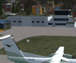
Freeware scenery made by Knudsenair simulations. Scenery is V2 of ENOV in Norway regional pack.
Ørsta–Volda Airport, Hovden (Norwegian: Ørsta–Volda lufthamn, Hovden; IATA: HOV, ICAO: ENOV) is a regional airport situated at Hovden (Hovdebygda), in Ørsta, Norway, midway between the towns of Ørsta and Volda. The airport features a 1,070-meter (3,510 ft) asphalt runway aligned 06/24. Services are provided by Widerøe using their de Havilland Canada Dash 8 as a public service obligation.
| Filename: | ENOVOrsta_Volda_Hovden_v2.zip |
| License: | Freeware |
| Added: | 29th April 2020, 19:17:25 |
| Downloads: | 327 |
| Author: | Knudsenair simulations |
| Size: | 389.98 KB |
| Category: Flight Simulator X - Missions | |
| WhistlerAirGolfOuting(2).zip |
|
File Description:
Helicopter mission. A helicopter at CYPS airport provides services. Take golfers out to the Whistler Golf resort in British Columbia . The weather is CAVU with light winds. This zip file contains two versions of this mission. V2 of the mission will work with Orbx base scenery and PNW, P3DV5, and P3DV6. V1 works with FSX, FSXSE, P3DV4. Which ever sim you are running, chose the right version. Also be advised that there may be some scenery anomalies but the mission will still work.
| Filename: | WhistlerAirGolfOuting2zip.zip |
| License: | Freeware |
| Added: | 12th November 2023, 22:24:06 |
| Downloads: | 33 |
| Author: | helomissionman |
| Size: | 10.81 MB |
| Category: Flight Simulator X - Original Aircraft | |
| Galactica TOS Package |
|
File Description:
FEATURES:
- Pilotable Battlestar Galactica from The Original Show
- AI Galactica designed for use with the AICarriers freeware addon
- Galactica TOS Scenery - puts Galactica near Catalina Island
- Galactica Library Object for use with the Object placement tool for new scenery files
- Bump mapping and night textures
- working Arrestor cables in the leftside landing bay (Acceleration users)
- Launch tubes
*Compiled with the FSXA SDK and tested in FSX w/Acceleration on WinXP / DX9
- for FSX ONLY by Bruce Fitzgerald -
| Filename: | Galactica_TOS_Package.zip |
| License: | Freeware |
| Added: | 6th March 2009, 16:40:36 |
| Downloads: | 1,293 |
| Author: | Bruce Fitzgerald |
| Size: | 9.56 MB |
| Category: Flight Simulator X - Scenery | |
| Preveza (LGPZ) |
|
Images related to this file:
File Description:
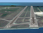
AS REAL AS IT GETS.
This is a highly detailed photorealistic scenery of beautiful Preveza.
The scenery contains many objects like cars, boats and buldings in Preveza, Amfiloxia and around the Amvrakikos Bay.
(Not all Amvrakikos is covered. See next upload).
Default FSX Preveza Aktion airport (LGPZ) was corrected and repositioned to the exact location and some buildings and trees were added along with aircraft hangers, airforce static aircraft and army vehicles.
Also I've added a small apron with parking for civilian planes.
| Filename: | Preveza_LGPZ.zip |
| License: | Freeware |
| Added: | 8th July 2011, 01:30:17 |
| Downloads: | 3,131 |
| Author: | Angelo Tassoglou |
| Size: | 243.61 MB |


© 2001-2026 AVSIM Online
All Rights Reserved
Privacy Policy |