
Where Flight Simulation Enthusiasts Gather from Around the World!
AVSIM Library - Search Results

| Category: Flight Simulator X - Scenery | |
| CYCW-Chilliwack Municipal |

|
File Description:
The Chilliwack Municipal Airport is home to approximately 75 private and commercial aircraft, which includes
both fixed wing and helicopters. There are over 20 businesses at the airport including: flight training schools,
charter companies: both fixed wing and helicopter, aircraft paint and maintenance shops, as well as, other
assorted aviation oriented businesses. They also boast a fine eatery: “The Airport Coffee Shop” and their
famous pies.
Chilliwack Airport is well known to B.C. aviators as one of the most attractive airports in the province.
It is a showpiece for the community.
| Filename: | CYCWChilliwack_Municipal.zip |
| License: | Freeware |
| Added: | 17th March 2009, 01:42:26 |
| Downloads: | 1,172 |
| Author: | Daniel Louvet |
| Size: | 892.71 KB |
| Category: Flight Simulator X - Aircraft Repaints, Textures and Modifications | |
| Cessna C172P (SX-AEW) |
|
Images related to this file:
File Description:
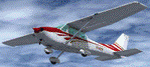
This is a representation of SX-AEW, of the Dekeleia Aeroclub based in Tatoi LGTT, north of Athens. It is used both for training and for flights by all club members holding a PPL. It is also available for pleasure flights and initiation flights for non members. The real one also has extended fuel tank capacity for 6 hours endurance.
The actual plane is an older "P" model with carburetor equipped engine so there are several model differences from the "R" represented by A2A including antennae, and very different cockpit with no headrests and different door interior and instrument panel. The tinted cabin glass has been reproduced in the repaint.
| Filename: | Cessna_C172P_SXAEW.zip |
| License: | Freeware |
| Added: | 18th September 2013, 00:16:55 |
| Downloads: | 342 |
| Author: | Vassilios Dimoulas |
| Size: | 21.71 MB |
| Category: Flight Simulator X - Aircraft Repaints, Textures and Modifications | |
| Boeing 737-800 Air Algerie livery (Default FSX aircraft, not for any addon version of the 737) |
|
File Description:
Boeing 737-800 livery designed for the default 737-800 available in Flight Sim X.
by Zergoun Aissa
| Filename: | Boeing_737800_Air_Algerie_livery_Default_FSX_aircr.zip |
| License: | Freeware, limited distribution |
| Added: | 15th August 2023, 14:45:25 |
| Downloads: | 43 |
| Author: | Zergoun Aissa |
| Size: | 2.96 MB |
| Category: Flight Simulator X - Scenery | |
| Active ILS, VHHX (Hong Kong Kai Tak Airport) |
|
File Description:
This FSX Airport is more then just an enhanced style Airport. As most know the Approach and Final (VMC) for AI Traffic in FSX is a straight in type landing and does not always consider real world approaches. This is due to the way that the coding is written in FSX and it puts limits on IFR arriving aircraft. At certain airports the AI Traffic will fly directly through a mountain once it is established on Final for a runway. What you will see with my files is a different type approach used for both the way I control AI and User Airplane Traffic in FSX. My AI Aircraft Approach coding system for FSX uses a visual offset approach so AI Traffic does not fly through the mountains but flys the IGS/LDA 13 approach to the Checkerboard. Try your skill flying a Large Heavy Airplane vectored by ATC onto the approach course of the IGS/LDA 13 approach to Kai Tak. Read the text file for all the enhancements added to the FSX VHHX Airport along with a full understanding of how the new Approaches work *** Full set of Freeware Approach Charts included ***
| Filename: | Active_ILS_VHHX_Hong_Kong_Kai_Tak_Airport.zip |
| License: | Freeware, limited distribution |
| Added: | 19th September 2007, 11:57:46 |
| Downloads: | 27,459 |
| Author: | Jim Vile |
| Size: | 3.61 MB |
| Category: Flight Simulator X - AFCAD Files | |
| Bridgeport-Cahill Field Airport (6NJ9), NJ |
|
File Description:
Located 01 miles SW of Bridgeport, New Jersey on 167 acres of land, this airport is non-existent in real life, as far as I am able to determine. although it is still listed as Active, no visible trace of anything remotely suitable for a landing strip is visible anywhere in this area. The strip mining operation nearby in some satellite/aerial photos shows a long narrow grass strip that could be used as a runway, but then others show it stripped down to bare dirt as part of the apparent mining operation, and the MegaSceneryEarth textures depict this latter representation as well. So I have simply removed visible evidence of this strip, although FSX will still try to tell you it's there in the airport directory.
Scenery constructed with use of satellite images/streetview/aerial photos - the author has not been there in person.
This scenery is meant to be used in conjunction with MegaScenery Earth New Jersey/Delaware 004. It is not required, but apron use is minimized to allow satellite scenery to show through as much as possible, and objects are placed based on the MSE textures - lack of it may make scenery look out of place.
| Filename: | BridgeportCahill_Field_Airport_6NJ9_NJ.zip |
| License: | Freeware |
| Added: | 10th February 2011, 05:01:38 |
| Downloads: | 197 |
| Author: | Drew Sikora |
| Size: | 209.8 KB |
| Category: Flight Simulator X - Scenery | |
| Dieuze - Gueblange V2 |
|
Images related to this file:
File Description:
This scenery depicts Dieuze-Gueblange aerodrome located in the north east of France. It is a very accurate rendition of this aerodrome made with photoreal textures for the ground and the objects. The ground is covered with volumetric grass. I have modelled an animated sock that indicates the wind direction and velocity. To see this windsock, Sode (Sim Objects Display Engine) module must be installed (module availabale here : http://sode.12bpilot.ch/?page_id=9). A user manual (pdf) is included.
The windsock library may be used in your own sceneries. If you share a scenery using this library, you must add the BJP_SOCKS folder without any modification in order to avoid duplicate files. Please include my name in any of your included documents. This new release is now compatible with a landclass environment: snowy ground and trees in the hard winter (from the first day of december to the last day of january). Please read the specific enclosed manual.
| Filename: | Dieuze__Gueblange_V2.zip |
| License: | Freeware, limited distribution |
| Added: | 1st February 2015, 23:14:45 |
| Downloads: | 1,453 |
| Author: | Jacques-Paul Bollard |
| Size: | 21.98 MB |
| Category: Flight Simulator X - AFCAD Files | |
| Thomas Browne Airpark Airport (61NJ), NJ |
|
File Description:
Located 02 miles W of Glassboro, New Jersey, Thomas Browne Airpark Airport is a private turf strip 2000��80 feet. There is no hard-surfaced runway, which means you will be landing on terrain so it is recommended you set your mesh resolution as high as possible. Watch out for trees and buildings alongside and at opposite ends of the runway. Crop fields are planted to the south of the runway and border the runway. You won't crash if you run into them but it certainly won't put you in good favor with the field owners! Take caution to avoid the transmission line towers as they are not lit at night! Neither is the runway, for that matter, so daytime VFR operations only are recommended for this airfield.
Scenery constructed with use of satellite images/streetview/aerial photos - the author has not been there in person.
This scenery is meant to be used in conjunction with MegaScenery Earth New Jersey/Delaware 004. It is not required, but apron use is minimized to allow satellite scenery to show through as much as possible, and objects are placed based on the MSE textures - lack of it may make scenery look out of place.
| Filename: | Thomas_Browne_Airpark_Airport_61NJ_NJ.zip |
| License: | Freeware |
| Added: | 4th February 2011, 02:47:24 |
| Downloads: | 166 |
| Author: | Drew Sikora |
| Size: | 1.41 MB |
| Category: Flight Simulator X - Aircraft Repaints, Textures and Modifications | |
| Austrian Airlines "Kahlenberg", Boeing 737-600 (OE-LNL) |
|
Images related to this file:
File Description:

This is a Repaint for the PMDG Boeing 737-600 model in the actual livery of OE-LNL (30137/526). OE-LNL was delivered to Lauda air in May 2000. This Boeing 737-6Z9 was leased from the US Navy for flight training purposes from December 2003 until October 2009 (it flew in Lauda colors; registration during this time: N743NV). It returned to Austria and then was repainted into Austrian Airlines color scheme. To use these textures you will need the PMDG 737-600/700 NGX available here: http://www.precisionmanuals.com/
| Filename: | Austrian_Airlines_Kahlenberg_Boeing_737600_OELNL.zip |
| License: | Freeware, limited distribution |
| Added: | 5th November 2011, 20:11:06 |
| Downloads: | 1,868 |
| Author: | Roman Reiner, Chris Jilli |
| Size: | 10.92 MB |
| Category: Flight Simulator X - Scenery | |
| Scenery Oksboel shooting area EKOL |
|
File Description:
I was getting tired of in FSX not having any scenery to practice weapon delivery (fx.TacPack from VRS) here in Denmark, so I decided, to try to make the Oksboel (Oksbøl) shooting area, which are used by the Danish military (air force too) for weapons training.
I made it photo real and with autogen vegetation (autogen annotator) and it contents some homemade targets: 10, 7, 5m shooting targets, SAM missile launchers, SAM radar and tank made of Bob Lacy.
I have tryed the scenery into P3D (version 3) and it worked fine there. (autogen vegetation too)
| Filename: | Scenery_Oksboel_shooting_area_EKOL.zip |
| License: | Freeware |
| Added: | 17th December 2017, 20:19:12 |
| Downloads: | 325 |
| Author: | Otto Knudsen |
| Size: | 41.87 MB |
| Category: Flight Simulator X - Gauges | |
| Radar Gauge |
|
File Description:
This is a generic Radar-Display (Version 1) with a moving sweep and range rings. The gauge can be used for any aircraft in the FSX-Environment. The gauge can be installed as a single gauge in the main panel window or as a extra window to be opened via a little icon on the panel. The gauge includes a control panel which allows the user to turn on/off individual displays like APTs, ILS, TAGs on ground and/or on Air etc.. Very helpful for hunting AI traffic and specifically useful for military aircrafts.
Installation:
Follow the installation/operational instructions on the pdf-documentation inside the zip-file .
| Filename: | Radar_Gauge.zip |
| License: | Freeware |
| Added: | 20th March 2009, 10:02:22 |
| Downloads: | 4,206 |
| Author: | Dietmar Loleit |
| Size: | 548.46 KB |


© 2001-2026 AVSIM Online
All Rights Reserved
Privacy Policy |