
Where Flight Simulation Enthusiasts Gather from Around the World!
AVSIM Library - Search Results

| Category: Flight Simulator X - Scenery | |
| Iguassu Falls - Save The Planet |

|
Images related to this file:
File Description:
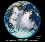
The Iguassu Falls, Itaipu Hydroelectric Power Plant, Foz do Iguassu City and Land Class Package for FSX
Save The Planet is my version of the Iguassu Falls, Itaipu Dam, bridges and landclass scenery for FSX.
Differently from my other version for MSFS 2004, I created a mesh of 5 meter resolution for Iguassu Falls area
to give me some idea how I could proceed. So, I decided to use on this addon
an image background avaliable at server (VirtualEarthSatellite). Thanks Microsoft.
Non-Airport Scenery - ICAO (SBFI). coming soon at www.Terra-Brasilis.org
Portuguese: Cataratas do Iguassu,
Spanish: Cataratas del Iguazu are waterfalls of the Iguassu River located on the border of the Brazilian state of Parana (in the Southern
Region) and the Argentinian Province of Misiones.
The Falls are shared between the Iguazu National Park (Argentina) and Iguacu
National Park (Brazil). The parks were designated UNESCO World Heritage Sites.
The Itaipu Hydroelectric Power Plant is located in the Parana River, in the stretch of the frontier between Brazil and Paraguay, 14 km north of the Friendship Bridge.
The area of the project extends from Foz do Iguassu, in Brazil, and Ciudad del Este, in Paraguay, in the south, up to Guaira (Brazil) and the Guaira Falls (Paraguay), in the north.
Enjoy FSX Iguassu Falls Scenery!
| Filename: | Iguassu_Falls__Save_The_Planet.zip |
| License: | Freeware |
| Added: | 9th December 2010, 01:57:00 |
| Downloads: | 2,850 |
| Author: | Cicero Costa |
| Size: | 31.71 MB |
| Category: Flight Simulator X - Scenery | |
| MYLD - Deadman's Cay - The Bahamas |
|
Images related to this file:
File Description:
Deadman's Cay is one of two airports on Long Island served by Bahamas Air, Southern Air and Pineapple Air from Nassau. The scenery includes custom scenery objects; placement of library objects and landclass changes. Scenery is based on Bing Maps and photos taken locally, and it is optimized for use with UTX-TAC.
| Filename: | MYLD__Deadmans_Cay__The_Bahamas.zip |
| License: | Freeware |
| Added: | 17th May 2013, 01:08:33 |
| Downloads: | 727 |
| Author: | Art Poole |
| Size: | 1.41 MB |
| Category: Flight Simulator X - Scenery | |
| Rock Sound - The Bahamas (MYER) |
|
Images related to this file:
File Description:
This scenery includes rework of the runway, taxiways, aprons and parking; custom scenery objects; placement of library objects and landclass changes compatible with UTX-TAC in the vicinity of MYER. It is based on Google Earth imagery and photos taken by Harrington Mallory.
| Filename: | Rock_Sound__The_Bahamas_MYER.zip |
| License: | Freeware |
| Added: | 21st November 2012, 01:56:51 |
| Downloads: | 1,309 |
| Author: | Art Poole |
| Size: | 1.18 MB |
| Category: Flight Simulator X - Scenery | |
| Cat Island - The Bahamas (MYCB) |
|
Images related to this file:
File Description:
This scenery adds runway and taxi paths and parking to accommodate AI traffic. It also includes custom scenery objects; placement of library objects and landclass changes. It is based on Google Earth imagery and photos taken by Harrington Mallory and is optimized for use with UTX-TAC.
| Filename: | Cat_Island__The_Bahamas_MYCB.zip |
| License: | Freeware |
| Added: | 3rd December 2012, 14:29:49 |
| Downloads: | 1,184 |
| Author: | Art Poole |
| Size: | 1.16 MB |
| Category: Flight Simulator X - Missions | |
| The Most Dangerous Airports: Madeira |
|
Images related to this file:
File Description:
I have created the next in The Most Dangerous Airports Mission Series, namely Madeira. The airport runway has a unique feature, it was lengthed by �± 1 mile by adding a section build on 70 meters high pillars.
| Filename: | The_Most_Dangerous_Airports_Madeira.zip |
| License: | Freeware |
| Added: | 19th November 2009, 20:37:16 |
| Downloads: | 3,539 |
| Author: | Robbie Albers |
| Size: | 15.06 MB |
| Category: Flight Simulator X - Aircraft Repaints, Textures and Modifications | |
| The Ultimate Global Update V1.1 |
|
Images related to this file:
File Description:
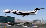
This package features 99 repaint updates for the DJC Global Express and Global 5000 models, including registration changes, colour scheme alterations and brand new aircraft previously not featured. You must have BOTH "ultimate_global_express_fsx_v1.1.zip" AND "ultimate_global_5000_fsx.zip" installed on your system for this update to work, no models are included. Please note: This is a FSX package ONLY! FS2004 users are required to download and install a separate FS2004 package!
| Filename: | The_Ultimate_Global_Update_V11.zip |
| License: | Freeware, limited distribution |
| Added: | 10th January 2011, 22:51:46 |
| Downloads: | 2,324 |
| Author: | Thomas Ernst, Daniel Fall, Felix Hippmann, Alex Peake | Ultimate GA |
| Size: | 18.16 MB |
| Category: Flight Simulator X - Scenery | |
| Monte Chaberton coordinates N 44.57.52 E 6.45.05 "The fortress between the clouds" |
|
File Description:
"The fortress between the clouds" of Mount Chaberton coordinates N 44.57.52 E 6.45.05. I wanted to realize this scenery in honor of the fallen of the 34th Artiglieri i Group and of the Italian Frontier who lost their lives during the 1nd World War. Within the package you will find a readme file where you explain how to install the scenery. The scenario is also compatible with P3d. Good flight.
| Filename: | Monte_Chaberton_coordinates_N_445752_E_64505_The_f.zip |
| License: | Freeware |
| Added: | 11th September 2017, 06:37:17 |
| Downloads: | 128 |
| Author: | Pasquale Marrulli |
| Size: | 1.31 KB |
| Category: Flight Simulator X - Aircraft Repaints, Textures and Modifications | |
| B-17G Stingy |
|
Images related to this file:
File Description:

This folder contains a repaint for the accu-sim version of the A2A B-17G Flying Fortress. The B-17G-1-BO 42-31053 ���«Stingy���» was operated from several UK wartime bases (the last was Snetterton Heath).
On a training flight on 11 October 1944 Stingy crashed at Woodend after being involved in a mid air collision with two other B-17's. Stingy participated in several missions, among them over Regensburg and Poznan.
| Filename: | B17G_Stingy.zip |
| License: | Freeware |
| Added: | 12th February 2011, 10:54:09 |
| Downloads: | 514 |
| Author: | A2A Simulations/Gunnar van der Meeren |
| Size: | 16.15 MB |
| Category: Flight Simulator X - Scenery | |
| YBMC - Maroochydore (Sunshine Coast) Airport - Queensland, Australia **With Corrections** |
|
File Description:
With his permission this is Martin Hiesboeck's airport layout file (AFCAD) for the default FSX YBMC Maroochydore (Sunshine Coast) Airport in Queensland, Australia with two changes. (ATIS changed to 119.5MHz due to conflict with CTR freq 119.8 and Primary Rwy set to 36/18).
It features an enlarged apron, additional asphalt surfaces to accommodate the FSX default buildings, corrected gate numbers, jetways (which aren't there in reality - you can turn them off by reducing scenery complexity), added parking areas and vehicle pathways.
The runway is configured for noise abatement procedures usually in place: Landing RWY 36, Takeoff RWY 18 for all jets, such as not to disturb the sunseekers on the beach. Gate assignments are incomplete. Tested with WoAI AI only.
Original file uploaded by Martin Hiesboeck named ybmc_mh.zip with changes and renamed ymbc_mh2.zip.
| Filename: | YBMC__Maroochydore_Sunshine_Coast_Airport__Queensl.zip |
| License: | Freeware |
| Added: | 11th March 2015, 13:55:08 |
| Downloads: | 433 |
| Author: | Simon Hitch, Martin Hiesboeck |
| Size: | 115.59 KB |
| Category: Flight Simulator X - Helicopters | |
| Royal Navy EH101. 824 NAS, RNAS Culdrose |
|
Images related to this file:
File Description:
This is a repaint for the default FSX Acceleration EH101 Merlin, depicting a 'Cab' used 824 Naval Air Squadron of RNAS Culdrose during the summer of 2009. The Merlin training unit, 824 NAS's HM.1s are a very regular site around west Cornwall. Especially south of the base on the Lizard Peninsula, on the short flight path between Culdrose and its satellite airfield, Predannack. A former RAF station in its own right. This is obviously a fictitious repaint as the FSX Merlin is modelled on the transport variant (HC.3 in RAF service) as opposed to the maritime patrol HM.1. By Ash Jackson
| Filename: | Royal_Navy_EH101_824_NAS_RNAS_Culdrose.zip |
| License: | Freeware |
| Added: | 9th November 2009, 18:19:52 |
| Downloads: | 878 |
| Author: | Ashley Jackson |
| Size: | 3.17 MB |


© 2001-2026 AVSIM Online
All Rights Reserved
Privacy Policy |