
Where Flight Simulation Enthusiasts Gather from Around the World!
AVSIM Library - Search Results

| Category: Flight Simulator X - Missions | |
| Battle of Midway 1942 V3.00 |

|
Images related to this file:
File Description:

Just after having passed the Aviation Cadet Program and the E base (Elimination base), The first month we spent our time flying the primary trainers or N3N's better known as "Yellow Perils." Transferred to Wheeler air base (Honolulu) Its the first time that we see the new Horse of Battle of the Navy, the Douglass Sbd3 Dauntless, It was a beautiful plane for is time!. two mount later we receive our first instruction of the war, rejoining the U.S.S Yorktown. Here five exiting mission that will return you back in the skin of a couragous US NAVY Pilots or a IJN pilots. Make your flight plan, Check the wind and Calculate the wind drift and flight time whit your "E6b" navigation tool and wind tool in board of your plane. and prey to come back alive !. In this old time, all was made by hands. Good luck !. Here some new feature of Fsx Midway 1942 Mission v3.00: "Dummy carrier" replaced by Wonderful Yanco San I.J.N and U.S carrier ! two new exiting mission added, "Attack on Midway" and "First mission rejoining U.S.S Yorktown" Now you will fly accompanied by 2 ai wing man.
| Filename: | Battle_of_Midway_1942_V300.zip |
| License: | Freeware |
| Added: | 28th December 2011, 19:59:37 |
| Downloads: | 1,821 |
| Author: | Ronald Dandurand |
| Size: | 26.61 MB |
| Category: Flight Simulator X - Scenery | |
| RAF Balderton |
|
File Description:
RAF Balderton is a former Royal Air Force station located 2.0 miles (3.2 km) south of Newark-on-Trent, sandwiched between the now extinct Great Northern Railway (GNR) Bottesford-Newark line and the A1 road in Nottinghamshire, England.
Opened in 1942, it was used by both the Royal Air Force and United States Army Air Forces. During the war it was used primarily as a troop carrier transport airfield and after for munitions storage before it was closed in 1957.
With the facility released from military control, Balderton was returned to agriculture, the runway concrete disappearing as hardcore under the AI road improvements of the 1960s. At that time, the developed Al was routed west of the original road, over the eastern perimeter track of the airfield, before coming back to the east to bypass Balderton village and Newark.
Gypsum open-pit mining has also taken its toll where quarrying has completely obliterated the airfield, with single track roads all that remain of the runway and perimeter track, and the occasional concrete runway end or pile of rubble.
Today the remains of the airfield are located on private property being used as agricultural fields.
| Filename: | RAF_Balderton.zip |
| License: | Freeware |
| Added: | 17th February 2016, 23:32:44 |
| Downloads: | 233 |
| Author: | Terry Boissel |
| Size: | 759.04 KB |
| Category: Flight Simulator X - Scenery | |
| HALA - Hawassa Intl. - Hawassa, Ethiopia |
|
Images related to this file:
File Description:
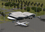
This project adds the booming city of Hawassa, Ethiopia, creates the new international airport (HALA), moves (and rebuilds) the downtown airport (recoded to HALX), and includes AI flight plans for the Ethiopian Airlines service that began April 2016. Tested in both the default FSX: Acceleration and with FTX Global/Vector, accurate coastlines, lakes, road data, and SRTMGL1 (30m) mesh, as well as corrected landclass are provided based on the latest available satellite imagery. The Hawassa International Airport was created using information from the current satellite footprint and the promotional video from Ethiopian Airports Enterprise (EAE). Although there is still very little published data on the airport, it is fully functional.
Updates were created or rebuilt in a manner which carefully aligns airport data with current satellite imagery. Scenery was created using Airport Design Editor X v1.70.6042, SBuilderX 3.13, and the FSX Object Placement Tool. Scenery objects were added and modified from stock FSX scenery to resemble as closely as possible the actual airports. The FSX apron lights included are from the set created by Jim Dhaenens. Thanks to Ron Blehm for bringing this part of the world to my attention.
| Filename: | HALA__Hawassa_Intl___Hawassa_Ethiopia.zip |
| License: | Freeware |
| Added: | 20th July 2016, 09:06:40 |
| Downloads: | 1,021 |
| Author: | Carlyle Sharpe |
| Size: | 10.41 MB |
| Category: Flight Simulator X - Scenery | |
| Ireland VFR Small Airports part 4 |
|
File Description:
Ireland VFR Small Airports Part 4.
Three new airports for FSX, consisting of EI50 Limetree, EI55 Eyne and EICN Coonagh. Limetree and Eyne are 70km southwest of EIDW Dublin. Coonagh is 16km East of EINN Shannon. These airports have been built from scratch, are standalone, and designed to sit on the default terrain. The scenery features custom runways and textures together with full custom models and textures based on real photographs. The scenery has been tested and authenticated by real local pilots. More realistic landclass, autogen rivers and roads have been added to the areas around the airports. It also features many HD textures, AI aircraft and road traffic. The scenery uses seperate elements which can be switched on or off according to the users preference and hardware.
This scenery is real flying 'by the seat of your pants'. There are no lights, navaids, or ILS and runway markings are eaten by the sheep.
Full installation instructions, settings, credits, hints and tips can be found in the README file.
Please enjoy and I hope you like the airports as much as I enjoyed making them.
| Filename: | Ireland_VFR_Small_Airports_part_4.zip |
| License: | Freeware, limited distribution |
| Added: | 15th October 2013, 05:28:25 |
| Downloads: | 2,153 |
| Author: | George Keogh |
| Size: | 164.6 MB |
| Category: Flight Simulator X - Scenery | |
| Sioux Falls South Dakota Regional Airport - Joe Foss Field for FSX |
|
Images related to this file:
File Description:
Sioux Falls South Dakota Regional Airport - Joe Foss Field for FSX. Several improvements have been made to the default airport. The default terminal buildings have been replaced with buildings created in FSDS; aircraft gates have been correctly coded using Airport Design Editor 1.70.6042; a new airport vehicle network has been built; extra fuel trucks have been added throughout the airport; the tower view has been changed to display from the roof of the control tower; a static FedEX truck in two different color schemes has been placed in the cargo area; all taxiway signs are correctly placed and all taxiway designators are correctly named; there is the option to open all three runways to AI traffic; the 114th Fighter Wing of the South Dakota Air National Guard is represented; optionally, a set of GA flight plans is included using all default FSX aircraft to liven up the GA area; also included is a set of military flight plans for the 114th Fighter Wing; and Jim Dhaenen's excellent ramp lights are also included. Please read the README FIRST.txt and Installation.txt files to insure proper installation of all files.
| Filename: | Sioux_Falls_South_Dakota_Regional_Airport__Joe_Fos.zip |
| License: | Freeware, limited distribution |
| Added: | 14th April 2017, 07:16:53 |
| Downloads: | 971 |
| Author: | Patrick Finch |
| Size: | 3.56 MB |
| Category: Flight Simulator X - Scenery | |
| Teterboro Airport, New Jersey |
|
File Description:
Teterboro Airport is located across the Hudson River in New Jersey, just 12 miles from midtown Manhattan, Teterboro Airport is considered a general aviation reliever airport. As a reliever airport, it does not offer scheduled airline service, nor does it permit operations of any aircraft in excess of 100,000 pounds on any airport surface. Teterboro Airport has five Fixed Base Operators (FBOs), Atlantic Aviation, Jet Aviation, First Aviation, Meridian, and Signature Aviation. Scenery includes Phototexture to cover the unattractive stock FSX airport ground texture. Along with Night, Fall and Winter varience textures. Autogen is placed on top of phototexture in specific areas. ALL airport objects have been placed in proper position to photoscenery. Aprons and taxiways in alignment with photostexture. Supports AI traffic for the pilots who use. Numerous Airport vehicles and stacic aircraft on the gounds. There are a few GMAX scenery objects along with Stock FSX objects. If you have cast ground shadows checked in your display feature, some of the vegetation will show black blocks on its base, so uncheck this if you wish. I designed this for all the Charter and General Aviation pilots out there, including myself.
| Filename: | Teterboro_Airport_New_Jersey.zip |
| License: | Freeware |
| Added: | 7th July 2010, 00:47:37 |
| Downloads: | 1,786 |
| Author: | Eric McCloud |
| Size: | 36.84 MB |
| Category: Flight Simulator X - Gauges | |
| Flypad Gauge V2.0 |
|
Images related to this file:
File Description:
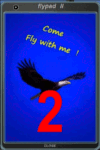
FSX, Flypad Gauge Version 2.0
This gauge has been developed on Win7 for FSX Flight Simulator SP2 or SP1.It should also work with Acceleration, but this is not guaranteed by the author. The gauge is a little extra addon based on the design of a smart phone and provides 9 different displays which are different from all of the standard gauge displays on a regular aircraft panel. It is mainly helpful for the user flying small propeller aircraft, and old timer aircraft.
However, the displays are as well attractive for sim pilots flying modern jet aircraft. Use it as if you just grabbed to your smart phone during a flight and check on the status of your aircraft, or how the terrain awareness situation looks like, how the AI traffic on the radar is, while you proceed with your flight plan. Enjoy the new design of a simple aircraft attitude display during an ILS approach. A new screen for LAT/LON coordination control and distance/bearing calculation has been added to this version in addition with a number of improvements.For credits look at the pdf documentation inside the zip file. By Dietmar Loleit
| Filename: | Flypad_Gauge_V20.zip |
| License: | Freeware |
| Added: | 2nd August 2014, 17:50:45 |
| Downloads: | 779 |
| Author: | Dietmar Loleit |
| Size: | 4 MB |
| Category: Flight Simulator X - Scenery | |
| Murray river and SE Victoria v2 for ORBX v2. YRIO Robinvale YBRN Balranald YDLQ Deniliquin YLEG Leongatha YYRM Yarram |
|
Images related to this file:
File Description:
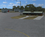
'Murray and SE Victoria v2' is made to match ORBX Australia v2 scenery. Use 'Murray + SE Victoria airports' for ORBX v1 or no ORBX. There are 5 airports. 3 airports near the Murray river in Victoria and NSW - YRIO Robinvale, YBRN Balranald, YDLQ Deniliquin. 2 airports in SE Victoria - YLEG Leongatha, YYRM Yarram. ORBX has done these as they have done every airport included with FSX in Australia to a reasonable standard. If I had not already done them for ORBX V1 I would not have bothered. However these are better than ORBX because the surroundings have been modified to match real life. Towns have been added or shifted. Forests cut down or added. Race courses, sewage treatment ponds and other stuff added. Local obstacles (towers etc) added. There are Included are 2 AI traffic files that cover the airports. These files are for Flight Simulator X. Made using Airport Design Editor using some objects borrowed from Robert Budd's excellent Baccus Marsh and 'Static aircrafts' by Jean-Pierre Fillion. REQUIRED The scenery is designed to interface with ORBX FTX_AU V2 scenery for Australia (payware).
| Filename: | Murray_river_and_SE_Victoria_v2_for_ORBX_v2_YRIO_R.zip |
| License: | Freeware |
| Added: | 15th December 2019, 19:06:10 |
| Downloads: | 316 |
| Author: | Colin Jeffery |
| Size: | 10.06 MB |
| Category: Flight Simulator X - Scenery | |
| East Coast Victoria v2 for ORBX v2 YLKE Lakes Entrance YGRL Great Lakes Airport YORB Orbost YMCO Mallacoota |
|
Images related to this file:
File Description:
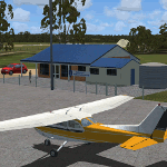
'East Coast Victoria v2' is made to match ORBX Australia v2 scenery. For ORBX v1 or no ORBX use 'East Coast Victoria'. There are 4 airports. YLKE Lakes Entrance YGRL Great Lakes Airport YORB Orbost YMCO Mallacoota. ORBX has done 2 of these (YORB, YMCO) as they have done every airport included with FSX in Australia to a reasonable standard. If I had not already done them for ORBX V1 I would not have bothered. However these are better than ORBX because the surroundings have been modified to match real life. Towns have been added or shifted. Forests cut down or added. There are also custom accurate versions of the terminal buildings. Included is an AI traffic files that covers the airports (little or no traffic from ORBX). In short a lot more time spent by me as I did not have to do every airport in Australia! These files are for Flight Simulator X. Made using Airport Design Editor using some objects borrowed from Robert Budd's excellent Baccus Marsh. REQUIRED The scenery is designed to interface with ORBX FTX_AU V2 scenery for Australia (payware).
| Filename: | East_Coast_Victoria_v2____for_ORBX_v2____YLKE_Lake.zip |
| License: | Freeware |
| Added: | 16th September 2019, 16:27:48 |
| Downloads: | 389 |
| Author: | Colin Jeffery |
| Size: | 6.32 MB |
| Category: Flight Simulator X - Scenery | |
| Limnos Ifestos Airport LGLM_1 |
|
Images related to this file:
File Description:
DUE TO AVSIM'S 500MB LIMITATION YOU NEED TO DOWNLOAD LGLM SCENERY IN TWO FILES. THE PRESENT
lglm Limnos airport_Installation folder_1 AND
lglm Limnos airport_Installation folder_2.
AFTER YOU UNZIP THEM INTO A SINGLE INSTALLATION FOLDER
OPEN THE INSTALLATION INSTRUCTIONS
Lemnos (or Limnos) is a Greek island, since ancient times, with a pure Greek population.
Due to the old volcanic activity, it was considered as the island of Hephaestus, the god of Fire. According to mythology, Zeus in a dispute with Hera threw his son Hephaestus from Olympus to the land of Lemnos. Hephaestus set up his workshop there and taught the art of metallurgy to the inhabitants of the island.
The lglm Limnos airport scenery was made over a period of 5 years and includes multiple moving parts, such as AI vehicles, moving people, night effects, air and sea traffic. Google earth was widely used for the 3D representation and the depiction of reality contains many fantastic additions to the airport and the surrounding area. An atmospheric scenery was created to provide a realistic flying experience in FSX.
You can also find a video of scenery capabilities in youtube:
https://youtu.be/y8q0dL5wb3Q
| Filename: | Limnos_Ifestos_Airport_LGLM_1.zip |
| License: | Freeware, limited distribution |
| Added: | 16th March 2023, 15:31:11 |
| Downloads: | 561 |
| Author: | Vangelis Vasilias |
| Size: | 100.66 MB |


© 2001-2026 AVSIM Online
All Rights Reserved
Privacy Policy |