
Where Flight Simulation Enthusiasts Gather from Around the World!
AVSIM Library - Search Results

| Category: Flight Simulator X - Scenery | |
| North Victoria v2 for ORBX v2 YBLA Benalla YECH Echuca YYWG Yarrawonga |

|
Images related to this file:
File Description:
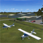
'North Victoria v2' is made to match ORBX Australia v2 scenery. Use 'YBLA Benalla' 'YECH Echuca' 'YYWG Yarrawonga' for ORBX v1 or no ORBX. There are 3 airports YBLA Benalla YECH Echuca YYWG Yarrawonga. ORBX has done these as they have done every airport included with FSX in Australia to a reasonable standard. If I had not already done them for ORBX V1 I would not have bothered. However these are better than ORBX because the surroundings have been modified to match real life. Towns have been added or shifted. Forests cut down or added. There are also custom accurate versions of the actual terminal buildings/hangers. In short a lot more time spent. ORBX had to do every airport has in Australia! Orbx have AI traffic files that cover all 3 airports. These files are for Flight Simulator X. Made using Airport Design Editor using some objects borrowed from Robert Budd's excellent Baccus Marsh and 'Static aircrafts' by Jean-Pierre Fillion. REQUIRED The scenery is designed to interface with ORBX FTX_AU V2 scenery for Australia (payware).
| Filename: | North_Victoria_v2_for_ORBX_v2___YBLA_Benalla_YECH_.zip |
| License: | Freeware |
| Added: | 2nd November 2019, 18:57:53 |
| Downloads: | 325 |
| Author: | Colin Jeffery |
| Size: | 10.01 MB |
| Category: Flight Simulator X - AFCAD Files | |
| EHAM - Amsterdam Airport Schiphol - Amsterdam, The Netherlands |
|
Images related to this file:
File Description:
Amsterdam Airport Schiphol is the Netherlands' main international airport, located 20 minutes (9.1 km; 5.6 mi) southwest of Amsterdam, in the municipality of Haarlemmermeer.
The airport is the primary hub for KLM as well as for Arkefly, Corendon Dutch Airlines, Martinair and Transavia. The airport also serves as a European hub for Delta Air Lines and as a base for Vueling. Schiphol is considered to be an Airport City.
Using ADEx 1.50, aeronautical maps and Google Earth the default AFCAD has been completely reworked to reflect today's situation including gate assignments.
Schiphol has a complex runway lay-out and usage and FSX may assign a runway that in real life is not used as such. I have implemented Jim Vile's crosswind runway technique to open all runways. Now the pilot can decide which runway to use but AI aircraft may show unrealistic behaviour. Only tailored AFCADs taking into account different wind directions will solve this but that is beyond the scope of this project.
Jetways appear based on your 'scenery complexity' settings.
| Filename: | EHAM__Amsterdam_Airport_Schiphol__Amsterdam_The_Ne.zip |
| License: | Freeware |
| Added: | 2nd November 2012, 19:54:24 |
| Downloads: | 2,202 |
| Author: | Menno C. Robert |
| Size: | 3.86 MB |
| Category: Flight Simulator X - Scenery | |
| CYBL (2011) Version 2 for FS9, FSX and Prepar3D |
|
Images related to this file:
File Description:
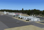
CYBL (2011) portrays the Campbell River (British Columbia, Canada) Airport and surrounding area, including the BC Forest Service tanker base, as it appeared in late 2011. (Campbell River, a small city mid-way up the eastern shore of Vancouver Island, is the "salmon capital" of North America and the gateway to Desolation Sound - summer cruising grounds for thousands of yachts from across the Pacific Northwest. Hence, CYBL is host to a lot of visiting GA.) This add-on includes a selection of Custom AI and static aircraft painted to represent aircraft based or often seen at CYBL. CYBL has recently completed a major runway extension and terminal upgrade - both of which are reflected in CYBL (2011). CYBL (2011) is compatible with BC Roads (FS9 only), ORBX FTX USA Canada Pacific Northwest and both FS9 and FSX versions of Ultimate Terrain.
Generally, this new version is visually identical to its predecessor - even though quite different internally. As well, to the extent possible, it is compatible with Prepar3Dv2. (v2.03 fixes a vehicle texture issue in 2.02)
| Filename: | CYBL_2011_Version_2_for_FS9_FSX_and_Prepar3D.zip |
| License: | Freeware, limited distribution |
| Added: | 22nd June 2014, 17:20:43 |
| Downloads: | 4,234 |
| Author: | Don Grovestine |
| Size: | 43.78 MB |
| Category: Flight Simulator X - Scenery | |
| VYMM Mawlamyine Intl Airport V2.0 with Traffic-Pack 2 |
|
File Description:
Mawlamyine International Airport in Burma, Myanmar, include Traffic-Pack 2. Traffic-Pack 1 comes with vyyy4tp1.zip. Traffic-Pack 3 comes soon too. This scenery was produced based of suppositions, stories and voices. It is therefore pure speculation. Whether this airport is ever increased, the God know. If the planned Asean-Highway leads at it past, this airport should gain importance very quickly. Version 2.0 with new docks, jetways, already extended runway, taxiways and new taxisigns. First of all we corrected the airport location to the real one. With Myanmar Air Force area, Helipads and even more parkings for civilian airplanes. You need mai321x.zip, mai738x.zip and mai744x.zip to use with this. Many Thanks go to Harald Nehring and Frank Weiss,
Robert Versluys, Mike Stone and the teams of HOUSE-RP in Burma, FSX Planner, SceneGenX, SBuilder X, Open Ports Scanner, AFXBgDownloader, FSUIPC, Google Earth and AI Flight Planner. This scenery is pure fiction and for FSX only, for FS2004 please download newVYMMfs9.zip and newVYMMup.zip. By HOUSE-RP, Switzerland and Burma
| Filename: | VYMM_Mawlamyine_Intl_Airport_V20_with_TrafficPack_.zip |
| License: | Freeware, limited distribution |
| Added: | 6th June 2008, 15:34:08 |
| Downloads: | 672 |
| Author: | HOUSE-RP, Robby Pauletto |
| Size: | 3.42 MB |
| Category: Flight Simulator X - Scenery Design | |
| "Gerald R. Ford Intl "KGRR" FSX" |
|
Images related to this file:
File Description:
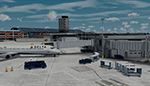
Microsoft Flight Simulator X Welcome to A "Fully Modeled" Gerald R. Ford International Airport (KGRR) for FSX.
All 3D Buildings including Runways, Taxiways and Photoreal, Even to the the smallest detail is custom hand made, through blender modeling tool.AI Traffic including Airport vehicles Work Perfectly. All Scenery is original work, This was a 3 year Long project, and was finally finished on 2021 of June. Main Features to this scenery is Custom 3D Building, Custom Seasonal Photoreal, Custom Fully modeled Airport, Custom Parked Static Vehicles throughout the airport, Custom Fences, Custom Runway and Taxiways, Working Ai Traffic, Custom small Detail and so much more...
Note to have it fully functional, GSX level 2 is Required to Power the Jetways, there's also a option to have static jetways, if you don't have GSX.
Please Don't Modify, Change, or Re-upload, Reuse 3d objects or Textures. The airport is intended to be Freeware. This is a Cheer-Up Gift to all Simulation Aviation community Pilots. Please enjoy! Fly lots "Keep-Climbing "Please Share the news of this Airport being released Thankyou.
| Filename: | Gerald_R_Ford_Intl_KGRR_FSX.zip |
| License: | Freeware, limited distribution |
| Added: | 7th July 2021, 15:35:39 |
| Downloads: | 979 |
| Author: | Dillon Rocque |
| Size: | 393.6 MB |
| Category: Flight Simulator X - Scenery | |
| California Central Coast with Megascenery Earth and FSGenesis Mesh |
|
Images related to this file:
File Description:
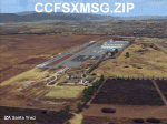
California Central Coast Scenery for FSX with Megascenery Earth and FSGenesis mesh. CCFSXMSG.ZIP covers the California coastal region from N36° 10' (Coalinga) to N34° 25' (Santa Barbara) and from the coast East to W119° 40'. It is a version of my previously created California Central Coast scenery redesigned and expanded to work with FSX MegaScenery Earth and FSGenesis USA Terrain Mesh for FSX V2 by Justin Tyme. Airstrips in the area covered by this scenery have been added for a total of 27 airports and airstrips. 6 imaginary water runways are also added for AI float plane traffic. Several other areas of interest such as the Santa Barbara marina, Morro Bay, etc. are included for a total of 41 points of interest. All airports, airstrips and related structures have been adjusted and realigned to conform to actual positions and dimensions as indicated by the MegaScenery Earth satellite textures. Megascenery Earth California-13, -14 and -15 are required and -12, -28 and -29 are recommended. By Al Wheeler 9/25/09.
| Filename: | California_Central_Coast_with_Megascenery_Earth_an.zip |
| License: | Freeware |
| Added: | 7th January 2010, 19:54:57 |
| Downloads: | 872 |
| Author: | Al Wheeler |
| Size: | 8.13 MB |
| Category: Flight Simulator X - Scenery | |
| CYXX (2012) Version 2 for FS9, FSX and Prepar3D |
|
Images related to this file:
File Description:

CYXX (2012) portrays the Abbotsford (British Columbia, Canada) Airport - home of the Abbotsford Air Show - and surrounding area as it appeared in late 2012. Abbotsford lies just east of Vancouver and only a short distance north of the US border. CYXX is home to Conair Aviation (a large operator of forest fire-fighting air-tankers), Cascade Aerospace (a major aircraft maintenance operation) and several helicopter training, service and operations facilities.) The recently completed major runway and taxiway extensions are reflected in CYXX (2012). This add-on includes a large selection of custom AI and static aircraft painted to represent airline and privately-owned aircraft based or often seen at CYXX, including every aircraft type currently operated by Conair. CYXX (2012) is compatible with BC Roads (FS9 only), Vancouver+, ORBX FTX USA Canada Pacific Northwest and both FS9 and FSX versions of Ultimate Terrain.
Generally, this new version is visually identical to its predecessor - even though quite different internally. As well, to the extent possible, it is compatible with Prepar3Dv2.
| Filename: | CYXX_2012_Version_2_for_FS9_FSX_and_Prepar3D.zip |
| License: | Freeware, limited distribution |
| Added: | 20th June 2014, 11:41:28 |
| Downloads: | 4,769 |
| Author: | Don Grovestine |
| Size: | 108.71 MB |
| Category: Flight Simulator X - AI Aircraft | |
| Air Sial Airbus A320-200 |
|
Images related to this file:
File Description:
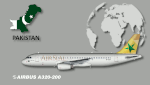
Repaint of Air Sial A320-200. There are 2 separate texture for FSX and FS9. To be used with The FAIB_A320_IAE model available separately. This is an AI only aircraft.
Air Sial is a proposed start-up formed by the local business community in Sialkot, which seeks to boost air traffic to the Pakistani region. The airline is under the Sialkot Chamber of Commerce and Industry, which has a capital expenditure of PKR2 billion (USD20 million). According to the Chamber of Commerce and Industry, Air Sial secured an RPT license from the Civil Aviation Authority in Oct-2017. Air Sial initially planned to launch domestic services in Jun-2020, with international services launching in 2021. The start-up plans to operate services to key destinations in Pakistan and the Middle East using three A320 aircraft.
In Nov-2020, Air Sial took delivery of its first aircraft, an A320 (AP-BOA) on lease from AerCap. The carrier plans to commence domestic operations in Dec-2020, serving Islamabad, Lahore, Karachi and Sialkot. By Kamil Fryzol
| Filename: | Air_Sial_Airbus_A320200.zip |
| License: | Freeware |
| Added: | 3rd December 2020, 20:18:33 |
| Downloads: | 32,183 |
| Author: | Kamil Fryzol |
| Size: | 4.61 MB |
| Category: Flight Simulator X - AFCAD Files | |
| RPVM - Mactan Cebu International, Lapu Lapu, Philippines |
|
File Description:
This Afcad for RPVM - Mactan, Cebu International Airport in Lapu-Lapu City, Mactan, Cebu Philippines was made with ADE V1.35 and is for the default RPVM airport in FSX. The civil/military dual use airport was changed primarily based on Google Earth images.
Mactan Cebu International currently receives flights from Cathay Pacific, Asiana, Korean, Malaysian, Mandarin, Qatar Airways, Silkair and Fedex, in addition to the domestic flights of PAL, Cebu Pacific, Air Philippines and South East Asian Airlines. Cebu Pacific also operate international flights from here and the airport is home to much of the Philippines Air Force C130 fleet.
The aprons and taxiways have been re-designed, jetways added, gates and parking spaces coded for the airlines and aircraft types visiting - including the addition of MIL_CARGO spaces for the C130's. The default airport lacks coding and the radius of gates is inadequate for the larger commercial jets coming to RPVM, so use of this file significantly increases traffic. Tested with WOAI, MAIW Exotic Alberts Philippines package and custom AI.
| Filename: | RPVM__Mactan_Cebu_International_Lapu_Lapu_Philippi.zip |
| License: | Freeware |
| Added: | 28th July 2008, 17:49:49 |
| Downloads: | 2,575 |
| Author: | Matthew Brooks |
| Size: | 10.79 KB |
| Category: Flight Simulator X - AFCAD Files | |
| Essex County Airport (KCDW), NJ |
|
File Description:
Located 02 miles N of Caldwell, New Jersey on 275 acres of land, Essex County Airport is a public airport with two asphalt runways, the longest of which is 4552'. Major changes include Runway 9/27 updated to the current 10/28; Runway 4/22 markings are custom made to match the real world, with threshold stripes on Runway 22 only; the beacon has been relocated to its real world location atop the control tower. Additionally, 221 parking locations have been accurately placed around the airport, broken up into 6 sections. See the included airport diagram that labels the various parking areas. 89 of these parking spaces are labeled RAMP_GA and these spaces are occupied by static aircraft. Collision with all static aircraft is disabled but still, if you do not want to start occupying the same space as another airplane, do not choose parking spots labeled RAMP_GA. Instead, all user aircraft should choose either RAMP_GA_SMALL (for wingspans up to 40') or RAMP_GA_MEDIUM (for wingspans up to 60' and only available in East Parking). Also, only 86 of these parking spaces are available for AI aircraft to spawn in. There are hangars available to transient aircraft: the two in South and Southeast parking are able to accommodate small craft with wingspans up to 40'; the one in Northeast parking is able to accommodate larger aircraft with wingspans up to 54'. Helicopters can start either on Taxiway P (South helipad), Taxiway N (North helipad) or in front of the main terminal (East helipad). Fuel is available in both the East and South parking areas by stopping anywhere on the concrete next to the fuel tank/pump. Take note that the runway patterns are both Left and Right and the pattern altitude varies for aircraft type. There are known issues with the AI for this airport, see the ReadMe for more details.
Scenery constructed with use of satellite images/streetview/aerial photos - the author has not been there in person.
This scenery is meant to be used in conjunction with MegaScenery Earth New York 005. It is not required, but apron use is minimized to allow satellite scenery to show through as much as possible, and objects are placed based on the MSE textures - lack of it may make scenery look out of place.
| Filename: | Essex_County_Airport_KCDW_NJ.zip |
| License: | Freeware |
| Added: | 14th April 2011, 01:50:13 |
| Downloads: | 416 |
| Author: | Drew Sikora |
| Size: | 2.4 MB |


© 2001-2026 AVSIM Online
All Rights Reserved
Privacy Policy |