
Where Flight Simulation Enthusiasts Gather from Around the World!
AVSIM Library - Search Results

| Category: Flight Simulator X - Scenery | |
| Denver International Airport |

|
File Description:
This is a redesign of the default FSX Denver International Airport. Here are the changes which have been made: Several jetways have been added throughout the airport; Concourse B, the United Airlines terminal, has been expanded, and the United Express commuter terminal has been added; numerous fuel trucks have been added to make a total of 30 in order to service aircraft faster; The vehicle roads have been rebuilt so as not to access taxiways, which can cause aircraft backups; the crosswind runways have been activated, ultimately allowing all six runways to be used simultaneously; accurate parking assignments have been created for AI aircraft; and settings have been changed so that as long as scenery complexity in FSX is set at Normal or higher, all of the jetways will display. In addition, as an option, a flyover of the completed airport has been created using the FSX Mission Editor. Please consult the Readme file for more information.
| Filename: | Denver_International_Airport.zip |
| License: | Freeware, limited distribution |
| Added: | 31st December 2007, 21:49:35 |
| Downloads: | 10,983 |
| Author: | Patrick Finch |
| Size: | 3.47 MB |
| Category: Flight Simulator X - AI Aircraft | |
| LCL Cargo Saab 340F |
|
File Description:
This is a complete "Project AI " Saab 340F aircraft of " LCL Cargo ".
That stands for " Low Cost Logistics ".
This ficticious airline/aircraft serves as a "newcomer" in the world of
parcel logistics , not seriously competing with the DHL's and Fedex.
To keep the operatingcosts in place , the airline is powered by
DFW Cargo , member of "The DFW group",
All just as ficticious.
This LCL-airline has a busy program of flying cargo runs in eastern France.
Routes are to :
Gap , Frejus and Toulon in the PACA-region (Provence/Alpes/Cote dAzur),
Grenoble and Chambery in the Isere and Savoie region respectively,
Dole-Tavaux in the Jura provence,
Metz / Nancy in the Lorraine / Moselle, up north in France
and serving Luxembourg Findel airport to connect with Cargolux ,
giving them the gateway to the rest of the world .
Original aircraft and flightdynamics by the "ProjectAI.com" website.
The re-paint is done by; " The DFW group " .
| Filename: | LCL_Cargo_Saab_340F.zip |
| License: | Freeware |
| Added: | 20th November 2009, 23:57:14 |
| Downloads: | 525 |
| Author: | Stellweg |
| Size: | 3.06 MB |
| Category: Flight Simulator X - Scenery | |
| Cedar Rapids Iowa USA Eastern Iowa Airport-KCID |
|
Images related to this file:
File Description:
Cedar Rapids Iowa USA Eastern Iowa Regional Airport for FSX. Several improvements have been made to the default airport. The default terminal buildings have been replaced with buildings created in FSDS; aircraft gates have been correctly coded using Airport Design Editor 1.70.6042; a new airport vehicle network has been built to prevent airport vehicles from entering the taxiways; extra fuel trucks have been added throughout the airport; the tower view has been changed to display from the roof of the control tower; static FedEx and UPS scenery objects have been placed throughout the airport; all taxiway signs are correctly placed and all taxiway designators are correctly named; there is the option to open both runways to AI traffic; optionally, a set of GA flight plans is included using all default FSX aircraft to liven up the GA area; and Jim Dhaenen's excellent ramp lights are also included. Please read the README FIRST.txt and installation.txt files to insure proper installation of all files.
| Filename: | Cedar_Rapids_Iowa_USA_Eastern_Iowa_AirportKCID.zip |
| License: | Check within download |
| Added: | 29th September 2017, 16:54:49 |
| Downloads: | 867 |
| Author: | Patrick Finch |
| Size: | 6.34 MB |
| Category: Flight Simulator X - Scenery | |
| SCIP - Isla de Pascua & Mataveri Intl - Easter Island |
|
Images related to this file:
File Description:
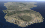
This project rebuilds Easter Island / Isla de Pascua. Mataveri Intl (SCIP) is completely overhauled, and all airport objects are aligned from satellite imagery. Landclass polygons and coastlines were meticulously hand-drawn directly from satellite imagery to provide the most detailed and accurate scenery available for this region. AI road and boat traffic is activated for the region. Accurate coastlines and road data, as well as corrected land and waterclass are provided based on the latest available satellite imagery. GA flights use default aircraft and include an option to add Chilean Air Force planes around the island. Numerous Moai (Easter Island heads) have been placed around the island according to satellite imagery. Scenery was created using Airport Design Editor X v1.61.5298, SBuilderX 3.13, and the FSX Object Placement Tool. Scenery objects were added and modified from stock FSX scenery to resemble as closely as possible the actual airports. The FSX apron lights included are from the terrific set created by Jim Dhaenens.
| Filename: | SCIP__Isla_de_Pascua__Mataveri_Intl___Easter_Islan.zip |
| License: | Freeware |
| Added: | 12th July 2014, 08:17:55 |
| Downloads: | 5,723 |
| Author: | Carlyle Sharpe |
| Size: | 5.33 MB |
| Category: Flight Simulator X - Scenery | |
| LFST - Strasbourg-Entzheim, France |
|
Images related to this file:
File Description:
A very detailed rendition of Strasbourg-Entzheim airport (France).
This scenery has been made for FSX SP2 or Acceleration and DirectX9.
However, it has been tested successfully with DX10 free shaders from Steve Parsons (not tested with DX10 Scenery Fixer SteveFSX)and with Prepar3D v.2.1.
Almost all the buildings have been built accurately, based on numerous pictures.
Runway, taxiways and aprons are covered with textured polygons so as to keep the look of the pavement regardless of extra add-ons installed. These textured polygons enable a smooth transition with the photorealistic ground (blend effect).
Aprons markings are up to date. This scenery is ready to accommodate your AI traffic : the stands are assigned to the main airlines serving the airport and their settings match with the real ones (nose-in, nose-out, drive through).
I have spent more than 2 years to make this photorealistic scenery.
I hope you enjoy discovering Strasbourg airport, have nice flights!
| Filename: | LFST__StrasbourgEntzheim_France.zip |
| License: | Freeware, limited distribution |
| Added: | 9th March 2014, 22:52:25 |
| Downloads: | 16,963 |
| Author: | Jacques-Paul Bollard |
| Size: | 66.87 MB |
| Category: Flight Simulator X - AFCAD Files | |
| Australian Capital Cities & Regional Airports |
|
File Description:
This is a basic update of FSX default Australian Capital City & Regional Airports BGL airport files.
Many gates have been resized where possible to enable larger aircraft such as b747s, A380s park in the international terminals. I have also added several gates to a number of airports and assigned ATC (airline) parking codes to all the parking spots. These parking codes have been aligned to the correct terminals. Military parking spots have also been added to many airports.
Note Melbourne airport (YMML) has also been updated from my last posting.
The airports included in this pack include:
Melbourne Intl - YMML; Canberra - YSCB (includes military); Sydney Intl - YSSY; Brisbane Intl - YBBN; Darwin Intl - YPDN (includes military); Perth Intl - YPPH; Adelaide Intl - YPAD; Hobart Intl - YMHB; Albury - YMAY; Cairns Intl - YBSC; Townsville - YBTL (includes military); Gold Coast - YBCG; Launceston - YMLT; Devonport - YDPO; East Sale (Military) - YMES
These BGL AFCAD files has been tested with VOZ, PAI and RAAF AI aircraft.
There are 15 BGL AFCAD files in this download.
| Filename: | Australian_Capital_Cities__Regional_Airports.zip |
| License: | Freeware |
| Added: | 13th October 2007, 10:38:57 |
| Downloads: | 6,355 |
| Author: | Garry Appleby |
| Size: | 2.09 MB |
| Category: Flight Simulator X - Scenery | |
| KHIO - Hillsboro Oregon Airport - Oregon, USA |
|
File Description:
Presenting Portland-Hillsboro airport (KHIO) in Oregon, for FSX. This is a stand-alone scenery for everyone, but if you have my Aurora scenery then this will be a nice addition, since the aircraft that fly out of Aurora head to Hillsboro and back.
There are two folders. Unzip this entire zip to a temp folder of your choice. The readme file is in the folder called 'additional files.... etc.'.
There are two installation instructions...very short, very easy to understand...depending on whether you have Aurora or not. Please note the custom rwy lights...the objects and the lights themselves which show at night, of course. (both rwys). Note also the tower transparent windows and the weather anemometer on the roof. I have chased AI from Aurora to Hillsboro... works fine. Fun to do. As always, if there are any problems please do not hesitate to contact me at my e-mail address which is in the readme file. Bob.
| Filename: | KHIO__Hillsboro_Oregon_Airport__Oregon_USA.zip |
| License: | Freeware |
| Added: | 12th January 2016, 18:15:13 |
| Downloads: | 769 |
| Author: | Robert Lacy |
| Size: | 40.18 MB |
| Category: Flight Simulator X - Scenery | |
| Lafayette Louisiana USA Regional Airport |
|
Images related to this file:
File Description:
Lafayette Louisiana USA Regional Airport for FSX. Several improvements have been made to the default airport. The default terminal building has been replaced with a custom building created in FSDS; aircraft gates have been correctly coded using Airport Design Editor 1.70.6042; a new airport vehicle network has been built to prevent airport vehicles from entering the taxiways; extra fuel trucks have been added throughout the airport; the tower view has been changed to display from the roof of the control tower; static FedEx and UPS scenery objects have been placed throughout the airport; all taxiway signs are correctly placed and all taxiway designators are correctly named; there is the option to open both runways to AI traffic; the ILS for Runway 4R has been added; optionally, a set of GA flight plans is included using all default FSX aircraft to liven up the GA area; and Jim Dhaenen's excellent ramp lights are also included. Please read the README.txt file to insure proper installation of all files.
| Filename: | Lafayette_Louisiana_USA_Regional_Airport.zip |
| License: | Freeware, limited distribution |
| Added: | 2nd November 2017, 17:58:44 |
| Downloads: | 689 |
| Author: | Patrick Finch |
| Size: | 3.09 MB |
| Category: Flight Simulator X - Utilities | |
| SimLauncherX v5.9 |
|
Images related to this file:
File Description:
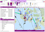
SimLauncherX (or SLX for short) can be used as a launcher application for both FSX:ME, FSX:SE and Prepar3D (v1, v2 and v3). Flights/scenarios can be loaded when launching the simulator or when the simulator is already running. New flights can be created by selecting one of the installed aircraft, selecting the start location (runway or parking position), selecting the type of weather and the time of day. You can also display and create flight plans and attach them to a flight as requested or active flight plan. Version 5.9 adds a flight computer, AI browser, interactive (spoken) checklists, PMDG 737/777 CDUs, approach charts, fleet management and many other improvements. SimLauncherX is a more modern version of my previous SimLauncher application with a lot of additional functionality:
- interactive map.
- display, create and modify flight plans.
- show .kml/.kmz files on the map.
- radio stack.
- instruments panel.
- scenery.cfg editor.
- dll/exe.xml editor.
- process monitor.
Works with FSX:ME, FSX:SE and P3D v1, v2 and v3.
| Filename: | SimLauncherX_v59.zip |
| License: | Freeware, limited distribution |
| Added: | 1st April 2017, 08:18:19 |
| Downloads: | 15,783 |
| Author: | Maarten Boelens |
| Size: | 52.64 MB |
| Category: Flight Simulator X - Scenery | |
| Merrill Field PAMR |
|
Images related to this file:
File Description:
This is a version for FSX of the Merrill Field made by Roger Wensley (me) for FS9, converted by John B Loney jnr. "PAMR read this first" explains this but I have modified John's original procedure, and instead of first installing the Merrill Field original plus two updates I have included here the current FS9 version as installed on my computer. Note that to see the apron lighting working in FS9 it was necessary to have Sidney Schwartz's light library installed, along with his updated textures (to avoid severe blurries caused by a faulty texture). The original installation instructions are included giving file library priorities etc. Just ignore the bits that do not apply, such as installing AI that is not included. I have of course omitted the original AI as this is replaced by John's version. I have no comment to make on installing in FSX as I have not done so, and I have not tested it in FSX. If you have comments or questions I will respond as much as I am able. Merrill Field is in Anchorage Alaska, between Anchorage International to the southwest and and Elmendorf Air Force Base to the north. It caters for general aviation and is the land equivalent of the Lake Hood float plane base, with fuel and numerous maintenance facilities, and several hundred parking spots for small planes. There are three runways, and the longest is 4,000 feet of 100 feet wide asphalt, the second 2,635 feet of asphalt 75 feet wide, and the third 2,000 feet of 60 feet wide gravel. The first two have runway lights. It is a controlled airfield with a relatively new control tower to cater for the numerous flights and to coordinate with Elmensdorf and Anchorage International, the latter also controlling flights from Lake Hood and the adjacent gravel strip Z41. (See my Lake Hood scenery). The gravel runway at Merrill Field is not connected with active taxiways to the rest of the airfield; this avoids you being ordered to land on it when flying a plane too large to do so.
| Filename: | Merrill_Field_PAMR.zip |
| License: | Freeware, limited distribution |
| Added: | 3rd July 2017, 18:00:19 |
| Downloads: | 452 |
| Author: | Roger Wensley and John B loney jnr |
| Size: | 21.73 MB |


© 2001-2026 AVSIM Online
All Rights Reserved
Privacy Policy |