
Where Flight Simulation Enthusiasts Gather from Around the World!
AVSIM Library - Search Results

| Category: Flight Simulator 2004 - Scenery | |
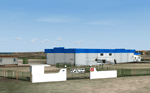
| Apron-Expansion with the new Terminal C (v. 2006) |

|
File Description:
Apron-Expansion with the new Terminal C, Airport Berlin Tegel (EDDT) Germany, for Microsoft Flight Simulator 2004 and German Airports 3, Requirements: German Airports 3, Version 2004 (Payware),
Scenery-File from 2006/2007
| Filename: | ApronExpansion_with_the_new_Terminal_C__v_2006.zip |
| License: | Freeware |
| Added: | 13th June 2010, 01:50:52 |
| Downloads: | 2,622 |
| Author: | Helmut Maass |
| Size: | 20.71 MB |
| Category: Flight Simulator 2004 - Scenery | |
| Saarmund EDCS Ver.1 |
|
File Description:
This is Version 1 for Saarmund EDCS (Germany) ,a little Airport near Berlin (SouthWest)for GA , Sailplane and motorgliders.
| Filename: | Saarmund_EDCS_Ver1.zip |
| License: | Freeware |
| Added: | 9th August 2005, 18:49:12 |
| Downloads: | 2,311 |
| Author: | Ralph Weber |
| Size: | 2.28 MB |
| Category: Flight Simulator 2004 - Scenery | |
| Realistic Ocean Waves |
|
File Description:
This is a replacement for the original OceanHeightField.bmp file (bump-map) of FS9. The included files will reduce the size of ocean waves for a more realistic appearance.
Works only with DirectX 8.1 compatible (or higher) graphics adapters (you must be able to set "water effects" to high).
| Filename: | Realistic_Ocean_Waves.zip |
| License: | Freeware, limited distribution |
| Added: | 27th October 2003, 00:11:58 |
| Downloads: | 15,506 |
| Author: | Daniel Buechter |
| Size: | 1.35 MB |
| Category: Flight Simulator 2004 - Scenery | |
| KLXT Lee's Summit Municipal, Missouri |
|
File Description:
Scenery for KLXT Lee's Summit Municipal, Missouri. This scenery includes new afcad, excludes and scenery files, AI traffic and landclassing. The only additional files required are the standard Rwy12 object libraries, available from Avsim.
| Filename: | KLXT_Lees_Summit_Municipal_Missouri.zip |
| License: | Freeware, limited distribution |
| Added: | 25th February 2008, 13:13:06 |
| Downloads: | 593 |
| Author: | David Dallaston |
| Size: | 407.62 KB |
| Category: Flight Simulator 2004 - Scenery | |
| Moore-Murrell Airport KMOR |
|
Images related to this file:
File Description:
FS2004 Scenery - Moore-Murrell Airport (KMOR) serves Morristown and Hamblen County and is owned by the City Of Morristown, TN. The paved runway extends for 5701 feet. The facility is at an elevation of 1313 feet at a distance of about 4 miles from Morristown. This scenery employs the usual scenery objects libraries. Check the readme file for more information. Original concept and design by Maurice Butz in collaboration with John B. LOney, Jr.
| Filename: | MooreMurrell_Airport_KMOR.zip |
| License: | Freeware, limited distribution |
| Added: | 10th June 2011, 09:07:28 |
| Downloads: | 301 |
| Author: | Maurice Butz and John B Loney Jr |
| Size: | 1.2 MB |
| Category: Flight Simulator 2004 - Scenery | |
| Aerodromo ULM da Tojeira (Magoito) - Portugal |
|
Images related to this file:
File Description:
Tojeira ULM Airfield. This scenery is fully compatible with Portugal Terrain from PTSIM (http://www.ptsim.com) and is based on digital pictures, accurate real measures by Aerodromos de Portugal (http://www.pelicano.com.pt/zmapa.html) and Google Earth. Freeware. For Microsoft FS2004. NOT tested for FSX
| Filename: | Aerodromo_ULM_da_Tojeira_Magoito__Portugal.zip |
| License: | Freeware |
| Added: | 31st January 2013, 20:18:12 |
| Downloads: | 455 |
| Author: | Joao A. Graca Ferreira |
| Size: | 7.78 MB |
| Category: Flight Simulator 2004 - Scenery | |
| City of Knoxville, TN |
|
File Description:
This is one of my favorite sceneries. Add-on adds few buildings to Knoxville city. Hope you like it.
| Filename: | City_of_Knoxville_TN.zip |
| License: | Freeware |
| Added: | 23rd September 2003, 17:55:26 |
| Downloads: | 2,856 |
| Author: | Toni Hiltunen |
| Size: | 85.48 KB |
| Category: Flight Simulator 2004 - Scenery | |
| EGLC-V2.0 |
|
File Description:
Version two fixes major bugs and texturing problems. Stand alone version so previous version is not required. Recommended with enhanced traffic packs. Developed on gmax with custom hand drawn textures.
| Filename: | EGLCV20.zip |
| License: | Freeware |
| Added: | 29th March 2009, 02:56:21 |
| Downloads: | 1,864 |
| Author: | Rosario Resta |
| Size: | 7.11 MB |
| Category: Flight Simulator 2004 - Scenery | |
| Sheldons Cabin |
|
File Description:
Don Sheldon was one of the great early bush pilots in Alaska. He was the founder of Talkeetna Air Service and the first person to routinely fly support (and rescue) for climbers on Mt. McKinley. In the early 1950's he built this cabin to serve as a base for these flights. The Sheldon family still own the cabin and it is rented out to climbers and others who just want to spend some time on the mountain.
| Filename: | Sheldons_Cabin.zip |
| License: | Freeware, limited distribution |
| Added: | 14th March 2004, 02:41:09 |
| Downloads: | 2,358 |
| Author: | Tom Fica |
| Size: | 326.76 KB |
| Category: Flight Simulator 2004 - Scenery | |
| City of Huntsville, AL v1.1 |
|
File Description:
Hi, here is updated City of Huntsville package. Previous Huntsville package included Landclass file and i forgot to give install information for that file. But, now this package doesn't include that file anymore, it's not needed. That causes a memory leaks and fs9 will be unstable then.
| Filename: | City_of_Huntsville_AL_v11.zip |
| License: | Freeware |
| Added: | 22nd April 2008, 14:32:03 |
| Downloads: | 961 |
| Author: | Toni Hiltunen |
| Size: | 3.14 MB |
© 2001-2026 AVSIM Online
All Rights Reserved
Privacy Policy |