
Where Flight Simulation Enthusiasts Gather from Around the World!
AVSIM Library - Search Results

| Category: Flight Simulator 2004 - Scenery | |
| New Terrain Mesh of the Province of Quebec in LOD09 (1/4) |

|
File Description:
The files in this package contain terrain mesh files of the province of Quebec (N45 to N53) to be used with my Quebec enhanced sceneries for FS2004 (Scenes_du_Quebec_2k4.zip). The public data sources are the Shuttle Radar Topography Mission (SRTM-3, 90m) and the Canadian Digital Elevation Data (CDED - 0.75s/arc - 23m). (QC09_2k4a.zip to QC09_2k4d.zip - 4 parts)
***********************
Les fichiers de ces archives contiennent les donnees d'elevation de terrain (mesh files - lod09), pour FS2004, du territoire de la province de Quebec sous le 53ieme degre de latitude nord. Ils ont ete crees pour etre utilises avec mes nouvelles scenes du Quebec contenues dans Scenes_du_Quebec_2k4.zip. Les donnees sources sont du domaine public et proviennent de la Shuttle Radar Topography Mission (SRTM-3, 90m) et des donnees numerique d'elevation du Canada (DNEC - 0.75s/arc -23 m). (QC09_2k4a.zip to QC09_2k4d.zip - 4 parties)
| Filename: | New_Terrain_Mesh_of_the_Province_of_Quebec_in_LOD09_14.zip |
| License: | Freeware, limited distribution |
| Added: | 27th January 2010, 18:10:18 |
| Downloads: | 8,920 |
| Author: | Gilles Gauthier |
| Size: | 23.76 MB |
| Category: Flight Simulator 2004 - Scenery | |
| New Terrain Mesh of the Province of Quebec in LOD09 (3/4) |
|
File Description:
The files in this package contain terrain mesh files of the province of Quebec (N45 to N53) to be used with my Quebec enhanced sceneries for FS2004 (Scenes_du_Quebec_2k4.zip). The public data sources are the Shuttle Radar Topography Mission (SRTM-3, 90m) and the Canadian Digital Elevation Data (CDED - 0.75s/arc - 23m). (QC09_2k4a.zip to QC09_2k4d.zip - 4 parts)
***********************
Les fichiers de ces archives contiennent les donnees d'elevation de terrain (mesh files - lod09), pour FS2004, du territoire de la province de Quebec sous le 53ieme degre de latitude nord. Ils ont ete crees pour etre utilises avec mes nouvelles scenes du Quebec contenues dans Scenes_du_Quebec_2k4.zip. Les donnees sources sont du domaine public et proviennent de la Shuttle Radar Topography Mission (SRTM-3, 90m) et des donnees numerique d'elevation du Canada (DNEC - 0.75s/arc -23 m). (QC09_2k4a.zip to QC09_2k4d.zip - 4 parties)
| Filename: | New_Terrain_Mesh_of_the_Province_of_Quebec_in_LOD0.zip |
| License: | Freeware, limited distribution |
| Added: | 27th January 2010, 18:15:12 |
| Downloads: | 7,500 |
| Author: | Gilles Gauthier |
| Size: | 29.35 MB |
| Category: Flight Simulator 2004 - Scenery | |
| New Terrain Mesh of the Province of Quebec in LOD09 (4/4) |
|
File Description:
The files in this package contain terrain mesh files of the province of Quebec (N45 to N53) to be used with my Quebec enhanced sceneries for FS2004 (Scenes_du_Quebec_2k4.zip). The public data sources are the Shuttle Radar Topography Mission (SRTM-3, 90m) and the Canadian Digital Elevation Data (CDED - 0.75s/arc - 23m). (QC09_2k4a.zip to QC09_2k4d.zip - 4 parts)
***********************
Les fichiers de ces archives contiennent les donnees d'elevation de terrain (mesh files - lod09), pour FS2004, du territoire de la province de Quebec sous le 53ieme degre de latitude nord. Ils ont ete crees pour etre utilises avec mes nouvelles scenes du Quebec contenues dans Scenes_du_Quebec_2k4.zip. Les donnees sources sont du domaine public et proviennent de la Shuttle Radar Topography Mission (SRTM-3, 90m) et des donnees numerique d'elevation du Canada (DNEC - 0.75s/arc -23 m). (QC09_2k4a.zip to QC09_2k4d.zip - 4 parties)
| Filename: | New_Terrain_Mesh_of_the_Province_of_Quebec_in_LOD0.zip |
| License: | Freeware, limited distribution |
| Added: | 27th January 2010, 18:17:08 |
| Downloads: | 7,859 |
| Author: | Gilles Gauthier |
| Size: | 20.94 MB |
| Category: Flight Simulator 2004 - Scenery | |
| Removal of Nuclear Plant in Nova Scotia, Canada |
|
File Description:
The file "nuclear plant removal.bgl" excludes the nuclear plant that was placed by mistake in the default scenery next to the Halifax/Shearwater ( CYAW ) airport in Nova Scotia, Canada. The only nuclear plant in the Maritimes is located in Pointe-Lepreau in New Brunswick. It is a CANDU 6.
| Filename: | Removal_of_Nuclear_Plant_in_Nova_Scotia_Canada.zip |
| License: | Freeware |
| Added: | 18th July 2004, 17:03:39 |
| Downloads: | 1,648 |
| Author: | Marc Renaud |
| Size: | 558.7 KB |
| Category: Flight Simulator 2004 - Scenery | |
| RAF Fairford 2007 |
|
File Description:
RAF Fairford 2007. Add-on scenery for the default FS2004 scenery - not tested with UK2000 or VFR scenery. This isn't photorealistic by any means but provides an accurate as possible representation of RAF Fairford, the home of the Royal International Air Tattoo. Zip file c6MB. Readme file contains instructions and recommended addon files.Readme recommends users download RWY12 package, Novagold textures and 4 other freeware object libraries.
| Filename: | RAF_Fairford_2007.zip |
| License: | Freeware, limited distribution |
| Added: | 6th September 2007, 23:34:12 |
| Downloads: | 2,571 |
| Author: | Dave Morgan |
| Size: | 6.05 MB |
| Category: Flight Simulator 2004 - Scenery | |
| LTBQ - Cengiz Topel Naval Air Station Scenery |
|
Images related to this file:
File Description:
LTBQ - Cengiz Topel Naval Air Station Scenery created with ADE9 v.1.79 and static objects libraries with using the latest satellite images available from Google Earth.
| Filename: | LTBQ__Cengiz_Topel_Naval_Air_Station_Scenery.zip |
| License: | Freeware |
| Added: | 27th May 2023, 00:48:20 |
| Downloads: | 232 |
| Author: | Taner Akol |
| Size: | 8.57 MB |
| Category: Flight Simulator 2004 - Scenery | |
| General Atomics Flight Test Facilites |
|
Images related to this file:
File Description:
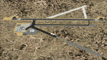
Sceneries of El Mirage (L69) and Gray Butte Field (04CA). These fields are owned by General Atomics and serve as the flight test facilites for the Predator and Reaper UAS/UAV/Drone (however you wish to call them). This scenery requries 2 extra files:
1. MAIW Hill AFB Package
2. MAIW Lemoore Hornets or MAIW Special Use Mentors Packages
| Filename: | General_Atomics_Flight_Test_Facilites.zip |
| License: | Freeware, limited distribution |
| Added: | 20th May 2010, 01:37:00 |
| Downloads: | 493 |
| Author: | Matthew Donica |
| Size: | 275.49 KB |
| Category: Flight Simulator 2004 - Scenery | |
| CYGK (2008) - Kingston (Norman Rogers) Airport, Ontario, Canada |
|
Images related to this file:
File Description:
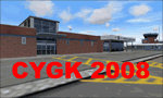
Kingston V2 (2008) - GMAX modeled scenery with custom ground textures. The airport was modeled in its 2008 state.
Kingston Airport or Kingston/Norman Rogers Airport (IATA: YGK, ICAO: CYGK) is located 4.3 nautical miles (7.96 km) west of the downtown of Kingston, Ontario, Canada. CYGK is now as the only airport (except CFB Trenton - restricted) between Toronto, Montreal, and Ottawa that has an ILS approach making it a preferred alternate airport to most aviators.
(This is a re-upload of the scenery to replace the original that was lost in the AVSIM hack. No changes have been made)
| Filename: | CYGK_2008__Kingston_Norman_Rogers_Airport_Ontario_.zip |
| License: | Freeware, limited distribution |
| Added: | 16th May 2010, 10:04:29 |
| Downloads: | 3,296 |
| Author: | Keith Murphy |
| Size: | 25.68 MB |
| Category: Flight Simulator 2004 - Scenery | |
| Qikiqtarjuaq CYVM (Broughton) and DEW FOX-5 in Nunavut, Canada |
|
Images related to this file:
File Description:
Qikiqtarjuaq is an airfield on the northeast coast of Baffin Island, just over 100 miles north of Pangnirtung. The airfield is the closest Canadian airfield to Greenland and is used for ferry flights from Canada to Europe for small planes, though there is normally only JetA1 fuel available. The airfield is at only 18 feet ASL next to the sea with the village to the north; it was previously (before 1998) called Broughton Island. The runway is 3,800' of 100' wide gravel and is lighted; as it is in the Northern Domestic Airspace the runway is signed as 033T-213T, using "true" bearings instead of magnetic. There is a terminal and a small maintenance building on the apron and these have been modeled specifically for this scenery. There are AI parking spots; the AI visiting aircraft are a Canadian North Dash 8 and a First Air 42-300. Qikiqtarjuaq village is just north of the airfield and has a population of around 520; it is approximately the right size and shape but no buildings were specifically modeled for the village. There is also a North Warning System site called Fox-5 to the northeast, and this too is included. You will need Ultimate Terrain Alaska Canada.
| Filename: | Qikiqtarjuaq_CYVM_Broughton_and_DEW_FOX5_in_Nunavu.zip |
| License: | Freeware, limited distribution |
| Added: | 14th June 2011, 02:04:26 |
| Downloads: | 561 |
| Author: | Roger Wensley |
| Size: | 1.85 MB |
| Category: Flight Simulator 2004 - Scenery | |
| CFB North Star, v7.1 |
|
Images related to this file:
File Description:
CFB North Star (version 7.1) fictional Canadian arctic military/commercial base for FS2004. Features triple runway configuration of the earlier versions, along with custom buildings and effects. Three alternate scenery configurations are provided for, including opened hangars, with unique library objects that may be used in other freeware scenery projects. Also includes flightplans and AI ship traffic (the icebreaker CCGS Louis St-Laurent). FREEWARE by Brian Sturton.
| Filename: | CFB_North_Star_v71.zip |
| License: | Freeware, limited distribution |
| Added: | 10th October 2011, 13:45:08 |
| Downloads: | 486 |
| Author: | Brian Sturton |
| Size: | 22.79 MB |


© 2001-2026 AVSIM Online
All Rights Reserved
Privacy Policy |