
Where Flight Simulation Enthusiasts Gather from Around the World!
AVSIM Library - Search Results

| Category: Flight Simulator 2004 - Scenery | |
| OLRA - Rayak Air Base in the Bekaa Valley, Lebanon - Updated |

|
Images related to this file:
File Description:
This is an updated version that includes the AI planes and WITH SCENERY TEXTURES. Rayak OLRA is at 3,183 feet asl in the Bekaa Valley in Lebanon, a short hop over the mountains from Beirut. It has a single runway almost 10,000 feet long, aligned 40-220. It used to be the main base of the small Lebanese air force (I think three Hawker Hunters) but is now, although still in use, relegated to secondary status since a new base was opened in the north of Lebanon. I believe there are also some civilian users, though that could be misinformation. I made this after a recent visit. Which does not mean that the buildings are all totally accurate but it is for sure better than the default FS9.
| Filename: | OLRA__Rayak_Air_Base_in_the_Bekaa_Valley_Lebanon__.zip |
| License: | Freeware, limited distribution |
| Added: | 24th May 2014, 19:47:41 |
| Downloads: | 495 |
| Author: | Roger Wensley |
| Size: | 3.69 MB |
| Category: Flight Simulator 2004 - Scenery | |
| FS2004 Scenery OLBA_BEIRUT_V3 BEYROUTH (LEBANON - LIBAN) |
|
Images related to this file:
File Description:
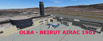
FS2004 Scenery--OLBA Beirut Beyrouth V3 (Lebanon - Liban)- NEW FULL INSTALLATION -- new night textures - gate numbers added - trees- Vehicules This scenery was built from the official maps for the runway and taxiways with Google Maps as a background image as support. The different signs were positioned without any documentation or references. Only use with IVAO or VATSIM; no AI possible. By Serge Libon.
| Filename: | FS2004_Scenery_OLBA_BEIRUT_V3_BEYROUTH_LEBANON__LI.zip |
| License: | Freeware |
| Added: | 24th January 2019, 05:06:27 |
| Downloads: | 1,158 |
| Author: | Libon Serge |
| Size: | 41.93 MB |
| Category: Flight Simulator 2004 - Scenery | |
| PANC / ANC Ted Stevens Anchorage International Airport, Alaska - Version 6.0 |
|
Images related to this file:
File Description:

This is a major rebuild of Ted Stevens International airport. All terminals have been heavily upgraded from the default form. Terminals A & B have been resized and relocated to be more accurately placed. Terminal C, the newest terminal, has been rebuilt from scratch, and the cargo ramps received special treatment as well. As usual, there is plenty of eye candy placed around the airport including plenty of static general aviation aircraft. The included AFCAD has been extensively reworked, and all gates are laid out per the ANC website and sat photos.
Update: Version 6 contains various changes to the scenery which make it more accurate. There are jetway updates, afcad changes, and various structure changes. Airline parking assignments have also been updated as well as a missing taxiway. The connecting walkway between the international terminal and terminal C has been added. The cargo ramps near terminal C have been expanded and made more accurate to real life. The jetways on terminal A have been removed, and the jetways on Terminal C have also been modified for accuracy.
| Filename: | PANC__ANC_Ted_Stevens_Anchorage_International_Airp.zip |
| License: | Freeware |
| Added: | 29th December 2012, 20:34:30 |
| Downloads: | 18,403 |
| Author: | FRFStudio.net, William Morgan |
| Size: | 6.13 MB |
| Category: Flight Simulator 2004 - Scenery | |
| Azores Islands SRTM Terrain Mesh |
|
File Description:
LOD9 76.4m SRTM Terrain Mesh of the Azores.
| Filename: | Azores_Islands_SRTM_Terrain_Mesh.zip |
| License: | Freeware, limited distribution |
| Added: | 3rd July 2004, 03:20:01 |
| Downloads: | 4,259 |
| Author: | Tom Finley |
| Size: | 2.16 MB |
| Category: Flight Simulator 2004 - Scenery | |
| North Netherlands |
|
File Description:
This is extra addon scenery for the default FS2004 in the northern part of Holland: Dokkum,Eernewoude,Oostwold,Giethoorn,Leek,Groningen and other spots for VFR flying.
| Filename: | North_Netherlands.zip |
| License: | Freeware |
| Added: | 12th August 2003, 16:32:54 |
| Downloads: | 5,619 |
| Author: | Joop Mak |
| Size: | 1.34 MB |
| Category: Flight Simulator 2004 - Scenery | |
| FYWB Walvis Bay, Namibia for FS9 |
|
File Description:
Based on googleEarth. Ez-scenery and rwy12 objects included.
Compatible with Holger Sandmann's Namibia LOD9 Terrain mesh (namibia_ne.zip, namibia_nw.zip, namibia_se.zip, namibia_sw.zip, namibia_cp.zip) as well as his namibia_scenery_updates.zip, all found at avsim.com.
| Filename: | FYWB_Walvis_Bay_Namibia_for_FS9.zip |
| License: | Freeware |
| Added: | 18th November 2008, 21:25:49 |
| Downloads: | 1,454 |
| Author: | Detlev J. Rohmer |
| Size: | 3.96 MB |
| Category: Flight Simulator 2004 - Scenery | |
| FS2004 RPMC Cotabato Awang Airport |
|
File Description:
Cotabato Awang Airport is the only airport for Cotabato City located at the southern part of the Philippines. The airport is currently flown by PAL Express, Cebu Pacific and Cebgo. Also, the airport is served as an airbase for the Philippine Air Force for military operations to fight against terrorists in the island. FS2004 only by Paulo Zosa (PFSG)
| Filename: | FS2004_RPMC_Cotabato_Awang_Airport.zip |
| License: | Freeware |
| Added: | 31st May 2020, 20:54:17 |
| Downloads: | 411 |
| Author: | Paulo Zosa |
| Size: | 19.95 MB |
| Category: Flight Simulator 2004 - Scenery | |
| New VTBS Bangkok ILS Approaches |
|
File Description:
Adds ILS Approaches for IFR operations at VTBS Bangkok. This will also mean that the runways and approaches are available for AI ILS assignment. It should work with any scenery.
| Filename: | New_VTBS_Bangkok_ILS_Approaches.zip |
| License: | Freeware |
| Added: | 21st January 2009, 13:24:34 |
| Downloads: | 1,803 |
| Author: | Bryn Battersby |
| Size: | 1.68 KB |
| Category: Flight Simulator 2004 - Scenery | |
| Alps LOD10 Topo Mesh - Austria and Italy |
|
Images related to this file:
File Description:
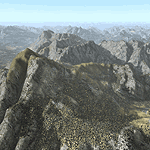
Yet another terrain mesh package of the European Alps? Well, this one is different in that it is NOT primarily based on the Shuttle Radar (SRTM) data with their incomplete coverage of prominent peaks and ridges. Instead, most of the source data for this project were developed over many months by Jonathan de Ferranti using detailed topographic maps. While Jonathan's work is unrelated to flight simulation he kindly gave me permission to compile his data for use in FS. The result is a wonderful improvement in detail and accuracy over any existing SRTM- or DTED-based mesh file, freeware or commercial (a link to an extensive set of screenshot comparisons is included in the read-me file).
I've compiled the source data at LOD10 (38-m) grid resolution because the coverage area is smaller than most existing mesh files. Thus, anyone can use these files without having to first uninstall their current mesh set. Also included are LOD9 and LO8 buffer mesh files. Note: if you own Austria Professional 2004 with its 1:50,000 scale terrain mesh then you don't need this package!
| Filename: | Alps_LOD10_Topo_Mesh__Austria_and_Italy.zip |
| License: | Freeware, limited distribution |
| Added: | 30th May 2010, 09:46:58 |
| Downloads: | 62,948 |
| Author: | Holger Sandmann, Jonathan de Ferranti |
| Size: | 73.32 MB |
| Category: Flight Simulator 2004 - Scenery | |
| Italy, Toscana 1, Grosseto, Photo Real |
|
Images related to this file:
File Description:
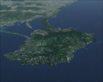
Toscana, Italy, Photoreal Scenery Part 1 (Grosseto).
The photoreal scenery covers a great area of Toscana (Tuscany) around the city of Grosseto. The airport of Grosseto(ICAO code LIRS) are found inside the scenery (see map). For the best results, use it in association with other parts of Toscana photoreal: Toscana 2 Piombino, Toscana 3 Siena, Toscana 4 Poggibonsi, Toscana 5 Livorno_Lucca_Pisa_Pistoia,Toscana 6 Firenze, Toscana 7 Massa_Carrara, italy_islands_vfr_part2_nw.zip
| Filename: | Italy_Toscana_1_Grosseto_Photo_Real.zip |
| License: | Freeware |
| Added: | 27th May 2010, 20:42:50 |
| Downloads: | 6,657 |
| Author: | Fulvio Mazzokan |
| Size: | 69.17 MB |
© 2001-2026 AVSIM Online
All Rights Reserved
Privacy Policy |