
Where Flight Simulation Enthusiasts Gather from Around the World!
AVSIM Library - Search Results

| Category: Flight Simulator 2004 - Scenery | |
| KGFL - Glens Falls, Floyd Bennett Memorial - Winter Textures |

|
Images related to this file:
File Description:

KGFL Winter Textures, for use with Kgfl_v20.zip thru Kgfl_v22.zip. A set of textures to replace the summer ground textures for KGFL ver.2 scenery (versions 2.0 and 2.2). Optional DXT3 textures included.
| Filename: | KGFL__Glens_Falls_Floyd_Bennett_Memorial__Winter_T.zip |
| License: | Freeware, limited distribution |
| Added: | 9th February 2010, 03:32:40 |
| Downloads: | 835 |
| Author: | Ed Geneer Cox |
| Size: | 12.28 MB |
| Category: Flight Simulator 2004 - Scenery | |
| PABV - Birchwood airfield - Anchorage, Alaska - USA |
|
Images related to this file:
File Description:
Birchwood PABV is in Alaska, some 20 miles northeast of Anchorage, on the south shore of Knik Arm. It is a smaller version of Merrill Field, almost entirely for just GA aircraft and the maintenance shops that a gathering of such aircraft attracts. The main runway is just over 4,000 feet long, aligned L01-R19 and asphalted and lit; this last is even more important in Alaska with short winter days. There is also a shorter and parallel runway that is gravel and which receives no winter maintenance; this is for winter use by planes that are on skis, rather than wheel/skis. This is not unusual and is found at other Alaska airfields. This scenery provides a place to fly to from my previous posts of Merrill Field and Lake Hood close to Anchorage. There will be others in this series, on the northern side of Knik Arm.
| Filename: | PABV__Birchwood_airfield__Anchorage_Alaska__USA.zip |
| License: | Freeware, limited distribution |
| Added: | 7th October 2014, 19:41:37 |
| Downloads: | 616 |
| Author: | Roger Wensley |
| Size: | 22.21 MB |
| Category: Flight Simulator 2004 - Scenery | |
| North American Winter Season replacement |
|
File Description:
This scenery addon replaces the default "hard winter" texture coverage maps for North America. The maps determine, on a monthly basis, where snow-covered textures appear in Flight Sim 9. In general, there will be more snow in this replacement. Note that the coverage maps change about the 19th of each calendar month in FS9. Also because of the resolution of the maps in FS9, it is impossible to use this technique to correct small scenery areas, such as mountain peaks. This file extends and replaces my previous Blizzard-06! scenery.
| Filename: | North_American_Winter_Season_replacement.zip |
| License: | Freeware |
| Added: | 6th December 2006, 10:49:23 |
| Downloads: | 1,947 |
| Author: | Scott Smart |
| Size: | 424.31 KB |
| Category: Flight Simulator 2004 - Scenery | |
| CYAZ Tofino, B.C. for Version 2 |
|
File Description:
CHANGES IN V2: 1. The trees I used in V1 use the hard winter textures when they should be using the regular winter textures. This results in the added trees being covered in snow while the rest of the trees are not. It looked too weird. I replaced them with a different set of trees. The new trees will sometimes appear darker than the default trees due to shading, but they will at least display the correct seasonal textures. It's not perfect, but it's an improvement. 2. The default windsock ended up unders the added trees, so I moved it. V1 of this scenery is not required.
| Filename: | CYAZ_Tofino_BC_for__Version_2.zip |
| License: | Freeware |
| Added: | 12th May 2006, 20:40:27 |
| Downloads: | 1,523 |
| Author: | Sidney Schwartz |
| Size: | 4.22 MB |
| Category: Flight Simulator 2004 - Scenery | |
| Canadian and Northern USA Winter Flying |
|
File Description:
This is an expanded version of a previous post a year ago, and stretches from east of Quebec City through Quebec, Ontario, and Manitoba, and now also through Saskatchewan, and into Alberta (past Calgary). There is also a northern area roughly centered on Hudson Bay. The exact coverages are given in the notes. All rivers and lakes within the area will "freeze" and allow ski planes to land, or even wheeled planes come to that. And it is not permanent, when you want to go back to floats just "untick" it in the FS library, and it will melt. The area covered crosses into the US too, down to around 45 degrees north, so that means most of Montana, all of North Dakota, half of Minnesota, and some of Wisconsin, Michigan etc. It seemed silly to stop at the border. Ultimate Terrain is highly recommended, so that there will actually be the right lakes and rivers ready to freeze.
| Filename: | Canadian_and_Northern_USA_Winter_Flying.zip |
| License: | Freeware |
| Added: | 26th May 2008, 13:24:29 |
| Downloads: | 669 |
| Author: | Roger Wensley |
| Size: | 354.86 KB |
| Category: Flight Simulator 2004 - Scenery | |
| Carleton Place airfield CNR6 near Ottawa in Canada, a REVISED version |
|
File Description:
Carleton Place was modelled a year ago and posted. This version has a new grass background which is more realistic and also supports winter snow. This is the first in an updated series of sceneries around Ottawa, and it replaces entirely the previous version, which should be deleted.
| Filename: | Carleton_Place_airfield_CNR6_near_Ottawa_in_Canada.zip |
| License: | Freeware |
| Added: | 5th August 2007, 19:53:23 |
| Downloads: | 587 |
| Author: | Roger Wensley and Jim Turner |
| Size: | 264.28 KB |
| Category: Flight Simulator 2004 - Scenery | |
| Relief textures: 5.-Spring And Water |
|
File Description:
FS2004 Relief textures: world surface textures: SPRING & WATER
This is the logic extension to my prior work, the relief textures for the autogen and
airport buildings, that you can find in the file rlftxts1.zip.
Now I try to improve the 3D aspect and ·relief of the ground textures, and give
them a "bit of life"...
I believe that these new textures are more "immersive" than the default ones, but
this is only my opinion.
Again, judge by yourself...
The water textures are FULLY COMPATIBLE with the water reflections textures of Bill Lyon's and other authors.
There are 5 files projected:
1.-fall
2.-winter
3.-Heavy winter
4.-spring and water
5.-summer
| Filename: | Relief_textures_5Spring_And_Water.zip |
| License: | Freeware |
| Added: | 29th November 2003, 01:52:32 |
| Downloads: | 3,630 |
| Author: | Carlos Lorenz Benlloch |
| Size: | 19.07 MB |
| Category: Flight Simulator 2004 - Scenery | |
| Boston Logan International Airport Version 1.1 |
|
File Description:
Realistic GMAX FS2004 airport with night lighting, winter textures & AFCAD2 file for AI traffic.
V1.1 includes new night lighting, Delta terminal construction, ILS fix, static aircraft pack & a few other fixes. Patch for FS2002 included.
Version 1.1 is a FULL INSTALL. Please REMOVE any previous Logan versions before installing 1.1.
| Filename: | Boston_Logan_International_Airport_Version_11.zip |
| License: | Freeware, limited distribution |
| Added: | 28th December 2003, 17:11:11 |
| Downloads: | 40,470 |
| Author: | George Grimshaw |
| Size: | 12.14 MB |
| Category: Flight Simulator 2004 - Scenery | |
| KGRR - Grand Rapids Intl for FS9 - Season Fix |
|
Images related to this file:
File Description:
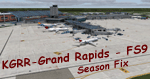
FS9 - KGRR Grand Rapids Airport Change of Seasons Adjustment
This is an update for the FS2004-Team-Forum's conversion of Dillon Rocque's KGRR Grand Rapids airport scenery. It synchronizes the transition to winter and summer with the default FS2004 change of seasons for the area. See Readme for further details.
| Filename: | KGRR__Grand_Rapids_Intl_for_FS9__Season_Fix.zip |
| License: | Freeware |
| Added: | 28th March 2022, 19:34:51 |
| Downloads: | 442 |
| Author: | Gregory Putz, The FS2004-Team |
| Size: | 2.23 MB |
| Category: Flight Simulator 2004 - Scenery | |
| Frozen & Landable Lakes & Rivers for All Canada Winter Ski Operations |
|
Images related to this file:
File Description:
This "freezes" ALL Canadian lakes and rivers for winter flying and means they can be landed on with skis or wheels. This edition covers all of Canada plus parts of the USA along the border, including Michigan, Wisconsin, Minnesota, North Dakota, and Montana. It is reversible with an "untick" in the FS scenery library. I have spent some time making sure that the sea and the inlets along the coast do not get frozen too, and also some of the lakes that are close to the coast and rarely get cold enough to freeze over. Along the north shore I went for the peak of the winter with sea ice all the way to the permanent polar cap; this is not totally realistic as there is usually a partially open lead along the coast, but this would be difficult to replicate convincingly. This is really for use with Ultimate Terrain, though it will work without it. The pics show Rockcliffe in the winter with the frozen Ottawa River for real and in FS for comparison; without UT the river would not be in the right place.
| Filename: | Frozen__Landable_Lakes__Rivers_for_All_Canada_Wint.zip |
| License: | Freeware, limited distribution |
| Added: | 15th November 2010, 01:01:36 |
| Downloads: | 603 |
| Author: | Roger Wensley |
| Size: | 871.82 KB |
© 2001-2026 AVSIM Online
All Rights Reserved
Privacy Policy |