
Where Flight Simulation Enthusiasts Gather from Around the World!
AVSIM Library - Search Results

| Category: Flight Simulator 2004 - Scenery | |
| Chiang Mai Photo scenery (Chiangmai city) |

|
Images related to this file:
File Description:
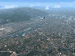
Chiang Mai was founded in the late 13th century. It was once the capital of Lanna, an independent Thai Kingdom and has preserved its unique cultural heritage to a marked degree. It is located 700 km (435 mi) north of Bangkok, among the highest mountains in the country. The city is on the Ping river, a major tributary of the Chao Phraya river. Culture of Chiang Mai is architecture reflects Lanna Thai,Burmese,Sri Lankan and Mon influences.There are some 300 temples in the city and on its outskirts. The Golden Age of Lanna-Chiang Mai lies some 500 years back in the time of king Tilokarat,but the city has recently been undergoing a process of regeneration,and while full of the bustle of modern life,it hasn't lost touch with its glorious past.
This scenery just only preview the real thing. If you visit Thailand, this city is the "must" see in your trip. The best time to go to Chiangmai is winter time since the weather is cool and bright sunny.
| Filename: | Chiang_Mai_Photo_scenery_Chiangmai_city.zip |
| License: | Freeware |
| Added: | 30th August 2010, 13:13:46 |
| Downloads: | 2,571 |
| Author: | PARIWAT LORDNGERN / Thaiflight Simulator |
| Size: | 26.31 MB |
| Category: Flight Simulator 2004 - Scenery | |
| Wekweeti CFJ2 in the Northwest Territories, Canada |
|
Images related to this file:
File Description:
Wekweeti is a small village in the Northwest Territories, around 120 miles north of Yellowknife and 100 east of Gameti, which was recently posted. It has a population of around 125. There is no all-weather road access and the village is reliant upon the airfield for supplies, along with an ice road in the winter months. The area is a complex collection of lakes and small rivers and the airfield is around 3 miles east of the village on a lake shore. The lit gravel runway of 3,400 feet with PAPI at both ends is aligned 307T-127T with T standing for "true" and not the unreliable magnetic heading in the Canadian northern domestic airspace. The airfield is served by Air Tindi from Yellowknife on an almost daily basis, included in the AI here along with some GA and a Thursday delivery by a Buffalo DC3. A note here about my scenery making. There will not be many more to follow this as I am almost at the end of the photos I either took or found for scenery purposes, plus I expect to move on from FS9 at some point during next year.
| Filename: | Wekweeti_CFJ2_in_the_Northwest_Territories_Canada.zip |
| License: | Freeware, limited distribution |
| Added: | 4th January 2020, 18:23:59 |
| Downloads: | 154 |
| Author: | Roger Wensley |
| Size: | 4.39 MB |
| Category: Flight Simulator 2004 - Scenery | |
| KPMD - Palmdale AF Plant 42 |
|
Images related to this file:
File Description:

FS2004 Scenery for KPMD Palmdale AF A huge 5,800 acres/23 km² airfield that has somehow been overlooked by addon developers. almost all hangers and buildings are custom built due to their uniqueness to KPMD. Most of the facilities are owned by private contractors and serve as a manufacturing plant
for aircraft used by the United States .Rockwell's Palmdale assembly facility is where Space Shuttle came together
and were assembled and tested. Upon completion, the Shuttles were turned over to NASA for transport overland
to Edwards Air Force Base, California.
The airfield was opened in the early 1930s.At the outbreak of the Korean War in 1950, the U.S. Air Force realized a need
for a location for use in final assembly and flight testing of military jet aircraft, away from major population centers but close enough to the major
centers of aircraft design and production .Year round excellent flying weather was also a prerequisite. The land which
became AF Plant 42 fit all these criteria. Therefore the USAF bought the facility in in 1951.In the 1960's Lockheed
relocated to Plant 42 from its original Burbank, Ca .
| Filename: | KPMD__Palmdale_AF_Plant_42.zip |
| License: | Freeware |
| Added: | 29th January 2015, 21:22:39 |
| Downloads: | 827 |
| Author: | Brian Sturrock |
| Size: | 1.43 MB |
| Category: Flight Simulator 2004 - Scenery | |
| Clyde River CYCY & Cape Christian in Nunavut Canada |
|
Images related to this file:
File Description:
Clyde River is a village on the northeast coast of Baffin Island, 250 miles above the Arctic Circle and around 150 miles north of Cape Hooper. It is on the shore of Patricia Bay at the entrance to Cylde Inlet, a fjord which stretches over 60 miles inland. The population is around 880 folks, and it was named by the explorer John Ross in 1818. The airfield is just east of the village and the lighted runway is 3,501' of 100' wide gravel at 87' ASL, aligned 018 True 198 True; "True" as opposed to magnetic in the Northern Domestic Airspace. There are two aprons, one with the new terminal building and one with the old terminal and the garage. Five miles northeast of Clyde River is Cape Christian, where there is a gravel runway around 3,000' long and adjacent to the beach, built to serve what was started as a weather station and later became a LORAN navigation system station. The station is still there, though it was closed some time ago and is now the subject of decontamination work. The runway is usable, though only for light planes as it is a bit rough. First Air and Canadian North are the AI planes visting Clyde River.
| Filename: | Clyde_River_CYCY__Cape_Christian_in_Nunavut_Canada.zip |
| License: | Freeware |
| Added: | 14th July 2011, 20:26:14 |
| Downloads: | 457 |
| Author: | Roger Wensley |
| Size: | 3.33 MB |
| Category: Flight Simulator 2004 - Scenery | |
| Rae Lakes CYRA at Gameti in the NW Territories Canada, corrected |
|
Images related to this file:
File Description:
This is a corrected version that rectifies the airfield elevation, which I forgot to include in the first post; 120 downloads and nobody tells me till now? The remainder of this is as first written, apart from the installation instructions: Gameti is a village in the Northwest Territories, around 65 miles north of Whati, which was recently posted. Until 2005 the village, which has a population of around 280, was known as Rae Lakes and the airfield is now renamed Gameti/Rae Lakes as shown in the 2010 version of the Nav Canada Flight Supplement, my standard reference year. Permanent settlement was established there in 1965 There is no all-weather road access and the village is reliant upon the airfield for supplies, along with an ice road in the winter months. The airfield is a mile or so east of the village, with a lit gravel runway of just over 3,000 feet aligned 14-32 and with PAPI at both ends. The airfield is served by Air Tindi from Yellowknife on an almost daily basis, included in the AI here along with some GA and a Friday delivery by a Buffalo DC3 that uses all of the runway. The runway has lake water at each end, ready for the unwary.
| Filename: | Rae_Lakes_CYRA_at_Gameti_in_the_NW_Territories_Can.zip |
| License: | Freeware, limited distribution |
| Added: | 30th November 2020, 18:04:00 |
| Downloads: | 137 |
| Author: | Roger Wensley |
| Size: | 3.9 MB |
| Category: Flight Simulator 2004 - Scenery | |
| Rae Lakes CYRA at Gameti in the Northwest Territories, Canada |
|
Images related to this file:
File Description:
Gameti is a village in the Northwest Territories, around 65 miles north of Whati which was recently posted. Until 2005 the village, which has a population of around 280, was known as Rae Lakes and the airfield is now renamed Gameti/Rae Lakes as shown in the 2010 version of the Nav Canada Flight Supplement, my standard reference year. Permanent settlement was established there in 1965. There is no all-weather road access and the village is reliant upon the airfield for supplies, along with an ice road in the winter months. The airfield is a mile or so east of the village, with a lit gravel runway of just over 3,000 feet aligned 14-32 and with PAPI at both ends. The airfield is served by Air Tindi from Yellowknife on an almost daily basis, included in the AI here along with some GA and a Friday delivery by a Buffalo DC3 that uses all of the runway. The runway has lake water at each end, ready for the unwary. A note here about my scenery making. There will not be many more to follow this as I am almost at the end of the photos I either took or found for scenery purposes, plus I expect to move on from FS9 at some point during next year.
| Filename: | Rae_Lakes_CYRA_at_Gameti_in_the_Northwest_Territor.zip |
| License: | Freeware, limited distribution |
| Added: | 26th December 2019, 19:32:09 |
| Downloads: | 124 |
| Author: | Roger Wensley |
| Size: | 4.81 MB |
| Category: Flight Simulator 2004 - Scenery | |
| Kindley Field Bermuda 1955-1962 |
|
File Description:
Kindley Field, on the British Overseas Territory of Bermuda, was built as a joint RAF/USAAF facility during the Second World War. Subsequently the RAF area became the civilian terminal while Kindley Air Force Base was operated by the USAF between 1948 and 1970. It was primarily a staging post between the US and Western Europe for land-based planes unable to cross the Atlantic non-stop, very like Ernest Harmon in Newfoundland and the civilian Gander, and like Harmon it closed when the jet age made such bases redundant. Prior to that it hosted no combat units, but the 59th and then 53rd Weather Reconnaissance Squadrons, the 'Hurricane Hunters', were based there, and also from 1 February 1956 to 15 June 1963 the 303rd ARS Stratotankers were present to support Strategic Air Command and other refueling requirements. After 1970 it became a US Navy facility primarily concerned with tracking Soviet submarines, and was closed at the end of the Cold War. This scenery represents Kindley between 1955 and 1962 and has custom made scenery by Dan French and ai military traffic by Al Von Pingel to add to the downloadable California Classic civilian and MATS traffic available at Tom Gibson's site. Like Harmon and Gander, it was one of the most important airfields of its time.
| Filename: | Kindley_Field_Bermuda_19551962.zip |
| License: | Freeware |
| Added: | 3rd December 2022, 13:10:38 |
| Downloads: | 149 |
| Author: | Ken Lawson, Al Von Pingel, Dan French |
| Size: | 30.31 MB |
| Category: Flight Simulator 2004 - Scenery | |
| Toronto Downtown Airport CYTZ Ontario, Canada |
|
Images related to this file:
File Description:
CYTZ is on an island in Lake Ontario and immediately adjacent to downtown Toronto. This updates the version made by Flight Ontario as there have been major changes since Porter Airlines purchased the airport. The obvious and main new item is the terminal, made with photo textures and with ten gates sized to accomodate the Dash 8-400 they currently use. The terminal has a passenger entrance and a vehicle setdown point as part of the link to the ferry terminal that wraps around the west side of the original and preserved terminal building. The ferry terminal is included here, along with a ferry. Also new are the car parking, road routing, gate and taxi markings, taxiways, taxiway signage, taxiway lighting, runway lighting, aprons, apron lighting (from Sid Schwartz and you will need to install his "lights_ss_v2"), fences, fuel tanks, tanker trucks, access roads to navigation equipment, ai parking, static parked planes, parked cars, apron equipment, and the useable floatplane ramp. The AI includes Porter, Jazz, several GA aircraft, and a helicopter. Only 3 of these require downloads. The Lake Ontario AI includes three large ships, typical of the traffic to be seen on all the Great Lakes. CYTZ has three runways and there is an airport diagram included. 08-26 has ILS and is the only runway actually long enough to be used by Porter; FS9 atc will ignore this. There is fuel available and it is dispensed from a truck. The longer projection from the front of the terminal building is a covered ramp that leads up from the terminal basement level, used by towed luggage trolleys. The gates are not powered in any way except for the weather cover that protects passengers as they cross the small area of asphalt between plane and gate. I did not try to reproduce this in FS9.
| Filename: | Toronto_Downtown_Airport_CYTZ_Ontario_Canada.zip |
| License: | Freeware, limited distribution |
| Added: | 23rd October 2012, 12:52:14 |
| Downloads: | 1,809 |
| Author: | Roger Wensley + Flight Ontario |
| Size: | 12.43 MB |
| Category: Flight Simulator 2004 - Scenery | |
| Polish Airports VOL. 1 DEMO |
|
Images related to this file:
File Description:

POLISH AIRPORTS VOL. 1 DEMO is a package of detailed sceneries of EPGD Gdansk, EPKT Katowice, EPRZ Rzeszow (including EPRJ) and EPLB Lublin (including EPSW) airports in Poland, fully compatible with FS2004.
This product is a fully functional DEMO version of the commercial payware product. It features same airports layout as in the full version but with limited 3D objects and low resolution textures. Using this free demo ensures no problems with online (VATSIM, IVAO, multiplayer etc.) flying in case some users use the payware scenery and some don't.
Gdansk Lech Walesa Airport (GDN/EPGD) is an international airport, the 3rd largest airport in Poland, often used as a diversionary airport for Warsaw Frederic Chopin Airport in the event of poor weather or emergencies. Katowice International Airport (KTW/EPKT) is an international airport, which service both passenger flow and cargo flights. Its concrete runway is 2,800 m * 60 m (9,186 ft * 197 ft) and can accommodate even heavy transports such as Antonov An-124 or An-225. Rzeszow-Jasionka Airport (RZE/EPRZ) is an international airport located in southeastern Poland. It is the seventh-busiest airport in Poland. Near to EPRZ there is located a smaller Rzeszow Jasionka Airport (EPRJ) used by Rzeszow Aeroclub (900x30m lighted asphalt runway (090/270), 700x100m grass strip). Lublin Airport (Port Lotniczy Lublin) (LUZ/EPLB) has a 2520m runway, and the terminal facilities are capable of handling 4 x B738/A320.
The product is equipped with an automatic installer, which means that the scenery will be automatically added to the Flight Simulator Scenery Library. Please uninstall all previous versions of this airport you may have installed before. Please make also sure that no duplicate AFCAD files are installed.
Enjoy your virtual flying with Drzewiecki Design!
| Filename: | Polish_Airports_VOL_1_DEMO.zip |
| License: | Commercial demo |
| Added: | 2nd September 2015, 22:18:50 |
| Downloads: | 1,058 |
| Author: | Drzewiecki Design |
| Size: | 35.47 MB |
| Category: Flight Simulator 2004 - Scenery | |
| Sachs Harbour CYSY in Northwest Territories, Canada |
|
Images related to this file:
File Description:
Sachs Harbour is on the southwest coast of Banks Island on the north side of Amundsen Gulf, around 240 miles northeast of Tuktoyaktuk and 180 miles northwest of Ulukhaktok. The village is the only permanent settlement on the island, and is located where it is to benefit from the harbour shelter provided by offshore land. The population is only 130 or so folks, who live on hunting and fishing with some tourism. One claim to fame is that the island is home to threequarters of the world's population of muskoxen and the second is the largest goose colony in North America. The airfield is on the plateau just above the village at 282 feet ASL. The gravel runway 084T/264T (true bearings in Northern Domestic Airspace) is 4,000' long and 100' wide and lit. The apron is on the south side at the centre of the runway and there is a new terminal building; there is JetA fuel available and perhaps 100LL in drums. To the west of the airfield are the deserted buildings of what was once a Department Of Transport weather station. Aklak Airlines flights (operated by Kenn Borek) fly to Sachs Harbour from Inuvik three times a week in summer and twice a week at other times; the AI will be included in the post of a revised Aklavik, and Inuvik revised and Tuktoyaktuk should be fully installed BEFORE Sachs Harbour.
| Filename: | Sachs_Harbour_CYSY_in_Northwest_Territories_Canada.zip |
| License: | Freeware, limited distribution |
| Added: | 14th May 2012, 17:20:09 |
| Downloads: | 395 |
| Author: | Roger Wensley |
| Size: | 6.16 MB |


© 2001-2026 AVSIM Online
All Rights Reserved
Privacy Policy |